
The Eco path cultural history Habichtswald runs around the two districts of Ehlen and Dörnberg in the municipality Habichtswald (municipality), which is northwest of the High Habichtswalds in the Habichtswald Nature Park lies. It is intended to encourage you to deal with the cultural history of the two places in the upper Warmetal and to save them from being forgotten. The landscape of the Habichtswald cultural history eco path is also attractive, as there are always beautiful views of the Hohen Dörnberg, the Warmetal, the Great Bear Mountain or Burghasungen Has.
Route profile


- Length: 16.5 km. The Habichtswald cultural history eco path is divided into two sections, Ehlen (6.7 km) and Dörnberg (9.7 km). The latter is only possible without the detour to the Silbersee 5.1 km long.
- Mark: The Eco Path Cultural History Holzhausen is marked with the route scheme. The two individual sections and the abbreviations are shown.
- Signposting: The signposting of the hiking trail can be described as good, the hiking sign can be found on trees and wooden pegs.
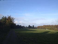
- Suitable footwear: With the exception of the short sections at Höllchen and Igelsburg, on which the eco path also runs over unpaved forest paths, the hiking route leads exclusively over paved paths, so that you do not need special footwear in normal weather.
- Family suitability: Yes, the Habichtswald cultural history eco path is also accessible with smaller children.
- Mountain bike suitability: Yes, the hiking route can even be used with normal touring bikes in many places.
- Best season: The Habichtswald cultural history eco path is accessible all year round.
background


.jpg/250px-Burgstall_Igelsburg_(05).jpg)
.jpg/250px-Dörnberg_Silbersee_(11).jpg)

The eco paths in North Hesse should encourage you to deal with the varied and interesting history of the region. A total of 32 eco paths have been set up in the Kassel district and two in the Schwalm-Eder district.
Since September 2013, the Habichtswald cultural history eco path has been strengthening the extensive network of eco paths. In the meantime, the 16.5 kilometer long eco path has been dated HWGHV awarded as "Approved Walk".
getting there
(Ehlen section 6.7 km)


By car
Through the community Habichtswald runs the ![]() (kassel-Korbach-Brilon). Alternatively, coming from Kassel you can also go through the High Habichtswald about the L 3298 drive. The next motorway junction is the
(kassel-Korbach-Brilon). Alternatively, coming from Kassel you can also go through the High Habichtswald about the L 3298 drive. The next motorway junction is the ![]() 67 Zierenberg the
67 Zierenberg the ![]() (kassel-Dortmund). At the Im Grund settlement, the starting point of the Habichtswald cultural history eco path, there is a 1 Parking spot.
(kassel-Dortmund). At the Im Grund settlement, the starting point of the Habichtswald cultural history eco path, there is a 1 Parking spot.
With public transport
The Habichtswald cultural history trail is located near the starting point of the eco path 2 ![]() Basically. It is approached by the bus routes 22 (kassel-High hawk forest-Habichtswald), 110 (kassel-Habichtswald-Wolfhagen) and 117 (Zierenberg-Habichtswald).
Basically. It is approached by the bus routes 22 (kassel-High hawk forest-Habichtswald), 110 (kassel-Habichtswald-Wolfhagen) and 117 (Zierenberg-Habichtswald).
Route description
(Section Dörnberg 9.7 km)


_Dörnberg.JPG/250px-Kuhnen_(Hoher)_Dörnberg.JPG)

The Habichtswald cultural history eco path is marked in both directions, the circular route is described in clockwise direction below. For a detailed hiking map, please simply click on the POIs that will immediately direct you to the described position. The start of the eco path is at the settlement Im Grund on the federal road 251 between Dörnberg and Ehlen.
Section Ehlen 6.7 km


From the information board at the starting point of the Habichtswald Im Grund cultural history eco path, first follow the course of the old route of federal road 251, gently winding past a riding stables. Shortly after this you turn west and walk on an asphalt farm road uphill past fruit trees towards Habichtswald. The eco path branches off into the second path to the south, which leads you to the 3298 state road after crossing a crossing path. This is also crossed and shortly afterwards you reach the coal road, which is also asphalted. You then follow this together with the local hiking trails ⊥ and E1 into Ehlen, where you follow the markings of the eco path into the bridge path.
- 1 The old village smithy - Built in 1893 and in operation until 1970, the village forge in Ehlen was extensively restored by the Habichtswald History and Local History Association from 1993-1994. Since then there has been an active and interactive museum in the forge, in which guests can forge themselves under supervision.
From the village smithy you walk on the bridge path to its end, where you turn into the street Ritterhagen and past old half-timbered houses through the old town center of Ehlen you reach the church square.
- 2 Steinscheuer and Evangelical Church - In the stone barn, an old building which was later used as a church and which is now privately owned, legend has it that the Holy Heimerad once organized a service. A tympanum - a semicircular stone bearing a bas-relief with a fan-shaped cross - and graves found nearby suggest that he held it in the stone barn. This would make the Steinscheuer the oldest church building in the Wolfhagen parish.
- Just a few meters away, a new church with a fortified tower was built in the 12th century. The defense tower was partially demolished in 1768 because it would have been too high and too dangerous. Furthermore, he appeared to the people to be too Catholic. The old nave had to be demolished in 1817/1818, and existing stones and beams were reused for the subsequent building. The benches in the gallery from 1652/1653, the pulpit canopy, the baptismal bowl, the organ from 1820 and a bell from 1578 are still preserved today.
On the east side of the Evangelical Church, cross Breitenbacher Straße (Landesstraße 3220) and walk along Kirchweg and Mühlenweg past the Evangelical Parish Hall to Kasseler Straße (Bundesstraße 251). Follow this briefly before continuing north on Sandweg and Sudetenstrasse. Finally, take the last cross street to the right.
- 3 The waiting room - The observation tower from the 14th century is an approximately five meter high watchtower or defense tower that is part of the Landwehr Zierenbergs was and is privately owned today. In addition to the Ehlener Warte, the Landwehr consisted of a kilometer-long ditch and a heaped wall, at the passageways of which guards were stationed. In the event of danger, this relayed signals to the next village or control room. The control room and the Landwehr emerged at the time when the Archdiocese of Mainz and the Landgraviate of Hesse were fighting for supremacy in Lower Hesse.
From the Ehlener Warte, continue on the An der Warte road, before turning left after a bend onto a gravel farm road, which runs downhill past a playground into the Warmetal.
- 4 Gut Bodenhausen - Gut Bodenhausen, which the eco path Kulturgeschichte Habichtswald does not pass directly, is located on Landesstraße 3220 between Zierenberg and Ehlen. It was first mentioned in a document issued from 1084-1088 and is now in private ownership, after it was in the meantime Hasungen Monastery, Landgrave Philipp, whose chamber clerk Christoph Scherer and the Privy Councilor belonged to Nikilaus Sixtinus. The courtyard now includes the striking gatehouse facing the street, the so-called manor house from 1660 and the so-called tenant house built in the classical style.
From the Gut Bodenhausen station on the outskirts of Ehlen, you hike down into the Warmetal, cross the Warm and follow along with you Warmetal cycle path and Kassel-Edersee cycle path an asphalt farm road to the country road 3390. In this one turns to the east, runs down again to the warmer and turns into a gravel forest path to the north, which leads along a shady above the warmer. At the end of the wood you do not leave it, but now follow the course of the forest edge along with the student path (X 13) and the Märchenlandweg (M) on a gravel forest path.
- 5 Bodenhäuser mills - The mills around the Habichtsstein in the Warmetal and the Kalenberg Vorwerk were also part of Gut Bodenhausen. The Habichtssteiner Mühle was first mentioned in 1433 and demolished in 1977 after a fire. In the mill, farmers from Dörnberg and Ehlen had their grain ground and crushed using an overshot mill wheel with a diameter of almost six meters. The courtyard, which is now near the station of the eco path, used to be the oil mill, which had been producing oil from poppy seeds and linseed since around 1650. The existing building was erected in 1813 by General von Motz, the owner of the Bodenhausen estate at the time.
Now again through the open landscape, follow the gravel path until shortly before Dörnberg. If you want to hike back to the Im Grund car park, follow the road Wegscheide up to the federal road 251 to get back to the starting point on an asphalt footpath and bike path. If you don't want to end your hike on the Habichtswald cultural history eco path, follow the Dörnberg section described below.
Section Dörnberg 9.7 km
Together with the Kassel-Edersee cycle path The eco path cultural history Habichtswald leads on the asphalted Breite Weg past the cemetery to Dörnberg. At the town hall, turn south into Laubachstraße and walk between the ![]() town hall (Lines 22 and 117) and follow the marking of the eco path over the Quergasse into the street Hinter der Kirche.
town hall (Lines 22 and 117) and follow the marking of the eco path over the Quergasse into the street Hinter der Kirche.
- 6 The church of Dörnberg - wall paintings and star vaults - The oldest part of the church still preserved today is the Romanesque defense tower next to the nave on the south side. At the beginning of the 16th century, a square choir was built to the east of the nave, which was raised and both parts of the building were covered with a common roof. The wall paintings discovered in 1934 were also created at the beginning of the 16th century, but had to be ordered by Landgrave Moritz, as everywhere in the Landgraviate kassel be painted over. Another attraction of the church is the star vault of the choir with 21 keystones.
To the south-east of the Dörnberger church you cross Wolfhager Straße (Bundesstraße 251) and walk on the Horstweg steadily uphill past the hiking car park Horstweg until the markings of the eco path point east into a gravel farm road. Follow this hilly and with a beautiful view to the Igelsburg, in between you come across the Kassel-Steig and hiking trail II to the Habichtswald cultural history eco path. When you arrive at the edge of the forest, you now follow that too Habichtswaldsteig via a small path, which can quickly become muddy when it rains, through the Igelsburg stables. Alternatively, you can follow hiking trail II, which runs parallel to the eco path on solid paths.
- 7 Igelsburg - The hilltop castle, which was also called Castel Sant'Angelo in the meantime, was located on a small basalt knoll with remains of prehistoric fortifications. Probably the Igelsburg already served Charlemagne and his troops in the Saxon Wars (772 to 804) as a strategic outpost to secure the Franconian Empire, but details are not known. Historians know today, however, that the Igelsburg fell into disrepair in the 13th century after it was abandoned by its last owners, the Junkers von Dörnberg, who had their seat at the castle. A little to the west of the castle stables, references to a medieval pottery from the 13th and 14th centuries were found.
From the information board on the western slope of the Igelsburg, which, by the way, does not belong to the eco path cultural history Habichtswald, you continue to follow the small path to a gravel forest path, in which you turn south. After a short time you leave this again and walk past a barrier on a rough and stony forest path uphill to the Silbersee.
- 8 The Silbersee - basalt in the Habichtswald - Just like the little hell, which the Eco Path Cultural History Habichtswald later leads past, the Silbersee was also created through the basalt mining in the Habichtswald. The basalt, which was mined south of the Igelsburg in open-cast mining from around 1900 to 1936, was created by volcanic eruptions 14 to seven million years ago. Basalt mining at Höllchen near Dörnberg took place from 1925 to 1943. Both opencast mines were closed due to poor stone quality and falling demand and soon filled with groundwater and spring water.
Follow this from the Silbersee Habichtswaldsteig initially steeply uphill, before the path you walk becomes flatter and wider and runs around the larger open-cast mine south of the Silbersee, which has now also been closed. At the end of the unpaved path, turn west and hike leisurely downhill on a gravel forest path along a clearing. Keep to the right at the following fork in the road.
- 9 The natural monument "Kaiserbuche" - The 500 year old book, originally called the Kaiserbuche, was uprooted in a storm around 1985 and destroyed by lightning strikes. Today a newly planted tree in the same place bears this name, which has its origins in the frequently undertaken carriage rides by Empress Auguste Viktoria, wife of Emperor Wilhelm II, with her children and company to the nearby forester's house in Haide, which was a guesthouse and inn until 1915. Often people rested under the Kaiserbuche or walked to the forester's house on a well-tended path.
Follow the gravel forest path to the west of the Haide forester's lodge, where the Eco path and the extra tour H3 des Habichtswaldsteiges turns into a small path to hell. You can reach the bank downhill past a small square with several benches. Further downhill you reach a gravel forest path over a meadow, which you follow to the north past a refuge with water treading facility to the Horstweg. Shortly after reaching the Horstweg, the Eco path Kulturgeschichte Habichtswald branches off to the west into a gravel farm path to cross the Laubach valley. Once the Laubach has been crossed, you reach Dörnberg for a short while, but do not go further into the village via the Grüne Aue, Saure Breite and Kuhnen streets, but walk uphill along its edge. Once the last ascent has been overcome, follow the markings of the eco path with another beautiful view of the Warmetal and to Great Bear Mountain Along the gravel farm road, steadily downhill north of the weekend houses, back to the starting point of the Habichtswald cultural history eco path, which you finally reach again after 16.5 kilometers.
trips
Extra tour H3 "In the shine of Hercules"
If you want to extend your hike on the Habichtswald cultural history eco path, that's it Extra tour H3 "In the shine of Hercules" recommended. It runs over a length of twelve kilometers as a circular hiking trail from Silbersee via Höllchen, the Essigberg, the High grass, the Rote Stollen and the Kastanienallee back to the Silbersee and leads in many sections over unpaved roads. The hiking route is marked with a white, double-edged circle with a white H3 in the middle on a dark purple background.
Eco path Hasungen Monastery
The Eco path Hasungen Monastery runs over the Burghasunger Berg over a length of only 2.8 km. Stops are the Hasungen Monastery Museum, the Alte Hof, the quarry and Hundsborn, the mountain stage and donkey path, the Heimerad on the Hasunger Berg, the Hasungen Monastery and the Evangelical Church of Burghasungen. The Hasungen Monastery Eco path can be reached via the federal road ![]() or with the Bus route 110 to
or with the Bus route 110 to ![]() Burghasungen.
Burghasungen.
Eco path archeology Dörnberg
The Eco path archeology Dörnberg runs over a length of ten kilometers over the barely forested plateau of the Hohen Dörnberg. Stops are the presumed castle on the Helfenstein, the Hohlestein near Ahnatal-Weimar, the Wallanlangen on the Dörnberg and Burg Blumenstein on the Wichtelkirche. The eco path Archeology Dörnberg can be reached from Habichtswald from across the country roads L 3320 / L 3211 and L 3214 or with the Bus route 117 to ![]() Nature Park Center (Last stop). For the latter variant, use the Bus route 110 to Burghasungen.
Nature Park Center (Last stop). For the latter variant, use the Bus route 110 to Burghasungen.
Eco path for the cultural history of the Großenritte
The Eco path for the cultural history of the Großenritte provides information on a route length of six kilometers about the settlement history of Großenritte, a district of Baunatal. Stops along the route are the train station, the Hünstein, the Kreuzkirche, the Langenbergkampfbahn, the Burgberg with quarry, as well as the Heiligenborn and the Pfaffeiche. Accessible via the state roads L 3298, L 3218 and the county road K 22 or with the bus lines 22, 51 and 62 with change in Druseltal and Baunatal-City center.
Web links
- Official website via the eco paths from the Kassel district.