
The Kassel-Steig is a 157 km long panoramic circular route around the Kassel basin. It runs over all the mountain ranges that frame this, and thus comes to an impressive 3,008 meters in altitude, which is why the nickname is "Steig", but this does not refer to the quality of the path. Since the Kassel-Steig touches all the villages on the edge of the Kassel basin, this is usually very good in normal weather conditions due to the many asphalt sections.
Route profile

- Length: 157 km. There are also additional routes marked with a blue sign and a yellow inscription. These also allow, for example, early exits, extensions or lateral entry into the route of the Kassel-Steiges.
- Altitude meters: 3008 meters in altitude. In some cases, you can save meters in altitude by walking individual stages in the appropriate direction to go downhill. This makes sense especially for mountain bikers, but also for normal hikers.
- Stages: 12 stages with an average of 13.05 km. The stages were limited to a maximum of 19.3 km in order to be able to visit sights alongside the route without time pressure, such as the Bergpark Wilhelmshöhe.
- Mark: Blue waymarks with white inscription "KS", but in some places additional waymarks with white "KS". The access routes are marked with a blue sign with the yellow inscription "KS".
- Signposting: Shortly after opening in spring 2013, the Kassel-Steig had to fight vandalism (see also HNA article). Even today, there are still a few signs that are missing, so it is definitely advisable to take a hiking map with you.
- Suitable footwear: Ideally, ankle-high hiking boots, with which you can also walk well over longer asphalt stretches. The choice of shoes also depends on the stage in question.
- Family suitability: Yes, continuously.
- Mountain bike suitability: Yes, but to protect nature, it is better to push in some passages. But you should always note that the Kassel-Steig was designed for hikers and not for mountain bikers.
- Best season: Accessible all year round. Not passable for mountain bikers in wet weather.
background


For the 1100 anniversary of the city kassel had the HWGHV Kassel the idea of setting up a hiking trail around the Kassel basin. The Kassel-Steig was created (official website).
Who goes hiking on the Kassel-Steig and his hikes in the Hiking certificate enters, receives the hiking badge of the Kassel-Steig on presentation of this and a cost sharing of 3 €. Information on this also on the Website and as PDF.
getting there
By car
kassel is well connected to the highways in terms of traffic ![]() ,
, ![]() and
and ![]() , as well as on the federal highways
, as well as on the federal highways ![]() ,
, ![]() ,
, ![]() , and until June 2010 also at the
, and until June 2010 also at the ![]() . Furthermore, the German fairy tale route through Kassel.
. Furthermore, the German fairy tale route through Kassel.
With public transport
The long-distance train station in kassel is Notas it seems at first glance, the Kassel Central Stationbut the Kassel-Wilhelmshöhe long-distance train station. There is a good local transport offer at both train stations and you can get there quickly with Bus & train the Kassel-Steig. All stops on the Kassel-Steig or in the immediate vicinity have been linked with a photo. In addition, all tram and bus routes operating there are listed, the timetables can be downloaded directly as PDF.
By plane
The new Kassel-Calden Airport started operations in April 2013. From there you can reach the Kassel-Steig (Espenau) in 20 minutes with the Bus route 47, or the Kasseler Downtown with the Bus route 100 in 25 minutes. Other nearby airports are the Paderborn Lippstadt Airport, the airport Frankfurt and the Hanover Airport. From the latter two you can take the ICE within 1 1/2 hours Kassel-Wilhelmshöhe.
Route description


The Kassel-Steig is divided into 12 stages, which are on average 13.05 km long. This means that you can comfortably hike the Kassel-Steig in half or day tours. In some cases, the route planners have deliberately accepted longer asphalted paths, as the Kassel-Steig is intended to connect the region with each other by all the villages on the edge of the Kassel basin be hiked through. This is the only way to admire many sights such as churches, historical buildings, local museums or romantic corners on the edge of the route. Unfortunately, this has the serious disadvantage that the Kassel-Steig cannot be recognized as a certified hiking trail. The route planners have tried to do this with many wonderful views kassel and to make up for the region.

1st stage: Herkules - Brasselsberg 8.0 km


This stage is an easy hike with only 141 m ascent, but 344 m descent. It starts at the 1 ![]() Hercules (Lines 22 and 23) at the visitor center. From there it is only a few meters east to the 2 Hercules, with a wonderful view over kassel. Those who are not afraid of the many stairs of the cascades can also go down them, but the Kassel-Steig leads in serpentines on the old carriage path down to the Neptune basin at the end of the cascades. This is also where the 1 Cascade Economy. The Kassel-Steig continues on park paths to 3 Steinhöfer waterfall, another action of the water arts of the world cultural heritage Bergpark Wilhelmshöhe. From the Steinhöfer waterfall you hike across a park meadow past a water treading area to just before the 4 Löwenburg, where the Kassel-Steig sharp right on a forest path at Pfaffenteich up to 5 Asch, a romantically situated forest lake, runs. The Kassel-Steig leads a few meters along its bank before it leads right into a narrow hillside path and down into the Druseltal valley 6
Hercules (Lines 22 and 23) at the visitor center. From there it is only a few meters east to the 2 Hercules, with a wonderful view over kassel. Those who are not afraid of the many stairs of the cascades can also go down them, but the Kassel-Steig leads in serpentines on the old carriage path down to the Neptune basin at the end of the cascades. This is also where the 1 Cascade Economy. The Kassel-Steig continues on park paths to 3 Steinhöfer waterfall, another action of the water arts of the world cultural heritage Bergpark Wilhelmshöhe. From the Steinhöfer waterfall you hike across a park meadow past a water treading area to just before the 4 Löwenburg, where the Kassel-Steig sharp right on a forest path at Pfaffenteich up to 5 Asch, a romantically situated forest lake, runs. The Kassel-Steig leads a few meters along its bank before it leads right into a narrow hillside path and down into the Druseltal valley 6 ![]() At the quarry (Lines 22 and 23). At the parking lot, continue on narrow gravel paths around the senior citizens' residence and come to 7 Tram end
At the quarry (Lines 22 and 23). At the parking lot, continue on narrow gravel paths around the senior citizens' residence and come to 7 Tram end![]() Druseltal (Lines 3, 12, 22, 23, 51, 52, 53). Follow the marking down Elgershäuser Straße (
Druseltal (Lines 3, 12, 22, 23, 51, 52, 53). Follow the marking down Elgershäuser Straße (![]() In the rose valley) to a meadow with ancient 8 Hat trees that are crossed once. Turn right at the end of the meadow and walk along with the K9 a little above the Dönche. Again and again beautiful ones open up 9 Look over kassel, before you turn right into a wooded area onto a gravel forest path, which you soon leave after a short climb to the left and into the Brasselsberg district past the
In the rose valley) to a meadow with ancient 8 Hat trees that are crossed once. Turn right at the end of the meadow and walk along with the K9 a little above the Dönche. Again and again beautiful ones open up 9 Look over kassel, before you turn right into a wooded area onto a gravel forest path, which you soon leave after a short climb to the left and into the Brasselsberg district past the ![]() Nordshauser Strasse (Line E.) goes. The goal of the first stage, the 1
Nordshauser Strasse (Line E.) goes. The goal of the first stage, the 1 ![]() Flower path. The bus routes run from here 12, 51, 52 and 53 back to kassel, also for Kassel-Wilhelmshöhe train station and to the city center.
Flower path. The bus routes run from here 12, 51, 52 and 53 back to kassel, also for Kassel-Wilhelmshöhe train station and to the city center.

2nd stage: Brasselsberg - Hoof 12.0 km


With an ascent of 469 m and a descent of 398 m, the stage belongs to the demanding category, which is also due to the sometimes poor quality of the path. Of the 2 ![]() Flower path you hike up a steep forest path to 3 Crossroads with a roundabout on the ridge or near the Porta lapidaria. If you want to avoid the incline (e.g. mountain bikers), you can alternatively follow the driveway at a water step and past the Marie mine, also up to the circular path. A 400 m long cul-de-sac leads from the circular path to the 4 Bismarck Tower, from which one has a wonderful view over large parts of kassel Has. Back at the crossroads, the Kassel-Steig runs slightly downhill on an easily accessible forest path to 5 Coffee mill, where you keep to the left and now go slightly uphill to the Teufelseck (refuge and natural monument Teufelsmauer). After a curve you come to one 6 Crossing at which the Kassel-Steig over a branch path to the charming 7 Hirzstein lookout point runs. Here is the Hirzstein telescope peep post, which offers a targeted view. Back to the intersection, on the right hand side there is a protective mushroom hidden in the forest. You continue on an almost flat stretch to an asphalt forest path, which you cross and straight ahead on a natural path down to the 8 Firnsbachtal hikes (see info box). This is where he meets Habichtswaldsteig on the Kassel-Steig, and together you hike to the 2 Forest gas site Autumn cottage. The Kassel-Steig leads along a pasture fence to the Konrad-Göbel-Hütte with three seating groups. To the right you walk through two gates and over the Hutewiese (no marking) slightly uphill to the edge of the forest. Here comes the 9 Hiking trail || from Tall grass down. You walk with him through another gate and across a clearing on a heavily overgrown meadow path down to forest paths that are easier to walk again. Follow these down in serpentines, and now again together with the 10 Habichtswaldsteig to the underpass under the
Flower path you hike up a steep forest path to 3 Crossroads with a roundabout on the ridge or near the Porta lapidaria. If you want to avoid the incline (e.g. mountain bikers), you can alternatively follow the driveway at a water step and past the Marie mine, also up to the circular path. A 400 m long cul-de-sac leads from the circular path to the 4 Bismarck Tower, from which one has a wonderful view over large parts of kassel Has. Back at the crossroads, the Kassel-Steig runs slightly downhill on an easily accessible forest path to 5 Coffee mill, where you keep to the left and now go slightly uphill to the Teufelseck (refuge and natural monument Teufelsmauer). After a curve you come to one 6 Crossing at which the Kassel-Steig over a branch path to the charming 7 Hirzstein lookout point runs. Here is the Hirzstein telescope peep post, which offers a targeted view. Back to the intersection, on the right hand side there is a protective mushroom hidden in the forest. You continue on an almost flat stretch to an asphalt forest path, which you cross and straight ahead on a natural path down to the 8 Firnsbachtal hikes (see info box). This is where he meets Habichtswaldsteig on the Kassel-Steig, and together you hike to the 2 Forest gas site Autumn cottage. The Kassel-Steig leads along a pasture fence to the Konrad-Göbel-Hütte with three seating groups. To the right you walk through two gates and over the Hutewiese (no marking) slightly uphill to the edge of the forest. Here comes the 9 Hiking trail || from Tall grass down. You walk with him through another gate and across a clearing on a heavily overgrown meadow path down to forest paths that are easier to walk again. Follow these down in serpentines, and now again together with the 10 Habichtswaldsteig to the underpass under the ![]() through and on paved paths along fruit trees Schauenburg-Hoof in. From 11 Graveyard is steadily increasing again. You cross the railway line of the museum railway Hessencourrier and hikes up steep meadow paths in a zigzag up to the 12 Schauenburg castle ruins. Only small remains of the wall remain from the ruins. After enjoying the wonderful view, you walk down many wooden stairs to the 3 Inn sky. Continue past the former Hoof train station to the station of the same name 1
through and on paved paths along fruit trees Schauenburg-Hoof in. From 11 Graveyard is steadily increasing again. You cross the railway line of the museum railway Hessencourrier and hikes up steep meadow paths in a zigzag up to the 12 Schauenburg castle ruins. Only small remains of the wall remain from the ruins. After enjoying the wonderful view, you walk down many wooden stairs to the 3 Inn sky. Continue past the former Hoof train station to the station of the same name 1 ![]() Hoof train station, the end of the 2nd stage of the Kassel-Steige. The bus routes 52, 53 and 59 bring you back to kassel.
Hoof train station, the end of the 2nd stage of the Kassel-Steige. The bus routes 52, 53 and 59 bring you back to kassel.


3rd stage: Hoof - Großenritte 12.4 km

This stage is to be rated as moderately difficult with 225 m ascent and 394 m descent. Of the 2 ![]() Hoof train station one walks together with the Habichtswaldsteig in an arch and under the L 3215 (earlier
Hoof train station one walks together with the Habichtswaldsteig in an arch and under the L 3215 (earlier ![]() ) uphill to a courtyard with a beautiful 3 Outlook direction Schauenburg-Breitbach offers. A little further up, the Kassel-Steig turns left and runs downhill along the edge of the forest before it joins a path on the left. It continues over roots and around fallen trees before entering a thick forest. Soon you turn right and come to a gravel forest path. Soon you will also reach the 4 Markings of the Ederseewegesthat of kassel to the Edersee lead, and continue in gentle arcs until you come to 5 emerges from the forest. The Kassel-Steig leads us along the edge of the forest past the "Forsthaus im Gerott" to the "Gertrudenstift" 6
) uphill to a courtyard with a beautiful 3 Outlook direction Schauenburg-Breitbach offers. A little further up, the Kassel-Steig turns left and runs downhill along the edge of the forest before it joins a path on the left. It continues over roots and around fallen trees before entering a thick forest. Soon you turn right and come to a gravel forest path. Soon you will also reach the 4 Markings of the Ederseewegesthat of kassel to the Edersee lead, and continue in gentle arcs until you come to 5 emerges from the forest. The Kassel-Steig leads us along the edge of the forest past the "Forsthaus im Gerott" to the "Gertrudenstift" 6 ![]() Gertrudenstift (Line 61). If you want to skip the Baunataler Burgberg, walk straight ahead on the Baunatal circular route, while the Kassel-Steig in a right curve to the 7 The water treading point at Trineplatz runs. From here it goes steadily uphill, at a fountain to the left and shortly afterwards again sharply to the right until you stand on the ridge. Of 8 Here a "path" runs up to the Burgberg vantage point, mountain bikers are best to hook up their bikes here. After you have come back here, you walk downhill past the Bärwinkelteich to the 9
Gertrudenstift (Line 61). If you want to skip the Baunataler Burgberg, walk straight ahead on the Baunatal circular route, while the Kassel-Steig in a right curve to the 7 The water treading point at Trineplatz runs. From here it goes steadily uphill, at a fountain to the left and shortly afterwards again sharply to the right until you stand on the ridge. Of 8 Here a "path" runs up to the Burgberg vantage point, mountain bikers are best to hook up their bikes here. After you have come back here, you walk downhill past the Bärwinkelteich to the 9 ![]() Culture hall (Line 61). In the center of Baunatal-Great rides are next to gas sites and other bus stops for the city bus, but we continue to hike to the 3
Culture hall (Line 61). In the center of Baunatal-Great rides are next to gas sites and other bus stops for the city bus, but we continue to hike to the 3 ![]() Großenritte train station (Lines 5, 7, 54, 61, 65).
Großenritte train station (Lines 5, 7, 54, 61, 65).

4th stage: Großenritte - Dörnhagen 16.0 km


With 192 m ascent and 189 m descent, one can definitely speak of an easy hike. Of the 4 ![]() Großenritte train station (Lines 5, 7, 54, 61, 65) walk down Bahnhofstraße to the church and continue along the Leisel under the new bypass road. Shortly before the Leiselpark, the Kassel-Steig swings to the right up the mountain, from which a beautiful one emerges 5 Outlook over Baunatal offers. Shortly afterwards, the Kassel-Steig leads into the Leiselpark and on 6 Leiselsee over. With the help of a small wooden bridge the Leisel is crossed and one reaches the 7
Großenritte train station (Lines 5, 7, 54, 61, 65) walk down Bahnhofstraße to the church and continue along the Leisel under the new bypass road. Shortly before the Leiselpark, the Kassel-Steig swings to the right up the mountain, from which a beautiful one emerges 5 Outlook over Baunatal offers. Shortly afterwards, the Kassel-Steig leads into the Leiselpark and on 6 Leiselsee over. With the help of a small wooden bridge the Leisel is crossed and one reaches the 7 ![]() Baunatal workshops (Line 62 and Line 63). It goes around this and to the small river Bauna, which the Kassel-Steig will follow to Guntershausen. Passing allotments and a cemetery you come to Kirchbauna, at the entrance to the village is the
Baunatal workshops (Line 62 and Line 63). It goes around this and to the small river Bauna, which the Kassel-Steig will follow to Guntershausen. Passing allotments and a cemetery you come to Kirchbauna, at the entrance to the village is the ![]() At the windmill (Line 62), and further into the village of Kirchbauna. You pass the 8
At the windmill (Line 62), and further into the village of Kirchbauna. You pass the 8 ![]() Parish hall (Line 50, Line 62 and Line 63) you hike on H.-Schektiven-Str. under the
Parish hall (Line 50, Line 62 and Line 63) you hike on H.-Schektiven-Str. under the ![]() through and over the Schützenstraße into the now narrowing tree-covered valley of the Bauna. At the edge of the forest is the 9 Rest area "Altes Holz" near the shooting club. The Kassel-Steig now runs on a path through the forest to 10 Höllewiesenhütte, right up to the Ratio shopping center and Hertingshausen. But we continue to hike over a bridge to the other side of the Bauna and later slightly uphill through the "Guntershäuser Klamm" to the 11 Rest area "Riesenstein" (refuge) on the Eulenberg, where we go to the Eco path cultural history Guntershausen to meet. From here then steeply downhill again over the Bauna and in an arc to Guntershausen. Who to railway station Guntershausen wants, follow the marking ◊ right up the mountain before entering the village, otherwise you will suddenly see a railway viaduct of the Main-Weser-Bahn high above you. Past the 12
through and over the Schützenstraße into the now narrowing tree-covered valley of the Bauna. At the edge of the forest is the 9 Rest area "Altes Holz" near the shooting club. The Kassel-Steig now runs on a path through the forest to 10 Höllewiesenhütte, right up to the Ratio shopping center and Hertingshausen. But we continue to hike over a bridge to the other side of the Bauna and later slightly uphill through the "Guntershäuser Klamm" to the 11 Rest area "Riesenstein" (refuge) on the Eulenberg, where we go to the Eco path cultural history Guntershausen to meet. From here then steeply downhill again over the Bauna and in an arc to Guntershausen. Who to railway station Guntershausen wants, follow the marking ◊ right up the mountain before entering the village, otherwise you will suddenly see a railway viaduct of the Main-Weser-Bahn high above you. Past the 12 ![]() church (Line 64) the Kassel-Steig now runs together with the Hess. Long-distance cycle route R1 (Fulda cycle route), shortly after leaving the village you can walk along a branch path to the confluence of the Bauna in the Fulda. The Kassel-Steig continues past a sports field and the fairy tale figure "Sterntaler" over the "Totenbrücke" (see the memorial plaque attached there) and under the imposing large one 13 Railway viaduct of the Friedrich-Wilhelms-Nordbahn through it. At the time of its completion (1848) it was the largest railway bridge in Germany at the time. Partly blown up by the National Socialists in 1945, the central part was rebuilt in a simplified manner in 1952. It continues up a mountain to the level of the tracks, over one 14 The barrier system on the other side and along the edge of the forest to the new ICE line from Hanover to Würzburg. Shortly thereafter, the
church (Line 64) the Kassel-Steig now runs together with the Hess. Long-distance cycle route R1 (Fulda cycle route), shortly after leaving the village you can walk along a branch path to the confluence of the Bauna in the Fulda. The Kassel-Steig continues past a sports field and the fairy tale figure "Sterntaler" over the "Totenbrücke" (see the memorial plaque attached there) and under the imposing large one 13 Railway viaduct of the Friedrich-Wilhelms-Nordbahn through it. At the time of its completion (1848) it was the largest railway bridge in Germany at the time. Partly blown up by the National Socialists in 1945, the central part was rebuilt in a simplified manner in 1952. It continues up a mountain to the level of the tracks, over one 14 The barrier system on the other side and along the edge of the forest to the new ICE line from Hanover to Würzburg. Shortly thereafter, the ![]() crossed and we reach Fuldabrück-Dörnhagen. Past the
crossed and we reach Fuldabrück-Dörnhagen. Past the ![]() center one arrives at the Ettapenziel, the 1
center one arrives at the Ettapenziel, the 1 ![]() settlement (Line 17, Line 17E and Line 50). Shortly beforehand, it is a good idea to cross the main road at the traffic lights and not, like the Kassel-Steig, at a curve that is difficult to see.
settlement (Line 17, Line 17E and Line 50). Shortly beforehand, it is a good idea to cross the main road at the traffic lights and not, like the Kassel-Steig, at a curve that is difficult to see.


5th stage: Dörnhagen - Wellerode 14.3 km


This stage can also be classified as an easy category with a 289 m ascent and 247 m descent. The 2 ![]() settlement (Line 17, Line 17E and Line 50) is left in a southerly direction. Through a new development area and past a playground you get to an asphalt path that leads us uphill to the 3 The edge of the forest of the Söhre leads. Here the Kassel-Steig turns left and runs between Dörnhagen and the Söhre. It will be working soon 4 right up into this at 340 m above sea level. 5 , which you soon leave and turn right (straight downhill the
settlement (Line 17, Line 17E and Line 50) is left in a southerly direction. Through a new development area and past a playground you get to an asphalt path that leads us uphill to the 3 The edge of the forest of the Söhre leads. Here the Kassel-Steig turns left and runs between Dörnhagen and the Söhre. It will be working soon 4 right up into this at 340 m above sea level. 5 , which you soon leave and turn right (straight downhill the ![]() Kiliansblick (Line 17)), then left down a path to one 6 Hiking parking lot is running. A little above the autobahn, you continue to the edge of the forest, from here you have one 7 fabulous views over the whole Kassel basin. Between a power line and the edge of the forest it goes on to one 8 Hikers' parking lot with shelter and water treading facility. Here the Kassel-Steig crosses the Wildbahn (X3) with its works of art from the ARS Natura hiking trail. Together with the wild, it continues on the 9 ARS Natura section "Trees of Life" via narrow paths through the Söhre. in the 10 The Steinbach forest area bends the Kassel-Steig to the left down through a field Sohrewald-Wellerode past an orchard with the 11 Resting place "billy goats". Shortly before the place it goes a bit on the old railway line of the Söhrebahn along and on 12 Pass the atonement cross before turning right down Goethestrasse to
Kiliansblick (Line 17)), then left down a path to one 6 Hiking parking lot is running. A little above the autobahn, you continue to the edge of the forest, from here you have one 7 fabulous views over the whole Kassel basin. Between a power line and the edge of the forest it goes on to one 8 Hikers' parking lot with shelter and water treading facility. Here the Kassel-Steig crosses the Wildbahn (X3) with its works of art from the ARS Natura hiking trail. Together with the wild, it continues on the 9 ARS Natura section "Trees of Life" via narrow paths through the Söhre. in the 10 The Steinbach forest area bends the Kassel-Steig to the left down through a field Sohrewald-Wellerode past an orchard with the 11 Resting place "billy goats". Shortly before the place it goes a bit on the old railway line of the Söhrebahn along and on 12 Pass the atonement cross before turning right down Goethestrasse to ![]() Kasseler Strasse (Line 37). The Kassel-Steig leads us a little further into the village and finally ends for this stage at the 1
Kasseler Strasse (Line 37). The Kassel-Steig leads us a little further into the village and finally ends for this stage at the 1 ![]() church (Line 37).
church (Line 37).


6th stage: Wellerode - Oberkaufungen 11.0 km

Easy stage: 171 m ascent and 242 m descent. Of the 2 ![]() church (Line 37) the Kassel-Steig leads us up Friedhofsstraße out of the village. It goes steadily uphill on a paved path, before we hike a little bit downhill again at a bank on the left, then to take the final slope up to the edge of the forest on the right. At the 3 The water reservoir meets the Kassel-Steig on a forest path. We follow this to the left, always along the edge of the forest, in between you can go down to the left to the Naturfreundehaus Unter den Eichen, to the 4 Heupelsberg hiking car park above Vollmarshausen. Now in curves up to the Heupelsberg, from where there is once again a beautiful view over the Kassel basin. The Kassel-Steig now runs at the next junction 5 slightly left on gravel forest roads through the forest area "Vollmarshäuser surcharge" to 6 Ahlegraben. Here left downhill, shortly afterwards right over a bridge to the popular former 7 Excursion restaurant "Setzebachgrund". Sharply to the right it goes together with the local circular route 25 over the beaten path from the Setzebachgrund out to the Kohlenstraße, where the Riedforstweg crosses. You walk to the on a beautiful asphalt farm road with inviting benches 8 Ziegelhütte, on the right is the RuhForst Stiftswald Kaufungen, and further under the
church (Line 37) the Kassel-Steig leads us up Friedhofsstraße out of the village. It goes steadily uphill on a paved path, before we hike a little bit downhill again at a bank on the left, then to take the final slope up to the edge of the forest on the right. At the 3 The water reservoir meets the Kassel-Steig on a forest path. We follow this to the left, always along the edge of the forest, in between you can go down to the left to the Naturfreundehaus Unter den Eichen, to the 4 Heupelsberg hiking car park above Vollmarshausen. Now in curves up to the Heupelsberg, from where there is once again a beautiful view over the Kassel basin. The Kassel-Steig now runs at the next junction 5 slightly left on gravel forest roads through the forest area "Vollmarshäuser surcharge" to 6 Ahlegraben. Here left downhill, shortly afterwards right over a bridge to the popular former 7 Excursion restaurant "Setzebachgrund". Sharply to the right it goes together with the local circular route 25 over the beaten path from the Setzebachgrund out to the Kohlenstraße, where the Riedforstweg crosses. You walk to the on a beautiful asphalt farm road with inviting benches 8 Ziegelhütte, on the right is the RuhForst Stiftswald Kaufungen, and further under the ![]() through, then right and left again together with the Grimmsteig steep downhill to Kaufungen into it. The Kassel-Steig continues along the 9 Collegiate Church and past the Old School Museum through the 10 Center of Oberkaufungen. This is where the
through, then right and left again together with the Grimmsteig steep downhill to Kaufungen into it. The Kassel-Steig continues along the 9 Collegiate Church and past the Old School Museum through the 10 Center of Oberkaufungen. This is where the ![]() Bürgerhaus Niester Straße (Line 34). At the Losse left and there are only a few meters to go 10 Tram-
Bürgerhaus Niester Straße (Line 34). At the Losse left and there are only a few meters to go 10 Tram-![]() Acquisitions in the middle (Line 4).
Acquisitions in the middle (Line 4).

7th stage: Oberkaufungen - Heiligenrode 19.3 km


.jpg/250px-Schloss_Windhausen_(03).jpg)
Longest stage of the Kassel-Steig, with its length as well as 341 m ascent and 352 m descent and some bad parts of the path, it can be rated as challenging. From the 11 ![]() center (Line 4) follow the marking of the Kassel-Steig through a new building area and over two level crossings into the local recreation area Steinertsee. It's worth taking a ride in the small park 12 Steinertseebahn, a so-called mini-train. We walk along the Steinertsee and first the 13 Rohrweg, then the Steinweg along the Losse to Niederkaufungen. After a while 14 our hiking trail turns steeply uphill to the right into a hillside path. The Windhäuser Straße (K5) is crossed and the Kassel-Steig leads us through the fields past a landfill into the valley of the 15 Diebachsgraben with the Kalkbergsee. This is crossed and left again north of the Kalkberg on a gravel path, we branch off to the right past a garden on the Balkenröder Weg and cross the 16 K4 (Witzenhäuser Strasse). Soon you reach a wooded area and together with the marker || we walk at the edge of the forest enltang to 17 Mühlenberg hiking car park. The Kassel-Steig branches off to the right again on an overgrown path, from which a beautiful view of Kassel is worthwhile. Shortly after the crossroads, the marking leads us to the park of Gut Windhausen. It is the only romantic-sentimental Germanic garden in Germany, but is currently still difficult to walk and drive on. If you want to bypass it, follow the sign of the hiking trail ||. At a pond we come to the 18 Main building of the courtyard and continue walking along the beaten path past the monkey pond with the famous monkey monument in an arc to the 19 Mausoleum by Martin Ernst von Schlieffen. At the edge of the forest, continue on a meadow path up to a height of 300 m above sea level, then turn right into another meadow path. The K4 is crossed for the third and last time, we continue to a large one 20 Signpost. On the right it goes on the premium hiking trail P11 to the youth home Sensenstein and to Königsalm, straight downhill after Staufenberg-Dalheim. We hike briefly together with the P11, then later around the Mühlenberg on one 21 Pacific silver fir with the forester Horst Dippel-Stein passing downhill after Staufenberg-Envelope ins 22 Valley of the Nieste. Whoever wants can do the hike at the nearby
center (Line 4) follow the marking of the Kassel-Steig through a new building area and over two level crossings into the local recreation area Steinertsee. It's worth taking a ride in the small park 12 Steinertseebahn, a so-called mini-train. We walk along the Steinertsee and first the 13 Rohrweg, then the Steinweg along the Losse to Niederkaufungen. After a while 14 our hiking trail turns steeply uphill to the right into a hillside path. The Windhäuser Straße (K5) is crossed and the Kassel-Steig leads us through the fields past a landfill into the valley of the 15 Diebachsgraben with the Kalkbergsee. This is crossed and left again north of the Kalkberg on a gravel path, we branch off to the right past a garden on the Balkenröder Weg and cross the 16 K4 (Witzenhäuser Strasse). Soon you reach a wooded area and together with the marker || we walk at the edge of the forest enltang to 17 Mühlenberg hiking car park. The Kassel-Steig branches off to the right again on an overgrown path, from which a beautiful view of Kassel is worthwhile. Shortly after the crossroads, the marking leads us to the park of Gut Windhausen. It is the only romantic-sentimental Germanic garden in Germany, but is currently still difficult to walk and drive on. If you want to bypass it, follow the sign of the hiking trail ||. At a pond we come to the 18 Main building of the courtyard and continue walking along the beaten path past the monkey pond with the famous monkey monument in an arc to the 19 Mausoleum by Martin Ernst von Schlieffen. At the edge of the forest, continue on a meadow path up to a height of 300 m above sea level, then turn right into another meadow path. The K4 is crossed for the third and last time, we continue to a large one 20 Signpost. On the right it goes on the premium hiking trail P11 to the youth home Sensenstein and to Königsalm, straight downhill after Staufenberg-Dalheim. We hike briefly together with the P11, then later around the Mühlenberg on one 21 Pacific silver fir with the forester Horst Dippel-Stein passing downhill after Staufenberg-Envelope ins 22 Valley of the Nieste. Whoever wants can do the hike at the nearby ![]() Landwehrhagener Strasse (Line 32, Line 33 and Line 34) end. The Kassel-Steig continues on a pleasant gravel path together with the Nieste-Werra-Weg charming through the Niestetal to 23 Rifle house of Heiligenrode. Officially, the main route of the Kassel-Steige leads further into the village to the
Landwehrhagener Strasse (Line 32, Line 33 and Line 34) end. The Kassel-Steig continues on a pleasant gravel path together with the Nieste-Werra-Weg charming through the Niestetal to 23 Rifle house of Heiligenrode. Officially, the main route of the Kassel-Steige leads further into the village to the ![]() Niestetalstrasse, At the forest bush and Wicherstrasse (Lines 31 and 32). At the 13 The Wicherstraße stop also ends the stage of the Kassel-Steig. Tip: If you want, you can continue from the Schützenhaus on the next stage of the Kassel-Steig for about 500 m to the forester's house and come to the
Niestetalstrasse, At the forest bush and Wicherstrasse (Lines 31 and 32). At the 13 The Wicherstraße stop also ends the stage of the Kassel-Steig. Tip: If you want, you can continue from the Schützenhaus on the next stage of the Kassel-Steig for about 500 m to the forester's house and come to the ![]() Forester's house (Line 32).
Forester's house (Line 32).


8th stage: Heiligenrode - Landwehrhagen 11.0 km
Middle stage with 226 m ascent and 111 m descent. The 14 ![]() Wicherstrasse (Lines 31 and 32) is left in a northerly direction via Lithstraße and you hike together with the Nieste-Werra-Weg to the
Wicherstrasse (Lines 31 and 32) is left in a northerly direction via Lithstraße and you hike together with the Nieste-Werra-Weg to the ![]() At the forest bush and Niestetalstrasse past into the valley of the Nieste. At the Schützenhaus then turn left to the edge of the forest, where the Nieste is crossed with a bridge and the Kassel-Steig on its left bank now continues to the forester's house. From the
At the forest bush and Niestetalstrasse past into the valley of the Nieste. At the Schützenhaus then turn left to the edge of the forest, where the Nieste is crossed with a bridge and the Kassel-Steig on its left bank now continues to the forester's house. From the ![]() Forester's house (Line 32) the Kassel-Steig runs up a steep forest path and comes to one 15 Grill hut at the edge of the forest. You hike twice to the right over the ridge of Habichtsfang to the K2. On the right, 500 meters away, is the
Forester's house (Line 32) the Kassel-Steig runs up a steep forest path and comes to one 15 Grill hut at the edge of the forest. You hike twice to the right over the ridge of Habichtsfang to the K2. On the right, 500 meters away, is the ![]() Sandershauser Mountain (Lines 31 and 52), but we continue to walk to the left through the 16 Gut Ellenbach in a curve uphill through a small forest and along the edge of the forest to the right. From here there are beautiful views over kassel. Shortly before the motorway, turn right twice into another piece of forest, which is crossed once and left at the end to the left. On a meadow path you continue up to the edge of the forest 17 Schanze, a so-called no man's land, because the old boundary stones are about 5 meters apart, between them there is a path that used to be from both sides (Hesse and Lower Saxony) was used the same number of times. Behind the jump it goes downhill in a zigzag (in between 18 Cycle sign) before the is crossed at the Staufenberg autobahn car park. The Kassel-Steig introduces us first 19 A bit around Landwehrhagen before turning right to the stage destination along the main street (Hannoversche Straße) to 10
Sandershauser Mountain (Lines 31 and 52), but we continue to walk to the left through the 16 Gut Ellenbach in a curve uphill through a small forest and along the edge of the forest to the right. From here there are beautiful views over kassel. Shortly before the motorway, turn right twice into another piece of forest, which is crossed once and left at the end to the left. On a meadow path you continue up to the edge of the forest 17 Schanze, a so-called no man's land, because the old boundary stones are about 5 meters apart, between them there is a path that used to be from both sides (Hesse and Lower Saxony) was used the same number of times. Behind the jump it goes downhill in a zigzag (in between 18 Cycle sign) before the is crossed at the Staufenberg autobahn car park. The Kassel-Steig introduces us first 19 A bit around Landwehrhagen before turning right to the stage destination along the main street (Hannoversche Straße) to 10 ![]() town hall runs. The lines run here 30, 32, 33 and 196 back to kassel, Niestetal or Hann. Münden.
town hall runs. The lines run here 30, 32, 33 and 196 back to kassel, Niestetal or Hann. Münden.


9th stage: Landwehrhagen - Rothwesten 14.5 km


Difficult section of the Kassel-Steig (slope 288 m, slope 345 m). The 11 ![]() town hall (Lines 30, 32, 33 and 196) is left in a northerly direction. At the cemetery you turn left into the street "Zum Ickelsbach". The Kassel-Steig now leads over rough paths down into the narrow and romantic Ickelsbachtal, the Ickelsbach becomes over a small one 12 Bridge crossed. You leave the valley again on the other side, partly over individual steps, and walk south around the Ickelsberg through the Landwehrhagener Genossen Forest. We hike downhill under the high speed track Hanover-Wurzburg through until shortly before the 13 Hanover Southern Railway and here on the right a steep path uphill to a gravel slope. This is followed through the Spiekershausen Comrades Forest to the former 14 Kragenhof station, left downhill you come to Spiekershausen. The Kassel-Steig, however, runs along with other hiking trails down into the valley of the Fulda over the 15 Wahnhausen lock. Hier befindet sich auch die gleichnamige
town hall (Lines 30, 32, 33 and 196) is left in a northerly direction. At the cemetery you turn left into the street "Zum Ickelsbach". The Kassel-Steig now leads over rough paths down into the narrow and romantic Ickelsbachtal, the Ickelsbach becomes over a small one 12 Bridge crossed. You leave the valley again on the other side, partly over individual steps, and walk south around the Ickelsberg through the Landwehrhagener Genossen Forest. We hike downhill under the high speed track Hanover-Wurzburg through until shortly before the 13 Hanover Southern Railway and here on the right a steep path uphill to a gravel slope. This is followed through the Spiekershausen Comrades Forest to the former 14 Kragenhof station, left downhill you come to Spiekershausen. The Kassel-Steig, however, runs along with other hiking trails down into the valley of the Fulda over the 15 Wahnhausen lock. Hier befindet sich auch die gleichnamige ![]() lock (Linie 42). Man überquert die
lock (Linie 42). Man überquert die ![]() und läuft entlang einer Wiese in einen Wald hinein und kommt oberhalb von 16 Fuldatal-Wahnhausen wieder aus diesem heraus. Weiter geht es stetig bergauf über den 17 Dicken Kopf in einem Bogen auf einer Eichenallee um das Gut Eichenberg herum vorbei an einem idyllisch gelegenen 18 alten Friedhof hinein nach Rothwesten. Am Ortseingang direkt am Kassel-Steig befindet sich zudem die
und läuft entlang einer Wiese in einen Wald hinein und kommt oberhalb von 16 Fuldatal-Wahnhausen wieder aus diesem heraus. Weiter geht es stetig bergauf über den 17 Dicken Kopf in einem Bogen auf einer Eichenallee um das Gut Eichenberg herum vorbei an einem idyllisch gelegenen 18 alten Friedhof hinein nach Rothwesten. Am Ortseingang direkt am Kassel-Steig befindet sich zudem die ![]() Abzweig Gut Eichenberg (Linie 40), die seit dem Fahrplanwechsel im Dezember 2014 wieder angefahren wird. Weiter läuft man auf der Eichenberger Straße entlang nach Rothwesten vorbei an der 19
Abzweig Gut Eichenberg (Linie 40), die seit dem Fahrplanwechsel im Dezember 2014 wieder angefahren wird. Weiter läuft man auf der Eichenberger Straße entlang nach Rothwesten vorbei an der 19 ![]() settlement (Linie 40) und dann rechts hoch über die Eichendorffstraße und Alte Straße wieder aus Rothwesten hinaus, dann links über einen Feldweg zur L 3232. In der Höhe der
settlement (Linie 40) und dann rechts hoch über die Eichendorffstraße und Alte Straße wieder aus Rothwesten hinaus, dann links über einen Feldweg zur L 3232. In der Höhe der ![]() Abzw. Winterbüren (Linie 40) wird diese überquert. Der Kassel-Steig verläuft nun hoch zum 20 Häuschenberg mit seiner Sternwarte und hinein nach Rothwesten. Offiziell endet diese Etappe an der 15
Abzw. Winterbüren (Linie 40) wird diese überquert. Der Kassel-Steig verläuft nun hoch zum 20 Häuschenberg mit seiner Sternwarte und hinein nach Rothwesten. Offiziell endet diese Etappe an der 15 ![]() Neue Straße, the
Neue Straße, the ![]() Raiffeisenbank (beide Linie 40) wird aber öfter angefahren und ist genauso weit entfernt.
Raiffeisenbank (beide Linie 40) wird aber öfter angefahren und ist genauso weit entfernt.
10. Etappe: Rothwesten - Mönchehof 10,1 km


Leichte, aber sehr sonnige Etappe mit keinen Waldanteilen, 185 m Steigung und 193 m Gefälle. Von einer der vielen 16 ![]() in Rothwesten (siehe letzte Etappe) wandert man östlich aus dem Ort heraus durch die Felder mit wunderschönen Aussichtspunkten teils über befestigte Wege, teils über Wiesenwege zusammen mit dem Eco Pfad Siedlungsgeschichte Simmershausen. Man kommt vorbei an einem 17 Steinzeitlichen Lagerplatz, an welchem immer wieder von Menschen bearbeitete Steine durch Forst- und Landwirtschaft ausgegraben wurden und der Wüstung Rudolfshausen, sowie einem 18 Kreuzstein, der die Grenze zwischen der Landgrafschaft Hessen und dem Herzogtum Braunschweig markierte. Nun im Tal der Espe hinab zum 4 Weidberghof (Gaststätte und Pension), wo sich zwischen ca. 5500 bis 5200 v. Chr. Geb. eine jungsteinzeitliche Siedlung befunden haben soll. Bald wechselt man von einem asphaltierten in einen Wiesenweg, der einen von Simmershausen weg hinauf und über den 19 Breiten Stein führt. Links befindet sich die
in Rothwesten (siehe letzte Etappe) wandert man östlich aus dem Ort heraus durch die Felder mit wunderschönen Aussichtspunkten teils über befestigte Wege, teils über Wiesenwege zusammen mit dem Eco Pfad Siedlungsgeschichte Simmershausen. Man kommt vorbei an einem 17 Steinzeitlichen Lagerplatz, an welchem immer wieder von Menschen bearbeitete Steine durch Forst- und Landwirtschaft ausgegraben wurden und der Wüstung Rudolfshausen, sowie einem 18 Kreuzstein, der die Grenze zwischen der Landgrafschaft Hessen und dem Herzogtum Braunschweig markierte. Nun im Tal der Espe hinab zum 4 Weidberghof (Gaststätte und Pension), wo sich zwischen ca. 5500 bis 5200 v. Chr. Geb. eine jungsteinzeitliche Siedlung befunden haben soll. Bald wechselt man von einem asphaltierten in einen Wiesenweg, der einen von Simmershausen weg hinauf und über den 19 Breiten Stein führt. Links befindet sich die ![]() Breiter Stein, bedient durch die AST-Linie 43. Der Kassel-Steig verläuft weiter auf dem Hainbachweg Richtung Vellmar. Bald erreicht man über einen Fußweg die 20
Breiter Stein, bedient durch die AST-Linie 43. Der Kassel-Steig verläuft weiter auf dem Hainbachweg Richtung Vellmar. Bald erreicht man über einen Fußweg die 20 ![]() Vellmar Nord, von hier verkehren die Straßenbahn-Linie 1 to kassel und die Buslinie 47 über Espenau and Calden zum neuen Flughafen Kassel-Calden. Der Kassel-Steig verläuft weiter zusammen mit dem Reinhardswald cycle path auf dem Vellmarer Weg über die 21 Vellmarer Höhe, hinter dieser Erhebung dann links zum Möncheberg über eine Eisenbahnstrecke. An dieser ein Stückchen entlang, dann zusammen mit der lokalen gelben Markierung V rechts auf einem geschotterten Forstweg. An dessen Ende 22 links und schließlich erreicht man über den Obervellmarer Weg und die Bahnhofstraße durch Espenau-Mönchehof hindurch den 13 railway stationEspenau, das Ziel dieser Etappe. Neben der RT1 and the RE17 (zeitweise) verkehrt an diesem die Buslinie 47.
Vellmar Nord, von hier verkehren die Straßenbahn-Linie 1 to kassel und die Buslinie 47 über Espenau and Calden zum neuen Flughafen Kassel-Calden. Der Kassel-Steig verläuft weiter zusammen mit dem Reinhardswald cycle path auf dem Vellmarer Weg über die 21 Vellmarer Höhe, hinter dieser Erhebung dann links zum Möncheberg über eine Eisenbahnstrecke. An dieser ein Stückchen entlang, dann zusammen mit der lokalen gelben Markierung V rechts auf einem geschotterten Forstweg. An dessen Ende 22 links und schließlich erreicht man über den Obervellmarer Weg und die Bahnhofstraße durch Espenau-Mönchehof hindurch den 13 railway stationEspenau, das Ziel dieser Etappe. Neben der RT1 and the RE17 (zeitweise) verkehrt an diesem die Buslinie 47.
11. Etappe: Mönchehof - Weimar 13,6 km


.jpg/250px-Burgstall_Igelsburg_(05).jpg)
.jpg/250px-Dörnberg_Silbersee_(11).jpg)
Steigung: 262 m, Gefälle 238 m, leichte Wanderung. From 14 railway stationEspenau verläuft der Kassel-Steig erst durch ein Neubaugebiet und dann über den Bruchfeldweg zum 15 Glockenteich, einer Vogelbeobachtungsstation. Weiter zusammen mit dem Märchenlandwanderweg auf den Schäferberg, wo sich die Waldruhe Schäferberg befindet, Fahrradfahrer sollten hier bitte schieben. Auf der Berliner Straße wandert man in den Ortsteil Schäferberg mit der gleichnamigen 16 ![]() Schäferberg (Linie 47 and Linie 100). In der Nähe befindet sich das Waldhotel Schäferberg und ein Biergarten. Der Kassel-Steig führt uns weiter über die ausgebaute
Schäferberg (Linie 47 and Linie 100). In der Nähe befindet sich das Waldhotel Schäferberg und ein Biergarten. Der Kassel-Steig führt uns weiter über die ausgebaute ![]() /
/![]() und an einem Wanderparkplatz nach links an dieser entlang. An einem alten Parkplatz wandert man 17 rechts in den Int.-Wald Obervellmar hinein. In Gegenrichtung sollte man aufmerksam nach der Kassel-Steig Markierung sein, da der Wanderweg von einem 18 unscheinbaren Trampelpfad auf einen festeren Forstweg trifft. Ansonsten oberhalb von Heckershausen um den Stahlberg herum bis zum 19 "Oberen Tanzeplatz" mit einer Grillhütte. Hinter dieser rechts auf schmalen Waldpfaden hoch und runter bis an den Waldrand, an welchem man nun unterhalb des Mittelberges bis zur 20 Rasenallee wandert, die man vorsichtig überquert. Auf der anderen Seite soll bald ein Neubaugebiet entstehen, hinter welchem der Kassel-Steig dann nach links aus dem Wald führt und rechts über Wiesenwege immer geradeaus zu einem 21 ehem. Kalksteinbruch, der auch als Deponie bis 1995 in Betrieb war. Um diese läuft man auf Schotterwegen herum und durch ein 22 Naturschutzgebiet mit Kalkmagerrasen am Berg Keischel vorbei hinab ins Tal des Erlebaches. Hier wird die K 30 über-, und die Bahnstrecke Vellmar-Volkmarsen unterquert. Bergauf geht es durch die Felder 23 "Hangars" im Zick-Zack nach Weimar hinein. Auf dem Hangarsteinweg (u. A.
und an einem Wanderparkplatz nach links an dieser entlang. An einem alten Parkplatz wandert man 17 rechts in den Int.-Wald Obervellmar hinein. In Gegenrichtung sollte man aufmerksam nach der Kassel-Steig Markierung sein, da der Wanderweg von einem 18 unscheinbaren Trampelpfad auf einen festeren Forstweg trifft. Ansonsten oberhalb von Heckershausen um den Stahlberg herum bis zum 19 "Oberen Tanzeplatz" mit einer Grillhütte. Hinter dieser rechts auf schmalen Waldpfaden hoch und runter bis an den Waldrand, an welchem man nun unterhalb des Mittelberges bis zur 20 Rasenallee wandert, die man vorsichtig überquert. Auf der anderen Seite soll bald ein Neubaugebiet entstehen, hinter welchem der Kassel-Steig dann nach links aus dem Wald führt und rechts über Wiesenwege immer geradeaus zu einem 21 ehem. Kalksteinbruch, der auch als Deponie bis 1995 in Betrieb war. Um diese läuft man auf Schotterwegen herum und durch ein 22 Naturschutzgebiet mit Kalkmagerrasen am Berg Keischel vorbei hinab ins Tal des Erlebaches. Hier wird die K 30 über-, und die Bahnstrecke Vellmar-Volkmarsen unterquert. Bergauf geht es durch die Felder 23 "Hangars" im Zick-Zack nach Weimar hinein. Auf dem Hangarsteinweg (u. A. ![]() Hangarsteinweg (Line 49), dem Seesenweg und dem Neuen Weg kommen wir zum 11 railway stationWeimar, dem Ende der vorletzten Etappe des Kassel-Steigs, von wo die RT4 and R4 (Kurhessenbahn) verkehrt.
Hangarsteinweg (Line 49), dem Seesenweg und dem Neuen Weg kommen wir zum 11 railway stationWeimar, dem Ende der vorletzten Etappe des Kassel-Steigs, von wo die RT4 and R4 (Kurhessenbahn) verkehrt.
12. Etappe: Weimar - Herkules 14,4 km

Königsetappe des Kassel-Steigs mit 577 m Steigung und 316 m Gefälle. The 12 railway stationWeimar wird in westlicher Richtung über die Elfbuchenstraße verlassen. Nach kurzer Zeit erreicht man den 13 Badesee Bühl (mit Campingplatz). Dieser wird einmal umrundet und über den gleichnamigen Wanderparkplatz verlassen. Die K 29 wird überquert und man wandert eine Zeit lang geradeaus und schließlich in den Wald hinein. Hier beginnt dann der 14 Anstieg hinauf zum Hohen Dörnberg auf einem geschotterten Wirtschaftsweg durch die Waldgebiete "Hölle" und "Schieferstein" zusammen mit dem Kassel-Edersee cycle path. An einem Radwegweiser weiter geradeaus zusammen mit dem Fulda-Diemel-Weg unterhalb der Helfensteine entlang zum 15 Naturparkzentrum Habichtswald. Hier befinden sich zwei Gasthäuser und die ![]() Naturparkzentrum (Linie 117).Der Kassel-Steig führt nun quer über die Weide die Helfensteine hinauf, von welchen sich eine grandiose Aussicht auf die umliegende Region bietet und weiter zusammen mit dem Habichtswaldsteig and the Eco Pfad Archäologie Dörnberg über die Immelberg auf Wiesenpfaden hinauf auf den 16 Dörnberg (578,7 m). Vom kahlen Bergrücken besteht eine fabelhafte Aussicht in alle Himmelsrichtungen (siehe Panoramabilder). Anschließend weiter geht es an den Rand der Wiesen und dann leicht versteckt links auf engen Pfaden durch den Wald immer bergab bis zu einem geschotterten Wirtschaftsweg, dem man nach rechts folgt Richtung Hohlestein.
Naturparkzentrum (Linie 117).Der Kassel-Steig führt nun quer über die Weide die Helfensteine hinauf, von welchen sich eine grandiose Aussicht auf die umliegende Region bietet und weiter zusammen mit dem Habichtswaldsteig and the Eco Pfad Archäologie Dörnberg über die Immelberg auf Wiesenpfaden hinauf auf den 16 Dörnberg (578,7 m). Vom kahlen Bergrücken besteht eine fabelhafte Aussicht in alle Himmelsrichtungen (siehe Panoramabilder). Anschließend weiter geht es an den Rand der Wiesen und dann leicht versteckt links auf engen Pfaden durch den Wald immer bergab bis zu einem geschotterten Wirtschaftsweg, dem man nach rechts folgt Richtung Hohlestein.

An einer 17 Kreuzung rechts im Zick-Zack auf Asphaltwegen hinunter westlich des Katzensteines entlang zur 18 ![]() . Diese wird überquert und man läuft stetig bergauf zusammen mit dem Eco path cultural history Habichtswald auf Schotterwegen zur Igelsburg, wo sich ein kleiner 19 Abstecher zum Silbersee anbietet. Über geschotterte Forstwege ist bald auch die gleichnamige 5 Ausflugsgaststätte reached. Von hier läuft man auf der Lindenallee und später über den Conrad-Henckel-Steg auf eine 20 Weide, später dann neben einem geteerten Weg zum Hercules. An ihm endet nach 157 km der Kassel-Steig mit einer letzten überwältigen 21 Aussicht über kassel:
. Diese wird überquert und man läuft stetig bergauf zusammen mit dem Eco path cultural history Habichtswald auf Schotterwegen zur Igelsburg, wo sich ein kleiner 19 Abstecher zum Silbersee anbietet. Über geschotterte Forstwege ist bald auch die gleichnamige 5 Ausflugsgaststätte reached. Von hier läuft man auf der Lindenallee und später über den Conrad-Henckel-Steg auf eine 20 Weide, später dann neben einem geteerten Weg zum Hercules. An ihm endet nach 157 km der Kassel-Steig mit einer letzten überwältigen 21 Aussicht über kassel:

trips

Bergpark Wilhelmshöhe
Hercules
The Hercules ist auch genauer zu besichtigen, wird aber zur Zeit bis 2014[outdated] saniert, weshalb mit Einschränkungen bei einer Besichtigung zu rechnen ist. Nichtsdestotrotz hat man von der Besucherplattform und von der Pyramide wenige Meter unterhalb der Herkulesstatue einen noch schöneren Blick auf kassel als vom Oktogon aus gesehen. Der Eintritt kostet für Erwachsene 3 €, ermäßigt 2,25 €; Studenten 2 €; Kinder bis 18 Jahre sind frei. Öffnungszeiten sind von Mitte März bis 6. Oktober 2013 Mo - So und feiertags: 10:00 - 17:00 Uhr, letzter Einlass: 16:30 Uhr, im Winterhalbjahr geschlossen. Alle Öffnungszeiten der Einrichtungen der Museumslandschaft Hessen-Kassel im Bergpark Wilhelmshöhe sind nochmal auf der Website der mhk listed.
Wasserkünste
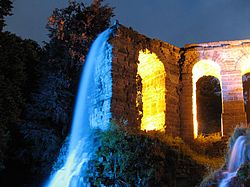
Die weltweit einmaligen Wasserspiele in Europas größtem Bergpark sind wie dieser weltweit einzigartig und wurden zurecht 2013 zum Weltkulturerbe erklärt. Sie finden immer Mittwochs und Sonntags, sowie Feiertags zwischen dem 1. Mai und dem 3. Oktober kostenlos statt und beginnen um 14:30 Uhr unterhalb des Herkules am Oktogon. Zuerst fließt das Wasser die Kaskaden herunter (barocke Wasserkünste), um dann als romantische Wasserkünste über den Steinhöfer Wasserfall, die Teufelsbrücke und das Aquädukt in den Fontänenteich zu fließen. Krönender Abschluss ist dann die 52m Große Fontäne um 15:45 Uhr. Beleuchtete Wasserspiele finden 2014 voraussichtlich am 7. Juni 2014 um 22 Uhr, 5. Juli 2014 um 22 Uhr, 2. August 2014 um 21.30 Uhr und am 6. September 2014 um 21 Uhr[outdated] instead of. Die Zeiten sind so bemessen, dass man bequem von einer Attraktion zur nächsten laufen kann.
Habichtswald (mountains)
Anschließend an den Kassel-Steig kann auch noch weiter durch bei den Kasseler Einwohnern sehr beliebte Habichtswald gewandert werden. Viele Wanderwege führen auch über den Herkules, ein Beispiel ist der als Premiumwanderweg ausgewiesene Habichtswaldsteig, welcher von Zierenberg until Edersee verläuft und 84 km lang ist.
Öffentliche Verkehrsmittel
The ![]() Hercules (Lines 22 and 23) liegt am Besucherzentrum östlich des Herkules.Wenn man mit der Linie 22 fährt (täglich), ist an der
Hercules (Lines 22 and 23) liegt am Besucherzentrum östlich des Herkules.Wenn man mit der Linie 22 fährt (täglich), ist an der ![]() Druseltal ein Umstieg in die Straßenbahnlinie 3 zur Weiterfahrt in die Kasseler Innenstadt nötig, bzw. ein Umstieg in die Buslinien 12 or 52, bzw. in die Gegenrichtung ein Umstieg in Habichtswald-Ehlen oder Habichtswald-Dörnberg in die Line 110 zur Weiterfahrt Richtung Wolfhagen. Die Linie 23 (Mittwochs, Sonn- und Feiertags) fährt dagegen entweder bis zur End
Druseltal ein Umstieg in die Straßenbahnlinie 3 zur Weiterfahrt in die Kasseler Innenstadt nötig, bzw. ein Umstieg in die Buslinien 12 or 52, bzw. in die Gegenrichtung ein Umstieg in Habichtswald-Ehlen oder Habichtswald-Dörnberg in die Line 110 zur Weiterfahrt Richtung Wolfhagen. Die Linie 23 (Mittwochs, Sonn- und Feiertags) fährt dagegen entweder bis zur End![]() der Straßenbahnlinie 1Wilhelmshöhe (Park) oder direkt bis zum Kassel-Wilhelmshöhe train station.
der Straßenbahnlinie 1Wilhelmshöhe (Park) oder direkt bis zum Kassel-Wilhelmshöhe train station.
literature
- Wanderführer Kassel-Steig - Ein Panoramawanderweg rund um das Kasseler Becken: ISBN 978-3-86973-064-6 , erschienen in der Kartograpischen Kommunalen Verlagsgesellschaft mbH (10,00 €).
- Wanderkarte Kassel-Steig - Ein Panoramawanderweg in der Region Kassel rund um das Kasseler Becken: Stadt Kassel, Vermessung und Geoinformation (2,00 €).
- Wander- und Freizeitkarte Kassel - Aktuell noch ohne Kassel-Steig und Habichtswaldsteig, nächste Ausgabe ist aber bereits in Planung, Stadt Kassel, Vermessung und Geoinformation (4,50 €)
Web links
- Offizielle Seite des Kassel-Steiges.
- Offizielle Seite des 1100 Jahr-Komitees der Stadt Kassel.