
The Fulda-Diemel-Weg is a 67-kilometer main hiking trail from kassel above Liebenau to Bad Karlshafen. Originally from 1930 as part of the Fuldahöhenweges (X 17) marked, the hiking route was given its current name in 1975 with a different marking due to criticism of the misleading naming. Old markings of the Fuldahöhenweg can still be seen today.
Route profile


- Length: 67 km. The Fulda-Diemel-Weg can be easily divided into several stages of different lengths.
- Altitude meters: About 1600 meters. The two starting points, the Wilhelmshöhe (park) stop and the train station Bad Karlshafen, lie at different heights.
- Stages: 5 stages, the start and end points of which can all be easily reached by public transport and often have a place to stop for refreshments.
- Mark: The Fulda-Diemel-Weg is marked with a white F, mostly on a black or dark background. The stickers also bear the words "Fulda-Diemel-Weg" and "HWGHV".
- Signposting: Most of the signs for the Fulda-Diemel-Weg can be described as good. Only signposts with kilometer information are rarely found on the hiking route.
- Suitable footwear: In dry weather, the hiking trail can be walked on with normal shoes with a good profile, apart from short sections such as on the Helfensteinen.
- Family suitability: Only sporadically, as the Fulda-Diemel-Weg always has steeper gradients.
- Mountain bike suitability: Yes, in parts also suitable for beginners without much experience.
- Best season: All year round, but preferably the Fulda-Diemel-Weg should be hiked in dry weather.
background


The Fulda, not to be confused with the city of the same name Fulda, is a 220.7 km long left main source river of the Weser and runs through it Hesse and Lower Saxony. It rises in the Hessian part of the Rhön at the Wasserkuppe and forms together with the Werra in the three-river city Hann. Münden most famous Weserstein in Lower Saxony the two headwaters of the Weser.
The Diemel is a 110.5 km long left tributary of the Weser and runs through it Hesse and North Rhine-Westphalia. It arises in the Rothaar Mountains near Usseln, a district of Willingen (Upland) and flows over the Diemelsee, Marsberg, Warburg and Trendelburg to Bad Karlshafen. The section of stems (at Trendelburg) to Bad Karlshafen was from 1710 to 1723 as part of the never completed Landgraf-Carl-Kanales made navigable.
The Fulda-Diemel-Weg was originally laid out as the Fuldahöhenweg (X 17) when the Kurhessian through hiking routes were set up in 1930. The naming was criticized early on, the hiking route runs between kassel and Bad Karlshafen far away from the Fulda. Therefore, this section became the Fulda-Diemel-Weg in 1975 and the Fuldahöhenweg was given a new route Hann. Münden. Today you can still see old markings of the Fuldahöhenweg (white X) in some places.
getting there


.JPG/250px-Eco_Pfad_Archäologie_Dörnberg_(1).JPG)


By car

Parking spaces for hikers along the Fulda-Diemel-Weg can be found at Bergpark Wilhelmshöhe and in Habichtswald (mountains), on the Hohen Dörnberg, at the grill hut Oberlistingen and at Deiselberg Trendelburg. Since the Fulda-Diemel-Weg is a long-distance hiking trail, the use of public transport to get there is recommended.
With public transport

Both starting points of the Fulda-Diemel-Weg can be easily reached by bus and train. All stops on Fulda-Diemel-Weg or in the immediate vicinity have been linked with a photo. In addition, all bus and AST lines operating there are listed, the timetables can be downloaded directly as PDF.
Route description


The Fulda-Diemel-Weg can be divided into five stages and runs mainly over paved forest and farm roads. But even these can quickly become muddy and difficult to walk on when the weather is appropriate. Between the Schreckenbergen and Sieberhausen, the Fulda-Diemel-Weg is 13.5 kilometers from the Habichtswaldsteiges. For a detailed hiking map, please simply click on the POIs that will immediately direct you to the described position.
1st stage: Wilhelmshöhe - Hoher Dörnberg 11.0 km

Of the 1 ![]() Wilhelmshöhe (park) (Lines 1 and 23) at the visitor center of the mhk (Bergpark Wilhelmshöhe) it is only a few meters to the Ochsenallee car park, at the entrance to which from Wilhelmshöher Allee the Fulda-Diemel-Weg begins at a now obsolete walking board. Together with the Herkulesweg (X7) you walk across the parking lot to Ochsenallee, which you go north together with the Discovery tour Kassel until the Prinzenqulle follows. There is a popular water step south of the actual spring. The Fulda-Diemel-Weg branches off shortly after the actual Prinzenquelle into a narrow, initially steeper forest path up to the Hessenschanze. Alternatively, you can also take the Prinzenweg (K2), one of the seven Spa routes, via Schanzenstrasse to 2
Wilhelmshöhe (park) (Lines 1 and 23) at the visitor center of the mhk (Bergpark Wilhelmshöhe) it is only a few meters to the Ochsenallee car park, at the entrance to which from Wilhelmshöher Allee the Fulda-Diemel-Weg begins at a now obsolete walking board. Together with the Herkulesweg (X7) you walk across the parking lot to Ochsenallee, which you go north together with the Discovery tour Kassel until the Prinzenqulle follows. There is a popular water step south of the actual spring. The Fulda-Diemel-Weg branches off shortly after the actual Prinzenquelle into a narrow, initially steeper forest path up to the Hessenschanze. Alternatively, you can also take the Prinzenweg (K2), one of the seven Spa routes, via Schanzenstrasse to 2 ![]() Hessenschanze (Line 8), where the Fulda-Diemel-Weg joins Schanzenstraße. From the tram stop you walk up the now graveled Schanzenstraße south of the Hessenschanze up to its upper end, from which you can follow the markings of the Fulda-Diemel-Weg above the forest playground in the Habichtswald follows into it. Initially on paved paths, later from a water tank and then on unpaved roads you can reach the uphill Alley of lawn, at which behind the Montessori School Kassel is also the homonymous 3
Hessenschanze (Line 8), where the Fulda-Diemel-Weg joins Schanzenstraße. From the tram stop you walk up the now graveled Schanzenstraße south of the Hessenschanze up to its upper end, from which you can follow the markings of the Fulda-Diemel-Weg above the forest playground in the Habichtswald follows into it. Initially on paved paths, later from a water tank and then on unpaved roads you can reach the uphill Alley of lawn, at which behind the Montessori School Kassel is also the homonymous 3 ![]() Alley of lawn (Lines 10, 18 and 24) is located.
Alley of lawn (Lines 10, 18 and 24) is located.
After crossing the Rasenallee (Landesstraße 3217) you walk along a gravel forest path along with other marked hiking routes west of Harleshausen to the Alte Wolfhager Straße. From this forest crossing you can easily take a short detour to the nearby one Artist necropolis do at the blue lake. The Fulda-Diemel-Weg continues down a depression to the Geilebach and past the former Mosthof on the 4 gravelled old Wolfhager Straße along some clearings through the Habichtswald. After several kilometers you shorten a bend in the now asphalted Alte Wolfhager Straße and finally you reach Wolfhager Straße in the Ahnetal, the currently closed Gasthaus Ahnetal and the 5 ![]() Ahnetal (Line 110). After crossing the ancestor, keep to the left of Wolfhager Straße (Bundesstraße 251) in order to hike on its old road route and other forest paths in the direction of Hohlestein. But before you can reach it via narrow, unpaved forest paths, you first have to cross Wolfhager Straße in a bend that is sometimes confusing. Finally, halfway around the hollow stone, you reach a wooden one 6 Refuge, on the one hand an information board of the Eco path archeology Dörnberg and on the other a footpath leads up to the mountain. However, due to a small climbing passage, the ascent of this is only suitable for people with a head for heights.
Ahnetal (Line 110). After crossing the ancestor, keep to the left of Wolfhager Straße (Bundesstraße 251) in order to hike on its old road route and other forest paths in the direction of Hohlestein. But before you can reach it via narrow, unpaved forest paths, you first have to cross Wolfhager Straße in a bend that is sometimes confusing. Finally, halfway around the hollow stone, you reach a wooden one 6 Refuge, on the one hand an information board of the Eco path archeology Dörnberg and on the other a footpath leads up to the mountain. However, due to a small climbing passage, the ascent of this is only suitable for people with a head for heights.
From the refuge below the Hohlestein, hike briefly through the forest before the hiking trail changes to a meadow path that runs along the edge of the forest to a crossroads west of the Hohen Dörnberg leads from which the Kassel-Steig runs up to the summit. The Fulda-Diemel-Weg runs together with the Kassel-Edersee cycle path first along the eastern slope of the Dörnberg over a gravel forest path to the west of the Helfensteine. Only at the 7 At the intersection with a bench and signpost, the Fulda-Diemel-Weg branches off to the west Hohen Dörnberg from. The meadow path used for this, or later forest path, is unfortunately often in a poor condition when the weather is appropriate, which is why it can sometimes be advantageous to make a detour via the Helfensteine via a further meadow path a little further south. Who, on the other hand, continues the Fulda-Diemel-Weg and the Kassel-Steig follows, soon reaches the beginning of the glider area between the pasture fence and the edge of the forest along a turnstile. Although the Fulda-Diemel-Weg only runs along the edge of it, which is why it can be walked without any problems even during flight operations, the alternative route is via the Habichtswaldsteig mentioned (see map). The first stage of the Fulda-Diemel-Weg ends shortly afterwards Habichtswald Nature Park Center. Gastronomy can be found with the Café Eden and the Dörnberghaus just like that 8 ![]() Nature Park Center (Line 117) in the immediate distance.
Nature Park Center (Line 117) in the immediate distance.
2nd stage: Hoher Dörnberg - Niederlistingen 16.5 km


.JPG/250px-Fulda-Diemel-Weg_Lied_Liebenau_(Hessen).JPG)
_Anhaltsberg.JPG/250px-Fulda-Diemel-Weg_Liebenau_(Hessen)_Anhaltsberg.JPG)


_(1).JPG/250px-Bahnhof_Liebenau_(Hessen)_(1).JPG)
Of the ![]() Nature Park Center (Line 117) you walk over meadow paths along the pasture fence past the Dörnberghaus, always parallel to the district road 97, which can also be used as an alternative. Finally, at the end of the glider site (turnstile), you change the side of the road and continue walking across a gravel parking lot past the 9
Nature Park Center (Line 117) you walk over meadow paths along the pasture fence past the Dörnberghaus, always parallel to the district road 97, which can also be used as an alternative. Finally, at the end of the glider site (turnstile), you change the side of the road and continue walking across a gravel parking lot past the 9 ![]() Alpine path (Line 117) with refuge to Landesstraße 3214. After carefully crossing this, follow the markings of the Fulda-Diemel-Weg and the extra tour H2 des Habichtswaldsteiges first on paved forest paths through a coniferous forest, then later on unpaved forest paths through a deciduous forest. After all, you are on the 10 Arrived north side of the Kleiner Schreckenberg, from which the hiking route "white circle" over the Schreckbergturm and the blue stones after Zierenberg branches off (approx. 3.5 km). The Fulda-Diemel-Weg continues on mostly paved forest roads in a northerly direction over the mountain ranges of the forest. Shortly after the branch to the Schreckenberg tower, 30 meters west of the hiking trail, there is a small vantage point with a bench high above the Warmetal. A little further to the northwest, not far from the hiking route, is the 11 Schartenberg castle ruins, which was first mentioned in 1124 and thus as one of the oldest Hessen applies. At the moment, access to the castle is forbidden due to the risk of collapse. To the north of the Schartenberg you always alternate between paved and unpaved paths and paths over the Hirschköpfchen to the 12 Forest area Hagen, through which the Upland-Weserbergland-Weg (X6), the Hessenweg 6 and the Huguenot and Waldensian trails run. Together with these hiking trails, the Fulda-Diemel-Weg leads steadily downhill over a paved forest path to Laar. Past the small cemetery, from which the hiking route ⊥ through the Warmetal to Zierenberg branches off (approx. 5.5 km), you cross the small estate with Laar Castle and 15 residents, which houses a mill museum in the old mill and at the same time a district of Zierenberg until you get the 13 Reached state road 3211.
Alpine path (Line 117) with refuge to Landesstraße 3214. After carefully crossing this, follow the markings of the Fulda-Diemel-Weg and the extra tour H2 des Habichtswaldsteiges first on paved forest paths through a coniferous forest, then later on unpaved forest paths through a deciduous forest. After all, you are on the 10 Arrived north side of the Kleiner Schreckenberg, from which the hiking route "white circle" over the Schreckbergturm and the blue stones after Zierenberg branches off (approx. 3.5 km). The Fulda-Diemel-Weg continues on mostly paved forest roads in a northerly direction over the mountain ranges of the forest. Shortly after the branch to the Schreckenberg tower, 30 meters west of the hiking trail, there is a small vantage point with a bench high above the Warmetal. A little further to the northwest, not far from the hiking route, is the 11 Schartenberg castle ruins, which was first mentioned in 1124 and thus as one of the oldest Hessen applies. At the moment, access to the castle is forbidden due to the risk of collapse. To the north of the Schartenberg you always alternate between paved and unpaved paths and paths over the Hirschköpfchen to the 12 Forest area Hagen, through which the Upland-Weserbergland-Weg (X6), the Hessenweg 6 and the Huguenot and Waldensian trails run. Together with these hiking trails, the Fulda-Diemel-Weg leads steadily downhill over a paved forest path to Laar. Past the small cemetery, from which the hiking route ⊥ through the Warmetal to Zierenberg branches off (approx. 5.5 km), you cross the small estate with Laar Castle and 15 residents, which houses a mill museum in the old mill and at the same time a district of Zierenberg until you get the 13 Reached state road 3211.
After you had to walk a short distance along the state road 3211, over which the Hessian long-distance cycle route R4 and the Warmetal cycle path run, turn west into the donkey path, an unpaved forest path and ravine. This leads you steadily uphill to the edge of the forest east of the Malsburg, where the Fulda-Diemel-Weg and Upland-Weserbergland-Weg (X6) separate again. Who made a detour over the Malsburg castle ruins want to do follow the latter hiking trail further uphill, if you want to continue hiking on the Fulda-Diemel-Weg, on the other hand, runs on gravel forest trails hilly along the edge of the forest to 14 Elevated reservoir of the waterworks Rittergut Hohenborn from 1909, where you also meet the Märchenlandweg (M) that leads down from the Malsburg and the estate of the same name. Together with this hiking route, you now hike further north on asphalt and gravel farm roads to the Langen Grund, in which the extra tour H1 des Habichtswaldsteiges come in addition. All three hiking trails now lead over an asphalt farm road up to Gut Sieberhausen, which, however, is half-bypassed on meadow paths. Of 15 Sieberhausen is then only a few meters over the district road 86, which is only used as an access road, to the edge of the forest of the Igelsbett forest area, which you enter after enjoying the wide view towards Warmetal. The Fulda-Diemel-Weg runs here over uneven forest paths and unpaved but pleasant forest paths parallel to district road 86, which can also be walked alternatively and which is also used by the Märchenlandweg (M). Along the edge of the forest with a beautiful view over Oberlistingen towards Warburg then lead all three hiking routes back together to 16 Barbecue hut Oberlistingen, at which there is also a small parking lot for hikers. From the grill hut it is about 750 meters to Oberlistingen via the asphalted hedgehog path ![]() Arolser Strasse (Lines 120 and 130).
Arolser Strasse (Lines 120 and 130).
The Fulda-Diemel-Weg, however, does not lead down to Oberlistingen, but rather over gravel farm roads under the federal highway 7, at the underpass of which you will find kilometer information, through to Niederlistingen. Via the Triftweg you finally reach the town center, where the Holländische Straße (Landesstraße 3080) is located 17 ![]() Niederlistingen (Lines 120 and 130) is located.
Niederlistingen (Lines 120 and 130) is located.
3rd stage: Niederlistingen - Lamerden 14.0 km
_(2).JPG/250px-Bahnhof_Liebenau_(Hessen)_(2).JPG)


Follow the Holländische Straße from the ![]() Niederlistingen (Lines 120 and 130) from west to the Evangelical Church, before which you turn north into the street Zum Goldesberg. Follow this uphill from Niederlistingen past a playground and the Niederlistingen barbecue hut, before reaching the edge of the forest via meadow paths, where the Fulda-Diemel-Weg and the Märchenlandweg (M) separate. While the Fulda-Diemel-Weg crosses the Wolfsloh forest area, the Märchenlandweg runs around it once. Further uphill into the forest you soon reach the highest point of the Wolfslohe via unpaved forest paths, from which you can reach the edge of the forest and the Märchenlandweg (M) for a short distance via a gravel forest path, then later again via an unpaved path. Both hiking routes now lead together over smaller trails to the now heavily overgrown 18 Refuge Desenbergblick at the edge of the forest of the Wolfslohes south of Ersen. Nonetheless, you have a nice view towards it from here Warburg and Desenberg. From the Desenbergblick refuge you walk along the edge of a field before you finally reach the Ersen cemetery. From here the two hiking routes lead along Bruchstrasse, Brautweg and Alzer Seiten on the outskirts; the
Niederlistingen (Lines 120 and 130) from west to the Evangelical Church, before which you turn north into the street Zum Goldesberg. Follow this uphill from Niederlistingen past a playground and the Niederlistingen barbecue hut, before reaching the edge of the forest via meadow paths, where the Fulda-Diemel-Weg and the Märchenlandweg (M) separate. While the Fulda-Diemel-Weg crosses the Wolfsloh forest area, the Märchenlandweg runs around it once. Further uphill into the forest you soon reach the highest point of the Wolfslohe via unpaved forest paths, from which you can reach the edge of the forest and the Märchenlandweg (M) for a short distance via a gravel forest path, then later again via an unpaved path. Both hiking routes now lead together over smaller trails to the now heavily overgrown 18 Refuge Desenbergblick at the edge of the forest of the Wolfslohes south of Ersen. Nonetheless, you have a nice view towards it from here Warburg and Desenberg. From the Desenbergblick refuge you walk along the edge of a field before you finally reach the Ersen cemetery. From here the two hiking routes lead along Bruchstrasse, Brautweg and Alzer Seiten on the outskirts; the ![]() Fountain square (Lines 132 and 140) is one cross street.
Fountain square (Lines 132 and 140) is one cross street.
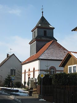
Ersen will be left east of the sports fields via the paved mountain road. Shortly after leaving the village, a dirt road branches off to 19 Old Ersen complaint court, where today there is a small rest area with a nice view towards Niedermeiser. You hike on along an asphalt farm road to the Petersholz forest area, from the edge of which a gravel forest path crosses it once. Passing blue signs indicating the water protection area there, you soon come to the edge of the forest of the Petersholz, which is now called Lied, and continue straight on along gravel forest paths Liebenau. Shortly before 20 Liebenau Then Fulda-Diemel-Weg and Märchenlandweg (M) branch off to the northeast, to lead over asphalt farm roads over the Hopfenberg to the Jewish cemetery. Alternatively, you can also use the old route of the Fulda-Diemel-Weg to Liebenau train station with the same name ![]() railway station (Line 140), but Liebenau station was closed in December 2015. From the Jewish cemetery it is not far to the north Liebenau into the
railway station (Line 140), but Liebenau station was closed in December 2015. From the Jewish cemetery it is not far to the north Liebenau into the ![]() Ostheimer Strasse (Lines 140 and 141), from which one can take the old stone path through the old town center of Liebenau runs over the Diemel to the Diemeltalschule, which is also where the 21
Ostheimer Strasse (Lines 140 and 141), from which one can take the old stone path through the old town center of Liebenau runs over the Diemel to the Diemeltalschule, which is also where the 21 ![]() school (Lines 140 and 141) is located.
school (Lines 140 and 141) is located.
From the Diemeltalschule, or the Diemel, on the banks of which there are several benches, you first follow the Diemel cycle path on the Nösselweg past the sports hall before the Fulda-Diemel-Weg branches off into the Rottweg, which goes up steeply Liebenau leads out to the Anhaltsberg and the Steinberg. For the first time in the immediate vicinity of wind turbines, you can quickly reach a wooded area via the Steinberg plateau on gravel farm roads with a beautiful view, through which the border between Hesse and North Rhine-Westphalia runs. This and the national border is crossed on paved roads and unpaved paths not far from the Wacholderberg. With the opposite edge of the forest, the Warburger Börde is finally reached, a predominantly treeless and fertile Börden landscape. The Fulda-Diemel-Weg, the Märchenlandweg (M) and for a short distance also the Höxter Süd district hiking trail run over meadow paths 22 Farms "Vor dem Walde", where the first two hiking routes mentioned branch off to the east and a fairly straight, partially graveled farm road, from which you have a beautiful view of Lamerden and the Diemeltal, lead down into the Diemeltal to Lamerden. The state border between North Rhine-Westphalia and Hesse crossed at which the Eco path Muschelkalk in the Diemel valley branches off to Schwiemelkopf. Once in Lamerden, it is not far to the 23 ![]() Lambs soil (Lines 140 and 141), which is located on the opposite bank of the Diemel at the level of the former train station.
Lambs soil (Lines 140 and 141), which is located on the opposite bank of the Diemel at the level of the former train station.
4th stage: Lamerden - Langenthal 13.5 km


Of the ![]() Lambs (Lines 140 and 141) you hike over the Diemel back to the Fulda-Diemel-Weg, which winds uphill over the paved Muddenhagener Weg up to the Sparrenstein. From there you continue to walk on asphalt farm roads, slightly uphill towards the north. The further you hike up the mountain, the more beautiful it becomes 24 View of the Diemeltal and across the Alstertal to the Warburger Börde. Finally, the first wind turbines southeast of Muddenhagen are reached, from which you can either take the Eberschützer Straße to Muddenhagen
Lambs (Lines 140 and 141) you hike over the Diemel back to the Fulda-Diemel-Weg, which winds uphill over the paved Muddenhagener Weg up to the Sparrenstein. From there you continue to walk on asphalt farm roads, slightly uphill towards the north. The further you hike up the mountain, the more beautiful it becomes 24 View of the Diemeltal and across the Alstertal to the Warburger Börde. Finally, the first wind turbines southeast of Muddenhagen are reached, from which you can either take the Eberschützer Straße to Muddenhagen ![]() Mitte (lines 200 (Ladleif / vph) and 532 (WEB / vph)), or down to Eberschütz or Sielen. At Sieler Straße, the Märchenlandweg (M) branches off into the Diemeltal to Sielen (approx. 3.5 km). The Fulda-Diemel-Weg, on the other hand, now leads over gravel farm roads along the state border of Hesse and North Rhine-Westphalia past the 25 Fritz-Gelhaus-Eiche into the forest, in which the hiking route changes to unpaved, sometimes hardly identifiable forest paths. Due to the very good marking in this section, it cannot get lost. In the Kohlschlag forest area, Grenzstein-Rundweg 2, starting from the Deiselberg hiking car park, meets the Fulda-Diemel-Weg and both hiking trails continue along the state border past an old border stone with the inscription Clemens August Bischof zu Paderborn / Wilhelm VIII Landgraf to Hessen. Finally, the Fulda-Diemel-Weg leaves the state border between Hesse and North Rhine-Westphalia leads over an unpaved forest path through the forest to Mittelberg, where there are two wooden huts right on the edge of the path. From these you then hike on over gravel forest roads to the 26 on Landesstrasse 763.
Mitte (lines 200 (Ladleif / vph) and 532 (WEB / vph)), or down to Eberschütz or Sielen. At Sieler Straße, the Märchenlandweg (M) branches off into the Diemeltal to Sielen (approx. 3.5 km). The Fulda-Diemel-Weg, on the other hand, now leads over gravel farm roads along the state border of Hesse and North Rhine-Westphalia past the 25 Fritz-Gelhaus-Eiche into the forest, in which the hiking route changes to unpaved, sometimes hardly identifiable forest paths. Due to the very good marking in this section, it cannot get lost. In the Kohlschlag forest area, Grenzstein-Rundweg 2, starting from the Deiselberg hiking car park, meets the Fulda-Diemel-Weg and both hiking trails continue along the state border past an old border stone with the inscription Clemens August Bischof zu Paderborn / Wilhelm VIII Landgraf to Hessen. Finally, the Fulda-Diemel-Weg leaves the state border between Hesse and North Rhine-Westphalia leads over an unpaved forest path through the forest to Mittelberg, where there are two wooden huts right on the edge of the path. From these you then hike on over gravel forest roads to the 26 on Landesstrasse 763.
At the Deiselberg hiking car park, from which two border stone circular paths start, cross the state road 763 and always walk along the edge of the forest on graveled forest paths around the Deiselberg. If visibility is good, the view from the edge of the forest extends across the Diemel valley and far into the Reinhardswald into it. On the north side of the mountain, the Fulda-Diemel-Weg changes to unpaved forest roads and meadow paths, from which Langenthal can be seen for the first time on the plateau to the north. But first you have to hike down partly small and steep forest paths into the Schwelligengrund, in which you come back to the Höxter Süd district hiking trail and the Kloster-Garten-Route cycle path. Under two high-voltage lines you follow the winding valley over gravel farm roads. Shortly before the Fulda-Diemel-Weg leads out of the Borngrund again, the branches 27 Kloster-Garten-Route to the north to Kreisstraße 72, on which direction Deisel also the ![]() Mill Klieves (Lines 180 and 181) is located (about 1.7 km). If you want to skip the climb up to Langenthal, you will find an attractive shortcut here. While the Höxter Süd district hiking trail continues along the Borngrund and leads up to Haarbrück, the Fulda-Diemel-Weg runs steeply uphill out of the Borngrund via an unpaved forest path, as described above. Finally you have reached the edge of the forest, from which you can already see Langenthal and reach the village via asphalt farm roads without steep inclines past cherry trees. Just a few meters from the Fulda-Diemel-Weg you can find the 28
Mill Klieves (Lines 180 and 181) is located (about 1.7 km). If you want to skip the climb up to Langenthal, you will find an attractive shortcut here. While the Höxter Süd district hiking trail continues along the Borngrund and leads up to Haarbrück, the Fulda-Diemel-Weg runs steeply uphill out of the Borngrund via an unpaved forest path, as described above. Finally you have reached the edge of the forest, from which you can already see Langenthal and reach the village via asphalt farm roads without steep inclines past cherry trees. Just a few meters from the Fulda-Diemel-Weg you can find the 28 ![]() center (Lines 180 and 181) on Deiseler Strasse.
center (Lines 180 and 181) on Deiseler Strasse.
5th stage: Langenthal - Bad Karlshafen 12.0 km

_(2).jpg/250px-Blick_vom_Hugenottenturm_(Bad_Karlshafen)_(2).jpg)
Of the ![]() center (Lines 180 and 181) follow Deiseler Straße to the second
center (Lines 180 and 181) follow Deiseler Straße to the second ![]() Mitte (line 200 (Ladleif / vph)). The Fulda-Diemel-Weg crosses the Helmarshäuser Strasse near this and leads north out of Langenthal via the asphalt Triftweg. First you follow the course of a small valley floor into the manufacturer forest, before you first switch to gravel paths and then later to unpaved forest paths. Near the border between Hesse and North Rhine-Westphalia a fenced forest area must be crossed, for which passages for hikers on the Fulda-Diemel-Weg were built. After passing the wire fence, however, make sure to close it again! Finally the national border is crossed and one reaches the 29 Rotsberg, on which the Höxter Nord district hiking trail from Jakobsberg meets the Fulda-Diemel-Weg. Shortly afterwards, the Weserhöhenweg, marked with a green X and the words "NaturZeitReise", comes from Beverungen added. All three hiking trails now run together over gravel forest paths steadily downhill through the manufacturer forest to the Red Mountain and before that past one 30 Information board of the Weserhöhenweg to the ravines running here. Soon afterwards the edge of the forest of the manufacturer forest is reached, from which one continues downhill, now asphalted past a grill hut to Manufacture wanders into it. If you follow the street Am Kemperborn down to the Weser in the village you come to
Mitte (line 200 (Ladleif / vph)). The Fulda-Diemel-Weg crosses the Helmarshäuser Strasse near this and leads north out of Langenthal via the asphalt Triftweg. First you follow the course of a small valley floor into the manufacturer forest, before you first switch to gravel paths and then later to unpaved forest paths. Near the border between Hesse and North Rhine-Westphalia a fenced forest area must be crossed, for which passages for hikers on the Fulda-Diemel-Weg were built. After passing the wire fence, however, make sure to close it again! Finally the national border is crossed and one reaches the 29 Rotsberg, on which the Höxter Nord district hiking trail from Jakobsberg meets the Fulda-Diemel-Weg. Shortly afterwards, the Weserhöhenweg, marked with a green X and the words "NaturZeitReise", comes from Beverungen added. All three hiking trails now run together over gravel forest paths steadily downhill through the manufacturer forest to the Red Mountain and before that past one 30 Information board of the Weserhöhenweg to the ravines running here. Soon afterwards the edge of the forest of the manufacturer forest is reached, from which one continues downhill, now asphalted past a grill hut to Manufacture wanders into it. If you follow the street Am Kemperborn down to the Weser in the village you come to ![]() Torbreite (line 220 (Risse / vph)), but the Fulda-Diemel-Weg leads uphill on Carolus-Magnus-Straße past the Herstelle cemetery to 31 Abbey of the Holy Cross Manufacture immediately south of the w: Castle Manufacture. If you want to visit this or the Karlstein with Kreuzstein to the north of the cemetery, turn off at the parking lot, on which an information board for the Weserhöhenweg can be found.
Torbreite (line 220 (Risse / vph)), but the Fulda-Diemel-Weg leads uphill on Carolus-Magnus-Straße past the Herstelle cemetery to 31 Abbey of the Holy Cross Manufacture immediately south of the w: Castle Manufacture. If you want to visit this or the Karlstein with Kreuzstein to the north of the cemetery, turn off at the parking lot, on which an information board for the Weserhöhenweg can be found.
From the Abbey of the Holy Cross Herstelle you walk east over the street Auf der Worth Manufacture out. Several signs on the Fulda-Diemel-Weg refer to the nearby one Erlenhof with a farm café, via which the hiking route does not lead. Instead, you follow the markings of the Fulda-Diemel-Weg in a zigzag up to the Strauchberg, from which you can reach the edge of the forest with a bench via a meadow path. We continue on unpaved forest paths, first along the edge of the forest, later through the forest and over a small staircase to the so-called 32 Tri-border area, at which the Peter-Peter-Hütte stands. Incidentally, the border triangle no longer lives up to its name today, the national borders of Hesse, North Rhine-Westphalia and Lower Saxony meanwhile moved so that they are on the other side of the Weser north of Bad Karlshafen meet each other. From the Peter-Peter-Hütte and the Dreiländereck you hike on narrow paths a little downhill to the temple of the singers, for the first time with a view Bad Karlshafen, and on to 33 w: Huguenot Tower (Bad Karlshafen). Further downhill through the forest you also pass the Ludwig Stein before you finally zigzag down stairs into the Diemeltal Bad Karlshafen descends. Together with Reinhardswald-Westweg (H) and Märchenlandweg (M) you reach Bremer Straße (Bundesstraße 83), which you cross together with the Diemel and follow Weserstraße (Bundesstraße 80) Bad Karlshafen wanders into it. At the harbor basin is the 34 ![]() Harbor square (Lines 180, 193 and 220 (Risse / vph)), where you can also find information about the hiking trails that start from here on the wall of the harbor basin. If you want to hike further to Bad Karlshafen train station a little away from traffic, you should not continue to follow the Fulda-Diemel-Weg over the Weserstraße, but the Weserberglandweg (XW) over the Kurpromenade along the Weser (see map). Both hiking routes finally run from the
Harbor square (Lines 180, 193 and 220 (Risse / vph)), where you can also find information about the hiking trails that start from here on the wall of the harbor basin. If you want to hike further to Bad Karlshafen train station a little away from traffic, you should not continue to follow the Fulda-Diemel-Weg over the Weserstraße, but the Weserberglandweg (XW) over the Kurpromenade along the Weser (see map). Both hiking routes finally run from the ![]() Brueckenstrasse (Lines 180 and 220 (cracks / vph)) along with the Weser cycle path over the Brückenstraße to the other bank of the Weser and past the
Brueckenstrasse (Lines 180 and 220 (cracks / vph)) along with the Weser cycle path over the Brückenstraße to the other bank of the Weser and past the ![]() At the saltworks (Line 180) to the 35 Train station of Bad Karlshafen (KBS 356), on whose forecourt there is also the
At the saltworks (Line 180) to the 35 Train station of Bad Karlshafen (KBS 356), on whose forecourt there is also the ![]() railway station (Lines 180 and 220 (cracks / vph)).
railway station (Lines 180 and 220 (cracks / vph)).
trips

From Bad Karlshafen train station you can take a short detour to the Weser Skywalk on the Hanover cliffs make, from which you have a beautiful view of the Weser valley and on Bad Karlshafen Has. To do this, you first hike on the from Bad Karlshafen train station Weser cycle pathbefore crossing the Sollingbahn via a level crossing and arriving at the entrance to the cliff path that was newly created in spring 2014. You then follow this demanding hiking trail up stairs to the hiking car park, from which a well-walked forest path secured with handrails leads to the Weser Skywalk. The length of the route is just about 1.5 kilometers at an altitude of 250 meters. Who of the Hanoverian cliffs not back after Bad Karlshafen If you want to hike, you can alternatively take the marked hiking trails down to Würgassen walk, it's two kilometers to the ferry.
literature
- HR Habichtswald / Reinhardswald Nature Park - Topographic leisure map 1:50 000, ISBN 978-3-89446-319-9 , 9.50 €, published jointly by the Hessisch-Waldeckischer Gebirgs- und Heimatverein e.V. and the Hessian State Office for Soil Management and Geoinformation (2012).
