,_Fira,_Drei_Glocken_von_Fira_--_2017_--_2589.jpg/300px-Santorin_(GR),_Fira,_Drei_Glocken_von_Fira_--_2017_--_2589.jpg) | |
| Santorini | |
| Regional district | South Aegean |
|---|---|
| Residents | 17.430 (2011) |
| no tourist info on Wikidata: | |
 Location of the Cyclades island of Santorini | |
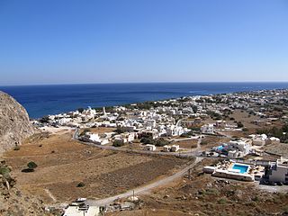
Santorini, Greek Σαντορίνη, is an archipelago of the Cyclades. Your main island with the Greek name Thira (Greek Θήρα) is probably the most popular tourist destination in the Cyclades, not only because of the beautiful beaches, but primarily because of the worldwide unique beauty of its villages on the edge of a volcanic crater.
Regions

The archipelago consists of five islands.
- 1 Thira (Σαντορίνη).


 in the Wikidata database") has an area of 79 km² and has a population of more than 13,000. The west side of Thira is characterized by a steeply sloping coast on the edge of the former volcanic crater, the east side, on the other hand, slowly slopes towards the sea, on its coast there are long beaches with dark lava sand. The highest point on the island is the limestone massif Profitis Elias with a height of 567 m.
has an area of 79 km² and has a population of more than 13,000. The west side of Thira is characterized by a steeply sloping coast on the edge of the former volcanic crater, the east side, on the other hand, slowly slopes towards the sea, on its coast there are long beaches with dark lava sand. The highest point on the island is the limestone massif Profitis Elias with a height of 567 m.

- 2 Thirasia (Θηρασία).is the second largest island with an area of around 9 km² and only a few 100 people live on it. Thirasia also has a steeply sloping coast on the inside of the caldera.

- 3 Aspronisi (Ασπρονήσι Θήρας).is a small uninhabited island. The name means white island and is derived from a pumice layer over 50 m thick.

- 4 Paléa Kaméni (Παλαιά Καμένη Θήρας).means old burned. The island first appeared in 197 BC. from the sea, it is uninhabited except for one hermit.

- 5 Néa Kaméni (Νέα Καμένη Θήρας).the new burned, first came in 1570 as Mikri Kameni over the water surface. After several volcanic eruptions, the uninhabited island got its present size and shape in 1950.

places
- 1 Firá
 (Φηρά Θήρας). Main town right on the edge of the crater. The place is actually called like the island Thíra, but the former Ottoman rulers pronounced the "th" like an "f" and emphasized it differently. To the north, Firá goes over to the higher places Firostefani (Φηροστεφάνι, "Crown of Firá") and Imerovigli. The three places have practically grown together and are sometimes viewed as a whole as Firá.
 - 2 Oía (Οία).spoken Yes, the place is on the edge of the crater in the north of the island, the sunsets are the most beautiful in the Cyclades. During the day it is quieter and more idyllic here than in Firá, but towards evening the place fills up very quickly with multitudes of tourists who want to watch the sunset. In the western part are the remains of a Byzantine fort. Below that, two hundred steps lead to the small port of Amoundi, from where you can reach the neighboring island of Thirassia in a ten-minute crossing.
- 3 Kamari (Καμάρι Θήρας).Tourist (too) well developed seaside resort in the southeast of the island near the airport with a car-free beach promenade with many hotels, restaurants, cafes and mini markets. The place was founded in 1956 when the inhabitants of the destroyed Mesa Gonia had to be relocated as a result of an earthquake.
- 4 Perissa (Περίσσα Θήρας).Seaside resort in the southeast of the island, popular with backpackers, with a centrally located campsite.
- 5 Akrotiri (Ακρωτήρι).the "Pompeii of the Aegean", famous for the excavations of an ancient city buried by volcanic ash.
- 6 Pyrgos Kallistis (Πύργος Καλλίστης Θήρας).Mountain village in the middle of the island, oldest still existing settlement, highest point on the island; quaint monastery and streets that can rival Oia.
- 7 Megalochori (Μεγαλοχώρι Θήρας). Village in the south of the island that has remained quite original.


Other goals
background
from history
The island known as "Kalliste" (the most beautiful) and "Strongyle" (the round) was inhabited as early as the 3rd millennium BC. By the Carians from Asia Minor. The Minoans followed them. At that time, the islands of Thira, Thirassia and Aspronisi were still connected to each other and formed an almost circular ring that only appears at today's south-western tip Akrotiri was open to the sea and enclosed a lagoon, in the middle of which a small mountain protruded from the water. This turned out to be a dangerous volcano, it erupted between 1630 and 1600 BC. off, the "Minoan Eruption" ended the settlement abruptly. Only a crescent-shaped crater rim remains of its once almost circular shape, covered with a meter-high layer of volcanic ash and pumice. The volcano's caldera collapsed, its crater rim drops steeply and extends several hundred meters into the depth.
A few centuries later, the Dorians settled here, they named the larger island as after their leader Thira, the smaller islands than Thirasia and Aspronisia. But volcanism remained active: in 197 BC. For the first time, a lava island rose from the middle of the caldera.
The Venetians came to the island around 1200. The name Santorini goes back to them after a church that Santa Irene was consecrated. From the 16th century to the 19th century the island was under Ottoman rule, in 1834 it came to the then newly founded Greek state.
Volcanism
Volcanism is still active in Santorini. In the 16th and 18th centuries, two more islands rose from the sea and united to form the island in 1925 Néa Kaméniwhose sulfur fumes still testify to the activity in the underground. And this volcanism caused an earthquake in 1956, with great destruction in all parts of the island. The place Mesa Gonia was almost completely destroyed, its inhabitants were relocated and founded the place Kamari.
Due to the volcanic ash of the Minoan eruption, some peculiarities have developed on Santorini that can only be found on this Cycladic island. Most of the houses in the villages on the edge of the crater are designed as cave dwellings: they were simply dug into the soft tuff, the front was closed with a vaulted roof and wall. The excavated pumice was used as a building material, it was still mined and traded until the middle of the last century. For example, the port of Port Said built on the Suez Canal with pumice from Santorini.
Water supply
In terms of water supply, Santorini has similar problems to most of the other Kykland Islands: there is no spring water. Rainwater is collected in cisterns, there is no central water supply. Much of the water comes from deep wells and is delivered by tanker truck. However, it is so salty that it is only suitable as service water for washing or showering. For some years now there has been a seawater desalination plant near Firá in order to obtain the quantities of water necessary for tourism at low cost. This water is available in bottles. Therefore, the following rule applies to Santorini:
- Water is from the tap no drinking water. However, you can safely use it for washing and brushing your teeth.
Agriculture and viticulture
The cultivation of agricultural products, especially wine, is naturally influenced by the water balance and the nature of the soil. The soils are a mixture of limestone, shale and volcanic earth, they have little humus and are permeable to water. The most important agricultural product is wine in many variations. Due to the dry soil, you can only grow a few vines, the plants get a large part of their water from the humidity and the morning dew. The vines are often drawn in a wreath shape and form baskets over time, the yield is often less than 35 hl per hectare despite all efforts. Mainly white grapes are grown, mostly Assyrtiko. The best-known product is the Vinsanto (not to be confused with the Italian Vin Santo). For this liqueur wine, the grapes are dried in the sun for several days after the harvest and only then pressed. Another well-known wine is the Nykterithat is pressed overnight. The pomace that arises during the pressing is also processed into Raki or Tsikoudia. Traditional products are also the small Santorini tomatoes and their processing into a paste, as well as the rarely found white aubergines.
For more information on viticulture and agriculture see article Megalochori and Pyrgos
language
The official language is modern Greek, but English is easy to communicate with.
getting there
By plane
The 1 Santorini Airport![]()
![]()
![]()
![]() (IATA: JTR) is located in the east of the island of Thira between Monolithos and Kamari. He is daily from Athens from Olympic Air and Aegean Airlines flown to, in the season 4-5 times a day. From other European airports there are also charter flights to the island, often with a stopover in Athens or at the airport in Chaniá on Crete.
(IATA: JTR) is located in the east of the island of Thira between Monolithos and Kamari. He is daily from Athens from Olympic Air and Aegean Airlines flown to, in the season 4-5 times a day. From other European airports there are also charter flights to the island, often with a stopover in Athens or at the airport in Chaniá on Crete.

By boat
- Of Piraeus there are several ferry connections:
- From Rafina: Rafina - Andros - Tinos - Mykonos - Paros - Naxos - Ios - Santorini]]
- There are also ferries to and from Crete
The ferries lay at the port Athinios at, a few kilometers south of Firá.
mobility
The bus network is designed in a star shape. The central point is the bus station in Firá, from there buses run regularly to Oía, Kamari, Perissa, Akrotiri and Santorini Airport, occasionally to Vlihada and Monolithos. Tickets are available from the machine or from the driver; the price for short journeys is € 1.80 (as of 2020). The bus timetables change several times during the season, current plans can be found on the operator's website KTEL. On site, the timetable at the bus station in Firá is decisive, the timetable at the airport is incorrect (as of 2020). Numerous holidaymakers have reported on Tripadvisor that the buses are generally unpunctual or canceled completely, the staff are rude and aggressive, especially in the high season, people are yelled at, cheated when paying the fare, and the drivers are on theirs while driving on the steep coast Typing a smartphone, stops would be left out at will or passengers simply not taken.
Rental vehicle: In all larger towns (Firá, Kamari and Perissa) rental of small cars, quads and two-wheelers. Due to the short distances, a scooter is usually sufficient to explore the island. However, weakly motorized vehicles are a traffic obstacle on the often hilly roads.
Taxi: There are less than 40 taxis across the island. The waiting time is correspondingly long in the main season. If you have a taxi called at the hotel, you may have to wait up to an hour for it. It is common for the taxi to pick up other passengers along the way and the fare to be shared among the passengers. The journey from the airport to Firá costs between € 15 and € 50. Not all taxi drivers can change larger bills.
Private transport companies: As an alternative to the few taxis, there are private transport service providers that can be booked in advance on the Internet. The trip from the airport to Firá costs from 30 € (as of 2020). Some hotels offer an airport shuttle.
Tourist Attractions

- Akrotiri archaeological site. After a ceiling collapse in September 2005, in which a tourist was killed, the excavation site was closed. On April 10th, 2012 she became reopened.
- Old Thira archaeological site. On the 567 m high Profitis Elias.
activities
Beach and swimming. Santorini is not a real bathing island, even if there are some beautiful beaches in the east and south of the island. Most of them are made of black sand of volcanic origin mixed with pebbles.
Hike. A highlight on Santorini is the hiking trail along the steep coast of the caldera from Firá to Oia. You need between 3 and 5 hours for the 10.5 km long route because of the many inclines. If you make a detour in Imerovigli to the Skaros rock, which is located on a headland high above the sea, you have to add at least an hour. Climbing the 5 m high rock plateau on a vertical wall with stone protrusions is not entirely safe. For all hikes on the island you absolutely need sturdy shoes.
Catamaran and boat trips. Numerous boat trips are offered from March to November, departing either from the old port of Firá (Ormos Firon), which can be reached either by a staircase with 588 steps or by cable car, or from the Athinios ferry port located 5 km to the south. The most popular tours include 5-hour round trips on a catamaran and 3-hour trips to the two volcanic islands with a hike on Néa Kaméni and a swim stop in front of Paléa Kaméni.
Stay
There are hotels and apartments with a fantastic view of the caldera in the towns of Fira and Oia (usually correspondingly expensive). The hotels get cheaper (and the quality sometimes better) the further you are from the crater rim. It can also be worthwhile to look for good but cheaper accommodation in Firostefani or Imerovigli. Most hotels close at the end of October and only reopen for Orthodox Easter (April or May).
Package accommodation mostly in Perissa and Kamari
Private room and apartment rental in all locations (rule of thumb: the further away from the crater rim, the cheaper)
kitchen
The island specialties are Fava, a porridge made from small yellow chickpeas and Keftedes, vegetable lobes fried in oil made from fava, possibly tomatoes, flour, onions and spices.
.jpg/220px-Φάβα_Σαντορίνης_(4463510858).jpg)
Fava
.jpg/220px-Ντοματοκεφτέδες_Σαντορίνης..._(4468320350).jpg)
Domatokeftedes
.jpg/220px-Φάβα_Σαντορίνης_(4463510858).jpg)
.jpg/220px-Ντοματοκεφτέδες_Σαντορίνης..._(4468320350).jpg)
Otherwise normal island cuisine with a lot of fish and seafood.
.jpg/220px-A_Real_Greek_Image_(4784838496).jpg)
Octopus hangs out to dry in the sun
.jpg/220px-Μπακαλιάρος_-_Σκορδαλιά_(4463505646).jpg)
Cod with garlic sauce
.jpg/220px-A_Real_Greek_Image_(4784838496).jpg)
.jpg/220px-Μπακαλιάρος_-_Σκορδαλιά_(4463505646).jpg)
The white wines produced on the island deserve special mention. The ash and lava rock in the ground produce excellent wines.
nightlife
Discos and bars in all places
Special feature: enjoy a view of the caldera at the edge of the crater while listening to classical music
security
There is hardly any crime in Santorini, and the risk of being a victim of pickpocketing is very low. On the other hand, there are numerous dubious renters of scooters and quads without adequate insurance. You shouldn't buy in shops or order from restaurants that don't show prices.
When hiking along the steep coast one should not deviate from the path, landslides and falls occur again and again. Access to Red Beach is officially closed for this reason, although the ban is regularly ignored. However, the water-side approach as part of a catamaran tour is better.
climate
From May to September (high season) there is hardly any rain with a consistently cloudless sky. It gets really hot in July and August, from 11 a.m. the temperature exceeds 30 ° C. In April and October, however, temperatures sometimes drop below 20 ° C and precipitation is possible.
literature
Web links
- http://www.kalliste.de/ - Informative Santorini site with forum
- http://www.santorin-insel.de/ - Travel information for Santorini with forum
- http://www.vulkaninsel-santorin.de/ Information about the nature, geology, land and people of Santorini
- https://santorinidave.com/santorini-map 35 detailed printable maps of Santorini