| Equatorial Guinea | |
 | |
Location  | |
Coat of arms and flag  | |
| Capital | Malabo |
|---|---|
| Government | presidential republic |
| Currency | Central African CFA Franc (XAF) |
| Surface | 28,051 km² |
| Inhabitants | 676.000 (2009 estimate) |
| Tongue | Spanish, French is Portuguese |
| Religion | Christianity (93%), Islam (1%) and the rest atheists or minor religions (2007) |
| Electricity | 220V / 50Hz (European socket) |
| Prefix | 240 |
| TLD | .gq |
| Time zone | UTC 1 |
| Website | Equatorial Guinea site[link previously not working] |
Equatorial Guinea is a state ofCentral Africa overlooking the Atlantic Ocean to the west and bordering the Cameroon to the north and with the Gabon to the east and south.
To know
Equatorial Guinea is a beautiful state that has a dense forest in the hinterland where you can find numerous villages and cities, and has 2 islands, theBioko Island where is the capital e Annobón a wonderful wild island that has wonderful beaches and a very welcoming population, the whole coast of the country is wonderful. This country has several oil fields which lead it to be the country with the highest per capita African GDP distributed in a totally unfair way due to a ferocious dictatorship. Virtually the entire oil proceeds end up in the absolute dictator's American bank accounts. In Equatorial Guinea there is no civil liberty, there are no rights and as some Italians have also experienced, one can be arrested for any reason and tortured by the police even to death.
Geographical notes
The continental zone, with the exception of a narrow coastal plain, is mountainous. It is crossed by various waterways, the most important of which is the Rio Benito which, coming down from the east, divides it into two parts. The most important continental region is undoubtedly that of Mbini, known as Rio Muni, which extends over 26,000 square kilometers. Its estimated population is 500,000 inhabitants and has very important centers, such as Evinayong and Ebebiyìn. The continental part is very rich in forests, which occupy about 60% of the national territory (2,200,000 hectares of which 400,000 are exploited for forestry). The forest mantle, an important environmental heritage because it protects the region's biodiversity, is in danger. Deforestation is increasing, also due to the increase in agricultural production.The island area includes the islands off the coast of Rio Muni (Corsico, Elobey Grande and Elobey Chico), the great Bioko (where the capital is located), located 40 km from the Cameroonian coast and 160 km northeast of the coast of Rio Muni, is Annobón, located in the southwest, 500 km from the continental area and 600 km from theBioko Island. These are volcanic islands, which belong to the submerged ridge which also includes the islands of São Tomé and Príncipe.
When to go
To choose when to visit the country it should be borne in mind that the continental region is characterized by a typically equatorial climate with two dry seasons (the seca from July to mid-September and the sequilla from December to mid-February), while the island region has a more marked and prolonged rainy season (July-late October and March-late April).
Background
Equatorial Guinea, a Spanish colony since 1778, gained independence on 12 October 1968.
Spoken languages
In addition to the three official languages, other minor languages are spoken such as: pidgin English, Fang, Bubi and Ibo.
Territories and tourist destinations
Equatorial Guinea is divided into 7 provinces, which in turn are divided into a total of 18 districts and 30 municipalities.


Urban centers
- Malabo - Capital of Equatorial Guinea located off the coast ofBioko island it has many rainy days and there are only 3 months of sunshine to be able to admire its beaches.
- Acalayong
- Bata - The largest city in the continental area.
- Ebebiyin - The main access point in the far northeast of the country.
- Evinayong - Famous for its nightlife.
- Luba - Another city on Bioko Island.
- Mbini
- Mongomo
How to get

Entry requirements
Passport and VISA. The procedures for obtaining the VISA are quite laborious, first of all move in time as it could take up to 30 days at the Embassy of Equatorial Guinea in Rome. In addition to the return ticket, a letter of invitation, the completed form, you will have to produce a certificate of pending charges and documentation that guarantees the return to Italy (such as: the bank statement, the tax return or the last 3 payslips). The VISA costs 100 euros (data updated to 2013).
By plane
The capital Malabo inBioko island has an international airport (IATA: SSG) which, among many others, is also served by the Iberia company with direct flights from Madrid.
How to get around
Transport is generally underdeveloped, and the communication routes are in poor condition.
Better conditions for air transport: in Equatorial Guinea there are 4 airports, including the international one of Malabo.
By car
the road network, of 2,703 kilometers, is extensive but in poor condition.
Taxis are not reliable, so taxi travel is not recommended.
On the train
Railways and subways are absent.
By bus
Even worse is the situation of public transport, which is virtually absent in almost the whole country, and only in Malabo there are companies that manage transport by bus, however there are private means of transport: the so-called "forest taxis" present above all in the continental zone. Given the general lack of electricity in the country, it is normal that trolleybuses and trams are also absent.
What see
What to do

Currency and purchases
 CEMAC - Map of participating countries 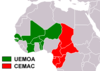 CFA Franc - Map of participating countries |
| 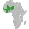 UEMOA - Acceding countries map 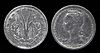 1 CFA Franc coin |
Below are the links to know the current exchange rate with the main world currencies:
| (EN) With Google Finance: | AUDCADCHFEURGBPHKDJPYUSD |
| With Yahoo! Finance: | AUDCADCHFEURGBPHKDJPYUSD |
| (EN) With XE.com: | AUDCADCHFEURGBPHKDJPYUSD |
| (EN) With OANDA.com: | AUDCADCHFEURGBPHKDJPYUSD |
At the table
Local cuisine is difficult to try first of all due to the scarcity of restaurants throughout the region (the ones that do serve European cuisine). Obviously on the islands fish is served as a main course and the accompanying sauces have a strong character that accompanies the taste of the meat. Many times, however, you will be offered grilled local fish.
Drinks
Try malamba, the local drink made from cane sugar, good and cheap, or palm wine, which is usually distilled directly in the places where you will have the opportunity to drink it.
Tourist infrastructure
Events and parties
National holidays
| Date | Festivity | Note | |
|---|---|---|---|
| January | New Year | International holiday | |
| March April | Good Friday, Easter | Christian holiday | |
| May | Workers Day | International holiday | |
| May June | Corpus Christi | Christian holiday that celebrates the Eucharistic sacrament | |
| June | President's Day | Memorial of the birth of President Obiang Nguema Mbasogo (1942) | |
| August | Freedom Day | Memorial of the coup against the dictator Francisco Macías Nguema (1979) | |
| August | Constitution day | Memorial of the birth of the national constitution and the election of Obiang Nguema Mbasogo (1982) | |
| October | Independence Day | Independence from Spain (1968) | |
| December | Immaculate Conception | Christian holiday that celebrates the conception of Mary. | |
| December | Christmas | Christian holiday that marks the birth of Christ | |
Safety
In the cities of Malabo is Bata there is an increase in common crime, in this regard carry only small amounts of cash and avoid exhibiting valuables.
Health situation
The availability of drugs is scarce and health facilities are inadequate.
The country is at high risk of malaria, so prophylaxis and vaccinations against typhoid and hepatitis A and B are recommended.
It is advisable to wash the vegetables carefully and to drink water without adding ice.
Respect the customs
How to keep in touch
Other projects
 Wikipedia contains an entry concerning Equatorial Guinea
 Commons contains images or other files on Equatorial Guinea
 Wikinews contains current news on Equatorial Guinea
![]() Algeria ·
Algeria · ![]() Angola ·
Angola · ![]() Benin ·
Benin · ![]() Botswana ·
Botswana · ![]() Burkina Faso ·
Burkina Faso · ![]() Burundi ·
Burundi · ![]() Cameroon ·
Cameroon · ![]() Cape Verde ·
Cape Verde · ![]() Chad ·
Chad · ![]() Comoros ·
Comoros · ![]() Ivory Coast ·
Ivory Coast · ![]() Egypt ·
Egypt · ![]() Eritrea ·
Eritrea · ![]() eSwatini ·
eSwatini · ![]() Ethiopia ·
Ethiopia · ![]() Gabon ·
Gabon · ![]() Gambia ·
Gambia · ![]() Ghana ·
Ghana · ![]() Djibouti ·
Djibouti · ![]() Guinea ·
Guinea · ![]() Guinea-Bissau ·
Guinea-Bissau · ![]() Equatorial Guinea ·
Equatorial Guinea · ![]() Kenya ·
Kenya · ![]() Lesotho ·
Lesotho · ![]() Liberia ·
Liberia · ![]() Libya ·
Libya · ![]() Madagascar ·
Madagascar · ![]() Malawi ·
Malawi · ![]() Mali ·
Mali · ![]() Morocco ·
Morocco · ![]() Mauritania ·
Mauritania · ![]() Mauritius ·
Mauritius · ![]() Mozambique ·
Mozambique · ![]() Namibia ·
Namibia · ![]() Niger ·
Niger · ![]() Nigeria ·
Nigeria · ![]() Central African Republic ·
Central African Republic · ![]() Republic of the Congo ·
Republic of the Congo · ![]() Democratic Republic of Congo ·
Democratic Republic of Congo · ![]() Rwanda ·
Rwanda · ![]() São Tomé and Príncipe ·
São Tomé and Príncipe · ![]() Senegal ·
Senegal · ![]() Seychelles ·
Seychelles · ![]() Sierra Leone ·
Sierra Leone · ![]() Somalia ·
Somalia · ![]() South Africa ·
South Africa · ![]() Sudan ·
Sudan · ![]() Southern Sudan ·
Southern Sudan · ![]() Tanzania ·
Tanzania · ![]() Togo ·
Togo · ![]() Tunisia ·
Tunisia · ![]() Uganda ·
Uganda · ![]() Zambia ·
Zambia · ![]() Zimbabwe
Zimbabwe
States de facto independent: ![]() Somaliland
Somaliland
Territories with status indefinite: ![]() Western Sahara
Western Sahara
Addictions French: ![]() Mayotte ·
Mayotte · ![]() Meeting ·
Meeting · ![]() Scattered islands of the Indian ocean
Scattered islands of the Indian ocean
Addictions British: ![]() Saint Helena, Ascension and Tristan da Cunha
Saint Helena, Ascension and Tristan da Cunha
African territories Italians: ![]() Lampedusa ·
Lampedusa · ![]() Street lamp
Street lamp
African territories Portuguese: ![]() Madeira (
Madeira (![]() Wild Islands)
Wild Islands)
African territories Spaniards: ![]() Ceuta ·
Ceuta · ![]() Canary Islands ·
Canary Islands · ![]() Melilla ·
Melilla · ![]() Plazas de soberanía (Chafarinas · Peñón de Alhucemas · Peñón de Vélez de la Gomera · Perejil)
Plazas de soberanía (Chafarinas · Peñón de Alhucemas · Peñón de Vélez de la Gomera · Perejil)