| Mauritania | |
 | |
Location 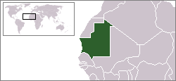 | |
Coat of arms and flag .svg/70px-Seal_of_Mauritania_(2018).svg.png) | |
| Capital | Nouakchott |
|---|---|
| Government | presidential republic |
| Currency | Mauritanian Ouguiya (MRO) |
| Surface | 1,030,700 km² |
| Inhabitants | 3.359.185 (2012 estimate), 1.864.236 (1988 census) |
| Tongue | Arabic |
| Religion | Islam (100%) |
| Electricity | 230V / 50Hz (European socket) |
| Prefix | 222 |
| TLD | .mr |
| Time zone | UTC |
| Website | Tourist Board |
| ATTENTION: Since 2012, all non-essential trips to the country are not recommended. The Islamic Maghreb terrorist organization Al Qaeda (AQIM) has been the culprit of numerous incidents in recent years and poses a danger to travelers in Mauritania. AQIM has been involved in the kidnapping of several Westerners, killing some of them or others during kidnapping attempts, and a couple of suicide bombings. Due to the civil war in neighboring Mali, where AQIM has close ties to Islamic rebels, there is a growing threat to Westerners in Mauritania. Isolated desert regions along the border with Algeria and particularly near the border with Mali are particularly dangerous. (November 2012). | |
Mauritania is a nation ofSaharan Africa which overlooks the Atlantic Ocean to the west and borders the Western Sahara to the north, theAlgeria to the northeast, the Mali to the south and the Senegal southwest.
To know
The name Mauritania comes from the ancient Berber tribes of the Mauri. The Romans called with the name Mauri all the native peoples of North Africa.
On November 28, 1960 the country became independent and Moktar Ould Daddah was the first president, however the French retained control over the economy. Today's capital Nouakchott was founded on the site of a small colonial village, Ksar.
Geographical notes
Mainly Saharan and Sahelian in the south, its territory is 75% sandy and rocky desert. The main peak is the 915m Kédia d'Idjil. The main mountain massifs, Adrare and Tagant, do not exceed the altitude of 600m, at their feet extend great plateaus that characterize the northern and eastern part of Mauritania.
When to go
When choosing when to visit the country, it should be borne in mind that from March to September temperatures tend to increase in inland areas and between March and April there can be sandstorms. From November to March it is hot during the day, around 25 ° C, but the nights are cool, and this is the best time to visit the country. The climate, on the other hand, is unbearable from April to October, and especially in the months of June and August, when the ref, warm winds from the north, and the temperature rises up to 45 ° C. The rainy season (hivernage), from July to September, occurs in the form of torrential but short thunderstorms, more significant in the south, in this period the dunes are covered by a light layer of vegetation and the wadis are transformed into streams.
Furthermore, keep in mind that climatically the country is divisible into three areas:
- Nouakchott area: maritime influence and constant trade winds
- area of the Senegal river: high temperatures for 6/7 months a year and a more humid climate
- Saharan area: hot climate, with temperatures over 45 ° and strong daily temperature variations, in winter night temperatures can approach zero.
Background
Archaeological finds show the presence of man since prehistoric times and also that Mauritania has not always been a desert region. Since the 3rd century the Berber farming tribes since North Africa they migrated towards present-day Mauritania due to the progressive drying up of the soil. Around 1100 the process of Islamization on local populations began, assisted by war conquests. Although it was the Portuguese who landed in the early 15th century, it was the French who transformed Mauritania in 1903 first into a protectorate and then in 1920 into a colony forming part of French West Africa. On November 28, 1960 the country gained independence from France.
Spoken languages
Official as well as national language is the Arabic dialect known as Hassaniya. The French it was the second official language until 1991; today it is only the second "de facto" language of the country as it is widely spoken. Several black-African languages are also spoken (Wolof, Pular, Soninke and Berber).
Suggested readings
- Francesco Tamburini, The Islamic Republic of Mauritania (1984-2007): From a regime of betrayed democratic hopes to a laboratory of African democracy?, in "Africana", 2007, pp. 127–146.
- Francesco Tamburini, The death of the first Arab democracy, in "Foreign Affairs", n. 162, 2009, pp. 384–393.
- Andrea Menegatti, "Authoritarianism, participation and fundamentalism in Mauritania, Confrerical Islam and democracy", in "Afriche e Orienti" nº3 / 4 2010 pp. 154–174.
Territories and tourist destinations
Mauritania is divided into 12 regions (wilaya) and one district (of the capital). Each region is divided into departments (moughataa, a term deriving from the Arabic muqaṭaʿa), which are in turn divided into municipalities.

Urban centers

- Nouakchott - The capital and largest city in the country.
- Atar - Capital of the Adrar region in the mountainous area of the Adrar on the caravan route to Morocco. The city owns the airport and boasts one of the oldest mosques in the whole nation (dated 1674) and a museum with archaeological finds found in the nearby Sahara desert was also opened a few years ago. An underground river has recently been discovered, thanks to a Russian satellite launched to study the topography of deserts, whose water will "quench" the whole city. Starting point of any excursion in the Adrar, being the commercial and tourist center even if it offers nothing else.
- Kaedi - Capital of the Gorgol region near the border with Senegal and on the right bank of the Senegal River. Thanks to the soil made fertile by the seasonal floods of Senegal and its tributaries, cereal and gum arabic cultures have developed considerably. Good fishing. The city also has the only hospital in the region and an airport.
- Kiffa - Capital of the Assaba region, it is located at the foot of the Hodh plateau, in southern Mauritania. The city is famous for its colorful houses and for the "glass beads" (colored glass balls) whose origins date back to around 1,000 ago.
- Nouadhibou - Capital of the homonymous region which rises on the narrow peninsula of Cap Blanc and second city of the country. Over 90% of the region's population lives in this city which was called Port Etienne until 1969. Main commercial and fishing port in the area, overlooking the Bay of the Greyhound in the Atlantic Ocean; its cold waters and rich in fish attract many fishing boats, not only local. The main industries are the canning ones.
- Ouadane - Built by the Berbers a thousand years ago, it was a caravan center for the trade of dates, salt and gold; today heritage ofUNESCO. It is located 120 km by road from Chinguetti and its typicality and the brown color of the houses: the same brown color of the hill on which it stands, so much so that in the distance it is a city perfectly camouflaged with the surrounding environment.
- Red (in Arabic Rusu) - Capital of the Trarza region. The city is located on the right bank of the Senegal River about 220 km from the capital Nouakchott. It is an important river port and agricultural market.
- Tichit
Other destinations
- Chinguetti - Place where the remains of ancient Muslim settlements were unearthed. The seventh holy city of Islam, heritage UNESCO, known for the preservation of numerous ancient books. It was home to the first university in West Africa.
- Arguin Shoal National Park (in FrenchParc national du banc d'Arguin) - The park, which is 50 km from Nouadhibou, was declared a World Heritage Site by theUNESCO, as it is a resting place for migratory birds that fromAfrica they go in Europe and vice versa, therefore a paradise for all lovers of birdwatching. The mating season, which runs from December to January, is certainly the best time to visit.
How to get
Entry requirements
Passport and entry visa. The VISA can be obtained upon arrival at the airport of Nouakchott, the passport must be valid for 6 months, the cost is 55 euros.
On the train
No train connects Mauritania with its neighboring states.
How to get around

On the train
There is only one train in the country, which connects Nouadhibou, Choum is Zouérat. This train can be considered a tourist attraction in itself, as it is said to be the longest in the world: 150 wagons for a total length of 2 km. It was used to transport the iron extracted from the mines of Zouérat to the port of Nouadhibou.
For those interested, the train leaves Nouadhibou every day around 3pm and arrives in Choum around 2am the next day. In any case, it is always good to check the actual timetables locally.
What see
In the Adrar region there are three noteworthy oases:
- Chinguetti - Place where the remains of ancient Muslim settlements were unearthed. The seventh holy city of Islam, heritage UNESCO, known for the preservation of numerous ancient books. It was home to the first university in West Africa.
- Tanouchert - Typical oasis, palm trees grown around fresh water, in the middle of the desert. Enchanting place to stop and sleep as it is on the road between Chinguetti and Ouadane.
- Azougi - Quiet oasis that was once the imperial capital of the Almoravid Berbers.
 Terjit
 - Terjit - Spectacular oasis, where inside an ocher-colored canyon that is gradually becoming narrower, there is an enchanting natural pool, fed by two springs, one cold and one hot, surrounded by very green vegetation. It is certainly a place that amazes.

In the Tagant region, a region in the geographic center of the country between the Sahelian Mauritania and the Saharan Mauritania and still unknown to tourism. there are other interesting oases:
- Tijikja - Oasis with incredibly beautiful and dense palm trees, perhaps the most beautiful in Mauritania. Famous is the Fort Coppolani, a French fort used to fight against the Moors. Don't miss the lively market and beautiful mosques.
- Rachid - 35 km from Tijikja, on top of a cliff is one of the most picturesque places in Mauritania, in the past it was a perfect place for ambushes to caravans.
It should be borne in mind that the access routes to Tagant are almost nil even if things are slowly changing.
- Natural pools of Matmata - Fed by a large waterfall that swells during the rainy season, they are the habitat of a colony of Nile crocodiles. This is another beautiful destination located in Tagant.
What to do
- Diving a Nouadhibou - The city is famous as a naval cemetery, as many boats have been sunk around the Cap Blanc peninsula, some of which are also visible from the ground.
Currency and purchases
The national currency is the Ouguiya (MRO).
Mauritania and the Madagascar they are the only countries to use a non-decimal currency.
Below are the links to know the current exchange rate with the main world currencies:
| (EN) With Google Finance: | AUDCADCHFEURGBPHKDJPYUSD |
| With Yahoo! Finance: | AUDCADCHFEURGBPHKDJPYUSD |
| (EN) With XE.com: | AUDCADCHFEURGBPHKDJPYUSD |
| (EN) With OANDA.com: | AUDCADCHFEURGBPHKDJPYUSD |
At the table
- Cous Cous Mauritanian - It is a couscous to which mutton is usually added, or a lamb is filled with couscous, in addition to the meat, seasonal vegetables are added. Usually couscous is accompanied by zrig which is a camel curdled milk that is not sweetened, not to be missed!
- Senegalese mafe - Peanut-based soup.
- Rice with fish - Typical dish of coastal areas.
Drinks
- The Mauritanian - It is good practice and politeness to accept at least the first 3 glasses that are offered.
Tourist infrastructure
Events and parties
There Guetna or fête des dattes (date festival) is a festival that takes place between July and August in conjunction with the date harvest in the oasis. In this period the families leave the cities or the camps to gather in the palm groves (equipped with huts) where weddings are celebrated and griot concerts take place in a festive atmosphere.
National holidays
| Date | Festivity | Note | |
|---|---|---|---|
| January | New Year | International holiday | |
| May | Workers Day | International holiday | |
| May | Feast of Africa | Memorial to the founding of the Organization for African Unity (1963) | |
| November | Independence Day | Independence from France (1960). | |
| muharram | Ras as-Sana | Muslim holiday that marks the beginning of the Islamic New Year | |
| rabi 'al-awwal | Mawlid | Muslim holiday that marks the birth of the Prophet Muhammad | |
| shawwal | Id al-fitr | Muslim holiday that marks the end of Ramadan | |
| dhul-hijja | Id Al Adha | Muslim festival of sacrifice or ram also called Tabaski or Id El Kabir (great festival) | |
Being a predominantly Muslim nation, all the recurrences of Islam are celebrated.
Safety
Before embarking on the journey consult:
- Safe travel - Ministry of Foreign Affairs (Farnesina) (Country safety information).
It is strongly not recommended to go to the areas bordering the Mali. In the coastal area petty crime is widespread so do not exhibit work items.
Activities of a homosexual nature are strictly prohibited in Mauritania and are punishable by death penalty through the beheading in public. It is recommended to LGBT travelers to be very careful and to avoid any talk about homosexuality (even supporters of gay rights are sentenced to death of course) and in general not to reveal one's sexual orientation.
Health situation
Hospitals are severely lacking in equipment and staff. Typhus and hepatitis A and B and malaria are widespread in Mauritania.
Respect the customs
Ramadan is the ninth and holiest month in the Islamic calendar and lasts 29-30 days. Muslims fast every day for its entire duration and most restaurants will be closed until dusk. Nothing (including water and cigarettes) should pass through the lips from sunrise to sunset. Foreigners and travelers are exempt, but should still refrain from eating or drinking in public as it is considered rude. Working hours are also decreasing in the corporate world. The exact dates of Ramadan depend on local astronomical observations and may vary from country to country. Ramadan ends with the feast of Eid al-Fitr, which can take several days, usually three in most countries.
- 13 April - 12 May 2021 (1442 AH)
- 2 April - 1 May 2022 (1443 AH)
- 23 March - 20 April 2023 (1444 AH)
- 11 March - 9 April 2024 (1445 AH)
- 1 March - 29 March 2025 (1446 AH)
If you are planning to travel to Mauritania during Ramadan, consider reading the article Traveling during Ramadan.
As in most Muslim countries, the religious tradition of henna is also practiced in Mauritania. Foreigners cannot drink alcohol in public places because it is prohibited.
How to keep in touch
Other projects
 Wikipedia contains an entry concerning Mauritania
 Commons contains images or other files on Mauritania
 Wikinews contains current news on Mauritania
![]() Algeria ·
Algeria · ![]() Angola ·
Angola · ![]() Benin ·
Benin · ![]() Botswana ·
Botswana · ![]() Burkina Faso ·
Burkina Faso · ![]() Burundi ·
Burundi · ![]() Cameroon ·
Cameroon · ![]() Cape Verde ·
Cape Verde · ![]() Chad ·
Chad · ![]() Comoros ·
Comoros · ![]() Ivory Coast ·
Ivory Coast · ![]() Egypt ·
Egypt · ![]() Eritrea ·
Eritrea · ![]() eSwatini ·
eSwatini · ![]() Ethiopia ·
Ethiopia · ![]() Gabon ·
Gabon · ![]() Gambia ·
Gambia · ![]() Ghana ·
Ghana · ![]() Djibouti ·
Djibouti · ![]() Guinea ·
Guinea · ![]() Guinea-Bissau ·
Guinea-Bissau · ![]() Equatorial Guinea ·
Equatorial Guinea · ![]() Kenya ·
Kenya · ![]() Lesotho ·
Lesotho · ![]() Liberia ·
Liberia · ![]() Libya ·
Libya · ![]() Madagascar ·
Madagascar · ![]() Malawi ·
Malawi · ![]() Mali ·
Mali · ![]() Morocco ·
Morocco · ![]() Mauritania ·
Mauritania · ![]() Mauritius ·
Mauritius · ![]() Mozambique ·
Mozambique · ![]() Namibia ·
Namibia · ![]() Niger ·
Niger · ![]() Nigeria ·
Nigeria · ![]() Central African Republic ·
Central African Republic · ![]() Republic of the Congo ·
Republic of the Congo · ![]() Democratic Republic of Congo ·
Democratic Republic of Congo · ![]() Rwanda ·
Rwanda · ![]() São Tomé and Príncipe ·
São Tomé and Príncipe · ![]() Senegal ·
Senegal · ![]() Seychelles ·
Seychelles · ![]() Sierra Leone ·
Sierra Leone · ![]() Somalia ·
Somalia · ![]() South Africa ·
South Africa · ![]() Sudan ·
Sudan · ![]() Southern Sudan ·
Southern Sudan · ![]() Tanzania ·
Tanzania · ![]() Togo ·
Togo · ![]() Tunisia ·
Tunisia · ![]() Uganda ·
Uganda · ![]() Zambia ·
Zambia · ![]() Zimbabwe
Zimbabwe
States de facto independent: ![]() Somaliland
Somaliland
Territories with status indefinite: ![]() Western Sahara
Western Sahara
Addictions French: ![]() Mayotte ·
Mayotte · ![]() Meeting ·
Meeting · ![]() Scattered islands of the Indian ocean
Scattered islands of the Indian ocean
Addictions British: ![]() Saint Helena, Ascension and Tristan da Cunha
Saint Helena, Ascension and Tristan da Cunha
African territories Italians: ![]() Lampedusa ·
Lampedusa · ![]() Street lamp
Street lamp
African territories Portuguese: ![]() Madeira (
Madeira (![]() Wild Islands)
Wild Islands)
African territories Spaniards: ![]() Ceuta ·
Ceuta · ![]() Canary Islands ·
Canary Islands · ![]() Melilla ·
Melilla · ![]() Plazas de soberanía (Chafarinas · Peñón de Alhucemas · Peñón de Vélez de la Gomera · Perejil)
Plazas de soberanía (Chafarinas · Peñón de Alhucemas · Peñón de Vélez de la Gomera · Perejil)