 | |
 | |
| Ed-Daqahlīya governorate محافظة الدقهلية | |
| Capital | Manṣūra |
|---|---|
| Residents | 6.492.381 (2017) |
| surface | 3,538 km² |
| Post Code | 44xxx |
| no postcode on Wikidata: | |
| prefix | 20 (0)50 |
| no area code on Wikidata: | |
| website | www.dakahliya.gov.eg |
| no tourist info on Wikidata: | |
| location | |
.svg/200px-Dakahlia_in_Egypt_(2011).svg.png) | |
The egyptian Governorate ed-Daqahliya (Arabic:محافظة الدقهلية, Muḥāfaẓat ad-Daqahlīya) is in the east Nile Delta. It borders on that in the north Mediterranean Sea and to the governorate Dumyat, in the east to the governorate Port Said, in the south to the governorates esch-Sharqīya and el-Gharbīya and in the west to the governorate Kafr esch-Sheikh. The administrative center is el-Manṣūra.
places

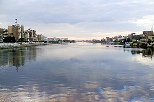
- 1 el-Manṣūra - Capital of the governorate. The sister city is on the opposite bank of the Nile Ṭalchā.

Other goals
- 1 Bashalush (Arabic:بشالوش), Village at With Ghamr - the el-Mitwallī mosque (Arabic:مسجد المتولي منصور الخولي, Masǧid al-Mitwallī Manṣūr al-Chūlī) dates from 1859.
- 2 Daqādūs - Village and Church of St. Virgin Mary.

- 3 Deir el-Qiddīsa Damyāna - Monastery of St. Damiana and the 40 virgins

- 4 Dimeira (Arabic:دميرة), Village near Ṭalchā - the el-ʿUmarī Mosque (Arabic:مسجد العمري, Masǧid al-Umarī) from the year 1904/1905 (1322 AH).
- 5 Drīn(31 ° 5 ′ 50 ″ N.31 ° 16 ′ 0 ″ E), Arabic:درين), Village near Nabrūh, approx. 13 kilometers northwest of el-Manṣūra - 6 Badrawi Ashur Palace(31 ° 5 '59 "N.31 ° 16 ′ 12 ″ E).
- 7 Dundīṭ(30 ° 41 ′ 16 ″ N.31 ° 18 ′ 34 ″ E), Village at With Ghamr - the Aḥmad Nāfid Mosque (Arabic:مسجد أحمد نافع, Masǧid Aḥmad Nāfiʿ) dates to the year 1853/1854 (1270 AH).
- 8 Kōm en-Nūr (Arabic:كوم النور), Village at With Ghamr - the Hilāl-el-Bey Mosque (Arabic:مسجد هلال البيه, Masǧid Hilāl al-Bey) dates from 1853.
- 9 Mīt Damsīs - Village and monastery of St. George.

- 10 eṭ-Ṭawīla (Arabic:الطويلة), Village near Ṭalchā - the en Nūr Mosque (Arabic:مسجد البور, Masǧid an-Nūr) from 1886.
- 11 Tell el-Muqdām(30 ° 40 ′ 59 ″ N.31 ° 21 ′ 18 ″ E), Arabic:تل المودام), The former Leontopolis - the ruins are located in the north of the village of Kafr el-Muqdām, about ten kilometers southeast of Mīt Ghamr. Under the late king Osorkon II. a temple was built here. Under Osorkon III. it was possibly a royal seat. The Gaufürst ruled here at the end of the 23rd dynasty Auput II. over Lower Egypt. Since early Greek times, the city was the capital of the 11th Lower Egyptian Gaus, Leontopolites.
- 12 Tell er-Rubʿ, the former Mendes - archaeological site.

background
getting there
The largest cities in the governorate, el-Manṣūra and With Ghamr are on the railway line from Cairo to Dumyāṭ and are easily accessible by train.
El-Manṣūra and Mīt Ghamr are easily accessible by buses, minibuses and service taxis from the capitals and larger cities of the neighboring governorates. From el-Manṣūra and Mīt Ghamr you can also take minibuses to the villages in the vicinity of these cities.
mobility
Tourist Attractions
activities
security
climate
holiday
The governorate national day is celebrated on February 8th.
