 | |
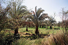
 Modern fountain in the northeast of the city of el-Chārga | |
| New Valley Governorate محافظة الوادي الجديد | |
| Capital | Chārga |
|---|---|
| Residents | 241.247 (2017) |
| surface | 440,098 km² |
| Post Code | 72xxx |
| no postcode on Wikidata: | |
| prefix | 20 (0)92 |
| no area code on Wikidata: | |
| website | www.newvalley.gov.eg |
| no tourist info on Wikidata: | |
| location | |
.svg/200px-New_Valley_in_Egypt_(2011).svg.png) | |
The egyptianGovernorateNew valley or el-Wadi el-Gadid, English: New Valley, Arabic:محافظة الوادي الجديد, Muḥāfaẓat al-Wādī al-Ǧadīd, is located in the southern part of the Western desert. It borders the governorates to the north at 27 ° 54 ′ Matruh, Gīza and el-Minyā, in the east to the governorates Asyūṭ, Sōhāg, Qinā, Luxor and Aswan, in the south to the Sudan at the 22nd parallel and in the west Libya at the 25th degree of longitude. The administrative center is el-Chārga. Unfortunately, word has not yet got around that the New Valley is one of Egypt's most attractive regions, both scenic and cultural.
places

- 1 el-Chārga is the capital of the valley of the same name el-Chārga. To the north of the city are the temples of 1 Hībis and the early Christian 2 El-Bagawāt cemetery. There are several Roman fortifications further north. The most significant is 3 Deir el-Munīra.


- 2 Bārīs is the second largest city in the south of the El-Chārga depression. The most important sights in the vicinity of the city are the temple and fortress complex of 4 Qaṣr Dūsch and that built in clay architecture 3 Hassan Fathy Village.


- 4 Courage is the main town of the valley ed-Dāchla. The city is the starting point for excursions to the Islamic old town of 5 Qaṣr ed-Dāchla, to the Roman temple 5 Deir el-Ḥagar and to the Greco-Roman burial ground of 6 Qārat el-Muzawwaqa. Mūṭ is also the starting point for desert safaris in the Gilf Kebir National Park.


- 6 Balāṭ is an important village in the east of the valley of ed-Dāchla. The highlights of the village include its old village center and the graves of the Old Reich governors of 7 Qilāʿ eḍ-Ḍabba.


- 7 el-Farafra is the main town of the valley of the same name el-Farafra. In the north of the city is the most important sight of the governorate, the White desert.

Other goals
- 8 White desert is a national park north of el-Farāfra. Its landscape is characterized by limestone and chalk cliffs.

- 9 Wādī el-Baṭṭīch, also Melon field called, is a landscape with thousands Geodes north of the Chārga Pass.

- 10 ʿAin Amūr is an ancient Egyptian temple complex west of el-Chārga on the route Darb ʿAin Amūr between el-Chārga and ed-Dāchla.

- 11 English Mountain is a former British observation post during the First World War west of el-Chārga.

- 12 el-Gara is a stalactite cave halfway between el-Farāfra and the Nile Valley. This cave is an eloquent sign of climate change around 6,000 BC. Chr.

- 13 Djedefre water mountain is a limestone rock southwest of Mūṭ with prehistoric depictions of animals and text inscriptions from expeditions of the ancient Egyptian kings Cheops and its successor Djedefre (Radjedef) to the Western Desert.

- 14 Gilf Kebir is a national park in the southwest of Egypt with great landscapes and numerous prehistoric rock carvings.

- 15 Samīr Lāmā rock and Sugar Loaf are sand-lime rocks on the way to Gilf Kebir National Park.

- 16 Abū Ballāṣ is a path with a rock with ancient Egyptian petroglyphs and a jug store on the way to Gilf Kebir National Park.

- 17 Toshka Canal is part of an irrigation and new land development project of the Egyptian government in the south of the New Valley, whose water comes from the Lake Nasser is related.

Routes
- The approximately 1,800 kilometer long Darb el-Arbaʿīn connects the Egyptian city Asyūṭ im Nile valley With Kobbe in the district Darfur in the Sudan. The route crosses the El-Chārga depression.
- The 280 kilometer long Darb Asyūṭ connects Asyūṭ with the depression el-Farāfra.
- About 250 kilometers long Darb eṭ-Ṭawīl connects Asyūṭ with the depression ed-Dāchla.
- About 200 kilometers long Darb el-Farāfra connects the valleys of ed-Dāchla and el-Farāfra.
background

The governorate "New Valley" was created in 1959 from the administrative area eṣ-Ṣaḥrāʾ el-Ǧanūbīya ("The southern desert") formed, which at that time still comprised the entire western desert. In 1966 and 1968, however, Siwa and el-Baḥrīya were separated. el-Chārga has been its capital since 1958. Even after the separation of Siwa and el-Baḥrīya, this governorate is the largest in Egypt in terms of area. With an area of 376,505 km2, a little more than the area Germany, it occupies about 38 percent of the total area of Egypt. With only 187,263 (2006) inhabitants[1] the governorate is the most sparsely populated governorate in Egypt. The population lives almost exclusively in the oases of the three depressions.
The most important industry is the phosphate mining in the mines of Abū Ṭarṭūr, 60 kilometers west of el-Chārga, even if it is probably not cost-covering. In agriculture, cereals, rice, dates, olives and citrus fruits are grown. However, agriculture cannot meet the demand. The New Valley and Toschka projects are being promoted to expand agriculture. The latter is used to supply water from the Lake Nasser. Tourism, handicrafts such as ceramics and carpet production, and housing construction play only a minor role.
getting there
In the street
The sinks are connected to one another by an asphalted trunk road, which was completed in 1980 and which runs through Asyūṭ begins. Public buses also run on these roads. There are no petrol stations outside the towns.
There are the following direct connections from the Nile Valley, but there are no regular services:
- The Dashlout El Farafra Road, طريق دشلوط الفرافرة, Ṭarīq Daschlūṭ al-Farāfra, branches off the desert highway el-Gīza to Luxor and Aswan on the western side of the Nile 1 27 ° 34 '36 "N.30 ° 39 '37 "E in the east, west of Daschlūṭ or west of Deirūṭ, north of Asyūṭ, and flows into the city el-Farafra at 2 27 ° 3 '37 "N.27 ° 58 ′ 12 ″ E onto trunk road 10.
- The Luxor Al Kharga Road, طريق الأقصر الخارجة, Ṭarīq al-Uqṣur al-Chārǧa, joins 3 25 ° 34 '54 "N.32 ° 27 '17 "E of the Aswan Western Agricultural Road on the western side of the Nile, southwest of Armant or southwest of Luxor and ends at 4 24 ° 48 ′ 47 ″ N.30 ° 34 '51 "E. on the Baris Al Kharga Road (Darb el-Arbaʿīn) about 80 kilometers south of the city el-Chārga. There are no gas stations or cafeterias on the way from Luxor to el-Chārga.
By plane
In the north of el-Chārga and southwest of Courage there are airports. But only that 5 El Kharga airport![]()
![]()
![]() (IATA: UVL) is used to a limited extent.
(IATA: UVL) is used to a limited extent.

mobility
Buses run between the depressions about two to three times a day from Upper Egypt Travel. Minibuses continue to run. Taxis and minibuses can be used within the depressions.
For the journey into the desert areas one is dependent on all-terrain all-wheel drive vehicles. Most of these vehicles and drivers can be found in ed-Dāchla.
Tourist Attractions

The governorate offers a variety Landforms both in the desert areas and in the oases. Here you will find sand and stone deserts as well as limestone and sandstone massifs. Traces of volcanic processes can be found on basalt, granite and TrachyteRead off inclusions. In addition to various palm trees and useful plants, there are more than a hundred other plant species in the oases.
The human legacies come from a longer period than in the Nile Valley. This can be seen in prehistoric rock carvings, various pharaonic monuments including the only temple in Persian times decorated Hībis, Greco-Roman settlements, Coptic churches and monasteries as well as medieval Islamic settlements.
activities
The most significant ventures are Desert safaris. These can be used to target both near the sinks Qaṣr el-Labacha or the White Desert, but also to more distant destinations that lead to the stalactite cave el-Gāra or the Gilf-Kebir National Park.
holiday
The governorate's national holiday is celebrated on October 3rd. On October 3, 1959, the governorship was established by the then Egyptian President Gamal Abdel Nasser justified.
security

The governorate is one of the safest areas in Egypt.
This does not apply to the southern areas of the Gilf Kebir National Park in the border triangle Egypt, Sudan and Libya, which internationally operating, armed smugglers use for their transports. They do not shy away from attacks on wealthy tourists either. A permit from the Egyptian military is required to travel south of the 23rd parallel. During the trip you will be accompanied by armed police officers and a military officer.
Vehicle failures must be expected on desert safaris. A trip with several vehicles is recommended. Sufficient food and drinks as well as navigation devices and satellite telephones must be carried.
British forces laid mines in several places during World War II that have not yet been cleared. Only some of the areas are cordoned off. This mainly affects areas in the Gilf Kebir National Park.
climate
The climate is warm to hot and dry all year round. Rainfalls are an absolute exception, the rain duration never exceeds a few minutes.
| ed-Dāchla | Jan | Feb | March | Apr | May | Jun | Jul | Aug | Sep | Oct | Nov | Dec | ||
|---|---|---|---|---|---|---|---|---|---|---|---|---|---|---|
| Mean highest air temperature in ° C | 22 | 24 | 28 | 34 | 37 | 39 | 39 | 38 | 36 | 33 | 27 | 23 | O | 31.7 |
| Average air temperature in ° C | 12 | 14 | 18 | 24 | 28 | 31 | 31 | 30 | 28 | 24 | 18 | 14 | O | 22.7 |
| Mean lowest air temperature in ° C | 4 | 5 | 9 | 13 | 18 | 22 | 22 | 22 | 20 | 16 | 10 | 5 | O | 13.8 |
| Precipitation in mm | 0 | 0 | 0 | 0 | 0 | 0 | 0 | 0 | 0 | 0 | 0 | 0 | Σ | 0 |
Dakhla, Egypt: Climate, Global Warming, and Daylight Charts and Data, accessed November 17, 2009. | ||||||||||||||
The sandstorms are feared Chamsīn (Arabic:خماسين, Chamāsīn, orخمسين, Chamsīn) to be named. These are hot south and south-east winds that stir up the desert sand and carry it away with them. The causes are low pressure areas in the Mediterranean area. The storms can occur all year round, their main season is the months of March to May (a period of 50 days after the beginning of spring - the Arabic word also refers to this period), and they also occur more frequently in autumn. The storms last for several days and are in large parts Egypt to be found.
literature
- Books:
- : Economic and social change in the “New Valley” of Egypt: on the effects of Egyptian regional development policy in the oases of the western desert. Bonn: Political working group for schools, 1989, Contributions to cultural studies; 12th, ISBN 978-3-921876-14-5 .
- : The Western Desert of Egypt: an explorer’s handbook. Cairo: The American University at Cairo Press, 2008, ISBN 978-977-416-090-5 , Pp. 85-208 (in English).
- Cards:
- Map of the Western Desert Oases of Egypt. Cairo: American University in Cairo Press, Geodia Edizioni, 2009 (2nd edition), ISBN 978-88-87177-76-3 . Erasable, tourist map, main map 1: 1,900,000 with detailed maps of the depressions and regions.
Individual evidence
- ↑Egypt population statistics, GeoHive, accessed May 23, 2011.
