The region Kraichgau-Stromberg is a hill country in the northwest of Baden-Wuerttemberg.

Ravensburg Castle near Sulzfeld
Regions

Steinsberg near Sinsheim
The area includes the sub-regions
- Kraichgau, the hilly landscape is also called Baden Tuscany designated
- Stromberg, Nature park and hiking paradise
- Zabergäu, Wine-growing landscape north of the Stromberg
- Hypocritical mountain Ridge between Zabergäu and Kraichgau
It is limited to the west by the Baden Rhine Plain, to the north by the Electoral Palatinate and the Little Odenwald, in the east by the Neckar and that Heilbronner Land. In the south that forms Alb-Pfinz-Plateau the transition to Northern Black Forest, to join that Heckengäu, the Strohgäu and the Neckar basin.
places

Auto and Technology Museum Sinsheim

Map of Kraichgau-Stromberg
- 1 Bad Rappenau


 in the Wikidata database") , a state horticultural show took place here in 2008
, a state horticultural show took place here in 2008 - 2 Boards - Melanchthonstadt
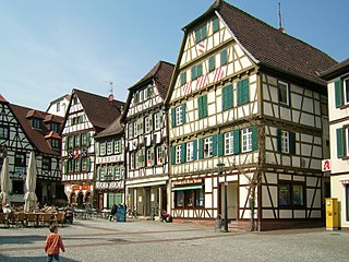
- 3 Eppingen on Fachwerkstrasse
- 4 Knittlingen , probably the birthplace of Georg Johann Faust
- 5 Maulbronn
- 6 Oberderdingen , Wine growing
- 7 Sinsheim with technology museum
- 8 Waibstadt
- 9 Neckarbischofsheim


Other goals
background
language
German in the forms Swabian, Badisch and Kurpfälzisch
getting there
mobility
Tourist Attractions
- Maulbronn Monastery. UNESCO World Heritage Site.
activities
kitchen
nightlife
security
climate
literature
- : Kraichgau, Heuchelberg, Stromberg, Enz and Neckar valleys. Munich: Bergverlag Rother, 2011 (2nd edition), ISBN 9783763343003 ; 158 pages. € 12.90
- Kompass hiking and biking map 768 "Kraichgau", Scale 1: 50000, 7.50 euros, ISBN 978-3-85491-599-7 , see also www.kompass.at
Web links
- Kraichgau-Stromberg Tourism - official regional website
- Holiday regions in Baden-Württemberg