


.jpg/220px-Main_Donau_Kanal_Luftaufnahme_(2019).jpg)
Rhine-Main-Danube Canal - 171 km long canal Germany, in the federal state Bavaria, in regencies Upper Franconia,Middle Franconia, Upper Palatinate and Lower Bavaria.
Characteristic
The canal runs between the mountains Steigerwald and Fränkische Schweiz, later Fränkische Alb and Oberpfälzer Jura. Its beginning is in Bamberg at the junction of the rivers Regnitz and Men and its end in Kelheim at the mouth Altmühl down Danube. He runs along the old one Louis canal.
Drive
By plane
The nearest airport is in Nuremberg.
By rail
Along the river, there is a railway road from Bamberg by Erlangen and Fürth down Nuremberg and on to Neumarkt in der Oberpfalz.
By car
There is convenient access by car. Highways run along the river A3 and A73.
Bicycle
A bicycle path runs along the canal.
Kayak
The canal is a canoe trail in Bavaria. River ports are located in larger cities. There are many large locks along the way.
Cities
- Bischberg
- Bamberg
- Strullendorf
- Hirschaid
- Buttenheim
- Eggolsheim
- Hallerndorf
- Forchheim
- Hausen (bei Forchheim)
- Baiersdorf
- Möhrendorf
- Erlangen
- Herzogenaurach
- Frauenaurach
- Fürth
- Zirndorf
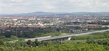
- Nuremberg
- Schwabach
- Roth
- Hilpoltstein
- Berching
- Beilngries
- Dietfurt an der Altmühl
- Riedenburg
- Essing
- Kelheim
| This is outline article. For now, it includes the article schema and not much else. You can help by supplementing the article with at least basic information, making it useful. |