 Satellite image of the Gulf of Suez | ||
| Gulf of Suez · خليج السويس | ||
| length | 280 km | |
|---|---|---|
| width | 33 km | |
| depth | 80 m | |
| location | ||
| ||

The Gulf of Suez or Gulf of Suez (Arabic:خليج السويس, Chalīǧ as-Suwais, „the Gulf of Suez“) Is a rift valley and a natural waterway in the northwest of the Red sea and lies in Egypt. It separates mainland Egypt from the peninsula Sinai. The Strait of Gūbāl, the southern gateway to the Gulf of Suez, is a popular one Diving area in Egypt.
background

The Gulf of Suez is a rift valley. It is 280 km long, about 33 km wide, but only an average of 80 m deep. The gateway to the Gulf in the south at the level of the southern tip of Sinai is the Strait of Gūbāl (Arabic:مضيق جوبال, Maḍīq Ǧūbāl, „Strait of Ǧūbāl“).
The Gulf of Suez is one of the most important waterways in the world. Together with the Suez Canal it enables the ship connection from Asia to Europe, without Africa having to go around. But it is not fully navigable: extensive coral reefs off the coast of Sinai and large islands off the mainland coast restrict the waterway on both sides.
In addition to shipping, the Gulf also serves as a source of raw materials. There are extensive oil deposits in its area.
The southern limit of the Gulf of Suez marks a line leading from the Cape Raʾs Muḥammad, the southern tip of Raʾs Muḥammad National Park 1 27 ° 43 ′ 25 ″ N.34 ° 14 '53 "E, about the southern point of the Schadwan or Shaker Island, Arabic:جزيرة شدوان, Gazīrat Schadwān, „Schadwan Island", At 2 27 ° 26 '57 "N.34 ° 2 ′ 9 ″ E and then continues at latitude 27 ° 27 'N to the African continent and about 7 kilometers north of El Gouna reached.[1] The northernmost point of the Gulf of Suez is the 3 Port of Suez(29 ° 57 ′ 28 ″ N.32 ° 33 '12 "E.).
In the field of 1 Strait of Gūbāl, which forms the southernmost part of the Gulf of Suez, the reefs (from northwest to southeast) are located off the coast of Sinai, Scha'ab 'Ali (Arabic:شعاب علي, Shaāb ʿAlī, „ʿAlī Reef"), Scha'ab ed-Deqa'iq (Arabic:شعاب الدقائق, DMG Shaʿāb ad-Daqāʾiq, „Reef of the subtleties"), Scha'ab el-Meqīda, Scha'ab Surūr (Arabic:شعاب سرور, Shaāb Surūr, „Riff of joy", = Scha'ab en-Neghs), Sha'ab Mahmud (Arabic:شعاب محمود, Shaāb Maḥmūd, „Maḥmūd reef") And Scha'ab el-'Utaf (Arabic:شعاب العطاف, Shaʿāb al-ʿUṭāf, „the coat reef"). The area between the reefs and the Sinai coast is occupied by extensive sandy lagoons.
Off the coast of mainland Egypt in the Strait of Gūbāl are the islands of Gūbāl (Arabic:جزيرة جوبال, Gazīrat Gūbāl), Tawīla (Arabic:جزيرة طويلة, Gazīrat Ṭawīla, „big Island“) And Schadwān and the reefs Scha'ab Abū en-Nuhās (Arabic:شعاب أبو النحاس, Shaʿāb Abū an-Nuḥās, „Reef of the father of copper") And Scha'ab Umm 'Ush (Arabic:شعاب أم عش, Shāʿāb Umm ʿUshsh, „Reef the mother of a nest“).
places
Mainland coast
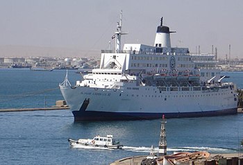
- 1 Sue is a port city in the north of the Gulf of Suez and at one end of the Suez Canal.
- 2 el-'Ain es-Sukhna is a seaside resort in the west of the gulf.

- 3 Ras Gharib is an industrial city at the southern end of the Gulf of Suez.

Sinai coast
- 4 et gate is a port city and at the same time the administrative center of the governorate South Sinai.

- 5 Ras Sudr, major spot for surfing, windsurfing and kitesurfing.
.jpg/350px-Ras_Sedr_(4).jpg)
Other goals


The Strait of Gūbāl in particular is a popular diving destination. Because of the great distance to the nearest resort Sharm esch-Sheikh This diving area cannot compete with those on the east side of the Sinai. But it has its peculiarities: On the one hand, the coral reefs are still intact due to the lower number of visitors, and the numerous wrecks at very shallow depths are attractive targets for wreck divers.
Reef diving areas
- Several coral blocks that 2 Alternatives and their western foothills Stingray Station and Lonely mushroom are located on the southern edge of the reef Scha'ab el-'Utaf in the west of the national park Ras Mohammed. These diving areas are popular as a stopover on the way to the wreck of the S / S (steam ship, Steamship) Dunraven or visited as an alternative dive site in rough seas.

- 3 Sha'ab Mahmud is a coral reef about eleven kilometers long in the southeast of the Strait of Gūbāl, the eastern limit of which it forms. The reef is broken by two passages that connect the Strait of Gūbāl in the west with the lagoon in the east. Both passages, the Small crack (Small passage) in the south and the Big crack (Big passage) Seven kilometers northwest of the aforementioned, can be passed by smaller ships. The passages themselves represent attractive diving areas. The southern end of the Scha'ab Mahmud, the Beacon Rock protruding from the water, is marked by a lighthouse after the S / S Dunraven sank here.

- 4 Shag rock (Shag Rock) is the south end of the reef Scha'ab 'Ali and is also marked by a lighthouse. It is used as an overnight place on liveaboards to the wreck of the S / S Thistlegorm popular.
Wreck diving areas
- By far the most important shipwreck is that of the S / S
 5 Thistlegorm, a British military transport sunk in 1941, in the southeast of Sha'ab 'Ali. What for the cultural tourist Giza pyramids is the S / S Thistlegorm for divers.

- In the south of the Sha'ab Mahmud, on 6 Beacon Rock, lies the wreck of the sunk in 1876 S / S Dunraven.

- In the area of the Shag rock is the wreck of the sunk in 1881 S / S Kingston.
- The reef 7 Sha'ab Abu en-Nuhas is a small reef north of Shadwan Island (Shaker Island) in the area of the islands near the mainland in the Strait of Gūbāl. The reef is the site of several sunken ships, four of which are still in good condition and are all on the north side of the reef: the Turkish freighter that sank in 1986 MS Giannis D., which sank in 1869 S / S Carnaticwho sank in 1981 MS Marcus and the one that sank in 1978 MS Kimon M. However, the weather conditions usually prevent exploration of the wrecks, which can only be done when the sea is absolutely calm. The only safe anchorage is on the west side of the reef.

getting there
In the street
The coastal towns can be reached via paved coastal roads. The west coast of Sinai is accessible by public buses Cairo or from different places on the Sinai reachable from.
By boat
Divers reach the Strait of Gūbāl with motor yachts mostly from Sharm esch-Sheikh out. There are both day trips and liveaboards.
By plane
The airport offers the cheapest connection from Sharm esch-Sheikh.
mobility
The diving areas can be reached with motor yachts. However, since it is not possible to anchor everywhere, the yachts should also have motorized inflatables. zodiac) feature.
security
Some diving destinations such as the wreck of the Thistlegorm can only be found with GPS devices.
Strong currents and surfs are to be expected, especially in the area of the water surface. The wrecks on Sha'ab Abu en-Nuhas can only be visited when the sea is absolutely calm.
The diving areas in the Strait of Gūbāl should only be explored by experienced divers, the minimum requirement should be the “Advanced Open Water” certification. If more than two dives per day are planned, nitrox (enriched air) gas mixtures should be used, but this requires special training.
climate
Climate on the coast
The climate is warm and humid, which results from the high temperatures of the adjacent desert areas and the high evaporation rate of the Red Sea.
| Sue | Jan | Feb | March | Apr | May | Jun | Jul | Aug | Sep | Oct | Nov | Dec | ||
|---|---|---|---|---|---|---|---|---|---|---|---|---|---|---|
| Mean highest air temperature in ° C | 20 | 21 | 24 | 28 | 32 | 35 | 38 | 40 | 34 | 31 | 27 | 21 | O | 29.3 |
| Mean lowest air temperature in ° C | 8 | 8 | 10 | 14 | 19 | 21 | 24 | 24 | 23 | 20 | 15 | 9 | O | 16.3 |
| Average water temperature in ° C | 19 | 20 | 20 | 21 | 23 | 25 | 29 | 29 | 28 | 25 | 23 | 19 | O | 23.4 |
| Relative humidity in% | 59 | 59 | 59 | 61 | 68 | 68 | 68 | 68 | 65 | 60 | 59 | 59 | O | 62.8 |
Waters of the Gulf of Suez
The water temperatures are between 19 ° C and 29 ° C, depending on the season, this temperature is also available at greater depths (30 m). Currents can also bring colder water with them. The salt content is very high at 4.1%.
literature
- : Sinai Diving Guide: Part 1; German edition. Verona: Geodia, 2005, ISBN 978-88-87177-66-4 . The book can be purchased in the diving centers on site.
Individual evidence
- ↑: Limits of Oceans and Seas. Monte Carlo: Monégasque, 1953 (3rd edition), Special publication; 23, P. 19; PDF.
