The resin, the most northerly German low mountain range, is a less well-known, but for that very reason an attractive winter sports area. In the western Harz, in the eastern Harz and especially in the Hochharz, many places have renewed and expanded their ski and toboggan centers as well as the general tourist offer, so that here in northern Germany - depending on the weather, of course - there are good to ideal opportunities for open up winter activities. The Harz winter sports areas cannot compete with the Alps in terms of size, but offer northern German winter sports enthusiasts a nearby alternative for a ski weekend or a longer winter holiday. Skiers from neighboring countries such as Denmark and the Netherlands are also increasingly drawn to the winter landscape Chunks, at the Wurmberg, On the field and elsewhere.

The Harz offers attractive opportunities for a wide variety of winter sports: cross-country skiers will find an extensive network of trails in almost all parts of the Harz, with mostly medium to demanding skill levels, combined with a unique experience of nature on the varied routes through extensive forests as well as over the raised bogs. Alpine skiers get their money's worth on the various slopes in the Hochharz, e.g. at the new ski center on the Wurmberg in Braunlage or at Matthias-Schmidt-Berg in Sankt Andreasberg. Snowshoe hikers will find excellent opportunities everywhere on the hiking trails away from the many groomed lopes. Toboggan runs of various levels of difficulty offer families in particular plenty of winter fun. And ice skating and curling are also on the natural ice rinks as in Schierke or in Rooster clover possible.
This travel guide gives an overview of the various winter sports areas in the Harz Mountains, detailed information on accommodation and gastronomy can be found in the respective local articles. Basic information about the Harz as a holiday region can also be found in the travel guides resin and Harz National Park.
getting there

The Hochharz in particular can usually only be reached by public transport with several changes, as there is no scheduled airport and no train station with a connection to the long-distance network in the immediate vicinity. Within the Harz, however, a dense network of public buses connects towns and ski areas.
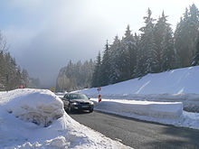
If you arrive in your own car in winter, you should bring snow chains with you, as the roads in the High Harz region are temporarily only released for use by cars with snow chains when there is heavy fresh snow (which, however, has only happened very rarely in recent years, as well as the clearance services are on site very quickly in the Harz).
By plane
The Hanover Airport in the northeast of the Harz is the nearest international airport, about Hanover Central Station you then have a connection to the train connections towards Harz.
By train
There are no long-distance Deutsche Bahn connections directly to the Harz, and regional connections only lead to towns on the edge of the Harz. Rail connections in the Harz region are only available in the Eastern Harz with the narrow-gauge railway Wernigerode. In all places with a rail connection on the edge of the Harz, there is a connection to regular buses directly to the ski centers. Detailed information can be found in the respective local articles.
The Goettingen train station is the closest long-distance train station for the ski areas in the West and Hochharz, from here there are regional train connections to, among others Herzberg am Harz, Osterode, Seesen, Goslar and Nordhausen.
Direct connections in the Harz from Hanover Central Station persist after Goslar (approx. 1 h) and Bad Harzburg (1:15 h).
Of Braunschweig can be reached with a direct regional train connection Osterode am Harz and Herzberg am Harz.
By bus
In the street
- The A7 runs west of the Harz Mountains and is a suitable approach for motorists from the north and west, especially for the ski areas in the West Harz and the Hochharz.
- Coming from the north, leave the A7 at the Rhüden exit for the journey via Goslar and to the ski areas in the East Harz, for the journey to the Hochharz it is better to use the descent Seesen.
- Coming from the south you leave the A7 in Goettingen and follows the B27 Gieboldehausen and Herzberg am Harz.
- If you want to come to the East Harz from the south, change from the A7 at Dreieck Drammetal to the A38 bis Nordhausen.
- Out of the room Leipzig coming you also drive on the A38 to Nordhausen.
- Coming from the northeast, e.g. from Berlin, the A2 is bis Magdeburg, then via A14 and continue on the federal road Oschersleben and Halberstadt a suitable route to get there.
Alpine skiing
Generally:to the winter sports report for the West Harz - Website of the Kurbetriebsgesellschaft Braunlage
Wurmberg / Braunlage ski area

At the Wurmberg in Braunlage the largest alpine ski area in northern Germany was opened in 2013, which is supposed to guarantee good skiing conditions with a snowmaking system even when the natural amount of snow is insufficient. However, the facility, which is critically discussed from an environmental point of view, requires sufficiently cold weather conditions. If the temperatures are cold enough, Braunlage am Wurmberg now offers a very varied alpine program.
- a total of 14 slopes
- the longest slope connects several other slopes and is 4.3 km in length and 405 meters in altitude
- Ski school slope
- 60% steep, very difficult Hexenritt piste (500 m)
- Panorama run, etc.
Information on the condition of slopes and lifts here.
Ski center Matthias-Schmidt-Berg / St. Andreasberg
- 2 Matthias-Schmidt-Berg ski center, Matthias-Schmidt-Berg 4, 37444 St. Andreasberg. Tel.: 49 55 82 265, Fax: 49 55 82 83 24, Email: [email protected].
 in the Wikidata database") .The ski area is located on the southwestern outskirts of Sankt Andreasberg (access via Silberhütte) between 540 m and 660 m and includes two drag lifts and two chair lifts. A snowmaking system is available. 6 runs of different difficulty levels. Floodlight operation on individual days on a 2 km route. Gastronomy down at the parking lot and up in the Matthias-Schmidt-Baude.Open: winter operation daily 9 a.m. - 4.30 p.m. (end of lift operation depending on the weather).
.The ski area is located on the southwestern outskirts of Sankt Andreasberg (access via Silberhütte) between 540 m and 660 m and includes two drag lifts and two chair lifts. A snowmaking system is available. 6 runs of different difficulty levels. Floodlight operation on individual days on a 2 km route. Gastronomy down at the parking lot and up in the Matthias-Schmidt-Baude.Open: winter operation daily 9 a.m. - 4.30 p.m. (end of lift operation depending on the weather).
Sonnenberg ski area near Sankt Andreasberg
- 3 Großer Sonnenberg ski lifts. Tel.: 49 55 82 513, Email: [email protected]. Outside the center of Sankt Andreasberg Located on the road to Torfhaus or Altenau (approx. 6 km north). There are three drag lifts and a pony lift. The area is quite snow reliable for the Harz, as it is between 854 and 780 m altitude. A total of 4 runs with a total length of 4.1 km (2 x 1.4 km difficult; 1 x 1 km medium; and the easy 0.3 km practice slope); The difference in altitude between the slopes is around 50 to 60 m.
Bocksberg ski area in Hahnenklee
- 4 The ski area in Rooster clover, a district of Goslar, lies between 540 and 727 m altitude. The winter sports area on the Bocksberg is accessible with a cable car, chair lift and two drag lifts. A total of 5 km of slopes are offered. The 1500 m long family run can snowed become. see more Bocksberg-Seilbahn.de.
Torfhaus ski lift
- 5 In Peat house owns the Torfhaus lift "Am Rinderkopf" (directly at the youth hostel) a 400 m long descent with an altitude difference of 80 m (altitude: 740 - 820 m).
Hohegeiß ski center
- The ski center Hohegeiß consists of a total of three tow lifts.
- 6 The two lifts "Am Brande" are each 350 m. There are several downhill slopes that are up to 1200 long with a height difference of 70 m. Floodlight skiing is possible.
- 7 There is also the 250 m long "Im Hasental" drag lift, which opens up a 300 m long slope with a 50 m difference in altitude.
You can see whether the lifts are open here on the private page harz-ski.de view (is not the lift operator).
Ravensberg / Bad Sachsa ski area
- 8 The lifts of the small ski area are located on the Ravensberg above Bad Sachsa in the southern Harz. The area is between 540 and 600 m high. There are some shorter runs from easy to difficult. The longest run is the 750 m long, blue family run. The Ravensberg is accessed via the health resort on the southern edge of the Harz Mountains. Further information can be found on the website of the lift operations www.sportzentrum-ravensberg.de) to find.
Altenau ski area
- 9 Ski Area On the rose. Small ski area with two tow lifts. Recommendation for snoboard beginners.
Ski Alpinum in Schulenberg in the Upper Harz Mountains
- 10 Ski Alpinum Schulenberg. Tel.: 49 53 29 69 09 090, Email: [email protected]. Above of Schuleberg in the Upper Harz This small ski area is located at the Okertalsperre. There are two tow lifts that are between 480 and 645 m high. The smaller lift opens up a practice slope. The longer lift, on the other hand, opens up four attractive runs 165 m difference in altitude. The four different slopes are 600 m (black slalom course), 800 m, 850 and 1200 m long (family run blue to red).
For reasons of nature conservation, the Ski Alpinum is not accessible with your own car. There is a bus shuttle service Schuleberg from 1 Parking in the center and from 2 Bramkebrücke car park.
Claustal-Zellerfeld ski lift
In Clausthal-Zellerfeld there is a smaller drag lift in the Zellerfeld district.
Nordic skiing

Generally:to the official trail report for the West Harz
"Hochharz" trail network around Torfhaus in the Harz National Park
The 80 km long network is relatively snow reliable between Altenau, Torfhaus and St. Andreasberg at an altitude of 700 to 880 m. Entry points with parking spaces are Torfhaus, Oderbrück, Sonnenberg or Oderteich or Königskrug. The entry points can also be reached by bus.
There are two beautiful viewpoints in the area: The Wolfswarte on Bruchberg as well as the Figure eight.
- Experience entry on the Wurmberg near Braunlage: ascent with the gondola lift from 580 to 970 m. From the summit there is a connecting trail that leads to the access to the Hochharz trail network on the Dreieckigen Pfahl. On the way it goes downhill over a long descent with about 180 meters of altitude!

The quite demanding, moderately difficult Altenau-Torfhaus trail leads past the Wolfswarte. The Wolfswarte, however, has to be climbed on deeply covered hiking trails, as the trail does not lead directly past the cliff. But there is guaranteed to be a real pioneering spirit when you fight your way uphill on a beautiful winter day after a lot of fresh snow over the possibly even untrodden snowdrifts on the hiking trails. You will be rewarded with a great panoramic view. However, if you're the first up there, there's a good chance that loneliness will soon be over. The vantage point can be seen clearly from the trail, so that latecomers will of course be happy to use the freshly laid track.
Alternatively, you can start the tour at the goldfinch corner. Tour tip: "Around the Bruchberg": Sonnenberg (800 m) - Oderteich - trail in the direction of Torfhaus / Oderbrück - trail in the direction of Altenau over the northern flank of the Bruchsberg up to around 880 m above sea level - goldfinch corner - back south of the Harz high road to the Sonnenberg. Other possible entry points into the 18 to 19 km long, fairly demanding, moderately difficult tour are Torfhaus and the Stieglitzecke car park. If that's not enough for a day tour, you can also build in the 16 km long cross-country ski trail at the goldfinch corner.St. Andreasberg trails
The small mountain town has around 40 km of trails. To the north of the village, in the Jordanshöhe area, there are a couple of attractive circular routes, especially for experienced and inexperienced people. For more see article St. Andreasberg here.
Cross-country trails & ski excursions from Sonnenberg

The Sonnenberg settlement is located in the middle of the national park at an altitude of around 800 m. From Sonnenberg there are various, attractive cross-country trails but also rounds for longer, Nordic ski excursions in the snow-sure Hochharz.


Snow White Cliffs trail
5.4 km long, snow-sure circular route in the classic style, which leads from the Alten Forsthaus Sonnenberg through the forest northwest of the large Sonnenberg. Altitude: at 770 m - up to 820 m altitude. Although the route is marked blue (lightly), the route requires good braking techniques on the last kilometer, as the trail is no longer groomed and the snow has been rolled flat on the path that has been more steeply sloping at the end. Route in OpenStreetMap.
- 11 Entry into the Snow White Cliffs circuit in Sonnenberg at the parking lot or shooting range.
Sonnenberg-Rehberg circular trail
The attractive, 12 km long cross-country ski run in classic style leads mostly sheltered from the wind in the forest around Reh- and Sonnenberg. The route runs relatively snow-sure between 670 and 810 m altitude. The more demanding but still moderately difficult circuit begins north of the city in the area of the Haus am Sonnenberg an der Landstrasse. In order to be able to complete the route safely, you should be able to brake safely with the snow plow and the "trail brake" (half-sided snow plow with the right ski). The route has some longer, faster descents that are also winding. Depending on the nature of the snow, it can be as fast as 25 to 30 km / h downhill if you let it run. With access from the city you are about 16 - 17 km on the way. If you take it slow, you can do the route as a day tour. Halfway there is a stop at the Hotel am Sonnenberg. On the eastern semicircle to the Sonnberg you pass two nice viewpoints with tables and benches. Here you can take a breather and let your gaze wander over the magical winter landscape: The first view is the "Rehberg-Südblick" on the slope of the mountain of the same name (for example at 51 ° 43 '54 "N.10 ° 32 '11 "E). About 2 km further on you reach the "Brockenblick" (approx 51 ° 44 ′ 31 ″ N.10 ° 32 '42 "E) to find. From here the view extends over the Oder valley and the Figure eight until Chunks, the highest mountain in the Harz Mountains. A Brocken panorama also opens up in the area of the lifts on the Sonnenberg. On the way back west of the road there may also be some beautiful valley views. These could not be precisely identified, however, as this route was only completed in fog at the end of January 2011 Route in OpenStreetMap.
Entry points:
- 1 Parking lot on the road to Sonnenberg at above St. Andreasberg.
- - Parking spaces in the area of the Hotel Sonnenberg or the ski lifts 51 ° 45 ′ 40 ″ N.10 ° 30 '53 "E
Ski tour "around the Bruchberg"
From Sonnenberg you can take a 18 to 19 km long, fairly demanding, moderately difficult tour to the Wolfswarte am Bruchberg on classic cross-country trails. Route: Sonnenberg settlement at the ski lifts -> trail to Oderteich -> trail in the direction of Torfhaus / Oderbrück -> trail in the direction of Altenau over the northern flank of the Bruchberg up to about 880 m above sea level -> here detour from the trail on hiking trails to the Wolfswarte With great panorama -> trail north around the Bruchberg to the goldfinch corner -> back south of the Harz high road to the Sonnenberg.
- -Arrival: From St. Andreasberg you can take the bus or car to the Sonnenberg. Those who are very sporty can of course ski from St. Andreasberg over the "Sonnenberg" circuit to the Bruchberg.

Farm trail
The 16 km long trail leads over the ridge On the field between 750 and 800 m altitude. Halfway through, you can go to the mountain hut Hanskühnenburg stop in. Beautiful valley views open up both at the Hanskühnenburg and partly along the route.
2 Entry point at the parking lot "Stieglitzecke" at the Harzhochstraße (B242). There is also a bus stop here.
Braunlage and Hohegeiß cross-country trails
All around Braunlage and Hohegeiß you will find an attractive network of cross-country trails that is between 550 and 650 m high. The trail around the Achtermannshöhe, which is actually part of the Hochharz trail network, is particularly snow-sure.
Schierke trails
The sometimes quite challenging trails in Schierke are mostly on the shady northern slope of the Wurmberg and in the forest valley of the Kalten Bode towards the triangular pile. The 40 km long network is at an altitude of between 650 and 850 m. At the triangular pile there is a connection to the Hochharz cross-country ski trail network in the area of Torfhaus, Oderbrück, Sonnenberg and Stieglitzecke. Current information in Trail report
Cross-country trails in Wieda
In Again there are connections to two trails:
- 3 Following the demanding Südharzloipe between Braunlage, Bad Lauterberg and Wieda
- Cuckoo trail, 2 km medium-difficult circuit southwest of the town center - the starting point is like the entrance to the Südharzloipe at the swimming pool west of the town
Südharzloipe
- 4 The Südharzloipe is an almost 50 km long, difficult trail with a starting point Bad Lauterberg to Again and with cross connection after Braunlage through the area east of the Oder dam.
Cross-country trails near Benneckenstein
A total of four trails are available for cross-country skiers all around Benneckenstein at:
- Pfeiferberg-Grauberg circuit, approx. 6 km of easy trail
- Rappenberg circular route, approx. 4.6 km easy trail
- Border trail 1 from Benneckenstein over Hohegeiß to Concern, approx. 20 km of medium difficulty trail
- Sophienhof trail (Rothesütte-Sophienhof-Benneckenstein), border trail 2, approx. 16 km of medium difficulty trail
There are three places in Benneckenstein where you can start or join the cross-country ski trails:
- 5 At the parking lot at Nordhäuser Straße / Jahnstraße in the Pfeiferberg-Grauberg-Loipe
- 6 At the Waldschlösschen south of the village on the Grenzloipe 1 and the Rappenberg circuit (west of the country road
- 7 Directly at the Waldschlösschen inn on the Sophienhof trail (Grenzloipe 2), where the Pfeiferberg-Grauberg trail can also be started
Cross-country trails near Elbingerode (Harz)
In Elbingerode there are two cross-country trails:
- Hornberg trail, 4.6 km long, medium-difficulty cross-country ski run
- Drei-Annen-Hohne trail, 12.5 km long, medium-difficulty cross-country ski run
- 8 Starting point for both cross-country trails at the restaurant at the Hirschbrunnen.
Cross-country trails in Wildemann
The small ski area around Wild man offers small, technically less demanding cross-country trails and trails that allow connections to the rest of the Upper Harz trail network.
- 9 Adlersberg trail. 4 km long, technically and physically not very demanding trail. Entry and end point opposite the gas station at the northern entrance to the village.
- 10 Skating trail over the Gallenberg. Short, only 1.2 km long, moderately difficult skating trail around the Gallenberg in the center of the village. Entry at the end of Seesener Straße.
- 11 Zechenhaus trail. 3.2 km long, moderately difficult cross-country ski run in the mirror valley. Entry at the outdoor pool.
- 12 Hasenberg trail. 10.4 km long medium-difficulty trail, on which you pass places with names like "Spider" and "Schweinbraten", in the west of the village. Cross connection to the Iberg trail (Bad Grund) via the Connecting trail possible.
Sledding
Numerous smaller and larger toboggan runs offer tobogganing fun for all "performance classes" across the entire Harz. A regularly updated one shows which of the larger systems are open Overview and Toboggan runs in the Harz Mountains.
Altenau
- 1 Toboggan slope at the ski area On the rose in Altenau.
Bad Harzburg
In Bad Harzburg there are several differently challenging toboggan runs:
- 2 Natural toboggan run on Butterberg, 180 m
- 3 Natural toboggan run on the old Molkenhaus-Chaussee, 1,700 m, start at the Molkenhaus forest restaurant
- 4 Natural toboggan run on the golf course, small 50 m long toboggan slope for children
Bad Sachsa
- 5 At the Ravensberg northwest of Bad Sachsa there is a toboggan run.
Benneckenstein
- 6 180 m long toboggan slope on the Pfeiferberg in Benneckenstein (with ski lift)
Clausthal-Zellerfeld
- 7 Toboggan run on Spiegelthaler Straße in Clausthal-Zellerfeld, 240 m long toboggan run
Elbingerode
- 8 100 m long toboggan slope "Hinter den Birken" in Elbingerode
Rooster clover
- 9 In Rooster clover 1500 m toboggan run, which is illuminated until 9:30 p.m. on weekends. The cable car leads from the mountain station of the Bocksberg cable car down to the large car park at the stave church, and is a bit more demanding as a continuous toboggan run. Those who prefer a simple train can get on the slope above the stave church.
Sankt Andreasberg

- 10 The Toboggan center is located on the large meadow at the Kurhaus in the center of Sankt Andreasberg:
- The valley basin offers the right slope for tobogganists of all ages and those willing to take risks. Hustle and bustle, which still has its own track for everyone and, thanks to its direct location at the Kurhaus (parking spaces, restaurants, toilets), offers good framework conditions for extensive and relatively safe tobogganing fun. The small house at the bottom of the valley is padded with bales of straw, but the very last outlet of the track ends at an open stream inlet, so that fast-paced little tobogganers should be advised of the possible danger. The toboggan run is Floodlit daily from 5pm to 10pm.
- At the Snow tubing On the large toboggan run, you slide down a specially constructed toboggan run on a large, air-filled tire. Uphill, lying on the pneumatic tire, you can comfortably use the rope lift. For information see skilifte-engelke.de.
- 11 The meadows around the Glockenberg are also popular toboggan runs.
There is also a toboggan slope on the Sonnenberg in the area of the ski lifts.
Peat house
- 3 Peat house
 . The only toboggan lift in the Harz Mountains. 300 m descent, occasionally floodlights in the evening.
Ice rinks
There are several in the Harz Natural ice rinks:
- In Rooster clover
- In Schierke in the valley of the kalten Bode, a stadium prepared as an ice surface in winter.
- In Wild man
Ice rinks:
Sled dog racing
Some places in the Harz offer a sled dog race once in the winter season, to which the mushers, the dog handlers, often come from far away with their dog sled packs. The venues for sled dog races include
climate
With the exception of the Brocken, there is no other region in the Harz for which it is almost 100% certain that snow will fall during the winter. With the exception of the winter of 2013/14, however, winter sports were at least temporarily possible; in good winter sports years, winter sports are possible from December to March.
Some places (including Braunlage, Hahnenklee) now also have snow-making systems, so that at least alpine skiing can be done without precipitation - provided that the weather is sufficiently cold.
The current snow conditions and the condition of cross-country trails, slopes and toboggan slopes can be found on the following pages:
literature
- The Harz - winter sports card: The topographic map on a scale of 1: 50000 shows the entire Harz on a large scale. The work is the official Winter sports map of the Harz cross-country ski trail network. All cross-country trails, ski hiking trails and cleared winter hiking trails are shown. The card is therefore particularly recommended for fans of Nordic skiing. But the alpine areas are also shown. The cross-country ski runs and ski areas are briefly presented in short texts (with contact addresses). ISBN 3936185530 ; Price € 6.80; Schmidt book publishing house Wernigerode
- Harz winter sports map - Scale 1: 50,000, 5th edition January 2009, ISBN 978-3-937929-19-4 , Price € 3.50, published by Kartographische Kommunale Verlagsgesellschaft mbH
- Harz winter sports map - 1:50.000, ISBN 3899203275 , tear and weatherproof design; 4,95 €; Publicpress publishing house
- OpenStreetMap: The worldwide map project OpenStreetMap has a very extensive database. Here at xctrails.org the circuits of the trail are specially shown from OpenStreetMap (just look for the Harz Mountains and zoom in). With a click on the black athlete symbols you get additional information about the respective cross-country ski run. The network of cross-country ski trails in the Harz is largely completely covered (especially the snow-reliable routes in the high elevations are well represented).
- The map is also based on OpenStreetMap slopemap.waymarkedtrails.org, here you can also download the GPS data for the trails and slopes.