| German Alpine Route (Deutsche Alpenstraße (of)) | |
 | |
| Information | |
| Country | |
|---|---|
| Location | |
 47 ° 29 ′ 56 ″ N 11 ° 16 ′ 41 ″ E | |
| Official site | |
The german alpine route is a itinerary located in Bavaria from Lindau up to Berchtesgaden. Obviously, we will push in Austria, because when we are so close to Salzburg, let's go.
Understand
A whole itinerary with multiple settings: country, forest, mountain and lakes. The cleanliness, the no advertising panels and a peasant girl in love with nature, make the walk a permanent treat, all along the route.
- The course is divided into 5 very distinct parts:
- Of Lindau To Fussen
- Of Fussen To Garmisch-Partenkirchen and the Zugspitze
- Of Garmisch-Partenkirchen in Bad Reichenhall
- From Bad Reichenhall to Berchtesgaden
- From Berchtesgaden to Salzburg
- If you have limited time to walk, do the sections first: 1) From Fussen To Garmisch-Partenkirchen and the Zugspitze 2) From Bad Reichenhall to Salzburg
Steps
Lots of landmarks, as the Deutsche Alpenstrasse is very winding, there are nearby tours noted (included) below, and the proximity to the Austrian border requires a lot of communication.
Start or End of the German Alpine Route (Deutsche Alpenstrasse)
From Lindau to Fussen
- Lindau(See main town)
- North exit by B 12, up to the B 31 that you take towards the east, and which becomes the B 308 crossing theA 96, in the direction of Lindenberg im Allgäu.
- If you go byA 96 to the north, you exit by the B 308 towards Lindenberg im Allgäu.
- 1 Lindenberg im Allgäu
- On the B 308 you continue to Sonthofen.
- 2 Oberstaufen
- 3 Immenstadt
- 4 Sonthofen
- The variant can hire you by B 19 towards the winter sports resort of Obersdorf, through the dead-end Iller valley
- 5 Obersdorf – Internationally renowned resort for ski jumping in particular, one of the sites for the tour of the four springboards (https://fr.wikipedia.org/wiki/Tournée_des_quatre_tremplins).
- You continue east by the B 308 for Bad Hindelang (), to Oberjoch ().
- 6 Oberjoch
- At the exit of the village, you turn left towards the north by the B 310, to Wertach.
- 7 Wertach
- Then after having skirted the Gruntensee lake, at the roundabout with the B 309, you continue to the right on the B 310 towards Pfronten.
- If you decide to enter the city of Pfronten you take the B 309 which will then become the L 69 in Austria to catch up Fussen.
- If at the entrance to Pfronten you turn left onto the B 310, you will earn directly Fussen.
- 8 Pfronten
- Over there B 310 directly or the B 309 by Pfronten you join Fussen.
- Fussen(See main town)
Of Fussen To Garmisch-Partenkirchen and the Zugspitze
- Fussen(See main town)
- Leaving Füssen to the east by the B 16, you cross the Lech river, and join then always take towards the east the B 17. Almost immediately you turn right towards Hohenshwangau.
- The same car park is used for visiting the two Castles. Choose Neuschwanstein Castle as your first visit, if time is short.
- Neuschwanstein(see remarkable monuments)
- Hohenshwangau(see remarkable monuments)
- After the majestic visit, all roads lead to the B17, which you take north to Steingaden.
- 9 Steingaden
- You then turn right east on the St 2059. After 5 /6 km approx, turn right south on the St 2559. There we are in the deep countryside, towards Wies.
- Wies(see remarkable monuments)
- You go up the St 2559 up to the St 2059 that you had left. You take it on the right towards the east, until the B 23. Direction right south to Oberramergau.
- Oberramergau(city)
- After leaving to the south by the B 23 a few kilometers from Oberramergau, on the right you take the St 2060 to Linderhof Palace. It's a little variation.
- Linderhof(see remarkable monuments)
- The return to the St 2060, brings you back to the B 23 that you take on the right, until Oberau. There you advance by the B 2 to Garmisch-Partenkirchen. In the distance we can see the Zugspitze.
- Garmisch-Partenkirchen(See main town)
- Over there B 23, towards the south-west, we go to Schmolz, then left at the end of the village to the Eibsee lake. There a cabin will climb you to the top of the summit.
- Zugspitze(See at Natural site)
Of Garmisch-Partenkirchen in Bad Reichenhall
- Garmisch-Partenkirchen (See main town)
- At the south exit, take the B 2 to Kalterbrunn, Klais and Krün via the B 11.
- 10 Krün
- Continue on the B 11.
- 11 Wallgau
- After Wallgau then Benedikbeuern on the B 11, turn right onto B 472 to Bad Tolz.

Bad Tölz. Isar Bridge and Church of the Assumption Mariä Himmelfahrt.
- Bad tolz
- Right south of Bad Tolz via the B 13 by going up the valley of the Isar which will pass downstream in Munich, you join the lake where the Isar, the Walchen and the Durrach meet. You turn left east on the B 307.
- After having gone up the valley of the Walchen by the B 307 who becomes L 28 then becomes again B 307, until the crossroads with the B 181 that you take on the left. You are on the Achenstrasse.
- Achenpass(See at Natural site)
- Achenpass B 181, becomes again B 307 down the Weissach valley via Kreuth and Oberhof, to Rottach-Egern.
- 12 Rottach-Egern – On Lake Tegernsee
- Proceed to Tegernsee, still on the B 307.

Tegernsee to Wallberg
- 13 Tegernsee – On Lake Tegernsee (http://tegernsee360.de/)
- The B 307 runs along the lake and brings you to Gmund am Tegernsee.
- Variant, just before Gmund am Tegernsee on the right, you can turn right by the St 2076 to Hausham.
- 14 Gmund am Tegernsee – On Lake Tegernsee
- If you haven't taken the variant quoted above, continue B 307 to Durnbach and the B 472 that you take to the right towards the east, until after Bach where you will turn right to the south on the ... B 307.
- 15 Hausham
- Full south on the B 307 towards Schliersee and Lake Schliersee.

Schliersee with the city of Schliersee.
- 16 Schliersee
- East-south-east on the Alpenstrasse B 307.
- 17 Bayrischzell
- Still on the B 307 and a few windings later, you stumble on the RO 52 that you turn right to Oberaudorf on the banks of the Inn.
- 18 Oberaudorf
- You cross the Inn by the St 2093 and you arrive in Austria on the B 172 opposite Niederndorf.
Austrian border
- 19 Niederndorf
- While driving in Austria on the B 172, you move towards Walschsee

Walchsee in the Kaisergebirge. Reflection of the "Tame Emperor" mountains in the lake.
- 20 Walchsee
- On the B 172 who, leaving Austria, becomes in Germany the St 2364, you will arrive at Reit im Winkl.
German border
- 21 Reit im Winkl
- You take the B 305 to Ruhpolding, city center. Fan of Biathlon, this is a classified site.

Ruhpolding. Here it is Biathlon-city, but presented without the snow.
- 22 Ruhpolding – Internationally renowned resort for biathlon.
- Leaving the city by the B 305 due east, at the crossroads with the B 306 and Inzell, turn right due south still on the B 305.
- 23 Inzell
- On the B 305 up to the junction with the St 2101 as you take a left towards Bad Reichenhall.
From Bad Reichenhall to Berchtesgaden
- Bad reichenhall(See main town)
- Over there B 21 to the south-southwest, to the B 205 to Ramsau bei Berchtesgaden.
- 24 Ramsau bei Berchtesgaden
- Possibility of cutting on the right before Berchtesgaden, by Schonau a. Königssee, to go directly to the Königssee.
- Konigssee(See at Natural site)
- Towards Berchtesgaden, either by returning by the shortcut and the end of the Alpenstrasse, or by taking the B 20 which brings you directly to the heart of the city.
- Berchtesgaden(See main town)
- Over there B 319 to the parking lot where the buses await you. Pay attention to the timetables.
- 25 Parking for Kehlsteinstraẞe – Parking before the bus tour compulsory if you want to visit the Kehlsteinhaus or the Eagle's Nest.
- On the right after the said parking lot, take the B 999, for a rather surprising panorama.
- Panorama Roẞfeldstraẞe(natural Park), in Roẞfeld, you are at 1 500 m overlooking Salzburg and Austria.
- Going down the Roẞfeldstraẞe, turn onto the BGL 9 right towards Hallein if you continue towards Salzburg and becomes the L 256, otherwise, on the left.
End or start of the German Alpine Route (Deutsche Alpenstrasse)
From Berchtesgaden to Salzburg
Austrian border
- 26 Hallein
- You get to cross the B 159 that you take a right heading east, to pass over the bridge over the river Salzach. You take a left towardsA 10.
- There, after having crossed the railway tracks, two solutions: or on the left by the L 105 to join Salzburg by Aigen or straight until theA 10 for Salzburg.
- 27 Aigen – If you can, go to sleep at Traunstraße 34, in the house of the Trapp family, from the film "Melody of Happiness" (1965 film).
- North, all roads lead to Salzburg.
- Salzburg(See main town)
German border
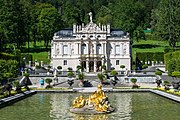
- Herrenchiemsee(See remarkable monuments). If you go back to Munich, you can go to see, the German "Palace of Versailles" of Louis II of Bavaria.
To see
Remarkable monuments
- 1 Neuschwanstein Castle (From Fussen.) – One of the most remarkable Castles in the world.
- 2 Hohenschwangau Castle (From Fussen.)
- 3 Church of Wies – Splendid church, unmissable. At the end of a small cul de sac road in the countryside.
- 4 Linderhof Palace
- Konigssee(natural Park). With the essential boat trip to Sankt Bartholomä, on the beautiful little lake of 5,2 km2, .
- 5 Herrenchiemsee Castle – If you go back to Munich, you can go to see, the German "Palace of Versailles" of Louis II of Bavaria.

Neuschwanstein Castle. Bavaria.
_(8).JPG/180px-Schloss_Hohenschwangau_(Baviara_2016)_(8).JPG)
Hohenschwangau Castle. Bavaria.

Church of Wies. In its green setting in Bavaria.
Linderhof Palace. Bavaria.

Herrenchiemsee Castle. Bavaria.

_(8).JPG/180px-Schloss_Hohenschwangau_(Baviara_2016)_(8).JPG)


Main towns
- 6 Lindau – With its old town on the Isle of Hoy.
- 7 Fussen
- 8 Oberramergau – Small town recommended for its painted houses, passion, woodcarvings.
- 9 Garmisch-Partenkirchen – Capital of the Bavarian Alps. Internationally renowned resort for skiing, springboards, etc ....
- 10 Bad reichenhall
- 11 Berchtesgaden – Berchtesgaden National Park (http://www.nationalpark-berchtesgaden.bayern.de/00_franzoesisch/index.htm). Visit to the Kehlsteinhaus or the Eagle's Nest. Panorama Roẞfeldstraẞe for the Roẞfeld.
- And in Austria ...
- 12 Salzburg – The city, its streets, its squares, its horse-drawn carriages, its Castle, the Cathedral, the cemetery, its gardens, its classical music festival, Mozart ... a whole program.
Natural sites
- 13 Lake constance – Lake Constance (Bodensee) is made up of 473 km2 upstream of the Obersee then the Überlinger See; and on 63 km2 downstream after Constance de Untersee and Zellersee (the northern part). Lots of bike paths at the west end of the lake.

The Zugspitze (2962m).
- 14 Zugspitze (2 962 m)
- 15 Achenpass (941 m)

Königssee near Berchtesgaden.
- 16 Konigssee – Beautiful little lake of 5,2 km2, located in a setting between mountains and forests. Don't forget the main boat ride at Sankt Bartholomä.
- 17 Panorama Roẞfeldstraẞe – Roẞfeld, you are at 1 500 m overlooking Salzburg and Austria. Then going down the Roẞfeldstraẞe, turn right towards Hallein.
Do
To buy
Eat
Have a drink / Go out
Security
Around
- Bavaria
- Tyrol (Land)
- Innsbruck
- Salzburg
- Sankt Wolfgang im Salzkammergut. (http://www.st-wolfgang.ooe.gv.at/system/web/default.aspx) on the Wofgangsee, east of Salzburg for dinner at theAuberge du Cheval Blanc.
- Wattens Swarovski International Holdings exhibition-museum, store and headquarters. TO 15 km approximately east of Innsbruck. Only parking is free.