Whether in a canoe, a kayak or a rowboat, the smaller German rivers in particular are ideal for hiking in the water. Here there is usually little or no professional shipping - so nothing “stands in the way” of a water hike. It is important to find out about the route before sailing on a river (see web links).

security
Even if you can swim, it is best to always wear a life jacket. You capsized quickly, especially in a kayak, but also in a Canadian that was a little more stable in the water. There are also dangerous currents in the river that may pull you down (especially in front of and behind power plants Groynes). It is essential to observe the relevant information signs and restricted areas in front of power plants and weirs, otherwise there is a rapid danger to life and limb! This also applies to experienced swimmers.
Always obtain detailed information about the selected river section before entering the river. If you rent a boat, you will usually receive the relevant information unsolicited during the handover meeting. If this does not happen unsolicited, it is essential to ask, unless you have an experienced "river expert" with you.
Anyone who is not yet familiar with driving a canoe or a kayak should also be instructed in how to use the boat.
On rivers with a lot of "large shipping traffic" you absolutely have to do the Know traffic rules. However, this also applies in part to smaller rivers, provided they are Federal waterway are classified (for further information see section "Legal").
Rivers
Smaller rivers that are not federal waterways or are only of regional importance are dealt with in the relevant regional articles (see list below). The following are some of the federal waterways that are particularly suitable for water hikes:
Fulda


The Fulda is from Mecklar (above Bebra) to Hann. Münden on 108.8 km of the federal waterway. Hiking paddlers can ride the river from the center of Fulda.
- For the inexperienced there is a drive by folding boat Fulda advised against because in summer the water level for folding boats only decreases Bad Hersfeld is sufficient.
- The Fulda has a few between Fulda-Kämmerzell and Mecklar Weir systems without locks. As of 07-2013, no information is available about the type and location of the transfer option or possibly existing boat lanes.
- On the upper reaches of the Fulda (above Lüdenmünd) there are certain maximum permitted boat contingents for nature conservation reasons (see article General decree Fulda in the folding boat wiki).
Tour suggestion from Bad Hersfeld:
- Arriving by train. Park your car under the Berliner Straße bridge.
- 1 day Bad Hersfeld to Rotenburg: 23 km camping site Tel. 06623 5556,
- Day 2 Rotenburg to Beiseförth (municipality Malsfeld): (?) km camping site Tel. 05664 93 94 04.
- Day 3 Beiseförth - Röhrenfurth: 14.4 km Tel. 06661 4666,
- 4th day Röhrenfurth - Büchenwerra: 10.5 km camping site 05665 96 10 44, the 3rd and 4th day can also be paddled on one day.
- Day 5 Büchenwerra - kassel: 19.4 km campsite 0561 22433.
- Day 6 Kassel - Hann Münden: approx. 30 km of backwater.
- Key points of the river description
- Weirs and locks in the course of the river from Fulda-Kämmerzell:
- Fulda city center: from here the Fulda is at the appropriate water level just mobile for canoes.
- 1 Weir Kämmerzell - no lock; Portability how and where? possibly boat lane?
- 2 Lüdermünd weir - no lock; Transfer options how and where? possibly boat lane?
- 3 Weir inhibitors - no lock; Portability how and where? possibly boat lane?
- 4 Weir Pfordt- no lock; Transfer options how and where? possibly boat lane?
- 5 Frauombach weir - no lock; Transfer options how and where? possibly boat lane?
- 6 Rimbach weir - no lock; Transfer options how and where? possibly boat lane?
- 7 Weir Eichshof above Bad Hersfeld - no lock; good portability on the right, unfortunately you have to go through the water lilies.
- 8 Weir at the Bad Hersfeld power plant - The weir must be carried around on the right. The only way out is about 70 m in front of the weir, directly in front of the “Berliner Straße” bridge. The canoe then has to be carried the entire distance, the path is paved. About 20 m behind the weir there is a staircase to the entrance, from which the Fulda can now also be navigated by rowing boats when the water level is appropriate.
- 9 Weir Mecklar - there is an exit to the left of the weir. A boat slide made of brooms and stairs are available.
- ~~> From Mecklar is the Fulda federal waterway.
- 10 Rotenburg on the Fulda - The barrage must be carried around on the left, as the Lock out of order or is defective.
- 11 Neumorschen lock - operational (manual operation with self-service)
- 12 Melsungen - The structure in the area of the historic Bartenwetzerbrücke is in operation. Attention when entering the self-service lock with muscle power: to the left of the lock is the power plant with the corresponding turbine suction. Therefore, when entering the lock, keep as far to the right as possible and maneuver carefully. Curious: a Road marking posts right hand marks the entrance to the weir.
- 13 Guxhagen The weir between Melsungen and Kassel owns right a functional lock system that is operated by hand.
- 14 Barrage Neue Mühle; Lock no longer in operation; Lorenbahn with boat wagons on the right - The New mill barrage at Kassel no functioning lock more. In the summer half year one finds right at the weir, however, a 150 m long wagon route for canoe transport. In the summer half of the year there is supposedly a boat wagon (lorry) available here.
- Below Kassel there is then from Kassel city center to the Weser five electrically operated locks with guard or central remote control (Lock opening times. At these locks there are also transfer routes so that you can also come downstream outside the opening times. From Kassel city center, some excursion boats and larger motor yachts (on weekends to Fuldaschleife Simmerhausen partly lively yacht traffic) use the Fulda. The river is dammed here for longer stretches so that there is little or no support from the current (a lot of backwater).
Other important information
- General information from the Waterways and Shipping Office Hann. Münden for water sports enthusiasts on the Fulda (PDF file including an explanation of the watermarks)
- Flow information of the WSA Hann. Münden to the Fulda with a detailed table of kilometers
- Flow information in Folding boat wiki.
Canoe rental company with offers for the Fulda
- Rhön Adventures - Tour offers between Fulda and Bad Hersfeld
- Canoe Tours - Tour offers between Fulda-Kämmerzell and Beiseförth
- Canoe rental Eder-Fulda-Tour - Tour offers between Rotenburg on the Fulda and Hann Münden
- Canoe tourism center - Tour offers between Rotenburg on the Fulda to Fuldabrück-Dittershausen
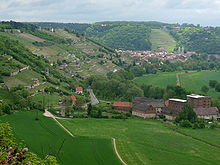
Lahn


The Lahn is between to water and Limburg one of the most beautiful water hiking trails for paddlers. At the Gießen-Zentrum weir and the two following weirs in Giessen there are still boat lanes. Then there are two more weirs in Wetzlar, also with boat lanes. Just above Wetzlar the first hand-operated lock can be found in Lahnau. Traffic noise still accompanies the river as far as Löhnberg. But between Löhnberg and Limburg, the Lahn then flows quietly and idyllically through a lovely landscape away from the traffic. Numerous locks now follow, which also have to be operated by hand. From Limburg the locks are electrified and a few motor yachts and excursion steamers use the river. The highlight of the route is the ship tunnel in Weilburg with the adjoining double lock.
Important: For reasons of nature conservation, only the official entry and exit points may be used to deploy boats!
Disadvantage of the river: Especially during the holiday season and on the weekends / public holidays, the river is meanwhile quite a lot populated by canoes. This is particularly true of the popular and really beautiful route between Weilburg and Runkel too, which is ideal for a day tour. It is therefore advisable to plan tours between Monday and Friday if possible. Then the rental prices for the boats are usually cheaper.
The Lahn is a federal waterway. Small vehicles must be marked accordingly (see legal information below).
- More extensive information with a List of canoe rental companies are in the "Water Hikes" section in the article To find the Lahn valley
rope
The leash is certainly not the best paddling area in Germany. Due to the often high banks, water hikers sometimes only have a very limited or no view of the Leine valley. The river is also not continuously navigable, you have good paddling conditions with all types of boats Friedland (Lower Saxony) and has to be in Goettingen handle some portages. A major obstacle, however, is the nature reserve between Northeim and Salzder heroes. The nature conservation authority has forbidden driving the river in two closely spaced sections, so it makes sense to implement the same for both sections. This concerns a 10 km long section between Hollenstedt at Northeim and Salzderhelden Einbeck. After that, the line is with you all the way to where it joins the Aller Schwarmstedt passable, but weirs and other obstacles often have to be moved around along the entire route. There are also some sections in which boarding and disembarking on the bank is prohibited (e.g. along the entire length between Gronau (Leine) and Elze).
A route sketch is on gewaesser.rudern.de.
Peene
Due to the very flat slope, the Peene is passable in both directions. When the wind is from the east it can also be interesting to paddle upstream. Detailed information is available from FlussInfo [1]
Rhine
Upper Rhine
- detailed information for the river route see Focus article Water hiking on the Upper Rhine
Dysentery
Information wanted!
Saale
Start / insert:
In principle, the Saale is navigable from Saalfeld, you should definitely inquire about the water level in advance, especially if you want to travel by folding boat.
When the water level is low you should therefore be prepared to have to tow the boat very often.
In any case, you have to reckon with some rapids and flat spots, over which you can also get a fully packed folding boat (with a little caution) over.
Otherwise, Jena is recommended as an alternative placement point. There it is quite easy to get the boat into the water, just ask the local canoe or rowing clubs whether you can "use" their area for a short time.
Landscape:
In terms of landscape, the Saale can be divided into two large sections. Once from Saalfeld to Leuna and from Halle to Barby, where the Saale flows into the Elbe.
In the upper part the Saale is still a bit wild, in addition there are the gentle hills (or mountains) of Thuringia with their old castles and dense forests, which results in a beautiful panorama.
The Saale is on long stretches, z. B. between Camburg and Naumburg easily navigable by canoe. There are enough Boat rentals to disposal. The routes are largely natural and offer a wonderful view of the vineyards.
Literature:
- Water sports hiking map WW 7 - Germany East with Saale, Unstrut, Zschopau, ISBN 3-929540-17-7
- Water hiking guide Mittlere Saale, publisher of the nature park "Saale-Unstrut-Triasland" e.V. Nebra, ISBN 3-9806006
Unstrut
The Unstrut is a somewhat less well-known but still attractive water hiking route in Germany. The river is open to canoes all year round from the 1 Straussfurt dam passable. From 2 Heroics the river is “free of defenses” for boats. All barrages below Heldrungen can be reconstructed with locks (seven pieces to the mouth at https://www.schmitt-hahn.de/shop/magazine/90654/goettingen.html Naumburg) can be overcome.
The landscape is particularly interesting for around 50 km in the valley of the Saale-Unstrut wine region Memleben and Naumburg (Saale).
Lock times according to Thuringia Tourism: between April and October Thursday-Monday 9 a.m.-12 p.m. and 1 p.m.-6 p.m. (Status 06-2013)
Weser


The approximately 200 km long upper Weser between Hann. Münden and Minden is an excellent water hiking route. The route leads through the beautiful landscape Weser Uplands. Between Hann. The river flows over to Münden and Hameln 100 km completely freeso that the flow of the river can be used completely for locomotion. Noteworthy shipping on the Weser is, although the river already from Hann. Münden is classified as a federal waterway, can only be found from Minden. Only a few excursion boats operate on the Oberweser.
On the initiative of Weserbergland Tourismus e. V. canoe docks were uniformly marked. Large signs with a "yellow wave" indicate the docks. Depending on the equipment of the pier, you will find tables, benches and an information board about the sights on site. Sometimes there are also toilets. The docks are listed in the leaflet “Canoe docks on the Weser”. Here you can also see whether the jetty is accessible by car as an entry or exit point. To the leaflet as PDF file with about 1.5 Mb.
- detailed information for the river route see Focus item Water hiking on the Weser
Further external information:
- General information from the Waterways and Shipping Office Hann. Münden for Water sports enthusiasts on the Weser
- River information from the WSA Hann Münden to the Weser with a detailed table of kilometers
Werra
The Werra is a federal waterway. Small vehicles must be marked accordingly (see legal)
- General information from the Waterways and Shipping Office Hann. Münden for water sports enthusiasts on the Werra (PDF file including an explanation of the watermarks)
- Flow information of the WSA Hann. Münden to the Werra with a detailed table of kilometers
- Canoe rental company (which usually also offer organized tours) are in the article Listed in Werra Valley.
Regional areas

Regional water hiking routes are listed here. The detailed description can be found in the regional articles.
- Spreewald
- Wiesent in Franconian Switzerland - 28 km
- Lower Eder in Northern Hesse (section Edertal-Affoldern to Edermünde with a length of about 45 km). The Untere Eder is less known in Germany, but it is a quite stately river Further information.
- The historic Finow Canal in Brandenburg northeast of Berlin. For information see Article "Barnim".
Bavaria
- Altmuehl in Bavaria - The river in the Franconian Jura is 120 km by canoe passable.
- rain - the river in Eastern Bavaria, which in Regensburg into the Danube flows out of Blaibach can be comfortably traveled in approx. 5 days.
- detailed information for the river route see Focus article Water walking on the rain
Mecklenburg - Western Pomerania
- Neustrelitzer or Mecklenburgische Kleinseenplatte, among others with the "Alte Fahrt" from Mirow in the Müritz
Baden-Wuerttemberg
- Chasing
- Stove
- Upper Neckar
- Upper Danube
- Deaf
Schleswig-Holstein
- Schwentine in Holstein Switzerland
- Wakenitz near Lübeck
- Schlei
Legal
- Marking of small craft on federal waterways
- "Inland Shipping Ordinance for Paddlers" - Compilation in Folding boat wiki for paddlers - Chapter 2 deals with the marking of small craft on federal waterways.
literature
- River hiking books of the German Canoe Association. The guides can also be purchased online as a PDF file for EUR 5–10 (PayPal). There are four volumes in PDF format for Germany:
- Danube River Basin (1)
- Rhine / Maas river basin (2)
- River Weser / East Frisia (3)
- River Elbe / Canals / Baltic Sea (4)
- Paper lovers can also buy the river guides in book form. That is recommended "German River Hiking Book"which, in addition to the ones mentioned here, also describes all of the other major rivers in Germany from a paddler's point of view and is suitable for both paddling and planning (23.80 euros); Worthwhile for everything for "real" river tours (in addition to the ones mentioned here, Main, Danube, Altmühl, Elbe, Havel ...) For short tours on small and very small rivers, there are regionally structured tours Water guide.
- Water hiking literature in Jübermannverlag Uelzen - publishes water atlases and planning maps for many bodies of water across Germany. The atlases are predominantly on a scale of 1: 75,000, in detailed maps also larger, and have a lot of additional information on places to stay, portraits, etc. Price per atlas 18-23 euros. Worthwhile for tours on lake plateaus and networked small bodies of water (Mecklenburg, Holstein lakes around Plön, Berlin city canals, Spreewald, etc.)
- Canoe tour guide in Thomas Kettler Verlag Hamburg - The book series Kanu Kompakt describes in detail tours with topographical water hiking maps including transfer points on the rivers, such as Altmühl, Isar, Lahn and Werra and also on the lake areas Spreewald and Mecklenburg Lake District.
Web links
- Water Sports Guide "Safety on the Water" of the Federal Ministry of Transport, Building and Urban Development
- German Canoe Association
- Folding boat wiki
- German Rowing Association