
The Westweg is a long distance hiking trail through the Black Forest over approx. 285 km in north-south direction. If you are in good shape, you need a good two weeks for this high-altitude hiking trail over the summit areas and pass heights of Pforzheim to Basel. A red diamond marks this classic route of the Black Forest Association, as well as the other routes middle way and East way.
background


The high-altitude hiking trail, first planned in 1894 and designated in 1900, is the oldest long-distance hiking trail in Germany. Since then it has been maintained by the Black Forest Association and has received various quality awards. Because of its popularity and as the flagship of the Black Forest, the route is marketed by the Schwarzwald Tourismus GmbH (www.westweg.info). Portals have been set up along the route in which hikers can stamp a stamp card, nine stamps are rewarded with a "Westweg" buff.
Parallel to the Westweg there are the north-south routes in the Black Forest middle way to Waldshut and the East way to Schaffhausen.
The Westweg begins in Pforzheim. He leads through that first Enztal to Chub and then through wide forests with moors to the Hohlohturm. After the descent into the Murgtal the path rises again to the highest point in the northern Black Forest, the Hornisgrinde. The further route runs along the Black Forest High Road to Knee to knee and then through forest areas into Kinzigtal to Hausach. After a steep ascent, the Westweg leads between the Martinskapelle (source of the Danube) and the Kalten Herberge along the watershed between Rhine and Danube.
In Titisee-Neustadt the Westweg forks into a western and an eastern variant.
- The western route (variant A) runs over the Feldberg, the Belchen and the Blue ones to Kandern and then through the Wolfsschlucht and the valley of the Meadow to Basel.
- The eastern route (variant B) branches off southwards to the third highest Black Forest mountain, the Herzogenhorn, goes over the heights between Wehra- and Wiesental, leads to the Hohen Möhr to the Dinkelbergto at Rheinfelden down to the Rhine Valley and to Basel.
preparation
The "Westweg" was calculated to be hiked in two weeks, which is a challenge! The twelve stages via variant A are tightly calculated, with the arrival and departure days you come to 14 days - but daily completion of long stages without rest days is not for everyone. In the middle section, depending on the time of year, there are bottlenecks in overnight accommodations, so it is best to book in advance. Several hosts who offer accommodation a bit away from the Westweg pick up hikers at the end of a stage and bring them back to the route the next day.
Some bottlenecks (with the alternatives to staying overnight:
- Unterstmatt (Mummelsee)
- Alexanderschanze (Kniebis)
- Harkhof (Brandenkopf)
- Wilhelmshöhe (Schonach)
- Cold hostel (Waldau)
- Wiedener Eck (Wieden)
- Luggage: As with all long-distance hikes, you can get the farthest if you limit yourself to the bare minimum! The backpack should weigh between 5 and 10 kg, including rain cover. The Black Forest is not high mountains, but here, too, the weather can change quickly and unexpectedly and in summer there can be thunderstorms and hailstorms at high altitudes, and even snowfall in the off-season.
- Robust and well-worn hiking shoes are a prerequisite. Everyone can decide for themselves whether a Goretex jacket or an umbrella has more advantages.
- Navigation / route finding: as a quality hiking trail, the Westweg is excellently signposted. You don't actually need a hiking GPS. Since most smartphones are equipped with a navigation system, OsmAnd (with the option of offline downloading of the relevant maps) is a clear recommendation.
Training is part of the preparation. To avoid surprises, you should be used to hiking for several days. The difficulty is not the individual stage, but the regularity of the loads so that the energy (and the feet) can still support the stages towards the end of the tour.
getting there
The train is recommended to get there.
The 1 Pforzheim central station![]()
![]()
![]() has direct connections to Karlsruhe and after Mühlacker, Vaihingen an der Enz and Stuttgart.
has direct connections to Karlsruhe and after Mühlacker, Vaihingen an der Enz and Stuttgart.

Basel is very well connected to the railway network. All trains to Germany run at the Badischer Bahnhof (Basel Bad Bf), so that this station becomes the return station for most German hikers. Regional and express trains of the DB end here, as do the trains of the Hochrheinbahn Schaffhausen to To sing. To Stuttgart the travel time is 2:45 h to Frankfurt am Main just under 3 hours.
Trains from the Swiss Plateau naturally run to Basel SBB station.
Here we go
1st stage: Pforzheim - Dobel (26.2 km) 
_03_ies.jpg/220px-Neuenbürg_-_Schloss_(Ilgenberg)_03_ies.jpg)


| Place / sight | route (km) | height (m aboveNHN) | additional Information |
|---|---|---|---|
| 2 Pforzheim - copper hammer | 0 | 260 | Starting point of the three Black Forest high-altitude trails Westweg (Pforzheim – Basel), middle way (Pforzheim – Waldshut and East way (Pforzheim – Schaffhausen) |
| Hoheneck ruins | 1,1 | 330 | |
| Dillweissenstein | 1,2 | 265 | |
| 3 Lower Enzsteg | 3,0 | 290 | Branch of the altitude variant |
| Grösselbachfurt | 3,8 | 310 | |
| Neuenbürg Castle | 2,4 | 400 | |
| Neuenbürg market square | 0,5 | 323 | |
| Buchberg, adventure playground | 0,5 | 460 | Meeting of the Westweg with the former route (altitude variant) of the first stage |
| Schwanner Wait | 3,6 | 490 | Schwann is a part of Straubenhardt Glider airfield |
| Herzogswiesen | 1,0 | 520 | |
| Dreimarkstein | 4,0 | 675 | Refuge and barbecue area |
| Large Volzemer stone | 1,2 | 700 | Sea of rocks |
| Chub | 2,4 | 710 |
Directions
The Westweg begins just like the other two Black Forest high-altitude trails middle way and East way at the Gasthaus Kupferhammer near the confluence of Worm and Nagold. From 4 Pforzheim Central Station The route is already signposted up to the beginning of the path. She leads to the 1 St. Michael Church along into the pedestrian zone, over the Guernika Bridge and past the CCP convention center 1 Reuchlinhaus, which also houses the Pforzheim Jewelery Museum. Then it goes along the Nagold to the Kupferhammer, the actual starting point of the route.
From Kupferhammer, the path initially runs uphill to 2 Hoheneck ruins and from there back downhill to 2 Dillweissenstein. There the Nagold is crossed, and it goes past the cemetery through the Pforzheim district of Büchenbronn to 5 Tornado Stone, which reminds of the tornado over Pforzheim on July 10, 1968. From there it goes down into the Enz Valley.
At the Unteren Enzsteg, today's Westweg separates itself from the altitude variant on which the path ran until 2006. From there the path goes up the enz to 6 Grösselbachfurt, where the Grösselbach is crossed over stepping stones. There is also the Eberhard-Essich-Hütte, named after a former board member of the Neuenbürg Black Forest Association.
The path continues along the Enz to Neuenbürg and there over the Hintere Schlosssteige past the hiking home up to the 3 Neuenbürg Castle. The path to the center of the village runs over the Vordere Schlosssteige 3 Neuenbürg and from there over the Hafnersteige up to the residential area 4 Buchbergwhere the altitude variant comes together again with the main variant of the trail.
Through the forest it goes past Schwann (district of Straubenhardt) to 4 Schwanner Wait, from the observation tower a nice view to the north into the Rhine plain. After crossing the state road 339 it goes past the 1 Herzogswiesen and Dennach to 7 Dreimarkstein . At Dreimarkstein came the markings of the former communities Dennach, Conweiler (which today belongs to Straubenhardt) and Chub getting together. The path crosses the state road 340 and continues on the Hüttwaldweg to 5 Great Volzemer stone. The milestone Dobel is reached via Neuenbürger Straße.
- 1 Gasthaus Kupferhammer, Am Kupferhammer 1, 75181 Pforzheim. Tel.: 49 (0)723167712.
- 2 Country inn Hohenegg, Huchenfelder Str. 70, 75181 Pforzheim. Tel.: 49 (0)72314153362. Open: closed on Mondays.
Height variant
In 2006 the first stage of the Westweg was relocated. The former stage via Birkenfeld is still signposted as an altitude variant.
| Place / sight | route (km) | height (m above sea level) | additional Information |
|---|---|---|---|
| Pforzheim copper hammer | 0 | 260 | |
| Hoheneck ruins | 1,1 | 330 | |
| Dillweissenstein | 1,2 | 265 | |
| Lower Enzsteg | 3,0 | 290 | Branch of the altitude variant |
| 5 Birch field | 2,0 | 358 | |
| 8 Wilhelmshöhe | 6,5 | 429 | |
| Buchberg, adventure playground | 0,5 | 460 | Meeting of the altitude variant of the first stage with the Westweg |
2nd stage: Dobel - Forbach (26 km) 


| Place / sight | route (km) | height (m above sea level) | additional Information |
|---|---|---|---|
| Chub | 0 | 710 | |
| Dobel water tower | 0,5 | 720 | |
| Weithäusle | 4,6 | 825 | Refuge |
| Schweizerkopfhütte | 1,5 | 850 | Observation pavilion |
| Hahnenfalzhütte | 3,3 | 890 | Hut of the ski guild Bad Herrenalb |
| Langmartskopfhütte | 1,0 | 915 | |
| Kreuzlehütte | 2,5 | 892 | |
| Kaltenbronn | 2,3 | 880 | |
| Hohlohsee | 1,2 | 990 | High moor |
| Hohlohturm | 0,7 | 984 | Observation tower Kaiser Wilhelm Tower, Refuge |
| Prince's hut | 1,5 | 976 | Refuge |
| Latschigfelsen | 2,3 | 750 | |
| 6 Witch fountain Hexenbrunnen (Gausbach) | 2,5 | 400 | Gausbach is a suburb of Forbach |
| Forbach | 2,1 | 300 |
Directions
From the town center in 6 Chub the path leads through the Sonnentor portal at the Kurhaus to the one built in 1937 7 Water tower on the Höhenstraße. and past the bull's head and lark's head to the 2 Weithäuslewhere different hiking trails come together. Past the 3 Schweizerkopfhütteleads the way to 4 Hahnenfalzhüttewhich is managed by the Bad Herrenalb ski guild on weekends and public holidays.
The path continues at first steeply uphill to the 5 Langmartskopfhütte and on to 6 Kreuzlehütte. From there it goes first on a forest path and on a hiking trail to 8 Kaltenbronn game reserve. The path crosses the L76B road before going up to the 9 Hohlohsee leads. From Hohlohsee it goes over a boardwalk and then on to 10 Hohlohturm and from there on the old wine route about the 7 Prince's hut down to the 11 Latschigfelsen with a view of the Murg valley. It then goes over serpentines to the 12 Witch fountain and on via Gausbach to the stage destination Forbach.
3rd stage: Forbach - Unterstmatt (20 km)


| Place / sight | route (km) | height (m above sea level) | additional Information |
|---|---|---|---|
| Forbach | 0 | 300 | |
| Maria-Hilf-Chapel | 1,2 | 380 | |
| Hut On Parting Away | 3,2 | 750 | |
| Schwarzenbach dam | 1,6 | 675 | |
| Herrenwieser See | 2,3 | 835 | |
| Seekopf | 1,2 | 1.001 | The Bussemer-Denkstein is reminiscent of Philipp Bussemer |
| Baden height | 1,2 | 1.002 | Observation tower Grand Duke Friedrich-Tower |
| 13 Herrenwieser saddle | 1,8 | 879 | |
| Sand (Bühl) | 2,5 | 828 | Intersection with the Schwarzwaldhochstrasse Bundesstrasse 500 |
| Hundseck | 1,1 | 856 | |
| 14 Hochkopf | 2,9 | 1.039 | |
| Untermatt | 0,9 | 930 |
Directions

In 7 Forbach The path crosses the Murg on the historic wooden bridge and continues past the Moses fountain before climbing steeply to 15 Maria-Hilf-Chapel and to 8 Hut On Parting Away goes up. Then you pass the Johannesbrunnen to 16 Schwarzenbach dam.
The path goes along the Seebach, one of the tributaries of the reservoir up to 17 Herrenwieser See. At a point marked with Zweiseenblick you can see the Schwarzenbachtalsperre and the Herrenwieser See. The Bussemer memorial stone on the 18 Seekopf reminds of one of the two founders of the Westweg, Philipp Bussemer from Baden-Baden.
Go straight ahead to 19 Baden height with the Friedrichturm, built in 1891 and named after Grand Duke Friedrich II of Baden. The hiking home can be reached slightly downhill Naturfreundehaus Badener Höhe and then the 20 Pass top sand on the B500 called here "Schwarzwaldhochstraße". The hike leads along a hiking trail parallel to the main road to 9 Hundseck and then up to the unwooded summit of the Hochkopfs. From there it goes over a path partly laid out with large granite slabs down to the top of the pass Untermatt.
- 3 Friends of Nature House Badener Höhe, 77815 Bühl-Sand. Tel.: 49(0)7226 238, Email: [email protected].
4th stage: Unterstmatt - Alexanderschanze (27.7 km)


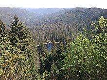
.jpg/220px-Schliffkopf_view_(9576217269).jpg)
| Place / sight | route (km) | height (m above sea level) | additional Information |
|---|---|---|---|
| Untermatt | 0 | 930 | |
| Ox barn | 2,0 | 1.036 | Ski and hiking home (managed) |
| Hornisgrinde | 1,5 | 1.164 | |
| Mummelsee | 1,8 | 1.035 | |
| Seibelseckle | 1,3 | 956 | |
| Darmstadt Hut | 3,4 | 1.020 | |
| Wildseeblick at the Seekopf | 1,3 | 1.040 | Julius Euting's grave |
| Hearthstone | 2,1 | 915 | Crossing with Schwarzwaldhochstraße B500 |
| Grinding head | 3,8 | 1.055 | |
| Hotel refuge | 7,1 | 950 | |
| Alexanderschanze | 3,4 | 965 | Intersection with B28 |
Directions
From the starting point in 10 Untermatt The path initially leads past the former Höhenhotel Unterstmatt to the left. Hiking trails lead up to the hiking home 1 Ox barn and then to the 21 Hornisgrinde transmitter. A path paved with granite slabs leads to the Bismarck tower or signal tower at the highest point of the summit level and then to the Hornisgrinde tower. The area around the Hornisgrinde Tower was used for military purposes from 1942 to 1997, which can still be seen in some of the decaying buildings and remnants of the barriers along the way.
After the Hornisgrinde tower, the descent to the Reached Mummelsee with the Berghotel Mummelsee. From the mountain hotel the path leads past the Mummelsee chapel to the 11 Seibelseckle. At the valley station of the ski lift there is an uphill slope to the right, past a monument that commemorates hurricane Lothar in 1999 to the 2 Darmstadt Hut. Until 1 Wildsee view At the grave of the orientalist Julius Euting, who died in 1913, the path climbs slightly. The detour down to the 22 Wildsee is very steep and only suitable for sure-footed hikers.
The Westweg, however, continues over the Seekopf and then zigzag down the ski slope to the 12 Hearthstonewhere the way is the Black Forest High Road ![]() crossed. Along the pig's head it goes up to the 23 Grinding head. The way leaves that Hotel Schliffkopf are on the left. A forest path leads past the Röschenschanze to the Hotel refuge and on to Alexanderschanze. The name goes back to a hill named after Duke Karl Alexander von Württemberg, built in 1734 for the military security of the strategically important crossing on the Württemberg border; the hotel is no longer in operation.
crossed. Along the pig's head it goes up to the 23 Grinding head. The way leaves that Hotel Schliffkopf are on the left. A forest path leads past the Röschenschanze to the Hotel refuge and on to Alexanderschanze. The name goes back to a hill named after Duke Karl Alexander von Württemberg, built in 1734 for the military security of the strategically important crossing on the Württemberg border; the hotel is no longer in operation.
- 4 Mountain hotel Mummelsee, Schwarzwaldhochstrasse 11, 77889 Seebach / Mummelsee. Tel.: 49 (0)7842 99286, Fax: 49 (0)7842 30266, Email: [email protected].
- 5 National Park Hotel Schliffkopf, Schwarzwaldhochstrasse 1, 72270 Schliffkopf. Tel.: 49 (0)7449 9200, Email: [email protected].
- 6 Hotel refuge, Refuge 1, 72250 Freudenstadt Refuge. Tel.: 49 (0)7804 912560, Fax: 49 (0)7804 912561, Email: [email protected].
5th stage: Alexanderschanze - Auf der Hark (17.4 km)
This stage and the next stage can be mastered in one day by capable hikers.


| Place / sight | route (km) | height (m above sea level) | additional Information |
|---|---|---|---|
| Alexanderschanze | 0 | 965 | |
| Renchtal viewpoint | 3,4 | 915 | |
| Hildahütte | 1,1 | 914 | |
| Lettstädter Höhe | 2,0 | 968 | |
| View of the Glaswaldsee | 1,2 | 945 | |
| Klagstein | 1,6 | 907 | |
| Freiersberg saddle | 0,5 | 752 | Crossing with the pass road Schapbach – Bad Peterstal |
| Littweger Höhe | 2,3 | 840 | Refuge Crossing with Cross path Gengenbach – Alpirsbach |
| On the rake | 4,3 | 700 | with overnight accommodation |
Directions
The fifth stage leads over long stretches through forest. From the intersection in front of the former hotel 13 Alexanderschanze you have to walk a short distance along the Schwarzwaldhochstraße before the Westweg turns left onto a path. The path leads over the 2 Renchtal viewpoint with a launch site for hang-gliders 9 Hildahütte. At the signpost Graseck you can make a detour to the Teufelskanzel. The path marked with the Westweg diamond leads to 24 Lettstädter Höhe. From there the path continues to a lookout point from which you can access the 25 Glaswaldsee can see. The lake itself is not on the Westweg; You have to plan around 30 minutes for a detour.
From the vantage point, the path continues across the lake level to the "Am Klagstein" signpost. Also the 14 Klagstein, a sandstone rock with a good view of the Wolftal, is not directly on the Westweg. This leads to 26 Freiersberg-Pass height (junction with the L93 and on to the hut on the 27 Littweger Höhe and another four kilometers to the stage destination on Harkhof, a working farm with overnight accommodation.
6th stage: On the Hark - Hausach (16.5 km)
This stage and the previous stage can be tackled in one day by capable hikers.


| Place / sight | route (km) | height (m above sea level) | additional Information |
|---|---|---|---|
| On the rake | 0 | 700 | |
| Kreuzsattelhütte | 2,6 | 738 | |
| Signpost to the Reiherskopf | 0,3 | 735 | Junction to Brandenkopf, which is about 3.5 km from the Westweg (hiking home). |
| Hirzwasen | 2,0 | 735 | Crossing with the Great Hansjakobweg |
| Ebenacker | 2,0 | 620 | |
| Hohenlochenhütte | 2,0 | 650 | Simple hiker's hut |
| Käppelehof | 0,3 | 640 | Mountain farm with overnight accommodation |
| 15 White cross | 1,5 | 510 | |
| Pointed Rock | 1,3 | 577 | Refuge |
| Hausach | 4,6 | 237 |
Directions
The Westweg runs from Dobel to Blue ones on the western route or to the Hohen Möhr on the eastern route consistently in the summit areas and on the pass heights of the Black Forest. The only two exceptions are the Murgtal and the Kinzig valley. The sixth stage leads from Hark down to the Kinzig valley Hausach, which is at the lowest point of the Westweg at an altitude of 237 meters.
From the Harkhof the hike goes briefly uphill to the Harksattel and over forest and hiking trails to 10 Kreuzsattelhütte. At the 16 Signpost to the Reiherskopf you can turn right to the 3.5 kilometers away 28 Brandenkopf turn. The Brandenkopf is reached via the Steiglehütte, on the mountain is next to the hiking home of the Black Forest Association, a lookout tower and the Brandenkopf transmitter, which can be seen from afar.
If you do not take the detour via the Brandenkopf, walk straight ahead at the signpost and then continue to the left to the wayside cross at 17 Hirzwasen, here the Westweg crosses the Big Hansjakobwegwho continues to the Brandenkopf leads. The Westweg continues to 18 Ebenacker, where there is a forest clearing and to 11 Hohenlochenhütte, which belongs to the Black Forest Association Wolfach. The Hohenlochen can be reached in about five minutes via a detour.
The route continues steeply downhill (a fork leads to the cultivated Käppelehof) and on to the White cross. Then the path goes uphill again for a while 29 Pointed Rock with a small pavilion-like hut from which there is a beautiful view of Hausach and the middle Kinzig valley. After the Spitzfelsen, the route leads steeply downhill to the stage destination in Hausach.
- 7 Vesperstube Harkhof, Hark 1, 77784 Oberharmersbach, Germany. Tel.: 49 (0)7837 835, Fax: 49 (0)7837 929235, Email: [email protected]. with guest rooms.
- 8 Brandenkopf hiking home, Brandenkopf 1, 77784 Oberharmersbach. Tel.: 49 (0)7831 6149, Fax: 49 (0)7831 966014, Email: [email protected].
- 9 Käppelehof Inn, Osterbach 7, 77756 Hausach, Germany. Tel.: 49 (0)7831 459, Fax: 49 (0)7831 83992, Email: [email protected].
7th stage: Hausach - Wilhelmshöhe (21.4 km)


.JPG/220px-Huberfelsen_(1).JPG)
.JPG/220px-Karlstein_(1).JPG)
| Place / sight | route (km) | height (m above sea level) | additional Information |
|---|---|---|---|
| Hausach | 0 | 237 | railway station |
| Husen castle ruins | 1,6 | 300 | |
| Farrenkopf | 4,5 | 790 | Refuge named after the painter Wilhelm Hasemann |
| Book corner | 2,6 | 651 | |
| Haselberg | 2,4 | 760 | here intersection with Crossing Rottweil – Lahr |
| 30 Prechtaler Schanze | 0,8 | 835 | Crossing with Zweälersteig |
| Huberfelsen | 1,2 | 760 | Natural monument with a viewpoint |
| Fährlefelsen | 0,2 | 755 | Crossing with the crossroad Rottweil – Lahr |
| Karlstein | 2,0 | 970 | also: Hauenstein, so named after the visit by Duke Carl von Württemberg in 1770. Former QuadrangleSwimming, Württemberg, Furstenberg and Upper Austria |
| "Beautiful view" | 1,0 | 915 | Inn |
| Rendsberg | 2,4 | 925 | |
| Vesperstube Silberberg | 2,1 | 980 | Guest room |
| Wilhelmshöhe | 1,4 | 975 | belongs to Schonach |
Directions
The stage of Hausach up to Wilhelmshöhe is considered the most demanding stage of the entire Westweg; in the first section to Farrenkopf, the path climbs 550 m for six kilometers.
From the train station 8 Hausach the path first leads under the railway underpass, on the main road past the town church of Saint Mauritius, the town hall and then climbs steeply past the castle spring to the 31 Husen Castle leads. Past the 12 Haseneckle-Hütte you reach the two-story Hasemann-Hütte named after the painter Wilhelm Hasemann on the 32 Farrenkopf. The steep ascent is now done.
Then the path leads down the southern ridge again to the top of the pass 33 Book corner crosses with the intersection with the L107. The Büchereck hut and the ski jump at the Büchereck are already passed before the intersection. All entrenchments belong to the Baroque entrenchments and are therefore part of a large defensive system from the 17th and 18th centuries, when they were built in the context of conflicts between the House of Habsburg and the Kingdom of France (Palatinate and Spanish War of Succession).
After the intersection at the Büchereck you pass the ski jump on the Höchst and the 34 Haselberg on the same route as that Crossing Rottweil – Lahr runs. The Hirschlachschanze, which is reached shortly after the two paths meet, is one of the Prechtaler Schanzen. There the path crosses with him Zweälersteig. On this route lies the one named after the Triberg Obervogt Theodor Huber 35 Huberfelsen, from here a beautiful view of the Elz Valley. Under the 36 Fährlefelsen the cross path bends down to the left Hornberg from; the Westweg, on the other hand, continues uphill to 37 Karlstein.
This rock, consisting of granite blocks, used to be called Hauenstein. It was renamed after Duke Carl Eugen von Württemberg climbed it on July 23, 1770. From the middle of the 15th century, the Karlstein was 968.9 meters above sea level. M. the highest mountain peak of Württemberg. With the border treaty between Württemberg and Baden of 1810 between the Kingdom of Württemberg and the Grand Duchy of Baden came Hornberg and thus also the Karlstein in Baden.
The path continues from Karlstein to the inn Beautiful view and then to the 10 Rendsberg with the inn To the Karlstein. After the Erwin-Schweizer-Heim you come to a stone archway that belonged to the former Herrenwälder Hof. There it goes straight ahead and later to the left in the Herrenwaldweg, before over the Silberbergweg the 11 Vesperstube Silberberg is achieved. After the Vesperstube, which also rents out guest rooms, it goes briefly up an asphalt meadow path and then on an almost flat stretch to the Schonach belonging Wilhelmshöhe.
- 12 Beautiful view, Schöne Aussicht 1, 78132 Hornberg. Tel.: 49 (0)7833 9369-0, Email: [email protected]. Hotel and restaurant "Schöne Aussicht".
8th stage: Wilhelmshöhe - Kalte Herberge (21 km)


| Place / sight | route (km) | height (m above sea level) | additional Information |
|---|---|---|---|
| Wilhelmshöhe | 0 | 976 | |
| Wolf farm | 1,6 | 1.023 | |
| Blindensee | 1,4 | 1.000 | Hochmoorsee |
| 19 Weißenbacher Höhe | 2,5 | 1.016 | Refuge and parking lot |
| Martin's Chapel | 2,9 | 1.094 | This is where the watershed is located North Sea/Black Sea. The rises south-east of the Martinskapelle Breg, one of the source rivers of the Danube, north of the Elz, a tributary of the Rhine. |
| Brend | 2,4 | 1.149 | Highest point in the central Black Forest; Lookout tower & mountain inn |
| Old corner | 2,1 | 1.075 | |
| Winkel / Southern State Mountain | 1,7 | 1.045 | Shortening with the Crossing the Black Forest – Kaiserstuhl – Rhine |
| Neueck | 1,6 | 988 | Saddle between Furtwangen and Simonswald |
| House level courtyard | 2,7 | 940 | |
| Cold hostel | 3,5 | 1.029 | Inn |
Directions


After this Gasthaus Wilhelmshöhe, the path first crosses the street before it leads through the rock portal onto a boardwalk. Over a knoll and past a small lake you come to the 38 Wolf farm. After a stretch on an asphalt path, a boardwalk leads to the 39 Blindensee. First it goes on on the boardwalk; then you come to the Fuchsbacher wayside cross 20 Weißenbacher Höhe. The path crosses the Elz on a bridge and then continues to the 40 Elzquelle. The Westweg now leads to the European main watershed to 41 Martin's Chapel, in the north the Elz, which flows into the Rhine, in the south the Breg, one of the headwaters of the Danube.
Next goals are the 42 Günterfelsen and the Naturfreundehaus Brend, the detour to 43 Brend Tower it's worth it. About the 21 Old corner (past the "Golden Raven") it goes south west of Furtwangen past; at 22 Neueck the path passes under the B500. Past the 44 House level courtyard, the Heubacher Höhe and the 45 Hollow shrines the path roughly follows the course of the Black Forest High Road B500 to Cold hostel.
- 13 Gasthaus Wilhelmshöhe, Lukas-Kuner-Weg 1, Rohrhardsberg, 78136 Schonach. Tel.: 41 (0)7722 3293, Fax: 41 (0)7722 4722, Email: [email protected].
- 14 Friends of Nature House Brend, Auf dem Brend 5, 78120 Furtwangen. Tel.: 49 7723 803, Email: [email protected]. with guest rooms.Open: closed on Mondays.
- 15 Brend mountain inn, Auf dem Brend 7, 78120 Furtwangen. Tel.: 49 (0)7723 50487 0, Fax: 49 (0)7723 50487 19, Email: [email protected]. Open: Tuesday and Wednesday closed until 5 p.m.
- 16 Hotel Golden Raven, Raben 7, 78120 Furtwangen. Tel.: 49 (0)7723 7397, Fax: 49 (0)7723 5695.
- 17 Gasthaus zum Hirschen, Oberbregenbach 1, 78120 Furtwangen. Tel.: 49 7723 7412, Fax: 49 7723 5788, Email: [email protected].
Separation of the western and eastern variants
In the ninth stage, the western and eastern variants are divided into Titisee, until 2006 the point of separation was still in Bärental. The western variant leads over the ridge between Titisee and Hinterzarten to Oberzarten and further on the Emil-Thoma-Weg to the Feldberg summit.
The eastern variant leads over to the earlier western variant Bärental, the Zweiseenblick and on to the Herzogenhorn.
Option A - Western route
9th stage (west): Kalte Herberge - Hinterzarten (26.2 km)

| Place / sight | route (km) | height (m above sea level) | additional Information |
|---|---|---|---|
| Cold hostel | 0 | 1.029 | |
| Lachenhäusle | 2,7 | 1.080 | |
| Schweizerhof | 3,2 | 1.040 | Inn |
| Silver fir height | 8,1 | 1.190 | |
| Charge amount | 2,0 | 1.071 | |
| Geigershof | 2,0 | 940 | |
| Titisee | 2,5 | 858 | Crossing with the Crossing Freiburg – Lake Constance, Tourist Information; Separation from the east variant |
| Hinterzarten | 5,7 | 1002 |
Directions
Of the Cold hostel the Westweg roughly follows the course of the road ![]() . At the Lachenhäusle, the path leads past a Schwaben ski jump over the Seemoos plain and arrives at Aloysen- and Schweizerhof. Past the Hohlengraben homestead and the The inn "Zum Kreuz" and a Schwedenschanze cross at the 23 Sweet houses again the
. At the Lachenhäusle, the path leads past a Schwaben ski jump over the Seemoos plain and arrives at Aloysen- and Schweizerhof. Past the Hohlengraben homestead and the The inn "Zum Kreuz" and a Schwedenschanze cross at the 23 Sweet houses again the ![]() and then ascends to the Doldenbühl (1,098 m). Then the path runs along the slope of the driving dump to Weißtannenhöhe, a refuge is a little further east on the hilltop. About the saddle of the Charge amount and past The hiking home Berghäusle leads down over the Geigershof after the hamlet of Oberaltenweg with its typical Black Forest farmhouses and then descends Titisee.
and then ascends to the Doldenbühl (1,098 m). Then the path runs along the slope of the driving dump to Weißtannenhöhe, a refuge is a little further east on the hilltop. About the saddle of the Charge amount and past The hiking home Berghäusle leads down over the Geigershof after the hamlet of Oberaltenweg with its typical Black Forest farmhouses and then descends Titisee.
At the 9 Kurhaus Titisee The two variants of the Westweg separate: The Eastern route continues on the busy Seestrasse with numerous restaurants and goes around the Titisee on the eastern bank to the Feldberg-Bärental to lead.
The West route runs from Kurhaus Titisee on the 46 Bühlhof (with the campsite) and about 24 Heater height and the 25 Keßlerhöhe and the Keßlerhof to Hinterzarten.
- 18 Gasthaus zum Kreuz, Hohlengraben 1, 79274 St. Märgen. Tel.: 49 (0)7669 91010, Fax: 49 (0)7669 910120, Email: [email protected]. Open: closed Thursday and Friday until 5:30 p.m.
10th stage (west): Hinterzarten - Wiedener Eck (26.7 km)


| Place / sight | route (km) | height (m above sea level & nbspM.) | additional Information |
|---|---|---|---|
| Hinterzarten | 0 | 1.002 | |
| Mathislesweiher | 2,1 | 1093 | |
| "On the Feldberg" | 1,9 | 1084 | |
| Brooding | 6,2 | 1.419 | |
| Feldberg | 1,0 | 1.493 | Highest point on the Westweg and the entire Black Forest |
| Stübenwasen | 3,0 | 1.386 | |
| Distress cry | 5,6 | 1.121 | |
| Trubelsmattkopf | 3,3 | 1.282 | |
| Wiedener Eck | 3,5 | 1.037 | hotel |
Directions
From the south-eastern exit of 10 Hinterzarten the path runs from the Kappelhof above past the 47 Mathislesweiher (worthwhile detour) along the Zartenbachtal. After a slow ascent, the clearing is there 26 "On the Feldberg" reached with individual homesteads.
The forest path rises above the 48 Field lake a hiking trail leads through primeval spruce forest and the subsoil becomes rocky. You can do this above the tree line 27 Brooding, where there can still be snow until the summer, after 20 minutes it is 49 Feldberg-summit reached as the highest point in the Black Forest at 1493 m. In good weather, the panoramic view is terrific: In the north and east you can see Black Forest heights on the horizon, in the west up to the Vosges and in the south the Alpine arc.
As a narrow hiking trail with steps, the Westweg climbs to the St. Wilhelmer Hütte from, we continue on the long ridge of the 28 Stübenwasen and on forest roads to the top of the pass 50 Distress cry. The path then circled 51 Trubelsmattkopf and runs towards the saddle of the Wiedener Eck.
- 19 Sankt Wilhelmer Hut, St. Wilhelmer Hütte, 79868 Feldberg. Tel.: 49 (0)7676 342. Restaurant, no overnight accommodation.Open: THU - MON 10:00 AM - 5:00 PM.
- 20 Todtnauer Hut, Todtnauer Hüttenstrasse 2, 79868 Feldberg. Tel.: 49 (0)7676 373, Fax: 49 (0)7676 939690, Email: [email protected]. Guest house and pension.
11th stage (west): Wiedener Eck - Kandern (32 km!)


At 32 kilometers, the stage is really long for a day's stage, probably to limit the route on the east and west routes to 12 stages. In the form described earlier (see also Wikipedia), the last 58 kilometers were divided into three stages, as stage locations were then Blue ones and Wolfbach suggested, so if you have an extra day, you would do well to split up the "monster stage", but there is Blue ones no more overnight accommodation.
| Place / sight | route (km) | height (m above sea level) | additional Information |
|---|---|---|---|
| Wiedener Eck | 0 | 1.037 | |
| Gutter | 4,0 | 1.119 | |
| Belchen (White rock) | 2,4 | 1.414 | |
| 29 High cup | 1,7 | 1.266 | |
| Haldenhof | 4,2 | 900 | Inn |
| Sirnitz saddle | 1,5 | 1.073 | |
| Chairs | 2,9 | 1.049 | Refuge |
| Egerten saddle | 3,5 | 927 | Refuge |
| Blue ones (High blue) | 2,8 | 1167 | |
| Hexenplatz | 2,3 | 845 | Refuge |
| Sausenburg | 3,5 | 665 | Ruin and observation tower |
| Kandern | 3,6 | 352 |
Directions
From 30 Wiedener Eck the Westweg circumnavigates the 52 Heidstein and then runs along steep mountain slopes to the 53 Gutter down. A stony ascent leads through the mountain forest to the bald summit of the 54 Belchen. The path runs parallel to the slope to the one built in 1898 Belchenhaus, a short detour leads to the summit.
It goes a little downhill through a mountain forest with whitebeams and mountain ash; the path circles the summit of the High chalice, some exposed areas are secured with railings. At the 55 Dean Strohmeyer Chapel the path to the Haldenhof and rise slightly to the parking lot 31 Way of the Cross resp. the pass of the Sirnitz saddle. On forest paths it goes to 13 Chairs hut and after another 3.5 km you reach the 14 Egerten hut on the saddle of the same name.
After an ascent is that 56 Blue ones reached, next to the VHF transmission tower there is also an iron observation tower, the mountain inn is currently closed. You can get to the 32 Hexenplatz and on the Hexenplatzweg via Vogelbach to the castle ruins 57 Sausenburg and climbs up on a ridge Kandern from.
- 3 Hotel Wiedener Eck, Oberwieden 15, 79695 Wieden. Tel.: 49 7673 9090.
- 21 Belchenhaus, Belchen 1, 79677 Schönenberg, Germany. Tel.: 49 7673 281.
- 22 Haldenhof, Haldenhof 1, 79692 Kleines Wiesental. Tel.: 49 7673 284.
12th stage (west): Kandern - Basel (26.1 km)


| Place / sight | route (km) | height (m above sea level) | additional Information |
|---|---|---|---|
| Kandern | 0,0 | 352 | Wolfsschlucht |
| Hammerstein | 3,7 | 313 | Next to Wollbach |
| Wollbach | 3,2 | 315 | Part of Kandern |
| Rötteln Castle | 6,0 | 422 | third largest castle ruin in Baden |
| Church of Rötteln | 1,0 | 333 | margravial burial chapel |
| Tumringen | 1,0 | 291 | District of Loerrach |
| Basel | 11,0 | 260 |
Directions
Of 11 Kandern the Westweg initially follows the Kandertal. At the end of the village, the Kander is crossed, the path then runs through the 58 Wolfsschluchtthat was created when rocks split off at the edge of the Kander. The path leads through the Wals on the slope above the Kander 12 Hammerstein. The path crosses the Kander and leads over Egisholz through vineyards and over the 15 Baselblick hut to 13 Wollbach.
After Wollbach, the path climbs up the Eselplatzweg, then circles the hill of the 59 Kleeplatz and runs in the forest to 60 Rötteln Castle. The castle, which was built in its current size after the Basel earthquake in 1356, is one of the largest castles in southern Baden. In the 61 Church of Rötteln The graves of Margrave Rudolf III can be found in the chapel. von Baden and his wife. over 14 Tumringen it goes to the 62 Tüllinger mountain and after 15 Obertüllingen, where there is a beautiful view of Basel from the terrace of the Ottilien Church.
Now the national border is crossed, from now on the hiking trail to "Basel Bad Bf" is signposted with the yellow Swiss hiking trail markings. Through the 1 Riehen vineyard one reaches the river meadow and can on the 63 Wiesedamm on the left bank through the Erlenpark and the get to the Badischer Bahnhof.
- 64 Lange Erlen Zoo, Erlenparkweg 110, 4058 Basel. Tel.: 41 61 6814344. Open: 8:00 a.m. - 6:00 p.m. Nov. - Feb. 8:00 am - 5:00 pm.Price: free entry.
Option B - Eastern route
9. Etappe (Ost): Kalte Herberge - Bärental (27,2 km)

| Ort/Sehenswürdigkeit | Strecke (km) | height (m ü. M.) | additional Information |
|---|---|---|---|
| 16 Kalte Herberge | 0 | 1.029 | |
| Lachenhäusle | 2,7 | 1.080 | |
| Schweizerhof | 3,2 | 1.040 | Gasthof |
| 65 Weißtannenhöhe | 8,1 | 1.190 | |
| 66 Fürsatzhöhe | 2,0 | 1.071 | |
| 67 Geigershof | 2,0 | 940 | |
| Titisee | 2,5 | 858 | Kreuzung mit dem Querweg Freiburg–Bodensee, Touristeninformation |
| Bärental | 6,8 | 967 |
Directions
Of the Kalten Herberge folgt der Westweg grob dem Strassenverlauf der ![]() . At the 4 Lachenhäusle führt der Weg an einer Schwaben-Schanze vorbei über die Ebene von Seemoos und gelangt zum Aloysen- und Schweizerhof.
. At the 4 Lachenhäusle führt der Weg an einer Schwaben-Schanze vorbei über die Ebene von Seemoos und gelangt zum Aloysen- und Schweizerhof.
Der Weg kreuzt nochmals die B500 und steigt dann auf zum Doldenbühl (1.098 m) verläuft entlang des Abhangs der Fahrenhalde bis zur Weißtannenhöhe, eine Schutzhütte liegt etwas weiter östlich auf der Hügelkuppe. Über den Sattel der Fürsatzhöhe und vorbei am Wanderheim Berghäusle führt der Weg hinab über den Geigershof nach dem Weiler Oberaltenweg mit seinen typischen Schwarzwald - Bauernhäusern und steigt dann ab nach Titisee.
At the 17 Kurhaus Titisee trennen sich die beiden Varianten des Westwegs: Die Östliche Route führt auf der geschäftigen Seestraße mit zahlreichen Restaurants weiter und umrundet den Titisee am östlichen Ufer. Hinter den Campingplätzen an der Seebachmündung steigt der Weg unterhalb der Bahnlinie stetig gemächlich bis nach Feldberg-Bärental hinauf.
- 23 Gasthaus Kalte Herberge, Urachtalstraße 50, 78147 Vöhrenbach. Tel.: 49 7723 7389. Gasthaus mit Restaurant und Gästezimmern zur Übernachtung.
- 24 Gasthaus Schweizerhof, Jostalstr. 128, 79822 Titisee-Neustadt. Tel.: 49 (0)7669 91040, Fax: 49 (0)7669 1308, Email: [email protected]. Geöffnet: MO geschlossen, DO geöffnet ab 17:00 h.
- 25 Berghäusle Wanderheim, Am Berg 2, 79822 Titisee-Neustadt. Tel.: 49 (0)7652 982065, Email: [email protected]. Geöffnet: DI, MI, DO geschlossen.
- 26 Gasthaus Heiligenbrunnen, Heiligbrunnenstr. 36, 79822 Titisee-Neustadt. Tel.: 49 (0)7652 381, Email: [email protected]. Geöffnet: MO nachmittags, DI geschlossen.
10. Etappe (Ost): Bärental - Weissenbachsattel (26,6 km)


| Ort/Sehenswürdigkeit | Strecke (km) | height (m ü. M.) | additional Information |
|---|---|---|---|
| Bärental | 0 | 967 | |
| Zweiseenblick | 4,0 | 1284 | Aussichtspunkt mit Blick auf den Titisee and the Schluchsee |
| Feldberg - Caritashaus | 2,5 | 1230 | |
| Feldbergpass | 1,7 | 1231 | |
| Herzogenhorn | 2,9 | 1415 | |
| 33 Hof Eck | 2,5 | 1127 | |
| Auf der Wacht | 3,1 | 973 | |
| Blößling | 3,0 | 1309 | Steiler Aufstieg |
| Präger Eck | 1,6 | 1.103 | |
| Lederschobenstein | 2,0 | 1.212 | |
| Weissenbachsattel | 2,8 | 1.076 | mit dem Wanderheim Hochkopfhaus |
Directions
From 34 Bahnhof Bärental geht es durch den Ort 18 Bärental und dann zügig aufwärts zum 3 Zweiseenblick, von der Granitkuppe aus kann man den Titisee und knapp den Schluchsee erkennen. Ein Bohlenweg führt durch die Hochmoorlandschaft und man gelangt zur 5 Hochkopfhütte and on to 16 Caritashaus (eine Reha.-Klinik) bei der Passhöhe des Feldbergpasses.
From 68 Hebelhof steigt der Weg parallel zu Skiliftanlagen aufwärts zur 69 Grafenmatt und vorbei am Leistungszentrum zum 70 Herzogenhorn, der zweithöchsten Erhebung des Schwarzwalds (unbedingt den kurzen Abstecher von der Hauptroute zum Gipfel machen). Über den Bergrücken zwischen Prägbachtal und Bernauer Achtal gelangt man zum Sattel 71 Auf der Wacht, in Zick-Zack - Kehren steigt der Weg dann zum 72 Blössling up.
About the 35 Präger Eck gelangt man vorbei am Hohen Zinken zum 73 Lederschobenstein und nach knapp 3 km Abstieg zum Weissenbachsattel resp. dem Wanderheim Hochkopfhaus.
11. Etappe (Ost): Weissenbachsattel - Schweigmatt (18,9 km)


| Ort/Sehenswürdigkeit | Strecke (km) | height (m ü. M.) | additional Information |
|---|---|---|---|
| Weissenbachsattel | 0 | 1.076 | mit dem Wanderheim Hochkopfhaus |
| St.-Antoni-Pass | 3,0 | 1.064 | |
| Altensteiner Eck | 3,0 | 1.090 | |
| Altensteiner Kreuz | 0,8 | 1.079 | |
| 36 Sägbaumdumpf | 1,4 | 1.045 | |
| Rohrberghütte, Schwellen | 2,8 | 1.000 | ca. 150 m bis zum 6 Naturfreundehaus Gersbach |
| Modellflugplatz Gersbach | 0,8 | 1.030 | Aussicht auf Gersbach, auf den Schweizer Jura und die Alpen |
| Hohe Möhr | 4,2 | 989 | Observation tower |
| Bad Schweigmatt | 3,0 | 725 |
Directions
From 74 Weissenbachsattel führt der Weg oberhalb von Distelrain hinauf zum 75 St.Antoni-Pass und über den 37 Sandboden to the 38 Altensteiner Eck. At the 39 Altensteiner Kreuz geht es weiter auf dem Sägbaumdumpfweg. Der Rohrenkopf wird im Westen umrundet, der Weg führt vorbei an der 17 Rohrberghütte entlang am Waldrand der 40 Schwellen und dann durch den Schwatternwald.
Nach einem kurzen steilen Aufstieg erreicht man die 76 Hohe Möhr und steigt dann entlang dem Graben nach Bad Schweigmatt ab.
12. Etappe (Ost): Schweigmatt - Oberminseln (19,9 km)


| Ort/Sehenswürdigkeit | Strecke (km) | height (m ü. M.) | additional Information |
|---|---|---|---|
| Schweigmatt | 0 | 724 | |
| Hasel (Baden) | 3,8 | 429 | (Erdmannshöhle am südlichen Ortsausgang) |
| 77 Hohe Flum | 12,9 | 535 | Observation tower |
| Oberminseln | 4,2 | 372 |
Directions
Vom Bad 78 Schweigmatt wendet sich der Weg in südlicher Richtung, führt vorbei an der Ruine Steinegg, quert den Schammernbach und erreicht dann das nördliche Ortsende von 19 hazel. Nach der Überquerung des Schammernbachs gelangt man auf das Karstmassiv des Dinkelbergs, der eigentlich nicht mehr zum Black Forest belongs. in the Dinkelberg versickert das Wasser im Karstgebiet, es bilden sich Dolinen, Einsturztrichter über im Erdinnern gelegenen Karsthöhlen.
Der Weg quert die B518 und man gelangt vorbei am 79 Eichener See, der nur zeitweise aus einer unterirdischen Karstquelle von Wasser gefüllt ist. Vorbei an der Versickerung von 41 Eckenstein quert man die K6353 und kommt dann auf dem 42 Johannishüttenweg der höchsten Erhebung der Tour, der Hohen Flum mit ihrem Aussichtsturm immer näher. Über den Windelberg steigt man nach Oberminseln ab.
13. Etappe (Ost): Oberminseln - Degerfelden – Basel (24,2 km)

| Ort/Sehenswürdigkeit | Strecke (km) | height (m ü. M.) | additional Information |
|---|---|---|---|
| Oberminseln | 0 | 372 | |
| Nollinger Berg | 4,2 | 421 | |
| Degerfelden | 3,6 | 280 | |
| Eigenturm | 1,7 | 523 | |
| Rührberg | 2,5 | 512 | District of Grenzach-Wyhlen |
| 20 Wyhlen | 3,6 | 512 | Teil der Gemeinde Grenzach-Wyhlen |
| 43 Basel (Bad Bf) | 8,6 | 260 | Zielpunkt ist der Badische Bahnhof in Basel |
Directions
From 21 Oberminseln steigt der Weg in südwestlicher Richtung an und überquert beim 80 Nollinger Berg the ![]() , die ihn im Tunnel unterquert. Entlang dem Wolfgraben führt der Weg hinab nach 22 Degerfelden, dem Dorfbach entlang und steigt dann zügig an zum 81 Eigenturm. Durch den Wald wird 23 Rührberg, ein zu Grenzach-Wyhlen gehöriger Ortsteil erreicht.
, die ihn im Tunnel unterquert. Entlang dem Wolfgraben führt der Weg hinab nach 22 Degerfelden, dem Dorfbach entlang und steigt dann zügig an zum 81 Eigenturm. Durch den Wald wird 23 Rührberg, ein zu Grenzach-Wyhlen gehöriger Ortsteil erreicht.
Kurz vor St.Chrischona, welches mit seinem Sendeturm bereits auf Schweizer Staatsgebiet liegt, biegt der Weg entlang der Staatsgrenze nach Süden ab und erreicht entlang dem Rütschenbachtal den Ort 24 Wyhlen in the Northeast. Nördlich der Ortschaften verläuft der Weg am Fuss des Rötelsteinfelsens und bei Grenzach am Fuss des Hornfelsens,erreicht dann gegenüber dem Rheinhafen von Birrfelden den Rhein und kurz darauf die 44 Schweizer Staatsgrenze, nach der Eisenbahnbrücke biegt er nach rechts zum Badischen Bahnhof ab.
literature
- Tourist-Information Pforzheim (Hrsg.): Westweg Pforzheim–Basel. Etappenplaner. 39. Auflage. Pforzheim 2009.
- Rudolf Walz: Schwarzwald-Westweg. Wandern ohne Gepäck. Walz-Wanderferien-Verlag, Neckartenzlingen 2010, ISBN 978-3-88650-048-2 .
- Hans-Georg Sievers: Hikeline-Wanderführer Westweg. 2. Auflage. Verlag Esterbauer, Rodingersdorf 2011, ISBN 978-3-85000-516-6 .
- Publicpress Publikationsgesellschaft (Hrsg.): Westweg. Wanderkarte. etwa 2007, ISBN 978-3-89920-395-0 .
- Johannes Schweikle: Westwegs – Zu Fuß durch eine deutsche Landschaft. Klöpfer & Meyer Verlag, Tübingen 2012, ISBN 978-3-86351-028-2 .
Web links
- Schwarzwald Tourismus mit Etappenplänen des Westwegs zum Download (Outdoor Active - Kartendarstellung)
- Wanderservice Schwarzwald: Web-Anwendung des Schwarzwaldvereins zur Visualisierung der Schwarzwaldwanderwege mit verschiedenen Overlays (Wegenetz, Wegweiser, Unterkünfte, …)
- Waymarked Trails: Übersichtskarte und GPX-Download des gesamten Westweges oder der einzelnen Etappen basierend auf OpenStreetMap-Daten
- Overview map auf www.wanderbares-deutschland.de