 | ||
| Bavarian forest | ||
| federal state | Bavaria | |
|---|---|---|
| Residents | unknown | |
| no value for residents on Wikidata: | ||
| height | unknown | |
| no value for height on Wikidata: | ||
| no tourist info on Wikidata: | ||
| location | ||
| ||

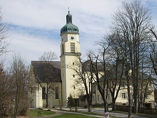
The Bavarian forest is a low mountain range in Bavaria and extends over the administrative districts Lower Bavaria and Upper Palatinate. It includes the districts of Cham, Straubing-Bogen (northern district), Regen, Deggendorf, Freyung-Grafenau and the northern district of Passau.
Regions
The Woid, as it is called by the locals, can be divided into:
- Upper Bavarian Forest - the area around Cham and Bad Kötzting to Straubing
- Middle Bavarian Forest - includes the circles Deggendorf and rain
- Lower Bavarian Forest - Freyung-Grafenau district and the northern district Passau.
- The region Front Bavarian Forest is geographically not fully defined and administratively includes the regions north-east of the Danube in the administrative district Lower Bavaria (Districts of Regen and Freyung-Grafenau).
The region east of regensburg (Administrative district Upper Palatinate), with the as "a gateway to the Bavarian Forest"designated Wörth on the Danube as well as the Lower Bavarian Straubing and Cham in the Upper Palatinate.
places


- 1 Altreichenau


 in the Wikidata database") , "The pearl in the Bavarian Forest"
, "The pearl in the Bavarian Forest" - 2 Bad Kötzting
 , Kneipp spa
 - 3 Bavarian Eisenstein, Border town too Czech Republic
- 4 Ground corn, climatic health resort at the foot of the Great Arber
- 5 Breitenberg, is located on the border triangle
- 6 Frauenau , at the Glass Street with glass museum
- 7 Furth in the forest on the border with Upper Palatinate Forest.
- 8 Geiersthal
- 9 Neuschönau, with the National Park Information Center and the world's longest tree-top walk
- 10 Spiegelau, "The gateway to the national park"
- 11 Viechtach, located on the Bavarian Ostmarkstrasse.
- 12 Waldmünchen
- 13 Wegscheid
- 14 Zwiesel, the glass city


Other goals


- 2 Great Rachel - At 1,453 m, it is the second highest mountain in the national park.

background
The Bavarian Forest is with the Bohemian forest in Czech Republic one of the largest contiguous forest areas in Europe. in the Bavarian Forest National Park an attempt is made to turn the commercial forest back into a primeval forest.
The wood and quartz deposits formed the basis for the development of the glass industry. The Glass Street runs through the whole Eastern Bavaria, there are still many glassworks and glass processing companies to visit (e.g. in Frauenau).
The locals confidently call themselves Waidler and are proud of their Woid. The unofficial hymn: "I feel like home from Woid ...".
language
The official language is German. However, the "Waidler" dialect differs from place to place and is difficult to understand for inexperienced ears.
getting there
By car
The Bavarian Forest is not accessed by any motorway. You can get to the edge of the woof with ![]() (Nuremberg - Linz),
(Nuremberg - Linz), ![]() (Munich - Deggendorf and
(Munich - Deggendorf and ![]() (court - regensburg).
(court - regensburg).
The ![]() runs through the forest of Schwandorf (A 93) above Cham, rain until after Passau full length. Of Deggendorf is it with the
runs through the forest of Schwandorf (A 93) above Cham, rain until after Passau full length. Of Deggendorf is it with the ![]() above rain to Bavarian Eisenstein on the border to Czech Republic.
above rain to Bavarian Eisenstein on the border to Czech Republic.
By train and regional bus
With ICE or IC / EC you can get to the edge of the low mountain range. Long-distance traffic stops are regensburg, Plattling or Passau. There is a connection with local transport to the Bavarian Forest.
From Regensburg there is a connection by train to the Upper Bavarian Forest via Schwandorf. From Schwandorf is Cham, Bad Kötzting to Lam Reachable with the Upper Palatinate Railway. There are also buses from Regensburg to the Upper Bavarian Forest.
The Middle Bavarian Forest is from Plattling above Deggendorf, Zwiesel to Bavarian Eisenstein opened up with the forest railway. Of Zwiesel branch lines after Ground corn and Grafenau from.
In the Lower Bavarian Forest, from Passau, only in the season from mid-April to the end of October is the voluntary run Ilz Valley Railway on weekends and public holidays from Passau to Waldkirchen and Freyung in operation. There are also bus routes in the Front Bavarian Forest.
With the long-distance bus
- Berlin - Bavarian Forest - Berlin with the BVG; Bus-Verkehr-Berlin KG, Grenzallee 13-15, 12057 Berlin, Tel: 030 68389143
- Bus arrival to Ground corn from over 140 locations across Germany; Tel: 01805 - 144514
By plane
The airports Nuremberg and Munich can be reached by car in about 1-2 hours. In Vilshofen can be landed with small private planes.
mobility
Most Regional bus connections are from the RBO hazards. Sometimes only a few connections are offered. In summer, the national park is opened up in the national park with the hedgehog buses. In winter there are very good ski buses to Bretterschachten (cross-country skiing center) and Großer Arber (alpine, World Cup location), e.g. from Ground corn.
The Forest railway drives from Zwiesel star-shaped after Ground corn, Bavarian Eisenstein (partly over the border to Czech Republic) and Plattling (here connection to the long-distance traffic of the DB) every hour. Every two hours there is an additional follow-up Grafenau along the Bavarian Forest National Park.
With the Bavarian Forest Ticket there is an inexpensive day pass for all public transport. In several municipalities, this day ticket is available with the GOOD (Guest service environmental ticket) or VLC card already included in the tourist card. Holiday guests with a tourist card can use local public transport in these communities free of charge in the districts of Cham, Freyung-Grafenau and Regen (the latter two only with GUTi).
Electromobility
Since the election by the Bavarian state government in July 2013, the Bavarian Forest has been a "model region for electromobility". The aim of the project is to show that the promotion of electromobility in rural areas is possible even under difficult natural conditions.
- Side of the model region: http://e-wald.eu/ (eCar sharing, charging stations);
Tourist Attractions

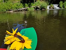
Bavarian CanadaThis is the name of the river region on the Black Rain, starting in Zwiesel, continuing via Regen and Teisnach to Viechtach. This route is particularly recommended by canoe, as it offers level 2 over whitewater, but other sections are also worth seeing for families. Sepp Schneider made this section accessible to the public with his canoe rental. Info at 49 1716366532, kanu-regen.de
- Bavarian Forest Museum Village - Herrenstrasse 11; 94104 Tittling; Tel: 08504 - 40461; Many, partly beautifully restored houses convey the "Woid" way of life, beautiful economy in an old atmosphere.
- Waldwipfelweg. near Sankt Englmar - The 370 m long path at a height of up to 30 m offers beautiful views.
- Treetop Walk. in Neuschönau, with a length of 1320 m and a height of 44 m, is considered to be the largest in the world.

Mountain tops
Strictly speaking, the following mountain peaks, which are worth seeing, belong geographically to the Bohemian Forest, touristic but to the travel region "Bavarian Forest". The German part of the Bohemian Forest is also known as the "Inner Bavarian Forest".
- Big Arber - with 1456 m the highest mountain in the mountains, gondola lift, modern ski area, cross-country skiing center Bretterschachten in the area of the mountain range on the Kleiner Arber.
- Great Falkenstein
- Great Rachel 1453 m
- Lusen
- Three armchairs - 1312 m, winter sports and hiking area
- Goat's head - 1097 m, Winter sports and hiking area
Accommodations
Based on the collected database of all municipal and city administrations in the entire district of the Bavarian Forest, the Ostbayern Tourist Association is hiring Host Directory available, in which all private landlords, holiday apartments, guest houses, huts, holiday homes or hotels in the Bavarian Forest are represented.
activities
The Bavarian Forest is particularly as Hiking area known. From easy walks to demanding tours with great differences in altitude, everything is included.
Sports in summer:
- Canoe trips through Klein Bavarian Canada: [2] from rain to Regensburg, canoe tours are based on Wasserpegen, [3]- Summer biathlon on the Arber in the Hohenzollern ski stadium [4]

- Mountain bike tours through the Bavarian Forest [5]
Winter sports
Alpine skiing
Geißkopf ski area,[6] T-bar lifts and a chair lift in Episcopal corn, Telephone 49 9920 16 88
- Großer Arber ski area with a 6-seater gondola, two chairlifts and three drag lifts. The snow-sure area is between 1050 and 1450 m high. It has a total of 7 km of slopes (3 km easy, 2 km medium and 2 km difficult). In addition, there is a 5 km long touring run to Ground corn. Snow telephone: 0 99 25 - 94 14 80; for more information see Arber.de
- Mitterdorf ski center - There are a total of 5 drag lifts and a chairlift. The slopes are quite snow-sure between 850 m and 1140 m altitude (info).
- "Hohenbogen" ski area at Neukirchen by holy blood. The ski area, which is between 650 and 1,050 m high, has 6 km of slopes (some of which have snow-making capabilities). The area is mainly accessed by a longer chairlift with a middle station. There is also a drag lift and a baby lift. For more see Hohenbogen.de.
- Ski lift on the Großer Riedelstein - There is a ski lift that opens up three slopes: easy (1.3 km), medium (1.1 km) and black (1.1 km). Also see Lift side).
- Silberberg mountain railway in Ground corn, a chair lift and a short ski slope and toboggan run. The children's ski park is ideal for beginners and families with small children. Snow telephone: 09924 778139; for more information see Silberberg.de
- Ski area in St. Englmar - There are a total of 13 T-bar lifts with a total of 2.5 km of slopes. For information, see a. Pröller ski triangle, Predigtstuhl ski lift and Kapellenberg ski lift
- Dreisessel ski lift - Close to the border triangle Bavaria - Czech Republic - Austria Altreichenau is the Dreisessel ski lift. The drag lift extends almost to the top of the mountain (approx. 1300 meters).
Nordic skiing
Biathlon in the Hohenzollern ski stadium: in the ski stadium used for international competitions (the European biathlon championships in February 2020) you can try your hand at this sport. The shooting range is explained, which you are otherwise not allowed to enter. The instruction on how to use a small-bore rifle and shooting while lying down or standing is also interesting, but this can only be tried out from the age of 14. Younger participants get laser rifles. Telephone for trial course and guided tour: 49 171 63 66 532, www.schneider-events.de
- Bayerwald trail - The 150 km long trail opens up the ridge region of the mountains from the Arber to the national park to the Dreisessel. The cross-country ski trails, which are signposted with a snowflake, can only be used in one direction, from the Arber towards Dreisessel.
- Bretterschachten cross-country skiing center at Ground corn, with over 1000 m above sea level NN very snow-sure location, 106 km of classic trails groomed trails (classic and skating). Ski bus every half hour from Bodenmais, only a few parking spaces that are relatively expensive (€ 6 for 3 hours). Snow telephone: 09924 - 77 81 39; for more information see Bretterschachten.de
- Ski hiking center Zwieslerwaldhaus - The cross-country ski center is 700 m at the foot of the Großer Falkenstein between Bavarian Eisenstein and Zwiesel. There are a total of 35 km of trails that are between 700 and 850 m above sea level: classic circuits with 3, 5, 9 and 13 km. There is also a 3 km long skating trail (Cross-country ski trail map as a PDF file). In addition to the cross-country trails, some winter hiking trails are also being rolled. For more information see Skiwanderzentrum.de
- Network of cross-country trails in the border triangle at the feet of the three-arm chair. In the area Mittelfirmansreut, Haidmühle, Altreichenau and Neureichenau you will find a generous regional cross-country ski trail network of 270 km in length (for information see winter sports map as PDF file). The skating park in Altreichenau deserves a special mention. There you can skate twice a week with floodlights and free of charge during the winter months. For more information see Altreichenau skating park
Events
Major regular events:
- Mid-July - Grenzlandfest in Zwiesel
- last weekend of July - Pichelsteiner Festival in rain
- January 5th - Rauhnacht in Altreichenau
- November 10th - Wolf skipping in Rinchnach
kitchen
- Roast pork with sauerkraut and bread dumplings
- Steamed noodles
- Meat brine
- Goose young
- Pichelsteiner, a stew made from various types of vegetables and meat.
- Sterz, Potato dish - best to try it yourself
- Bärwurz digestive schnapps, is made from Bärwurz (el) (Latin: Ligusticum Mutellina)
- Tormentil, is distilled from the root of the same name, which gives it its characteristic red color
nightlife
In many villages, the sidewalk is folded up relatively early. In some places, however, the typical village inn with a regulars' table still holds up.
The youth are sometimes far away to visit the trendy localities.
- Vulcano disco
- Geiersthal adventure park - at Ground corn
- Martinique discotheque in rain
- Papilio discotheque in Bischofsmais
- Discotheque dance floor in rain
- Eazy nightclub in Zwiesel
If you like it a little quieter:
- Village barn - Event catering in Ground corn
security
Even after the opening of the border Czech Republic (Schengen Agreement) the Bavarian Forest remains very safe. Due to the veil search, a kind of mobile border control in the hinterland, increased controls are to be expected in some cases.
climate
At the edges of the Bavarian Forest up to the peaks, the average rainfall increases and reaches 1,300–1,400 mm per year at high altitudes.
In general, however, the precipitation values measured here are lower than, for example, in comparable regions of the Bavarian Forest due to the more eastern, more continental location of the Bavarian Forest Black Forest.
The air throughout the area is exceptionally dry; Values around 35% relative humidity occur frequently. The average temperatures are due to the altitude and the prevailing east wind in the lower range. It can be particularly cool at high altitudes in late spring, autumn and summer. Night frosts are not uncommon.
The Bavarian Forest is for his Abundance of snow known. Due to the accumulated precipitation and the relatively high location of the low mountain range and ultimately also due to the continental eastern location, 120-180 days of snow cover can be expected in the ridge locations. Depending on the winter, the snow depth can be over 250 cm. The average snow depths, however, are around 40–90 cm.
The sphere of influence of the Alpine Foehn often extends as far as the course of the Danube and the Bavarian Forest. The chain of the Alps can therefore be seen from the mountains of the Bavarian Forest, especially on clear autumn days with a strong foehn.
literature
- Bavarian Forest - where wilderness awakens by Sven Zellner, Verlag Tecklenborg 2000 ISBN 3924044570
- Schee is gwen, owa hirt. Old pictures from the Bavarian Forest by Martin Ortmeier, book and art publisher Oberpfalz 2003 ISBN 393571923X
- The following GPS-enabled digital Cell phone maps available at Fritsch hiking maps directly to your own mobile phone or as a CD.
- 656 NP Upper Bavarian Forest, mobile phone card
- 658 Ferienland Bavarian Forest Nature Park, mobile phone card
- 660 Middle Bavarian Forest, mobile phone card
- 662 Southern Bavarian Forest, mobile phone card
Web links
- Bavarian Forest - Official website of the region
- Bavarian Forest Association V.
- Interactive region map
- The Glass Street
- Bavarian Forest Nature Park
- Canoe tours through Bavarian Canada
- Biathlon in the Bavarian Forest
- Bavarian Forest adventure region