The Kocher-Jagst cycle path leads along the stove from Bask above Schwäbisch Hall and Künzelsau to Bad friedrichshall, then up the Jagst over Dörzbach and Crailsheim to Ellwangen and back to Aalen.

Route profile
- Length:: Total length 330 km, can be divided into any number of stages, can be expanded with numerous connections to other cycle paths
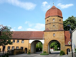
- Signposting: see picture, good signage
- Slopes: The path remains mainly in the river valley, in the Kocher valley only above Schwäbisch Hall, in the Jagst valley above Langenburg there are significant gradients.
- Path condition: Mostly asphalt, in the area of the cooker there are still gravel sections.
- Traffic load: low
- Suitable bike:: Normal trekking bike
- Family suitability: Well suited on the lower reaches of Kocher and Jagst
- Inline suitability: In the Kochertal the Künzelsau-Sindringen and Ohrnberg-Bad Friedrichshall sections are well suited; the path between Sindringen and Ohrnberg is partly graveled. The lower reaches in the Jagsttal (from Dörsbach) is also suitable for inline skiers. However, there are some climbs and descents to cope with (safe braking required), the surface is sometimes very rough and the route sometimes leads over public roads.
background
The twin rivers Kocher and Jagst cross the regions Eastern Alb, Hohenloher level and the Heilbronner Land. On the way you pass idyllic villages with half-timbered buildings, castles and palaces, vineyards and meadows and fields. Usually the differences in altitude are not particularly great, the paths are mostly paved and well signposted.
It is advisable to divide the route according to ability and interests. You should plan about a week for the entire route, but it is also worthwhile to limit yourself to just a part of the route so that you can deal more intensively with the country and its people.
Discovering the Kocher and the Jagsttal by canoe from the water from the river perspective is one of the most beautiful experiences in Hohenlohe. For a nature-friendly canoe tour, the time and space restrictions must be observed. There are certified canoe rental stations and more information
- in Braunsbach Hohenlohe active tours
- in Neuenstadt-Kocherthürn 100% canoe & bike
- in Niedernhall Heffner outdoor events
preparation
- Define the length of the tour: the total distance is usually estimated to be 5 - 6 days.
- Check accommodation options. In Dörzbach there is e.g. a Hay hotelwhich can be an interesting alternative for families. However, hay fever shouldn't be a problem.
- Clarify arrival and departure. There are excellent rail connections from Bad friedrichshall, Möckmühl, Crailsheim, Schwäbisch Hall and Bask. A number of hotels offer transport and pick-up services, and there are other places such as:
- Bad friedrichshall: Micha's taxi and limousine service, Bautzenweg 6, Tel. 07136 5757
- Möckmühl: Taxi Strässer, Marktstr. 3, Tel. 06298 92230
- Schwäbisch Hall: Andreas Gehring, Johanniterstr. 49, Tel. 0791 71692.
- Cycle with or without luggage? There are Package deals for tours where luggage is transported.
- What is the focus of the tour? If it is more about cycling with children, then the lower Jagst or Kochertal valley is recommended, for ambitious riders it can easily be a detour up to the Hohenlohe plain with its rugged valleys. Then there would be a detour to the Humpback tour maybe just right.
getting there
Public transportation
Aalen, Gaildorf, Schwäbisch Hall, Bad Friedrichshall, Möckmühl, Crailsheim, Jagstzell and Lauchheim can be reached by train.
By bicycle
There are connections with
- the Pan-European Cycle Route (Paris-Prague)
- Lovely Taubertal cycle path
- Alb-Neckar cycle path
- Idyllic street
- Neckar valley cycle path
In the street
Close to the highway A6 are Bad Friedrichshall, Schwäbisch Hall and Crailsheim, the places Aalen and Westhausen are near the A7, Neuenstadt am Kocher and Möckmühl are close to the A81.
Route description with sights

From Aalen to Künzelsau: 74 km
The road mainly runs along the Kocher, and you have to expect heavy traffic on the B19.
- 1 Bask


 in the Wikidata database") 429 m. You can easily reach the city by train. The tour can start here. Before that, you can visit the largest Roman museum in southern Germany, which brings the Limes closer as a UNESCO World Heritage Site. Or that Urweltmuseum. A detour to Oberkochen can take you to the source of the Black stove to lead. Now it goes to
429 m. You can easily reach the city by train. The tour can start here. Before that, you can visit the largest Roman museum in southern Germany, which brings the Limes closer as a UNESCO World Heritage Site. Or that Urweltmuseum. A detour to Oberkochen can take you to the source of the Black stove to lead. Now it goes to - Abtsgmünd 375 m. Here the street goes a little way on the busy one B19 along. In the Untergröningen district you can see Laubach Castle. This is where they meet Idyllic street and the Bühlertal cycle path and the Limpurg tour the Kochertal.
- In Sulzbach-Laufen, 360 m you can see the Heerbergskirche at the top. The Altenberg with an observation tower is the highest point in the district of Schwäbisch Hall. It continues in the Kochertal
- 2 Gaildorf329 m, worth seeing the old castle. On the further journey it gets a bit hilly, the road leaves the valley, and once there is a 17% gradient at Rosengarten-Westheim, where reason can dictate descending.


When you have reached the church and the chapel in R.-Westheim, you have a fantastic view of the Limpurgen Land - towards Gaildorf.
- 3 Schwäbisch Hall304 hm has a lot to offer: once the Hällisch-Fränkisches Museum, then the Kunsthalle Würth, the fire department museum and finally the open-air museum Wackershofen, which with over 60 buildings clearly documents the life of the Hohenlohe population in earlier times. The cityscape is also worth seeing. It goes on after 4 Untermünkheim and Geislingen am Kocher. Here you drive under the Kochertal bridge that closes
- 5 Braunsbach268 m belongs. With a height of up to 185 m and a length of 1128 m, the structure is imposing.
- 6 Künzelsau218 m is after all the district town of the Hohenlohe district. In addition to a number of picturesque houses, the Würth Museum is an attraction.


From Künzelsau to Bad Friedrichshall: 54 km
The path follows the Kocher in a deeply cut valley. Behind
- Künzelsau the valley becomes wider, the vineyards of the villages are on its sunny slopes 7 Ingelfingen and 8 Niedernhall.
- 9 Forchtenberg223 m has a beautiful old town with city walls. Then you drive through
- 10 Ohrnberg188 hm, from where the bike path follows the route of the former lower Kochertalbahn
- 11 Hardthausen182 hm and finally after
- 12 Neuenstadt am Kocher182 hm. Now it is not far to the point where the Kocher flows into the Neckar
- 13 Bad friedrichshall167 m, Kochendorf district. Here you can see the headframe of the Salt mine. The visitor mine can be visited from May to the beginning of October.


From Bad Friedrichshall to Dörzbach: 59 km
Up the Jagsttal, past castles and palaces, it goes on the Hohenloher level.
- From Bad Friedrichshall it is worth taking a detour to the Kaiserpfalz in Bad Wimpfen. This is also where you come across the Alb-Neckar cycle path, the Neckar valley cycle path and the Castle Road. At the end of Bad Friedrichshall, the path turns right along the Jagst, past the former Heuchlinger Schloss. After a few kilometers you can reach it
- 14 Neudenau189 m. The town is picturesquely situated above the Jagst. Soon afterwards you come to the Ganolf Chapel and the outdoor swimming pool. After two bends in the river you come after
- 15 Möckmühl179 m. It is worth not only looking at the city walls from the outside. The journey continues Rams and after
- 16 Jagsthausen240 hm, where the ancestral castle of the von Berlichingen stands. From here it is only 4 km to the Forchtenberger District Sindringen at the Kocher, back to Bad Friedrichshall would be a leisurely full-day tour with many interesting viewpoints. But it goes on after
- 17 Schöntal209 mnot to visit the former monastery would be a sin. Then you come after
- 18 Krautheim289 m with a castle well worth seeing. Now one reaches
- 19 Dörzbach242 m, the three castles community.


.jpg/320px-Kloster_Schöntal_-_Flickr_-_cspannagel_(3).jpg)
_Burg3008.JPG/162px-Krautheim_(Jagst)_Burg3008.JPG)

From Dörzbach to Crailsheim: 55 km
- Behind Dörzbach the chapel is located upstream after 3 km St. Wendel, after the village of Ailringen, the cycle path leads along the adventure trail. Shortly before
- 20 Mulfingen263 m you can see the Anna chapel from the 16th century. That is waiting a few kilometers further Riddle of Unterregenbach, the remains of a basilica, the meaning of which has not yet been finally clarified. Now you can see the silhouette of in front of you
- 21 Langenburg439 m. Even if you shy away from the 180 meters of altitude into the old town, you should still make a visit. In addition to a magnificent view of the Jagst Valley, there are numerous sights. The most important are probably the renaissance castle with the baroque garden and a collection of around 80 ready-to-drive vintage cars. On the drive to the south you come to the ruin Leofels over, then you reach
- 22 Kirchberg an der Jagst384 mThe former residential palace and the city tower are particularly worth seeing. The Jagsttal now forms some loops, at the end of which is
- 23 Crailsheim414 m. The town hall tower with a height of 57 m, the water tower and the city wall with arsenal tower are just a selection of the most interesting buildings.


From Crailsheim via Ellwangen to Aalen: 58 km
- Of Crailsheim upstream it goes through the Virngrund. Just behind
- Jagstzell 424 m lies in a side valley of the Orrotsee and the Fischbachsee. Now it's not far behind
- 24 Ellwangen440 hm. Here are those Alemanni Museum, the St. Vitus Basilica and Ellwangen Castle the main attractions. A few kilometers above the Jagst is dammed into a flood retention basin to form a bathing lake. It already belongs to
- Westhausen 474 m. There are still a number of sizable little churches in the parish, then you can get there
- 25 Lauchheim492 m. The upper city gate, the parish church and Kapfenburg Castle are the main attractions. From here the course of the Jagst turns north, towards its source you can quickly reach the Stockmühle reservoir. The cycle path, however, closes its circle: a short but strong ascent crosses the Alb near the villages of Waldhausen and Ebnat, and finally it goes downhill again
- Aalen 429 m, one of the possible starting points of the route.

Cross connections from the cooker to the Jagst
In Bad friedrichshall Both rivers flow into the Neckar at an altitude of around 145 m above sea level, but the surrounding area is around 60 m higher. Here you can already see that the rivers run deep into the Hohenloher level have dug in. This becomes even more evident upstream. Although both rivers are sometimes only a few kilometers away from each other, it can be quite difficult to switch from one to the other, especially when a few streams flowing in between have dug deep gorges into the landscape. Nevertheless, it is quite possible in some places.
Of Neuenstadt am Kocher to Neudenau
From the Neuenstadt district Stone on the stove A road leads to Herbolzheim and Neudenau on the Jagst, there is an altitude difference of approx. 80 m over a distance of approx. 5 km, another road would go from Stein via the hamlet of Kreßbach to Siglingen and Neudenau, altitude difference approx. 100 m on a path length of around 6 km. It is recommended for a leisurely day tour from Bad Friedrichshall, which can also be tackled with children. Mostly easy to manage with inline skates.
Of Forchtenberg to Jagsthausen or. Schöntal
From the Forchtenberg district of Sindringen am Kocher (185 m above sea level) a path leads to Jagsthausen (200 m above sea level), over a distance of 4 km it goes over a ridge, around 100 meters in altitude have to be covered. Another path goes from Sindringen via the Edelmannshof (345 m above sea level) and the Neuhof to the Schöntal monastery (210 m above sea level). Easily feasible as a circular route from Bad Friedrichshall via Neuenstadt to Schöntal Abbey, back via Jagsthausen and Möckmühl. Interesting day tour, with children it can also be a two-day tour, which is very interesting in terms of the route and, apart from this one incline, is very easy to master.
Of Ingelfingen to Dörzbach
A path leads along the B19 via Belsenberg, Stachenhausen to Dörzbach-Hohebach. Difference in altitude: approx. 180 m ascent, 150 m descent over a distance of around 11 km. There are quieter, slightly longer stretches, e.g. via Rodachshof and Wendischenhof, unfortunately there won't be less vertical meters.
Of Braunsbach to Kirchberg an der Jagst
The route leads from about 250 m above sea level via Orlach (430 m above sea level) and Nesselbach (440 m above sea level) to Bächlingen (290 m above sea level). ==== From Braunsbach-Geislingen to Kirchberg an der JagstThe only noteworthy right tributary of the Kocher flows into Geislingen, the Buhler. The journey first goes into the Bühlertal to Cröffelbach, then over Wolpertshausen and Ilshofen to Kirchberg. Approx. 22 km.
Of Schwäbisch Hall to Crailsheim
Schwäbisch Hall-Steinbach, via Sulzdorf to the Bühlertal Vellberg, then via Waldbuch to Crailsheim.
Of Gaildorf to Crailsheim
Over the Limpurg Mountains to Obersontheim, through the Bühlertal and on to Crailsheim, approx. 34 km
From Sulzbach-Laufen to Jagstzell
Over the Limpurger Mountains to Bühlerzell, on to Rosenberg and Jagstzell, alternatively to Ellwangen.
From Abtsgmünd to Braunsbach
After a short ascent of almost 100 m to Pommertsweiler, the journey only goes downhill through the Bühlertal via Bühlerzell, Bühlertann, Obersontheim to Vellberg and finally to Braunsbach-Geislingen. This route corresponds to that Bühlertal cycle path.
Connections to other cycle paths
- To the Lovely Taubertal cycle path
- Of Dörzbach via Rengershausen and Stuppach Bad Mergentheim, approx. 14 km
- Of Langenburg above Blue heroes, Schrozberg and Niederstetten to Weikersheim, approx. 35 km
- Of Crailsheim above Satteldorf, Wallhausen and Insingen Rothenburg ob der Tauber
- The Grünkern Cycle Path branches in Rams to the north
- The Limes cycle path crosses in Jagsthausen the Kocher-Jagst cycle path
- The Idyllic streetrunning across the Swabian Franconian Forest leads, meets in Gaildorf on the Kocher-Jagst cycle path.
- The Castle path or Kraichgau-Burgenweg crosses at Braunsbach and Langenburg. Here Kocher-Jagst-Radweg and Burgenweg form part of the Pan-European cycle path from Paris to Prague.
Other places to stay
security
Some repair shops, if necessary:
- Aalen: bike and action, Bahnhofstr. 33 b, Tel. 07361 62238
- Aalen-Wasseralfingen: All around the bicycle shop, Wilhelmstr. 30, Tel. 07361 79152
- Bad Friedrichshall: Roland Schmieg, Heilbronner Str. 18/1, Tel. 07136 21886
- Crailsheim: Zweirad Stegmaier, Lange Str. 39, Tel. 07951 7962
- Ellwangen: Bicycle Ilg, Amtsgasse 12, Tel. 07961 2390
- Forchtenberg: Peter Tröndle, Hauptstr. 5, Tel. 07947 942 437
- Gaildorf: Eggis Bike Planet, Bahnhofstr. 50, Tel. 07971 92499 50
- Oberkochen: two-wheel center Emil Elmer, Aalener Str. 64, Tel. 07364 6507
- Schöntal-Bieringen: Fahrrad Link, Gartenstr. 7, Tel. 07943 586
- Schwäbisch Hall: 2 wheel reins, Johanniterstr. 55, Terl. 0791 971 400
References to literature and maps
Cycling map - Leporello Kocher-Jagst-Radweg, 26 partial maps, scale 1: 50,000, Publicpress-Verlag, ISBN 978-3-89920-379-0