
The European long-distance hiking trail E10 is one of twelve long-distance hiking trails that are coordinated by the European hiking association and maintained by national and regional associations. The E10 runs from the northernmost point Finland through eastern Germany, then through the Czech Republic and Austria to the Italian city Bolzano. From there it has not really been realized until Spain.
In Stralsund the E10 runs for a good 1 km with the European long-distance hiking trail E9 on a common route, in Potsdam will the European long-distance hiking trail E11 crossed.
The E10 is made up of various long-distance hiking trails at national level.
In Finland it is the UKK path (the name is reminiscent of the former Finnish President Urho Kaleva Kekkonen), in Germany it is the old A-Z path (the one in GDR times Cape Arkona With Zittau association), and in Austria the Rupertiweg. The E10 continues on parts of national and regional hiking trails, such as the route along the Vltava River in the Czech Republic (between Prague and České Budějovice and in Austria on parts of the Nordwaldkammweg and the Südalpenweg.
background
The long-cherished plan to continue the E10 to the south of Spain,[1] was not implemented.[2] Mentioned Gorges[3] Already in 1999/2000 the Tratto Lombardo and the Grande Traversata delli Alpi in Italy and the GR 52A in France and the GR 51 as a possible continuation of the E10, so even his chairmanship of the European Hiking Association at that time could not lead to the respective national organizations decided this. In Spain, part of the GR92 was already finished at that time, namely from the French border to Ulldecona. But this route was partly already from that European long-distance footpath E4 used and there were still about 2000 kilometers missing.
In Finland, too, the road is not finished yet. There are still discussions about the course, the marking and the extent to which overnight stays and meals are available.[4] The main focus is therefore on the section to reprimand- Bolzano, which is fully recorded on the maps and also relatively well marked.
preparation
.jpg/100px-Tick_male_size_comparison_(aka).jpg)

Parts of the E10 are very safe, while others must be classified as dangerous. The most dangerous are lonely mountain landscapes, to be found in Finland, Lapland and in the Alps. In Lapland and the rest of Northern Finland you have to be in excellent physical condition and take food with you for several days. A. Is present in nature.
A number of alpine routes are only for experienced mountain hikers and you should only undertake something like this if you are sure you can do it.
A certain danger is hidden in ticks, which can transmit dangerous diseases. So far, it has not been possible to get vaccinated against the bacterial disease Lyme disease with sufficient certainty. If a ring-shaped reddening of the skin occurs 5-28 days after contact with a tick, a doctor should be consulted and an antibiotic will probably be prescribed. The other infection, TBE (early summer meningitis) is caused by a virus, so you should protect yourself with a vaccination before traveling (day 0 and 18 as well as after 12 months)! To protect yourself against ticks you should search yourself every evening, the ticks are mainly in the undergrowth and tall grass.
Other dangers along the route are low: wild boars, other large game and wolves are usually very shy. Rabies is very rare in Western Europe, according to WHO "low risk".
getting there
Here we go
The E10 offers some extreme landscapes: the treeless tundra to the north of Finland, the Finnish primeval forestsKuusamowho are at the Baltic Sea, the Reißeck massif in the Austrian Alps and the more difficult to reach Dolomites on the border between Austria and Italy. In the middle of the route there are friendlier areas for more comfortable hiking: the lake districts of Finland and eastern Germany, the chalk cliffs and the rapeseed fields of to reprimand, the hills in the south of Finland and the mountains in the north of Austria, and the low mountain ranges of Czech Republic. The sun-drenched southern flank of the Alps in Italy can be conquered well. In addition to unusual landscapes, the E10 also cuts through areas that had to suffer from the political consequences of both world wars of the previous century. When the Finns drove the Germans out of Lapland, there was no building left. The area on the Finnish eastern border witnessed two wars with Soviet Russia in 1940. From Rügen to the Czech border, the E10 runs through areas that belonged to the GDR and were cut off from the rest of Germany.
When reaching and leaving the Czech Republic, one crosses mountainous regions (often mining areas) that came to the Czech Republic after the First World War, but had a predominantly German-speaking population. This German-speaking population (originally from Austria) was expelled from their homeland after the next World War and called themselves expellees or Sudeten Germans. Today Czech is spoken in the Czech Republic. In some museums along the E10, the fate of the Czech-speaking population during the occupation of Hitler's Germany is illustrated.
On both sides of the Czech-Austrian border there is a museum and small memorial stones to commemorate the German-speaking population who then had to leave the Czech Republic.
The province South-Tirol has a more or less comparable history. Until the end of the First World War, this region was a German-speaking area of Austria and was then annexed to Italy. There, the German language has largely been preserved only in Bolzano the majority of the population now speaks Italian.
Finland
The official start of the E10 is in
- 1 Nuorgam, the northernmost point of Finland. From there there is already a hiking trail to the southeast.
- 2 Sevettijärvi, not far from the three-country point with Russia. The route is marked insofar as it largely runs along the Finnish-Norwegian border and the boundary stones form the markings. The route is described as impressionistic on a website, although it remains unclear why the author needs 6 days for a distance of 80 km and also used a lift for the last 20 km.[5] In 1997 everything there was marked with red paint on trees and stones,[6] but this book apparently no longer exists since 2006.
More to the south, individual sections of the E10 are already well marked and there are also places to stay overnight. This includes the well-known Karhunkierros Bear round, which can be hiked in one or five days.
In the future, the E10 will be Finland at the port city Hanko / Hangö leave. This is located in the outermost southwestern corner of the country.
Actually, you should first exclude the Finnish part of the route and wait until it is fully developed. The start is then included Cape Arkona, the northernmost point of Ruegen.
Germany
The E10 runs through Germany twice. The little bit in the Berchtesgadener Land is described below for Austria. The greatest distance is from to reprimand to the border between the Czech Republic and Germany. In Mecklenburg-Western Pomerania and Brandenburg the E10 is identical to the old GDR main hiking trail (A-Z trail), but the route has been rigorously changed in Saxony.
- Rügen (marking is white-green-white or the E10 sign)
- Mecklenburg-Western Pomerania
- European long-distance hiking trails E10 in Brandenburg and Berlin, of Roads to Bad Muskau[7][8]. (Attention: Between Spremberg and Bad Muskau there is an overlap of (31.5 km) with the following part) (Depending on the variant, 298-320 km)
- European long-distance hiking trail E10 in Saxony, of Spremberg to Seifhennersdorf and to the Czech Varnsdorf (160 km).
In Germany the E10 begins on the island to reprimand. Although the long-distance hiking trail coming from Finland in Sassnitz should arrive, there is nothing to see of the marking (3 horizontal lines white-color-white or the St. Andrew's cross). The connection from Finland seems to have been completely abandoned (at least for the time being).
The long-distance hiking trail E 10 begins in German territory at the northernmost point of Rügen, at Cape Arkona at the lighthouses. From there he follows near the coast Wittwhich he does not touch, then continue after Juliusruh and from there along the bay near Glowe, through which, however, it no longer leads directly. Behind the Spycker lake there is no longer any variant in an easterly direction over the Königstuhl and Sassnitz designated, but the E 10 leads in a southerly direction via Polchow Lietzow. From there it leads in an approximately westerly direction Ralswiek and from there then past the eastern edge of Jarnitz to Mountains on Rügen. The long-distance hiking trail now continues in a southerly direction via Neklade Putbus. Then it continues in a south-westerly direction Great Schoritz. Now it goes on Puddemin, Mellnitz, Glutzow settlement and then in an approximately north-westerly direction to Gustow. From there, the long-distance hiking trail leads roughly westwards to the train station Altefähr, where he then leaves the island of Rügen in a southerly direction on the Strelasund Bridge and Stralsund reached.
Here the E 10 has a common course with the for about 1.5 km European long-distance hiking trail E9, but from here on it is no longer marked at all. However, he is at least still up Franzburg marked on hiking maps. Between Franzburg and Prebberede however, there is a gap in the Compass hiking maps.
Starting from the Rügen train station in Stralsund, the E 10 runs roughly south-south-west to Voigdehagen, then through to the south Wendorf above Zarrendorf to Elmenhorst. There the long-distance hiking trail then takes a westerly direction and continues via Krummenhagen Steinhagen. Now it leads first in a northerly direction, then in a westerly direction Jakobsdorf, takes a south-westerly direction there and finally reaches Franzburg.
The E 10 leaves Franzburg in an approximately south-westerly direction, then takes a southerly direction, crosses Neumühl and reaches Pöglitz. Here he takes up the westerly direction, finally reaches Drechow. About 3 km further on, the E 10 then takes a southerly direction again, traversed Rönkendorf and then continue on the road for about 1 km in the same direction. Now he is heading west again and reaches Landsdorf. From there the hiking trail leads in an approximately southward direction to Tribsees.
From Triebsees, the long-distance hiking trail leads west through a moorland to Bad aspic Expansion. If it was not dry for a long time at the time of the hike, hikers are really advised to bypass this moorland on the road to the south. In a north-westerly direction, the E 10 then leads past Bad Sülze Aufbau, then swings almost 1 km further in a southerly direction and about 1 km further, then again in a westerly, then north-westerly direction and finally leads back into a moor area. Here, too, a note is appropriate, if the drought is not really long, it is better to pass the moorland east on the road. After crossing this moor area, the E 10 leads south through a forest, passing an eastern barracks and finally reaching Böhlendorf. From there, the hiking trail heads approximately west to Neuhof, in the same direction it reaches Liepen, where it then takes a southerly direction again and Thelkow reached. In the same direction it goes to Kowalz and after another 4 km you reach Woltow. Here the E 10 takes a westerly direction and reaches about 3 km further Selpin. From here it goes in a southerly direction to Wesselstorf, then to Polchow, from where it continues for about 1.5 km in a south-westerly direction. At the few houses on Polchower Heide, the hiking trail first takes the southeastern, then the southern direction, passes Grieve and finally reaches Prebberede. From here on, the hiking trail is also recorded in compass hiking maps.
In an approximately south-westerly direction, the E 10 now runs to Neu Heinde and then, after crossing the town, to leave it in a westerly direction. After about 5 km, after passing Lissow Bau, Lissow and Diekhof The Diekhof Hof hiking trail reaches the village. Where he then leaves the street. Near the Rossewitz Castle he then takes the south-westerly direction again and reaches Recknitz. From there it leads on the road to Spoitgendorf. After crossing the autobahn, the E 10 now leads through wooded areas, with the one to the east Glasewitz happened at some distance. Finally, the hiking trail follows a busy road in a westerly direction Guestrow.
The E 10 leaves the place via the Plauer Vorstadt in a southerly direction, then first to take the eastern, then again the southern direction and then lead through joke. After that, the places Mühl Rosin and Kirch Rosin happened, later in the same direction Bellin touched. Now it goes in a south-westerly direction to Groß Breesen where the hiking trail swings to the south-east and starts Reimershagen over after Old Sammit leads. Then the E 10 continues through the Mecklenburg Lake District in a southerly direction to Neu Sammit. From there it zigzags through a wooded area near to Karow, from where it then runs in a south-easterly direction Old Schwerin reached. It then follows in the same direction Malchow. Now it goes almost in an easterly direction via Laschendorf Goehren-Lebbin. From here in a south-easterly direction via Poppentin, Sietow village to Gotthun. This place is left in an easterly direction. Shortly before the Müritz (lake), the long-distance hiking trail turns south and leads to it Röbel / Müritz. From here it goes over again in an easterly direction Ludorf until shortly before the Müritz, where the E 10 then swings south to after Vipperow respectively. Here the hiking trail takes roughly the southeastern direction and leads through Larz finally after Mirow, from where it then continues in a southerly direction, passing Peetsch west to the Fleether Mühle. From here the long-distance hiking trail leads in an approximately south-easterly direction Canowhe leaves in a northeasterly direction and Wustrow reaches, where it continues after in an easterly, then in a southerly direction Roads leads.
Here the path divides into 2 variants, with the eastern variant over Fürstenberg / Havel leads and the western over Rheinsberg.
Eastern variant: In an easterly direction, the variant leads to the Strasen cemetery, where it takes a southerly direction, passes the Großer Glitzensee and reaches the Großer Stechlinsee. From there it goes over Neuglobsow, then past the Peetschsee to Steinförde. From there then in an easterly direction Fürstenberg / Havel. Now it goes on in a south-easterly direction, then finally on the southern edge of the Stolpsee Bred area. This place is left first in a southerly direction, then it goes briefly southeast, then again in a southerly direction to Boltenhof. Now, with several changes of direction, but in a general south-westerly direction, a wall area is crossed and finally Dannenwalde reached. From there, the hiking trail heads east to the northern edge of the Great Wentowsee, and then heads south-east to reach Ringsleben and traverse it. This variant of the E 10 then leads eastwards Tornowto then cross the ramparts south and in the same direction Zehdenick to reach. From there, the eastern variant of the E 10 leads south after expansion Falkenthal, thence in a south-southwest direction near Grueneberg, where they then head south past Freienhagen Friedrichstal leads. Now it goes on in a southerly direction, taking the memorial Sachsenhausen happens to then almost on the eastern edge Oranienburg to run along. Further south you reach the eastern variant Hohen Neuendorf and then continues in a south-westerly direction Hohenschöpping. From here the trail continues south to Hennigsdorfwhere it takes a westerly direction, it also leads through the place and out of it Schönwalde village. From there it goes westwards to Old Brieselang. This is where the two variants of the E 10 come together again. This is where the two variants of the E10 come together again.
Western variant: To the south, this variant leads past the Großer Pälitzsee at some distance, finally separates from the Großer Pälitzsee in Pelzkuhl and reaches Beerenbusch in an almost south-westerly direction. Here this variant takes about a westerly direction and leads north past the Großer Kesselsee Zechlinerhütte. The place is crossed, then the hiking trail leads in a southerly direction first along Schlabornsee and completely leaves the place and the lake at the residential area Reiherholz. Now it continues in a southerly direction through a wooded area until after the Linower main ditch the hiking trail turns in an easterly direction and after Goods after leads. Now it goes, in an approximately easterly direction, on to the Grienericksee, on the western bank of which the hiking trail then follows Rheinsberg leads. This variant of the E 10 leaves the village in an almost southerly direction, and then leads in an approximately south-westerly direction to reach Braunsberg (district of Rheinsberg) from. Now we continue in a westerly direction to Binenwalde am Kalksee. Here the hiking trail takes a southerly direction and leads through Boltenmühle, then on along 3 lakes Molchow. It continues in the same direction via Neumühle Old Ruppin, from where the hiking trail first on the west bank of the Ruppiner See Neuruppin leads, where it crosses the lake on the lake embankment, then on its eastern bank first the southern, then the southeastern direction and Wuthenow to reach. Now this variant of the E 10 continues on or near the Ruppiere See in a southerly direction, whereby Gnewikow, Seehof and Karwe must be crossed before the trail Old frieze sack reached. Here he swings west and reaches Wustrau old frieze sack. From here it continues in a southerly direction and passes Zietenhorst. It continues in an approximately south-westerly direction until before Hakenberg, where it then swings to the southeast and Linum reached. Now the hiking trail leads in an almost southerly direction past Kuhhorst (district of Fehrbellin) to before Sandhorst, from where the hiking trail first heads south-east and then eastwards Tietzow leads. The E 10 leaves the place in a southerly direction and reaches Grünefeld, which is left further in a southerly direction to finally Mating to reach. The place is traversed in an approximately south-easterly direction, almost at the end of which the south direction is taken. When reaching Old Brieselang then the two variants of the E 10 come together again.
The now reunited Long-distance hiking trail E 10 leads from Alt Brieselang in a southerly direction Brieselang, which he leaves in a southerly direction, happens on the west side of the Havel Wustermark and first change to the east side of the Havel in Buchow-Karpzow, and then continue along it in a southerly direction up to the height of Paretz. Here the hiking trail swings to the west and leads to Paretz into it. In a westerly direction it goes on to the ferry Ketzin / Havel, with which the Havel is then crossed. Now the E 10 continues in a southerly direction and reaches it Phoebaswhich is left in a further south direction. After a few pans the trail reaches Kemnitz, where he reaches the Great Pesslower See, on the east side of which he then Werder (Havel) reached. The place is crossed in an easterly direction, behind the Havel bridge the hiking trail leads in a south-east arch through the Wildlife Park West, to then already at Potsdamto reach the Havel again. The hiking trail now leads on the northern bank, first in a north-easterly direction, then in an easterly direction to Potsdam train station, where it comes to a boulder at the corner of Bundesstrasse 2 and Albert-Einstein-Str. the European long-distance footpath E 11 crosses.
From here, the E10 leads south out of the village, well signposted, further over the Kleiner Ravensberg to the Großer Ravensberg, passes the Teufelssee and then leads in an easterly direction past the former Bergholz stop, and then, a little behind a riding stables, in about to pan south before getting close Wilhelmshorst swings to the east. After crossing under the A115, head south and then east to the airfield Saarmund. Here it goes on in a general southerly direction, the Autobahn (Südlicher Berliner Ring) is crossed, it goes further south. Southeast of the remote one Pieces the trail swings in an easterly direction and finally reaches Blankensee (Trebbin). First south, then east again, the E 10 follows Trebbin. (Potsam Hbf -> Trebbin: 41km) The place is left in a southerly direction, Klein Schulzendorf is crossed, then the trail swings in an easterly direction, and reached Ludersdorf. This place is left in a southerly direction, in the forest area the E 10 then swings to the east, passed Kummersdorf-Alexanderdorf on the northern edge, to then continue to the northeast and reached Mellensee. Here the hiking trail continues in the same direction Zossen, leaves the place in an easterly direction, touches Beautiful oak and continues eastwards Kallinchen. Here the hiking trail leads south near the western shore of Lake Motzen. At the southern end of the lake it goes eastwards for a short time and then southwards again at the edge of a wetland. After a good 2 km in this direction, the E 10 turns east and reaches Rankenheim happening, Great Koris, which it crosses and continues in the same direction to Klein Köris. The place is left in a south-easterly direction, when you reach the Dahme river, the hiking trail swings south and follows near the Dahme Märkisch Buchholz. After crossing the village, the trail leads further south, following Koethen. The place is left in a southerly direction, then it goes on the east bank of several lakes in a southwesterly direction to Wehlaberg. From here the hiking trail continues in an easterly direction Great moated castle, where then the southern direction is taken. After about 4 km the hiking trail swings to the east and finally reaches Sloppy. The place is left in a southerly direction, first it goes on the east bank of the island pond, then on the west bank along several ponds, then again on the east bank of the Spree further south Luebben (Spreewald) respectively. The place is left in an easterly direction, then the hiking trail leads with many changes of direction, but ultimately in a generally southern direction Luebbenau. The E 10 turns east, then crosses Leipe and finally reaches Castle (Spreewald). From here the hiking trail continues in a south-easterly direction to [[w: Werben] | Werben]]. From here we continue in a southerly direction, we pass Brahmow to the west, then we go to the south-east Papitz further, which is left in an easterly direction. In Rabenau, the E 10 swings back in a southerly direction and then continues in a south-easterly direction Kolkwitz respectively. The place is left in an easterly direction and then after a few changes of direction Stroebitz reached from where it is in the same direction all the way to cottbus goes in.
This place is left in a southerly direction, it goes along near the Spree, then one after the other the districts Madlow and Gallinchen belonging to Cottbus are passed and then Neuhausen (Spree) also happens. South it goes on to Bräsinchen, where the place is then crossed and the Spremberg dam is achieved. The E 10 continues south on its east bank Sellessen and then continues east of the Spree Spremberg. It now continues in an easterly direction Turkish village and Bloischdorf to Reuthen, which leaves the E 10 in a southerly direction, reaches Lieskau, which is crossed further southwards loop leads. Here the hiking trail takes an easterly direction and leads to Halbendorf, which it leaves in a general easterly direction, and then in an approximately south-easterly direction to Kromlau respectively. We continue to the east Gablenz, the settlement of Gora is passed and finally the hiking trail reaches Bad Muskauwhich is left in a southerly direction. The E 10 runs near the Lusatian Neisse, then continues in a south-easterly direction, being the first Sagar happened then Skerbersdorf and finally Bad luck reached. The hiking trail then leads through between the military training area and the Neisse Werdeck and then through Podroschewhere he then turns south Little Priebus to cross and then continue between the military training area and the Neisse to Steinbach. Now the E 10 leads in a westerly direction south of the military training area past a pond area, where it then swings to the south and crosses Waldorf, then in a westerly direction Daubitz to reach. From the western edge of the village, the hiking trail leads south and crosses it Teicha, happens Stannewisch and achieved Trebus, which is crossed up to the pond area. Now the E 10 follows in a southerly direction Niesky.
The place is left in a general southerly direction, then the trail leads in a south-easterly direction Wilhelminenthal and reached after a swivel to the southwest Why. From there, the E 10 follows in a north-westerly direction Ullersdorf, which he then leaves in a southerly direction through a pond area and finally Thiemendorf reached. Now it goes first in a south-easterly direction, then in a southerly direction to the north-western end of Königshain, where it then continues for about 1 km on the road in a westerly direction, for example the hiking trail leaves the road to the south and through Praise effort to Mengelsdorf leads. The place is crossed in a south-westerly direction, then the hiking trail swings back to the south and reaches it Reichenbach. This place is crossed further in a southerly direction, it goes to in the same direction Sohland am Rotstein. The E 10 then follows over the Rotstein Wendisch-Cunnersdorfthat is traversed. In front of the railway line, the hiking trail then takes a southerly direction and crosses it Wendisch-Paulsdorf, behind which he then follows in a south-westerly direction Löbau leads. The hiking trail leaves the village in a southerly direction and leads via Klein Schweidnitz, then through Niedercunnersdorf to Obercunnersdorf. We continue in a southerly direction over the mountain Kottmar and then to the northwest corner of Forest village, from where it is then in an approximately southerly direction Neugersdorf goes on. The place is left at the southeast end of the place, the E 10 continues in a southerly direction, crossed Seifhennersdorf. The German-Czech border is then reached about 2 km in a southerly direction, calculated from the town center.
The long-distance hiking trail E10 reaches between Salzburg and Berchtesgaden again German territory. Here, however, it still has its Austrian marking as a marker Red White Red. From Salzburg high throne Coming the hiking trail crosses the German-Austrian border and leads to the Berchtesgaden high throne, then down after Maria gladly and over Anzenbach to Berchtesgaden. From there it goes further south to Schoenau upon Kings sea, then continue in the same direction to the northern tip of the Königssee. From here the E10 then uses a ship to St. Bartholomä. Now it goes on again on solid ground, over serpentines up to the Funtensee, behind which the German-Austrian border is crossed again.
Czech Republic
- The E10 runs from the German-Czech border Česká Lípa to Prague.
- After that he follows the Vltava river for a long time through magnificent landscapes that are described in Smetana's composition. Actually, it is advisable to hike this section from south to north.

To České Budějovice the E10 is shown on the Kompass map 2024 (2082). The path climbs to the top of the Klet (1083 m) and then drops steeply to the picturesque Český Krumlov. This medieval town distinguishes itself as a cultural center with a festival around the longest day of the year and is especially a magnet for young backpackers. There are many inexpensive accommodations and alternative restaurants that make it possible to get to know the ancient houses from the inside.
From Český Krumlov, the E10 can also be found on Freytag & Berndt's map 262. It runs blue marked to Světlik and then with a green mark to the reservoir on the upper reaches of the Vltava. The blue marking now accompanies the E10 hiker Frymburk and Lipno nad Vltavou to Vyšší Brod. A well-used path leads to Studánky, and shortly afterwards the Austrian border (the route between Vyšší Brod and the border is not shown on the map and after Studánky is not marked either).
At the train station from Lipno to Vltavou a blue marked variant starts, which runs over Medvědi hora to the Austrian border and follows this about 3 km to the west to Guglwald (see below). Actually the path runs on a path completely overgrown with nettles, but if you follow the paved path next to it, you will pass some monuments that are reminiscent of villages that existed there before 1945. After 1945 there was a restricted military area along the border. This little path originates from the time when soldiers patrolled there. You reach the Austrian border at Guglwald.
Austria (661 to 711 km)
In Austria, the E10 is initially not marked immediately; from the border crossing at Weigetschlag, it follows the local route 11 to the village of Rading, then the local route 12 bis Bad Leonfelden. From here the E10 is identical to a part of the Nordwaldkammweg,[9] , which on the whole in the E6 has been recorded.[10] De E10[11] now runs in a north-westerly direction to Guglwald, where it joins the above-mentioned variant from Lipno to Vltavou at a castle converted into a hotel-restaurant. Here you can find a permanent exhibition of the German speakers who were expelled from the Czech Republic in 1945. The E10 follows the Nordwaldkammweg and the E6 Haslach and Sankt Oswald near Haslach to the mountain of the Bärenstein above the twin city Aigen-Mallets. Der Abstand zur Grenze bei Weigetschlag bis Guglwald beträgt 20 km; von Guglwald bis zum Panyhaus auf dem Bärenstein 29 km.
Rupertiweg

In 1 Schlägl beginnt der österreichische Wanderweg 10, der Rupertiweg,[12] mit einer Schleife zum 1 Bärenstein und zurück nach Schlägl. Dieser nationale Weg macht einen bedeutenden Teil des E10 aus. Er endet in Naßfeld an der italienischen Grenze. Wer dem E10 folgt, auf der Route Bärenstein kann den gemächlicheren weil teilweise asphaltierten östlichichen Abstieg über Panyhaus wählen oder den schöneren westlichen Abstieg an den Liebesfelsen vorbei ; beide Wege treffen sich bei Aigen im Mühlkreis. Der Rupertiweg kann also 529 bis 548 km lang sein.

Der E10/Rupertiweg kreuzt etwas südlicher den E8;zwischen Ameisberg und Oberkappel laufen sie zusammen. Nach der Überquerung der Danube hat der Wanderer die Wahl zwischen zwei Varianten: eine einfachere aber auch langweiligere Route, die hauptsächlich den Ufern des Inn and the Salzach folgt und eine abewechslungsreiche hügelige Route über den Hausruck. In Ostermiething kommen diese beiden Wege wieder zusammen bis Salzburg. Hier angekommen, kann der Wanderer wieder wählen: Es gibt einen schönen aber auch mühsamer zu gehenden Weg über Gaisberg, man kann natürlich auch durch die Stadt laufen. In der Stadt und auf dem Gaisberg werden Varianten des Europäischer Fernwanderweg E4 gekreuzt und hier und dort verlaufen der E10 und der E4 gemeinsam.
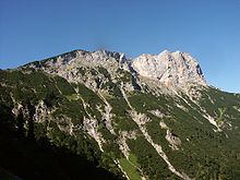
Unmittelbar nach dem Stadtteilabschnitt erheben sich die Alpen hoch über dem Wanderer. Hier beginnt der E10 mit einem alpinen Anstieg von mehr als 1000 Meter Höhenunterschied. Ab hier bis Bozen ist der Weg ein Hochgebirgsweg und ist an manchen Stellen zu gefährlich für unerfahreren Bergwanderer. Dies gilt bei Regen wegen der glatten Grashügel und Felsen etwa für den Salzburger und Berchtesgadener Hochthron. Bei gutem Wetter ist die Ausicht über die Alpen natürlich ausgesprochen überragend.
Dadurch, dass die Berge auf dem E10 immer wieder auf 1000 Meter ansteigen ist dieser Abschnitt auch sehr anstrengend.
Der erste Abstieg geht ins deutsche Berchtesgaden. Eine Bootstour auf dem Koenigssee bringt den Wanderer an den Fuß des Steinernen Meers, in welchem sich kein Wasser findet, sondern das eine Steinwüste ist und welches erst nach 1000 Meter Aufstieg erreicht wird. Weitere markante Punkte sind das touristische Maria Alm, Taxenbach und der mondäne Kurort Badgastein, die jeweils durch hohe Bergrücken von einander getrennt sind.
In Mallnitz wird der Teilstaat Karinthië reached. Den meisten Wanderen muß man von eine Überquerung der Reißeckgruppe abraten, denn hier wird richtiges Bergsteigen verlangt. Es gibt ein Glück eine Alternative die ebenso schön ist nämlich der Weg über Obervellach; ab Kolbnitz ist der Berg Reißeck einfacher zu besteigen.
Südalpenweg

From the 2 Nassfeld folgt der E10 in westlicher Richtung den Bergketten der Karinthische Alpen, die hier die Staatsgrenze zwischen Österreich und Itlien bilden. Genauer gesagt, ist der E10 hier identisch mit der Österreichischen Wanderroute 3, dem Südalpenweg (Markierung 403 und 403A), welcher meistens identisch ist mit dem Karnischen Höhenweg und ein Teil der Via Alpina. Dieser Teil des E10 hat einen ausgesprochen alpinen Charakter. Auch von diesem "Weitwanderweg" gibt es einen unentbehrlichen Führer.[13] Er wird ständig auf neuestem Stand gehalten und bietet neben einer detaillierte Beschreibung auch Hinweise zu Gefahrenstellen und zu Einkehr- und Nächtigungsmöglichkeiten. Für Einkäufe wird man etwa 1000 Meter oder mehr absteigen müssen in ein Tal nach Österreich oder Italien, aber Essen und Trinken findet man genügend in den Hütten.
Erfahrene Bergwanderer können ohne Probleme in 3 oder 4 Tagen über die Hauptroute zum österreichischen Hochweißsteinhaus unter dem Gipfel des 3 Monte Peralba kommen (eine der hochalpinen Varianten). Ab hier geben viele Wanderer den kürzeren aber gefährlicheren Strecken auf österreichischem Gebiet den Vorrang. Die Hauptroute auf italienischem Gebiet macht es aber möglich, auch bei schlechterem Wetter und mit weniger Bergerfahrung die Porzehut to reach. Für Wanderer, die die Passagen über das Roßkopftörl und die Gipfel von Eisenreich (2665 m), Schöntalhöhe (2635 m), Demut (2592 m), Hollbrucker Spitze (2580 m), Hornischegg (2550 m) und Hochgruben (2538 m) zu gefährlich und anstrengend empfinden, bietet sich ein Abstieg über den Weg 465 als Alternative an; Man kommt im Dorf Kartitsch an und wird am folgenden Tag durch das Tal nach Sillian hike.
Bei Sillian nimmt der E10 Abschied vom Weg 03 und verlässt Österreich. Die gemeinsame Strecke mit dem Weg 03 ist, abhängig von den Varianten die man wählt, 109 oder 114 km lang. Der Abschnitt Hermagor (Verkehsknotenpunkt unterhalb von Naßfeld) bis Sillian kann in ungefähr einer Woche bewältigt werden. Man muß mit Tageswanderungen von 7 Stunden und auch mehr rechnen, wobei Ruhepausenzeiten noch dazu kommen.
- Karten: 223 und 182 von Freytag-Berndt oder 60 und 47 van Kompass.
Italien (132 km)
In Italien folgt der E10 nicht einem einer bestehenden regionalen oder nationalen Wanderroute, sonder wechselt alle paar Kilometer auf eine andere lokale Wanderroute. Deshalb ist auch die Markierung E10 sehr lückenhaft. Die lokalen Wegweiser sind zwar sehr gut, etwa so wie in Österreich. Man hat die Möglichkeit den E10 mit den unten angeführten Orten und Wegen zu finden. Diese Liste basiert auf der nicht mehr lieferbaren Übersicht von van Gorges[3] und Detailkarten von Kompass.[14] Man kann auch die Karten S3 (bis Bruneck), S16 (Bruneck - Brixen) en S1 (Brixen - Bolzano) von Freytag & Berndt benutzen. Obwohl man in Italien noch stets in den Alpen läuft, sind die Wege einfacher und weniger gefährlich als in Österreich. Im August muß man damit rechnen, daß man Mühe hat, eine Unterkunft zu finden, denn dann ist die Region der Dolomiten sehr gut besucht.

Ab der Österreichischen Grenze folgt der E10 einem Weg nördlich von der Drau (Drava) nach 4 Winnebach (Prato alla Drava). Dann geht es über den Weg 14 zur Kapelle San Silvestro, dann direkt über den 1A zur Silvesteralm. Dann folgt man nach links dem Toblacher Höhenweg (Weg 1) durch das Tal des Silvesterbaches nach der Teilung an der Bushaltestelle unter dem Dorf Kandellen. Man folgt dem verhärteten Weg nach unten und kommt entlang der Gentiaanhütte zum Dorf Wahlen (Valle San Silvestro; hier steht die Silvesterhütte) oberhalb von Toblach (Dobbiaco).
In Wahlen geht man rechts über den Weg 41 zum Kirchberg, Schloß Welsberg und dem Dorf Welsberg (Monguelfo-Tesido). Hier überquert der E10 den Gsieser Bach (Rio di Casies) und folgt dem befestigten Weg 2 km bis Taisten (Weg 38). Hier scharf links über den befestigten Weg 21 der nach 5 km nicht mehr befestigt bis Niederrasen verläuft.
An der anderen Seite des Tales des Antholzer Baches (Rio Anterselva) wählt der E10 Weg 4 und später Weg 17 oder 17A zu den Erdpyramiden (Piramidi di Terra). Hier gibt es ein Schild, daß man über den E10 läuft.
Ab dieser Erdpyramiden verläuft der Pyramidenweg zum Pyramidencafé, welches durch den Weg 1 mit Bruneck (Brunico) verbunden ist; unklar ist ob dies die Route über das nicht bestehende "Oberwielenbach" ist, welche Gorges angibt. Auf jeden Fall geht der E10 ab dem Stadtteil Stegen weiter auf dem Weg 7 nach Pfalzen (Falzes) und Issing (Issengo). Hier geht man links auf dem Weg 5 zum Issinger Weiher (Lago d'Issengo). Jetzt rechts nach Mühlen und über den Weg 3 über Hofern (Corti), Moar am Gruben, Ast und Terenten (Terento). In Terenten ist Weg 9/9A der direkteste Weg nach Niedervintl (Vandoies di Sotto).
Ab Vintl ist der E10 auf den Karten von Kompass angegeben. Er überquert den Fluß Rienz und folgt dann Weg 3 (ein anderer Weg 3 als bei Terenten) nach Rodeneck (Rodengo). Dann über einen Kilometer auf dem Weg 2 nach Vill und ein gutes Stück über den Weg 1 nach [Brixen]] (italienisch: Bressanone, Ladinisch: Prsenù). Diese an der Bahnstrecke nach Innsbruck und München gelegene Stadt liegt am Zusammenfluß von Eisack (Isarco) und Rienz(A). Sie ist die erste große Stadt im Bereich der Route. Nach Brixen klettert der E10 nochmal in Form des Weges 8, bis über 2000 Meter, um nach weiten Ausblicken ab der Radlseehütte und dem Jocherer Berg (Monte del Passo) über Weg 1, ab Pemmern über Weg 6, herunter zu gehen bis in das tief gelegene Bolzano. Die Stadt trägt 3 Namen, denn es werden hier 3 Sprachen gesprochen. Drei Viertel der Bevölkerung benutzt den Namen Bolzano. Außer Bozen gibt es noch den von der ladinischen Minderheit benutzen Namen Bulsan.Von hier aus ist der E10 noch nicht realisiert. Zum Weiterwandern zur französisch-italienischen Grenze bietet sich eventuell der Tratto Lombardo und der Grande Traversata delli Alpi at
France
In France ist der Verlauf des E10 noch nicht einmal festgelegt, geschweige denn markiert. Von der französisch-italienischen Grenze bis zur französisch-spanischen Grenze kann man sich nur teilweise an den Verlauf des E 7 an der French Riviera halten, um dann möglicherweise dem Verlauf des E 4 zu zum Grenzort Portbou consequences.
Spain
In Spain ist der E10 auch noch lückenhaft, führt jedoch auf GR 92 entlang. Of Portbou geht es an der Costa Brava to Cadaqués. Im weiteren Verlauf werden Roses, Palamós, Lloret de Mar berührt, dann wird Blanes reached. Hier verlässt der Wanderweg die Küste und führt im Hinterland über Tordera weiter, umgeht dann Barcelona und erreicht erst wieder in Sitges die Küste. Nun führt er in einem großen Bogen durch das Hinterland wieder an die Küste bei Tarragona. Es geht weiter über Gambrils, l'Hospitalet de l'Infant, l'Amettla del Mar um dann bei l'Ampolla die Küste erneut zu verlassen. In Amposta wird dann der Ebro überquert, kurz darauf endet dann der E10/GR92 in Ullecona an der Grenze zur Provinz Valencia.
Erst in der Region Murcia ist der E10 wieder realisiert und führt wieder auf dem GR92 entlang. Vom küstennahen San Pedro del Pinatar aus geht man in Küstennähe am Mar Menor vorbei, Cabo de Palos wird etwa abseits passiert. Dann führt der E10 in Cartagena am Hafen entlang und dann weiter durch die Sierra de la Muela nach Puerto de Mazarrón and after Águilas, wo an der Küste die Grenze der autonome Gemeinschaft Andalusien erreicht ist.
Über San Juan de los Terros führt der E10/GR92 an der Küste entlang über Garrucha, Carboneras, in den Naturpark Cabo de Gata. In der Sierra del Cabo de Gata führt der E10 weiter durch Las Negras, Los Escullos, San Jose, dann weiter über den San Miguell zum Leuchtturm von Cabo de Gata. Nun scheint eine Markierungslücke bis hinter Almeria vorhanden zu sein. Von Aguadulce aus geht es dann an der Küste nach Roquetas de Mar, und von dort dann nach Adra am Fuß Sierra Nevada, wo der markierte Bereich des E10 endet.
literature
- ↑Freytag & Berndt im Auftrag des Europäischen Wandervereins: European Footpaths (2001), Karte und Routenbeschreibung. ISBN 3-7079-0100-9
- ↑Prames in opdracht van de Europese Wandelvereniging: Map of European Long-Distance Footpaths (2011). ISBN 9-788483-21962-1
- ↑ 3,03,1Hans Jürgen Gorges: Auf Tour in Europa. Das Handbuch für die Europäischen Fernwanderwege. Ausg. Kompass, 1999/2000. ISBN 3-8134-0338-6
- ↑


 www.SaunaLahti.Fi/EeroMari/
 - ↑ http://www.saunalahti.fi/eeromari/outdoor/alkusivu_d.html "Auf Schusters Rappen", "E10 - von Nuorgam ... nach Hanko" en "Volker Hartwigs Trekkingseiten"
- ↑Jaap Pegels: Finnland. 35 Tagesrouten und 4 Weitwanderwege. Elmar Wandelgids, 1997. ISBN 90-389-0479-7
- ↑Wanderungen durch Brandenburg, Unterwegs auf den Europäischen Fernwanderwegen, Trescher Verlag. Beschreibung des E10 und E11 in Brandenburg (2003). ISBN 3-89794-033-7
- ↑Kompass Wander- und Radtourenkarte (1:50.000) nr. 745 Havelland. ISBN 3-85491-505-5 mit eingezeichnetem E10 zwischen Paaren im Glien, über Potsdam nach Stücken.
- ↑Margot Haag: Nordwaldkammweg, Wanderbegleiter. Ausgabe Ennsthaler. ISBN 3-85068-603-5
- ↑{de} siehe w:Nordwaldkammweg .
- ↑auf Karte 262 von Freytag-Berndt und Kompass-Karte 2024=2082 und in dem Feld werden nur der E6 und der Nordwaldkammweg angeben, der letzte mit einem Logo in Weiß und Blau
- ↑Erika & Fritz Käfer, Österreichischer Weitwanderweg 10 (Rupertiweg), Sektion Weitwanderer des Oesterreichischen Alpenvereines. Kein ISBN, erhältlich bei www.freytagberndt.com
- ↑Fritz und Erika Käfer, Günther Eigenthaler: Österreichischer Weitwanderweg 03 (Südalpenweg). Sektion Weitwanderer des Österreichischen Alpenvereines, kein ISBN. Erhältlich bei www.freytagberndt.com
- ↑Kompass-kaart 699, Südtirol Alto Adige