
The Hessian long-distance cycle route R5 is a 234 km long cycle path between Willingen (Upland) and Wanfriedthat once completely North Hesse crossed from west to east. He does not always follow the course of the rivers through the larger river valleys, but collects especially in the Waldecker Land, in the Kellerwald, in the Knüllgebirge and in Stölzinger Mountains several meters in altitude, partly also on poorly navigable paths. If you have conquered the mountains, however, you will be rewarded with beautiful views.
Route profile


- Length: At 234 km, the Hessian long-distance cycle route R5 is one of the shorter Hessian long-distance cycle routes.
- Signposting: The complete signage corresponds to the standard of the Hessian long-distance cycle paths. As a rule, the probability of getting lost is very low.
- Slopes: The largest and longest inclines of the Hessian long-distance cycle route R5 can be found in the Waldecker Land, in the Kellerwald, in the Knüllgebirge and in Stölzinger Mountains. But who in Willingen (Upland) starts, saves a few meters in altitude.
- Path condition: For the most part, the Hessian long-distance cycle route R5 runs on asphalt paths (almost 80%), but also over gravel paths, so that the cycle route is not always accessible by racing bike.
- Traffic load: There are stages where you almost never have to drive on county or state roads, but there are also stages where you have to cycle on those for longer distances. Most of the time, these roads are rarely used by cars.
- Suitable bike: Touring bike with 7-speed gear hub is sufficient, but more gears are better. At some stages it can be helpful not to ride with the thinnest bicycle tires.
- Family suitability: Most of the sections are also suitable for families with small children. For more detailed information, please refer to the route description for the individual stages.
- Inline suitability: Unfortunately, the cycle route cannot be used continuously with inline skates or racing bikes. Longer paved sections are indicated in the route description.
background
The Eder is a 176.1 km long western tributary of the Fulda and runs through it North Rhine-Westphalia and Hesse. It arises in the Rothaar Mountains and runs through the Edersee, with 11.8 km² of water surface and 199.3 million m³ of storage space, the second largest reservoir in terms of area and the third largest in terms of volume Germany. At Edermünde-Grifte flows into the smaller Fulda.
The Fulda, not to be confused with the city of the same name Fulda, is a 220.7 km long left main source river of the Weser and runs through it Hesse and Lower Saxony. It rises in the Hessian part of the Rhön at the Wasserkuppe and forms together with the Werra in the three-river city Hann. Münden most famous Weserstein in Lower Saxony the two headwaters of the Weser.
The Werra is a 299.6 km long right main source river of the Weser and runs through it Thuringia, Hesse and Lower Saxony. It rises in the Thuringian Slate Mountains in South Thuringia and together with the Fulda in Hann. Münden the two headwaters of the Weser. The river is the industrial river most heavily loaded with salt in today Central Europe.
getting there


With public transport
The Hessian long-distance cycle route R5 can be reached relatively easily by public transport. Here is a list of all train routes and bicycle buses in Northern Hesse, with which you can travel to and from the Hessian long-distance cycle route R5.
- Railway line Wabern - Brilon Wald - Today only the sections of this railway line are left Brilon - Korbach and Bad Wildungen - Wobble in operation. Both enable easy access to the Hessian long-distance cycle route R5, train stations and stops can be found in Brilon forest, Willingen (Upland), Usseln, Korbach, Wega and Bad Wildungen (KBS 621 / KBS 622).
- Warburg - Sarnau railway line - Since the reactivation of the Lower Edertalbahn in September 2015, through trains have been running between Brilon and Marburg, as well as on the section as before Korbach - Volkmarsen continue after kassel. It's wrong Kurhessenbahn usually with barrier-free class 646 railcars (KBS 612 / KBS 622).
- Waldecker Land bicycle buses - The bus routes run in summer 503 (Herzhausen - Waldeck - Edersee), 505 (Volkmarsen - Bad Arolsen - Korbach), 510 (Korbach - Waldeck - Bad Wildungen), 515 (Bad Wildungen - Edersee), 526 (Bad Arolsen - Diemelstadt) and 560 (Bad Arolsen - Diemelsee - Willingen (Upland)) on weekends and during the Hessian school holidays with a bike rack (max. 5 bikes) or a bike trailer (max. 20 bikes). Taking bicycles with you is free (Flyer excursion bus).
- Railway line Kassel - Frankfurt am Main - In addition to the RegionalExpress (RE 30), which does not stop everywhere, run on the Main-Weser-Bahn. kassel - Frankfurt am Main the regional train stopping everywhere (R 38) kassel - Treysa and the RegionalExpress (RE 98) stopping at all stations kassel - Frankfurt am Main. While the train station or stopping point Bark-Singlis is located directly on the Hessian long-distance cycle route R5, the train station is located Bark somewhat removed from the cycle route (KBS 620).
- Bebra - Guntershausen railway line - In addition to the RegioTram, this double-track main line runs between kassel and Melsungen also a regional express of the cantus transport company between kassel and Fuldawhich from Melsungen but also stops at all train stations or stops (KBS 610).
- Railway line Göttingen - Bebra - The also operates on this main line, which is also double-tracked cantus transport company. Some of the barrier-free trains only run from / to Eschwege, partly but also consistently from Goettingen to Bebra and in rush hour also further up Bad Hersfeld and Fulda (KBS 613).
- Bicycle buses in the Werra-Meißner district - Of Wehretal to WanfriedThe bus routes operate at the start and end point of the Hessian long-distance cycle route R5 200/231 in summer on weekends with a bicycle trailer for a maximum of 20 bicycles parallel to the Hessian long-distance cycle route R5. Taking bicycles with you is like the whole NVV free of charge (Flyer excursion bus).
By bicycle
At the national border Hessen to North Rhine-Westphalia the Hessian long-distance cycle route R5 has a connection to the NRW cycle network, which is signposted with red signs Brilon, in Willingen-Usseln to the Diemel cycle path to the Diemelsee and in Korbach to the Ederseebahn cycle path to Waldeck. At the Edersee then one meets Eder cycle path, Edersee cycle path and Hess. Long-distance cycle route R6 to Frankenberg (Eder)while in Bad Zwesten-Niederurff connection options to the Schwalm cycle path and the Hess. Long-distance cycle route R4 to Schwalmstadt or. Wobble Has. Next crosses in Homberg (Efze) including the Schwalm-Efze-Wegwhile in Fulda valley Malsfeld-Beiseförth on the very popular with cyclists Fulda cycle path meets. The two last big crossing bike trails are then at Wehretal-High oak the Herkules-Wartburg cycle path and in Werra Valley at Eschwege the Werra valley cycle path. More information can be found in Hesse cycle route planner.
Route description


.JPG/250px-Radweg_Hoppecketal_Brilon-Wald_Willingen_(Upland).JPG)
.JPG/250px-Radweg_Am_Hoppern_Willingen_(Upland).JPG)
.JPG/250px-Radweg_Stryckpark_Talweg_Willingen_(Upland).JPG)

1st stage: Willingen (Upland) - Korbach: 31 km
,_Viadukt,_2012-05_CN-01.jpg/250px-Willingen_(Upland),_Viadukt,_2012-05_CN-01.jpg)


The first stage of the Hessian long-distance cycle route R5 runs mainly on asphalt farm roads, only between Brilon-Wald and Willingen (Upland), as well as at Rhena sometimes longer over gravel roads. Since it leads through the highlands of the Upland, one should note that a lot of snow here can hinder a bike tour in winter and the temperatures are much cooler than in the surrounding region in spring and autumn. Sights along the first stage include the Mühlenkopfschanze and the Diemelquelle (starting point Diemel cycle path). For a detailed cycling map, please simply click on the POIs that will immediately direct you to the described position. If you start instead of in Willingen (Upland) already in Brilon forest at the 1 Bahnhof, the stage is extended to 36 kilometers.
The meters in altitude are in the direction of travel Willingen (Upland)-Wolfhagen around 360 m, in the opposite direction around 550 m.
- ~
 ~> The Hessian long-distance cycle route R5 officially begins at the state border North Rhine-Westphalia/Hesse, but the first signpost can already be found in 2 Brilon-Wald opposite the Schmalah bus stop on state road 743. Most of the time, not far from the Warburg-Sarnau railway line, the bike path runs slightly hilly over gravel forest roads to the state border, where the green signs for the R5 finally take over. Shortly afterwards you have to cycle up a bigger climb before you pass the Willingen summer toboggan run to Willingen (Upland) drives in.
- 3 Willingen (Upland) (580 m) - The community with about 5,970 inhabitants was first mentioned in a document in 1380 and is known nationwide as a winter sports resort, in particular due to the annual World Cup ski jumping at the Mühlenkopfschanze. Landmarks of the community are the Willingen Viaduct and the Ettelsberg. In Willingen (Upland) There is also a train station not far from the cycle path on the Wabern - Brilon Wald railway line (KBS 622), the bus routes continue 506, 507 and 560 with bike rack and the bus routes 382, R46 and N7 without bike rack.
- ~ ~> Past the valley station of the Ettelsberg cable car, the Sauerland Star Hotel, the Lagoon adventure pool and the Ice rink you drive down into Ittertal and along the Stryckpark with Stryckteich over the valley path to Stryck.
- 4 Stryck (610 m) - In that to the core town Willingen (Upland) belonging to the district of Stryck live about 100 inhabitants, the biggest attraction is the Mühlenkopfschanze, currently the largest large hill in the world, in a side valley south of Stryck. The Willingen-Stryck stop (KBS 622, Kurhessenbahn) is only served seasonally, the bus line operates as a substitute 507 with bike rack and the bus routes R46 and N7 without bike rack.
- ~ ~> First you cycle uphill over the street "Im Stryck" to Hochsauerlandstraße (Bundesstraße 251) and the World Cup station Willingen-Stryck (only seasonal traffic), before you cycle uphill on a paved footpath and bike path along the Hochsauerlandstraße to Usseln. Shortly before Usseln, a little below the highest point, a small sign informs about the height - 640 m above sea level. NN.
- 5 Usseln (625 m) - The climatic health and winter sports resort has around 2,090 inhabitants and is the highest town in Hesse and on the Hessian long-distance cycle route R5. The crosses south of Usseln Diemel cycle path the Hess. R5 long-distance cycle path, the last train station is in Usseln (KBS 622, Kurhessenbahn) in front of the Hanseatic city Korbach. The bus line operates 507 with bike rack and the bus routes R46 and N7 without bike rack.
- ~ ~> Together with the Diemel, the Diemel cycle path in the valley, via which a short detour to the Diemel spring is worthwhile. The Hessian long-distance cycle path R5 continues past the valley station of the Kahler Pön ski lift over asphalt farm roads and south of Usseln to state road 3436. Follow this past the Curioseum hilly across the border Hesse/North Rhine-Westphalia away from where the state road is no longer developed. At the " Junction 70 "branches off the cycle route into an initially paved, later gravel farm road and leads, again over the state border, to district road 61, which you follow partly steeply downhill to Welleringhausen.
- 6 Welleringhausen (495 m) - Just under 100 people live in Welleringhausen, making the town the smallest part of the municipality Willingen (Upland) is. Not far from the cycle path is the Romanesque Abrahamskirche, which was probably built around 1275 and was first mentioned in 1351. The bus line runs 507 with bike rack.
- ~ ~> Even before you actually drive into Welleringhausen, you turn into an asphalt farm road and follow this hilly to Bömighausen.
- 7 Bömighausen (415 m) - The state-approved resort and district of Willingen (Upland) is located in the Neerdatal and has about 355 inhabitants. To the west of the Bömighäuser pond there is a not far from the cycle route campsite. Bömighausen is served by the bus route 507 approached (with bike rack), the station was abandoned at the end of the 20th century.
- ~ ~> From Bömighausen you first drive on the state road 3437 past the Bömighäuser pond through the Neerdartal, before you turn into the smaller side valley of the Rhena and cycle on gravel forest roads and asphalt farm roads past the Buhtal hut uphill towards Rhena.
- 8 Rhena (435 m) - The district of the Hanseatic city Korbach was first mentioned in a document in 980 and is now inhabited by around 535 inhabitants. The biggest attraction is the Romanesque St. Thomas Church from the 12th century in the town center; the Lelbach-Rhena train station east of Rhena on federal road 251 has not been in operation for a long time. Instead, the bus line operates in Rhena today 507 (with bike rack).
- ~ ~> After driving the Rhenatal a short distance back down the river, turn into another side valley and follow this up on gravel farm roads. Past the Silberkuhle hiking car park, you continue downhill on asphalt side roads to Kreisstraße 58 and, together with the "Korbacher Hochfläche - KB 1" cycle route, follow an asphalt foot and cycle path along this to Lengefeld.
- 9 Lengefeld (390 m) - The Lengefeld district, about three kilometers west-southwest of the Korbach town center, was first mentioned in 1036 as "Lenkevelde" and is now inhabited by around 510 people. The Romanesque hall church, built around 1200, and the Lengefeld moated castle in the center of the village are well worth seeing. The bus routes run in Lengefeld 507 and 550 (both with bike rack).
- ~ ~> From Lengefeld you drive directly on an asphalt farm road Korbach. In Korbach, it is advisable to make a detour through the city center and not the Hessian long-distance cycle route R5 over the Südring on the edge Korbachs follow along.
- 10 Korbach (370 m) - The Hanseatic city of Korbach consists of the core city and 14 other districts and was first mentioned in 980 as "Curbechi". A good 23,170 inhabitants live in the district town, the biggest sights are the well-preserved old town or city center and the Korbach Fissure. In Korbach is next to the main train station (KBS 612 and KBS 622) also the Korbach Süd stop (KBS 622), which is closer to the Hessian long-distance cycle route R5. The bus routes continue to run 505, 507, 508 and 510 with bike rack and the bus routes 502 and 504 without bike rack.
2nd stage: Korbach - Hemfurth-Edersee: 46 km


The second stage of the Hessian long-distance cycle route R5 runs south of Korbach and on the banks of the Edersee sometimes for several kilometers on gravel farm roads, so that this is not always suitable for racing bikes. Over a length of one kilometer, the Hessian long-distance cycle route R5 also runs on the former railway line of the railway line Wobble - Brilon Forest, which today is called Ederseebahn cycle path is expanded, and also longer stretches along the banks of the Edersee along in parts along with the Edersee cycle path, the Eder cycle path and the Hess. Long-distance cycle route R6. If you use the ferry between Asel and Asel Süd (or, if the water level is very low, the Edersee the Aseler bridge), the stage is shortened to a length of 31 km. For a detailed cycling map, please simply click on the POIs that will immediately direct you to the described position.
The meters in altitude are in the direction of travel Korbach - Hemfurth-Edersee around 410 m and in the opposite direction around 520 m.
- ~ ~> From the Hanseatic city Korbach you first cycle together with the Ederseebahn cycle path on the former railway line of the railway line Wobble-Brilon forest, before the Hessian long-distance cycle route R5 leads on asphalt farm roads to federal road 252, over this and on gravel paths uphill into Dalwigker Holz. Passing a small refuge, you drive on partly rough forest paths through the forest and along the edge of the forest before you reach the branch down to Obernburg shortly after the Hessentags chestnut.
- 1 Obernburg (415 m) - The district of the municipality Vöhl was first mentioned in 1278 and has about 440 inhabitants today. On the edge of the village is the Drachenhöhle, also called Siegfriedshöhle, in which Siegfried is said to have slain the dragon Fafnir and from which a passage leads to the pulpit of the Obernburg church. This corridor used to be used as an escape route. The bus routes run 504 and 504.1 without bike rack.
- ~ ~> The Hess. Long-distance cycle route R5 runs on asphalt farm roads up a ridge, crosses the two district roads 25 and 29 in quick succession and leads over Obernburger Strasse, gently winding and uphill to Marienhagen. There is a small rest area at the bus stop at the entrance to the village.
- 2 Marienhagen (410 m) - The state-approved resort and second largest district of the municipality Vöhl was first mentioned in 1585, but archaeological finds and several barrows from the Bronze Age suggest that the area was settled much earlier. Today around 865 people live in Marienhagen; after the Second World War many people were displaced from, among other places, the Sudetenland a new home in that place. The bus routes run 504 and 504.1 (without bike rack).
- ~ ~> From Marienhagen you roll downhill on an asphalt farm road all the way to Vöhl into it. In the village, the cycle route runs briefly over Arolser Straße (Landesstraße 3084).
- 3 Vöhl (300 m) - In the parish Vöhl Today there are a good 5,645 inhabitants, but archaeological finds show that the area has been continuously inhabited since the Stone Age. In the core Vöhl There are several buildings worth seeing not far from the Hessian long-distance cycle route R5. Incidentally, the founder of the Henkel Group, Friedrich Karl Henkel, was also born in Vöhl. Vöhl is off the bus route 503 with bike rack and the bus routes 504 and 504.1 approached without a bike rack.
- ~ ~> Take the streets Wiesenweg and Am Mühlenberg to Aseler Straße (Kreisstraße 31), but do not follow it up to Asel, but continue down the Kreisstraße 32 in the Aselbachtal.
- 4 Asel (260 m) - The place Asel with about 255 inhabitants is known nationwide for the Aseler bridge. This was built between 1887 and 1890 and has been on the bottom of the river since 1914, the year the Edertalsperre was completed Edersee. However, if the Edersee There is only a little water left, mostly in autumn and winter, the Aseler Bridge becomes visible again and is accessible on foot. Otherwise, the Ferry Asel - Asel South the connection between Asel and Asel-Süd.
- ~ ~> You cycle past the Asel Bucht settlement with the Ederseerundweg Continue downhill on Kreisstraße 32 to the northern ferry terminal of the Asel-Asel South ferry on the bank of the Edersee. At Kreisstraße 32 above this, the Hessian long-distance cycle path divides R5, cyclists can between the loop along the Edersee above Herzhausen or the shortcut via the ferry or, if the water level is low, via the Aseler bridge. If you decide on the route over Herzhausen You cycle first on the county road 32 to Youth hostel Hohe Fahrt am Edersee, before you go over partly bumpy forest roads, always not far from the shore, all the way to Herzhausen moves.
- 5 Herzhausen (250 m) - The district of Vöhl with around 490 inhabitants is due to the influence of the Eder in the western end of the Edersee. It is worth a detour to in between Herzhausen and Kirchlotheim Kellerwald National Park Center (Route length simply about one kilometer). With the Vöhl-Herzhausen National Park Station, Herzhausen has a stop on the railway line Warburg - Sarnau (KBS 622, Kurhessenbahn), and the bus line also operates 503 with bike rack and the bus routes 501, 501.1, 501.2, 504.1 and 521 without bike rack.
- ~ ~> Past the Vöhl-Herzhausen national park station, across the Eder and under the federal road 252, you drive to the district road 59. This is followed along with the cycle routes Hessian long-distance cycle route R6, Eder cycle path and Ederseerundweg on the south bank of the Edersee along to the junction to Harbshausen.
- 6 Harbshausen (245 m) - Harbshausen was first mentioned in a document, today with around 175 inhabitants, in 1245, but the place has probably been around for much longer. The bus line stops in Harbshausen 501.2 without bike rack.
- ~ ~> Continue on Kreisstraße 59 and on the edge of the Kellerwald-Edersee National Park along one drives past the Sports, nature and adventure camp the sports youth Hessen and the Albert Schweizer holiday center to Asel-Süd (ferry).
- 7 Asel-South (250 m) - The district of Asel, which emerged from an old manor, is inhabited by around 15 residents and is characterized by a permanent campsite and a weekend house area. Immediately north of the place the Aseler bridge or the Ferry Asel - Asel South. The bus line operates 501.2 (without bike rack).
- ~ ~> From Asel-Süd the Hessian long-distance cycle route R5, the Hessian long-distance cycle route R6, the Eder cycle path and the Ederseerundweg on natural paths along the course of the bank of the Edersee following through the Kellerwald-Edersee National Park. Past a nice rest area above the Banfebucht and over the Banfebrücke you come to the small viewing platform "The thoughts are free" on the Warzenbeißer Kunstweg. Finally, a little further along the bank and over the birch meadow Bringhausen can be reached.
- 8 Bringhausen (250 m) - Like Asel and Berich, Bringhausen is one of the three places that had to be relocated during the construction of the Edertalsperre. While Asel and Bringhausen were newly built on the higher bank, the village of Neu-Berich lies between Bad Arolsen and Volkmarsen east of the Twistesees. A monument directly on the bike path reminds of the village of Alt-Bringhausen. Today around 305 people live in Bringhausen, next to the bus route 515 (with bicycle trailers) operate the ships of the Passenger shipping on the Edersee. As in Asel, it was possible to cross the Eder over a bridge in Bringhausen (across to Scheid) before the Edertalsperre was completed.
- ~ ~> First of all following the Seestrasse past the Campsite at the Bringhäuser Bay and the Campsite Am Linge you can reach the Alt Bringhausen monument at Kreisstraße 35 (bus stop). This is then followed via a footpath and bike path that runs alongside the road, over a parking lot and up a ridge to the parking lot or the "Am Weißen Stein" viewpoint to Rehbach.
- 9 Rehbach (245 m) - The too Hemfurth-Edersee belonging district is opposite the village Scheid, both villages are from the Rehbach-Scheid ferry connected with each other. The freely accessible Rehbach bathing beach, monitored by the DLRG, is located directly on the cycle path. The bus line runs 515 (with bicycle trailer).
- ~ ~> Between Rehbach and Hemfurth-Edersee is perhaps the most beautiful section of the Ederseerundweges. Past the Camping Rehbach, the Rehbach bathing beach and the Rehbach pond, you cycle to the gravel forest path Am Eschelsberg, which you follow once along the steep slope around the Eschelsberg. Continue past the Edersee climbing forest down straight to the bank of the Edersee and along this and along the edge of the forest past the Hammerspitze to the dam wall Hemfurth-Edersee. Shortly before the village there is a small ascent up a mountain ridge.
- 10 Hemfurth-Edersee (245 m) - The state-approved climatic health resort and district of Edertal with around 870 inhabitants is located directly on the Edertalsperre. The place is divided into Hemfurth (in the Edertal) and Edersee (at the dam), the latter part of the town is more touristy. From 1996 to 2001 seasonal trains ran from the Hemfurth-Edersee stop Wobble to kassel, today drive the bus route 515 with bike trailers and the bus routes 503 and 510 with bike rack. There is also a jetty at the barrier wall Passenger shipping on the Edersee.
3rd stage: Hemfurth-Edersee - Bad Zwesten: 41 km


The third stage of the Hessian long-distance cycle route R5 runs through the Edertal without any inclines before it descends Bad Wildungen-Wega mountainous through the Kellerwald goes. Like in the Edertal, you ride there with the Eder cycle path mostly only on gravel paths, or off Mountain freedom on district roads with very little traffic, which is why this stage is not always suitable for racing bikes. At Bad Zwesten-Niederurff then meets the Hess. Long-distance cycle route R4 and the Schwalm cycle path, with which one together after Bad Zwesten cycles. Next is the spa town Bad Wildungen another possible milestone. For a detailed cycling map, please simply click on the POIs that will immediately direct you to the described position.
The meters in altitude are in the direction of travel Hemfurth-Edersee - Bad Zwesten around 350 m, in the opposite direction around 390 m.
- ~ ~> Steep downhill to the Eder to Hemfurth and further between the draisine route and the Affoldener See along an asphalt footpath and bike path to the dam of the lake, which is also a campsite is located.
- 1 Affoldern (200 m) - In the district of the municipality with around 550 inhabitants Edertal the Hess separates. Cycle route R6 back from the R5 to get together with the Ederseebahn cycle path to Waldeck to run away. The bus routes run 503, 510 and 515 with bike rack or bike trailer and the bus route 514 without bike rack.
- ~ ~> The Eder is crossed and you continue south along the Eder on gravel roads that are usually easy to drive.
- 2 Flours (195 m) - The district of Edertal consists of the larger core town of Mehlen, south of the Eder, and the smaller residential area of Lieschensruh, north of the river. The bus routes run 510 and 515 with bike rack or bike trailer and the bus route 514 without bike rack.
- ~ ~> On another campsite always over with that Eder cycle path south along the Eder on gravel roads; the old railway line is crossed under.
- 3 Bergheim (190 m) - A district of the municipality with a population of around 1050 Edertal, which merges directly into the town of Giflitz in the south. The old route of the Hess used to run from Bergheim. Long-distance cycle route R6 to Frankenberg (Eder). The bus routes run 510 and 515 with bike rack or bike trailer and the bus routes 513 and 514 without bike rack.
- ~ ~> From Bergheim, the two long-distance cycle paths now run on asphalt farm roads instead of gravel, but also a little further away from the Eder. There is a small barefoot path right on the route.
- 4 Attack (185 m) - The small district of the municipality with a good 380 inhabitants Edertal liegt circa 600 Meter südwestlich des R5 und wird nur an Schultagen von der Buslinie 514 (ohne Fahrradträger) bedient.
- ~ ~> Nach einer weiteren Überquerung der Eder radelt man gemächlich bergab nun nördlich des Flusses. Im Hochsommer findet man in diesem Streckenabschnitt durch die Ederauen viele Mücken und Fliegen. Über eine weitere Brücke verlässt man das Gebiet der Gemeinde Edertal und kommt nun in das Stadtgebiet von Bad Wildungen. Vorbei an der Erich-Hucke-Eiche und dem Wellener Stein erreicht man Wega.
- 5 Wega (190 m) - Der um die 700 Einwohner große Stadtteil von Bad Wildungen besitzt einen eigenen kleinen Bahnhof an der Bahnstrecke Wabern - Fritzlar - Bad Wildungen (KBS 621), welche zweistündig durch die Kurhessenbahn mit barrierefreien Dieseltriebwagen der DB-Baureihe 646 bedient wird. Allerdings ist die Bahnsteigkante in Wega sehr niedrig, man muss sein Fahrrad also ein ganzes Stück hinauf in den Zug heben. Zudem verkehren die Buslinien 500, 514 and 515.
- ~ ~> Zunächst unterquert man die schon seit langem stillgelegte Eisenbahnstrecke nach Korbach in der Nähe des ehemaligen Haltepunkts Wega Mühle, bevor man an der sich noch in Betrieb befindlichen Bahnstrecke nach Bad Wildungen und später entlang der Kreisstraße 37 mäßig bergauf nach Bad Wildungen radelt. Der R5 verläuft leider nicht durch die sehenswerte Fachwerkaltstadt.
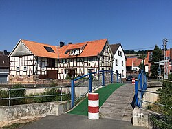
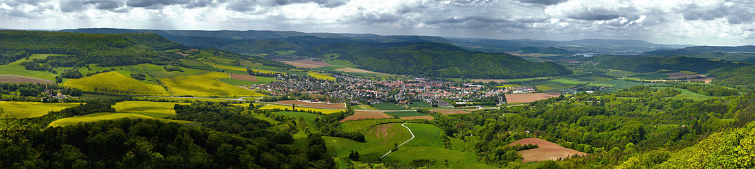
- 6 Bad Wildungen (235 m) - Die circa 16.630 Einwohner große alte Kurstadt besitzt durch die hier endende Bahnstrecke Wabern - Brilon Wald (Teilstück Wabern - Fritzlar - Bad Wildungen (KBS 621); Kurhessenbahn), sowie einem eigenen Stadtbusnetz und mehreren teilweise mit Fahrradträgern oder Fahrradanhängern ausgerüsteten Regionalbuslinien einen guten Anschluss an das Umland. Sehenswürdigkeiten sind unter anderem Schloss Friedrichstein, die Fachwerkaltstadt, das ehemalige Gelände der Landesgartenschau 2006 und der mit 50 ha größte Kurpark Europe.
- ~ ~> Bad Wildungen wird durchgehend ansteigend über die Wohnstraße Am Langen Rod und deren ebenfalls asphaltierte Verlängerung in Form eines Wirtschaftswegs verlassen, von welchem man einen schönen Ausblick über große Teile Bad Wildungens hat.
- 7 Odershausen (360 m) - Der staatlich anerkannte Erholungsort mit gut 1330 Einwohnern ist ein Stadtteil von Bad Wildungen und liegt südlich dieser. Odershausen wird von den Buslinien 407, 408 and 544 angefahren.
- ~ ~> Die Bundesstraße 253 wird überquert und man radelt auf einem asphaltierten Wirtschaftsweg leicht hügelig an einem größeren Bauernhof vorbei nach Braunau hinein.
- 8 Braunau (330 m) - Mit 14 km² und um die 670 Einwohnern ist Braunau der flächenmäßig größte Stadtteil von Bad Wildungen. Sehenswert ist neben der evangelischen Kirche auch die Braunauer Warte, von welcher man eine schöne Aussicht auf die bewaldeten Gipfel des Kellerwalds hat. Auch Braunau wird von den Buslinien 407, 408 and 544 angefahren.
- ~ ~> Zunächst fährt man auf einem asphaltierten Wirtschaftsweg hinauf zum Waldrand, bevor man nun auf einem teilweise groben Schotterweg erst an diesem entlang und später an Lichtungen vorbei bergig hindurch fährt. Über die Landesstraße 3296 radelt man dann bergab an zwei Autoparkplätzen vorbei tiefer in den Kellerwald hinein.
- 9 Bergfreiheit (320 m) - Der staatlich anerkannte Luftkurort ist mit circa 335 Einwohnern der südöstlichste Stadtteil von Bad Wildungen und überregional besonders durch das Märchen Schneewittchen der Brüder Grimm bekannt, welches hier seinen Ursprung haben soll. Es verkehrt die Buslinie 544.
- ~ ~> Ab Bergfreiheit radelt man auf der sehr wenig befahrenen Kreisstraße 62 durch das schattige Urfftal, wo man bei den Angelteichen fangfrische Fische kaufen kann und schließlich am Oberurffer See den Kellerwald verlässt.
- 10 Oberurff-Schiffelborn (235 m) - Der circa 620 Einwohner große Ortsteil von Bad Zwesten liegt am östlichen Waldrand des Kellerwalds. Der westlich des Ortes gelegenen Oberurffer See, ein Freizeit-, Bade- und Angelteich, bietet im Sommer eine schöne Abkühlung oder Möglichkeit zur Rast. In Oberurff-Schiffelborn halten die Buslinien 407, 408 and 411.
- ~ ~> Über einen asphaltierten Wirtschaftsweg direkt südlich der Urff entlang erreicht man schnell Niederurff, wo der Hess. Radfernweg R5 Anschluss an den Schwalm-Radweg und den Hess. Radfernweg R4 hat. Folgt man diesen nach Süden, kommt man zum Bahnhof bzw. Haltepunkt Neuental-Zimmersrode (KBS 620).
- 11 Niederurff (205 m) - Der circa 420 Einwohner große Ortsteil von Bad Zwesten ist ein Knotenpunkt im hessischen Radfernwegenetz, da hier der Hess. Radfernweg R5 auf den Schwalm-Radweg und den Hess. Radfernweg R4 trifft. Der Ort wird von den Buslinien 407 and 411 angefahren.
- ~ ~> Niederurff wird östlich verlassen; man radelt bergab und überquert die Schwalm. Nun verlaufen die drei Fernradwege auf einem schlecht befahrbaren unbefestigten Weg (nur teilweise geschottert) am Waldrand entlang. Hinter dem Waldcampingplatz fährt man am Wälzebach entlang wieder kurz bergauf an den Ortsrand des Etappenziels.
- 12 Bad Zwesten (200 m) - Die Gemeinde mit insgesamt circa 3920 Einwohnern besitzt eine Mineralquelle, an der unter anderem der Bad Zwestener Löwensprudel abgefüllt wird. Mit der Buslinie 408 bestehen gute Busverbindungen nach Borken and Bad Wildungen mit weiteren Anschlüssen, außerdem verkehren die Schulbuslinien 407 and 411.
4. Etappe: Bad Zwesten - Homberg (Efze): 27 km


.JPG/250px-Radweg_Caßdorf_Homberg_(Efze).JPG)

Die vierte Etappe des Hessischen Radfernwegs R5 ist zwischen Bad Zwesten und Singlis identisch mit dem Hess. Radfernweg R4 und dem Schwalm-Radweg. Circa die Hälfte der Strecke ist asphaltiert, während die andere Hälfte leider nur geschottert ist und oft auch mehr Konzentration beim Fahren erfordert. Dafür ist die Etappe überwiegend autofrei und man hat besonders bei Homberg (Efze)-Lembach eine schöne Aussicht in die offene Landschaft der Schwalm-Eder-Aue. In Homberg (Efze) hat man Anschluss an die lokalen Radrouten Schwalm-Efze-Weg (R 14), Fulda-Efze-Weg (R 16) und Efzetalweg (R 17). Für eine detaillierte Radwanderkarte bitte einfach auf die POI's klicken, die einen sofort an die beschriebene Position leiten.
Die Höhenmeter betragen in Fahrtrichtung Bad Zwesten - Homberg (Efze) um die 250 m und in die Gegenrichtung rund 180 m.
- ~ ~> Über asphaltierte Wirtschaftswege fährt man weiter meistens geradeaus ohne Umwege immer dem Verlauf der Schwalm folgend. Über einen Wiesenweg kann man einen Abstecher zu einer der Mühlen an der Schwalm machen (ausgeschildert).
- 1 Kerstenhausen (190 m) - Knapp 600 Einwohner großer Stadtteil von Borken an der Bundesstraße 3. Die drei Fernradwege verlaufen durch den Ort unmittelbar an dieser entlang, zum Glück gibt es breite Bürgersteige auf welche man zur Not als Radfahrer ausweichen kann. Es verkehren die Buslinien 407 and 408.
- ~ ~> Ab Kerstenhausen muss man für 2 km bis zum Friedhof Arnsbach die Kreisstraße 73 mit benutzen, zu welcher leider keine alternativen Wege unter der Bundesautobahn 49 hindurch in der sogenannten Schwalmpforte bestehen. Doch gerade Familien mit kleineren Kindern sollten die Straße besonders im Berufsverkehr meiden, da sie teilweise sehr eng sowie unübersichtlich ist und schnell befahren wird. Aber wenigstens die Straßenqualität ist gut.
- 2 Arnsbach (200 m) - Der 525 Einwohner große Stadtteil von Borken befindet sich 500 Meter südlich der drei Fernradwege, allerdings kommt man am Friedhof vorbei. Von Arnsbach kann man auf der lokalen Radroute 101 über Trockenerfurth zum Borkener See radeln. Der Ort wird von den Buslinien 407, 411 and 419 angefahren.
- ~ ~> Auf einem asphaltierten Fuß- und Radweg fährt man direkt am Waldrand entlang, bevor man über eine Holzbrücke die Schwalm überquert und den Naturbadesee Stockelache (mit Gastronomie) erreicht. Mit Hilfe einer Ampelanlage kann man die Landesstraße 3223 passieren und radelt weiter über asphaltierte Wirtschaftswege an Obstbäumen vorbei.
- 3 Kleinenglis (190 m) - Gut 1510 Einwohner großer Stadtteil von Borken. Sehenswert ist neben der St.-Michaels-Kirche vor allem das Kaiserkreuz an einem Kinderspielplatz in der Hundsburgstraße (siehe Karte). Es verkehren die Linien 407 and 413.
- ~ ~> Weiter geht es auf einer lokalen Straße unter der Landesstraße 3150 kurz stark bergauf auf eine Anhöhe südlich Großenenglis. Hier biegt man nach Süden ab und fährt mit Blick auf Borken zurück zur Schwalm; wer zum Bahnhof Borken (KBS 620) will, muss noch vor dem Gombether See die drei Fernradwege nach Süden verlassen (siehe Karte). Diese verlaufen dann allerdings landschaftlich schön auf einem Schotterweg direkt oberhalb des Gombether Sees mit Blick auf diesen. Hinab zu dessen Ufer kann man aber leider nicht, zumindest gibt es keine öffentlichen Wege.
- 4 Gombeth (175 m) ist mit 765 Einwohnern ein weiterer Stadtteil von Borken und wird von den Buslinien 407 and 413 angefahren. Der Ort liegt genau zwischen den beiden großen Seen direkt an der Schwalm.
- ~ ~> Ab Gombeth radelt man auf geschotterten Wirtschaftswegen nördlich der Schwalm und sieht so leider nicht den schönen Singliser See in unmittelbarer Nähe. Für einen Abstecher zu diesem fährt man auf den drei Fernradwegen über eine Brücke über einen Seitenarm der Schwalm hinweg und kommt so nach Singlis, wo man ein Stück der Landesstraße 3149 folgen muss. Am See findet man dann neben Gastronomie eine Aquagolf-Anlage (nur im Sommer).
- 5 Singlis (170 m) - Der mittelgroße Stadtteil von Borken besitzt einen eigenen kleinen Bahnhof bzw. Haltepunkt an der Main-Weser-Bahn (KBS 620). Im Ort trennen sich der Hess. Radfernweg R5, der Hess. Radfernweg R4 and the Schwalm-Radweg wieder. Weiter verkehren die Buslinien 407 and 424.
- ~ ~> Hinter Singlis fährt man auf einem asphaltierten Wirtschaftsweg zunächst einen Bergrücken hinauf, von welchem man später, nun geschottert, einen schönen Blick auf Borken und den Gilserhof hat. Über einen Asphaltweg fährt man schließlich nach Lembach hinunter, welches im Tal des Lembachs liegt.
- 6 Lembach (195 m) - In dem kleinen, circa 190 Einwohner großen Stadtteil von Homberg (Efze) gab es früher einmal eine Wasserburg, eine Ziegelei und eine Schnapsbrennerei. In Lembach halten die Buslinien 410, 420 and 424.
- ~ ~> Nachdem man die Landesstraße 3148 überquert hat, beginnt noch vor dem Ortsausgang der steile Aufstieg auf der wenig befahrenen Kreisstraße 48 den nächsten Berg hinauf. Oben angekommen, erwartet einen ein schönes Panorama zurück Richtung Borken (Hessen) in die Schwalm-Eder-Aue und anschließend eine rasante Abfahrt die andere Seite des Bergs wieder hinunter.
- 7 Mühlhausen (185 m) - Der 1209 erstmals urkundlich erwähnte Stadtteil von Homberg (Efze) hat heute um die 360 Einwohner und liegt im Tal der Efze nordwestlich von Homberg (Efze). In der Ortsmitte trifft der Hess. Radfernweg R5 auf den Efzetalweg (R17); es verkehrt an Schultagen die Buslinie 424.
- ~ ~> Auf der gut befahrbaren Kreisstraße 47 radelt man direkt westlich der Efze entlang fast ohne Steigungen.
- 8 Caßdorf (190 m) - Bereits 1145 erstmals urkundlich erwähnt ist Caßdorf heute ein Stadtteil von Homberg (Efze) mit gut 680 Einwohnern und wird von den Buslinien 410 and 424 served.
- ~ ~> Nach Überquerung von Ohebach und Efze und Unterquerung der Bundesstraße 254 fährt man auf einer asphaltierten Fahrradstraße bergauf nach Homberg (Efze) hinein. In der Stadt gibt es zwei durch Einbahnstraßen bedingte unterschiedliche Wegführungen (siehe Karte).
- 9 Homberg (Efze) (255 m) - Die Kreisstadt des Schwalm-Eder-Kreises mit rund 13.850 Einwohnern ist geprägt durch ihre vielen Fachwerkhäuser, besonders in der Altstadt. Der Hessische Radfernweg R5 führt direkt durch diese über den Marktplatz; wer die Steigung hinauf zu letzterem auslassen will und die Altstadt schon kennt, folgt einfach dem Efzetalweg (R 17), der unten im Tal der Efze ohne Steigungen verläuft. Da auf der Bahnstrecke Leinefelde - Treysa, die ein Teilstück der Kanonenbahn war und an welcher Homberg (Efze) einen Bahnhof hatte, der Personenverkehr 1981 eingestellt wurde, verkehren heute mehrere Buslinien vom Busbahnhof, ebenfalls direkt am Radweg, in die umliegenden Gemeinden und Städte. Wer will, kann einen Abstecher zur Hohenburg hoch über Homberg (Efze) machen, von der man einen schönen Panoramablick in das Knüllgebirge hat.
5. Etappe: Homberg (Efze) - Rotenburg an der Fulda: 42 km
_Relbehausen.JPG/250px-Radweg_Homberg_(Efze)_Relbehausen.JPG)


.jpg/250px-Blick_vom_ICE_auf_Morschen_(2009).jpg)


Die fünfte Etappe des Hessischen Radfernwegs R5 ist zwischen Homberg (Efze) and Knüllwald-Remsfeld identisch mit dem lokalen Efzetalweg (R 17) und zwischen Remsfeld und Morschen-Neumorschen im Streckenverlauf identisch mit dem Beisetalweg (R 18), sowie im zwischen Knüllwald-Niederbeisheim und Malsfeld-Beiseförth mit dem Mühlenradweg (MR). Fast die komplette Etappe ist asphaltiert und somit für Rennräder geeignet, nur kurz hinter Remsfeld für 300 Meter und zwischen Oberbeisheim und Niederbeisheim verläuft der R5 ein kurzes Stück über einen Schotterweg, welcher aber über die nahe Landstraße 3254 umfahren werden kann. Bis Beiseförth, wo man auf den bis Rotenburg an der Fulda identisch verlaufenden Fulda-Radweg trifft und wo man auf der Fahrradseilbahn die Fulda überquert, verläuft die Radroute allerdings auf längeren Abschnitten auf wenig aber schnell befahrenen Kreisstraßen, nämlich von Remsfeld bis Oberbeisheim auf der Kreisstraße 41 und zwischen Niederbeisheim und kurz vor Beiseförth auf der Kreisstraße 29. Die Etappe ist deshalb nur bedingt für Familien geeignet. Zwischen Homberg (Efze) and Malsfeld kann alternativ auch der Fulda-Efze-Weg (R 16) befahren werden. Für eine detaillierte Radwanderkarte bitte einfach auf die POI's klicken, die einen sofort an die beschriebene Position leiten.
Die Höhenmeter betragen in Fahrtrichtung Homberg (Efze) - Rotenburg an der Fulda um die 290 m, in Gegenrichtung rund 360 m.
- ~ ~> Aus der Fachwerkaltstadt radelt man in östlicher Richtung Bergab nördlich der Osterbachschule entlang. Zwischen zwei Supermärkten hindurch unterquert man die Bundesstraße 323 und trifft in Holzhausen wieder auf den Efzetalweg (R 17).
- 1 Holzhausen (225 m) - Der ungefähr 680 Einwohner große Stadtteil von Homberg (Efze) ist schon lange mit der Kreisstadt zusammengewachsen. Seit Abschaffung des Stadtbusses bedient den Ort heute nur mit wenigen Fahrten die Buslinie 426.
- ~ ~> Steil aus dem Ort hinaus erreicht man die asphaltierte ehemalige Streckenführung der Bundesstraße 323, auf welcher man zwischen der neuen Streckenführung und der Efze entlang radelt.
- 2 Relbehausen (245 m) - Im kleinsten Stadtteil von Homberg (Efze) leben circa 65 Einwohner; er wird neben der zweistündlich verkehrenden Linie 450 auch regelmäßig von den Buslinien 423, 426 and 491 angefahren.
- ~ ~> Auf der asphaltierten Remsfelder Straße fährt man im Efzetal aus dem Ort hinaus und unterquert das denkmalgeschützte Eisenbahnviadukt der schon seit langem stillgelegten Kanonenbahn (Bahnstrecke Leinefelde - Treysa).
- 3 Remsfeld (265 m) - Der größte Ortsteil und Verwaltungssitz der Gemeinde Knüllwald besitzt um die 1210 Einwohner und liegt unweit westlich der Federal motorway 7. Im Ort zweigt der Efzetalweg (R 17) nach Wallenstein ab und es beginnt der Beisetalweg (R 18) durch das Beisetal nach Spangenberg. Auch in Remsfeld halten die zweistündlich verkehrende Linie 450, sowie die Buslinien 423, 426 and 491.
- ~ ~> Man verlässt Remsfeld nördlich auf der Kreisstraße 41. Wer den 300 Meter langen Schotterweg auslassen will, folgt einfach dieser und nicht den beiden Radwegen. Auf der Kreisstraße 41 geht es dann auch stetig bergauf zur Wüstekirche an der Federal motorway 7. Wurde letztere überquert, folgt eine schöne Abfahrt am alten Oberbeisheimer Bahnhof am Ende des 917 m langen Oberbeisheimer Tunnels vorbei. Vielleicht wird ja auch dieser irgendwann einmal für Radfahrer geöffnet.
- 4 Oberbeisheim (290 m) - Der gut 560 Einwohner großer Ortsteil von Knüllwald wird seit Einstellung der Buslinie 451 nur in größeren Abständen von den Buslinien 423 and 491 angefahren. Direkt am Hessischen Radfernweg R5 befindet sich das große Schuhhaus Heinmüller.
- ~ ~> Dem groben Verlauf der stillgelegten Kanonenbahn folgend radelt man auf asphaltierten und geschotterten Wirtschaftswegen bis unter eine Hochspannungsleitung. Fährt man hier weiter geradeaus, kommt man nach 400 Metern zum Freibad Niederbeisheim, die beiden Radwege aber biegen hier nach Norden ab und verlaufen auf der Straße In der Ecke steil bergab nach Niederbeisheim hinein.
- 5 Niederbeisheim (250 m) - In dem erstmals 1319 erwähnten Ortsteil von Knüllwald leben heute gut 950 Einwohner. Im Ort kreuzt der Mühlenradweg (MR) und es verkehren die beiden Buslinien 423 and 491.
- ~ ~> Auf der wenig befahrenen Kreisstraße 29 radelt man auf einer Länge von ungefähr sechs Kilometern bergab durch das Beisetal. Während man anfangs noch ein Stück auf den Mühlenradweg (MR) ausweichen kann, gibt es ansonsten keine alternativen Wege. Man unterquert drei Mal durch kleine Brücken die ehemalige Bahntrasse der Kanonenbahn und kommt an der Hennemühle (Linie 491), der Roten Mühle, der Grüneismühle (Linie 491) und der Märchenmühle vorbei. Kurz vor Beiseförth kann man sich dann noch in einem durch die Beise gespeisten Wassertretbecken abkühlen.
- 6 Beiseförth (175 m) - Der circa 1300 Einwohner große Ortsteil der Gemeinde Malsfeld in the mittleren Fuldatal besitzt einen eigenen Bahnhof bzw. Haltepunkt an der Bahnstrecke Bebra-Guntershausen (KBS 610), an welchem die cantus Verkehrsgesellschaft verkehrt. Weiter verkehren die Buslinien 443 and 491, größte Sehenswürdigkeit ist seit 2009 die Fahrradseilbahn über die Fulda, über welche der Hessische Radfernweg R5 zusammen mit dem Fulda-Radweg verläuft.
- ~ ~> In Beiseförth teilen sich der R5 und der Fulda-Radweg. Während eine Streckenvariante steil bergauf aus dem Ort hinaus verläuft und der Kreisstraße 131 am Hang entlang folgt, verläuft die andere Streckenvariante am Naturbadesee mit Campingplatz Beiseförth vorbei auf einem asphaltierten Wirtschaftsweg auf der anderen Uferseite entlang zur Fahrradseilbahn, mit welcher man vom 1. April bis zum 1. November tagsüber ans andere Ufer kommt. Beide Varianten verlaufen dann gemeinsam weiter über einen asphaltierten Wirtschaftsweg oder die Kreisstraße 131 nach Binsförth hinein.
- 7 Binsförth (185 m) - In dem Ortsteil der Gemeinde Morschen leben um die 260 Einwohner, es verkehrt an Schultagen die Buslinie 441. In der Ortsmitte findet man den Lindenplatz mit dem alten Backhaus, wo das jährliche Dorffest gefeiert wird.
- ~ ~> Man fährt zunächst weiter auf der Kreisstraße 131, bevor man kurz vor der Fuldatalbrücke Morschen der Schnellfahrstrecke Hanover - Wurzburg auf einen asphaltierten Wirtschaftsweg wechselt, auf welchem man bis Neumorschen radelt. Alternativ kann man Neumorschen auf dem Beisetalweg (R 18) umfahren.
- 8 Neumorschen (180 m) - Der zweitgrößte Ortsteil von Morschen mit gut 730 Einwohnern wurde 1259 erstmals urkundlich erwähnt und ist heute fast mit Altmorschen zusammengewachsen, nur die Fulda trennt die beiden Orte noch voneinander. Neumorschen wird von der Buslinien 441 angefahren.
- ~ ~> Auf der Landesstraße 3225 überquert man die Fulda und fährt direkt nördlich des Bahnhofs (KBS 610) nach Altmorschen hinein. Im Ort verlaufen der Hessische Radfernweg R5 und der Hessische Radfernweg R1 (Fulda-Radweg) über das Gelände des Kloster Haydaus.
- 9 Altmorschen (185 m) - Der mit circa 1700 Einwohnern größte Ortsteil und Sitz der Gemeindeverwaltung der Gemeinde Morschen wurde erstmals urkundlich im Jahre 1235 erwähnt, ist aber wohl wesentlich älter. Größte Sehenswürdigkeit direkt am Radweg ist das Kloster Haydau, das in seinem baulichen Bestand am besten erhaltene Kloster der Zisterzienserinnen in Hesse. Altmorschen hat einen eigenen Bahnhof an der Bahnstrecke Bebra - Guntershausen (KBS 610) an welchem die cantus Verkehrsgesellschaft hält, weiter verkehrt die Buslinie 441.
- ~ ~> Über das Gelände des Kloster Haydaus erreicht man den Ortsausgang von Altmorschen, von welchem man auf einem asphaltierten Wirtschaftsweg weiter radelt. Man überquert die Bahnstrecke über eine Brücke und fährt im Zick-Zack durch die Fuldaaue an einem Sportplatz vorbei.
- 10 Heinebach (185 m) - Der Hessische Radfernweg R5 und der Fulda-Radweg verlaufen nicht direkt durch den mit circa 2285 Einwohner größten Ortsteil der Gemeinde Alheim, sondern 300 Meter südwestlich an ihm vorbei. Heinebach hat einen Bahnanschluss durch die cantus Verkehrsgesellschaft (KBS 610) und wird von den Buslinien 304, 305 and 306 angefahren.
- ~ ~> Hinter der Kiesgrube Heinebach verläuft der Hessische Radfernweg R5 zunächst auf einem asphaltierten straßenbegleitenden separaten Radweg an der Kreisstraße 67 entlang, bevor er kurz vor der Brücke über die Fulda nach Niederellenbach nach Südosten in einen fast geraden ebenfalls asphaltierten Wirtschaftsweg einbiegt. Direkt an der Radroute befindet sich an einem alten Kiesteich in einer kleinen Flussschleife der Fulda gelegen eine hölzerne Tierbeobachtungsstation, von welcher es nicht mehr weit zum ehemaligen Bahnhof Baumbach ist.
- 11 Baumbach (185 m) - In dem Ortsteil von Alheim leben circa 800 Einwohner, früher besaß der Ort zudem einen eigenen Bahnhof an der Bahnstrecke Bebra - Guntershausen. Heute verkehren stattdessen die Buslinien 305, 306 and 308 regelmäßig nach Heinebach und Rotenburg an der Fulda.
- ~ ~> Auf einem asphaltierten Wirtschaftsweg radelt man erst durch die Felder und später unweit südlich der Fulda entlang bis zur Brücke zwischen Braach und der Bundesstraße 83. Diese darf man nicht hinauffahren, sondern fährt einmal um die Rampe zur Brücke hinauf herum (teilweise ungenaue Wegweisung, siehe Markierungen auf dem Boden).
- 12 Braach (185 m) - Der gut 1005 Einwohner große Stadtteil von Rotenburg an der Fulda liegt circa 200 Meter südlich vom Hessischen Radfernweg R5 und dem Fulda-Radweg away. Braach wird von den Buslinien 305 and 308 angefahren.
- ~ ~> Leicht kurvig radelt man auf dem letzten Abschnitt der fünften Etappe des Hessischen Radfernwegs R5 südlich der Fulda entlang, bevor man an der Jakob-Grimm-Schule und einem Sportplatz mit Tribüne vorbei die historische Fachwerkaltstadt von Rotenburg an der Fulda erreicht. Bei Hochwasser kann der enge asphaltierte Radweg schnell überflutet sein, sodass man in die engen Gassen der Altstadt ausweichen muss.
- 13 Rotenburg an der Fulda (185 m) - Die Fachwerkstadt Rotenburg an der Fulda liegt nördlich von Bebra in the mittleren Fuldatal und ist mit circa 13.325 Einwohnern eine der größten Städte im Landkreis Hersfeld-Rotenburg, den man geographisch auch schon zu Osthessen zählen könnte. Im Bahnhofsgebäude befindet sich ein InfoPoint of Nordhessischen VerkehrsVerbunds, neben den Zügen der cantus Verkehrsgesellschaft (KBS 610) verkehren vom Bahnhof mehrere Buslinien in das Umland.
6. Etappe: Rotenburg an der Fulda - Sontra: 24 km
.jpg/250px-Wasserburg_Lispenhausen_(02).jpg)
.jpg/250px-Wasserburg_Schwarzenhasel_(01).jpg)


Die sechste Etappe des Hessischen Radfernwegs R5 verläuft auf asphaltierten und geschotterten Wirtschaftswegen durch das meist bewaldete Stölzinger Gebirge und ist nicht durchgehend für Rennräder geeignet. Nur das letzte Teilstück zwischen dem Schloss Rittershain und Sontra verläuft durch eine durch landwirtschaftlich genutzte Felder geprägte Landschaft. Wer die Steigung zwischen Schwarzenhasel und Rockensüß auslassen will, kann auch alternativ auf der lokalen Radroute R16 über Bebra radeln (5 km länger und 50 Höhenmeter weniger) oder zwischen Bebra and Sontra with the cantus Verkehrsgesellschaft (KBS 613) fahren; entlang der Etappe gibt es bis auf Rotenburg an der Fulda, Lispenhausen und Sontra keine Bahnhöfe mehr. In Sontra hat man Anschluss an mehrere lokale Radrouten von Waldhessen. Entlang der Radroute findet man mehrere alte Schlösser und Wasserburgen. Für eine detaillierte Radwanderkarte bitte einfach auf die POI's klicken, die einen sofort an die beschriebene Position leiten.
Die Höhenmeter betragen in Fahrtrichtung Rotenburg an der Fulda-Sontra um die 270 m und in die Gegenrichtung rund 230 m.
- ~ ~> Zusammen mit dem Fulda-Radweg radelt man nördlich des Schlossparks und des Hallenbads out Rotenburg an der Fulda hinaus. Am gegenüberliegenden Ufer befindet sich der Campingplatz Rotenburg an der Fulda; kurz vor dem Storchensee (Ablegestelle Fulda-Floß) trennen sich der Fulda-Radweg (nach Bebra and Bad Hersfeld) und der Hessische Radfernweg R5 wieder. Über eine Brücke mit Schieberillen überquert man die Fulda und fährt nach Lispenhausen hinein zum Bahnhof.
- 1 Lispenhausen (190 m) - Der mit circa 2400 Einwohnern nach der Kernstadt größte Stadtteil von Rotenburg an der Fulda besitzt einen eigenen Bahnhof an der Bahnstrecke Bebra - Guntershausen (KBS 610; cantus Verkehrsgesellschaft). Sehenswert ist die gut erhaltene Wasserburg Lispenhausen aus dem 13. Jahrhundert unweit des Radwegs entfernt in der Ortsmitte.
- ~ ~> Nach Überquerung der Bundesstraße 83 fährt man am Friedhof vorbei bergauf über den Gieseweg aus Lispenhausen hinaus. Man folgt nun über asphaltierte Wirtschaftswege dem Haselbachtal flussaufwärts vorbei an einer alten Mühle mit gut erhaltenem Mühlrad, der hölzernen Riedelhütte und dem Naturschutzgebiet "Haselgrund bei Schwarzenhasel".
- 2 Schwarzenhasel (225 m) - Der rund 400 Einwohner große Ort ist einer von vier Orten, die im als Haselgrund bezeichneten Tal des Haselbaches liegen und zu Rotenburg an der Fulda gehören. Am nördlichen Ende des Dorfes befindet sich die um 1600 erbaute sehenswerte Wasserburg Schwarzenhasel; im Ort verkehrt die Buslinie 301.
- ~ ~> Ab Schwarzenhasel beginnt der Anstieg hinauf in das Stölzinger Gebirge. Zunächst auf asphaltierten Wirtschaftswegen, später auf teils gröberen Schotterwegen radelt man einen Grund zum Teil recht steil hinauf und trifft schließlich unweit der Betteleiche auf die Wanderroute Franzosenstraße (F). Weiter auf wieder besser befahrbaren Forstwegen und weniger ansteigend erreicht man schließlich den Schwarzen Stock, eine Passhöhe an der Kreisstraße 50 mit kleinem Wanderparkplatz. Über die kurvenreiche, schmale und sehr wenig befahrene Straße erreicht man bergab schnell den Abzweig zum Schloss Rittershain.
- 3 Rittershain (330 m) - In der kleinen zu Rockensüß gehörenden Siedlung, erreichbar vom Hess. Radfernweg R5 über die Kreisstraße 70, befindet sich das 1854 erbaute Schloss Rittershain mit Park im Jugendstil, in dem sich im 20. Jahrhundert eine Gaststätte befand. Zur Zeit verfällt das Schloss langsam vor sich hin. (Anmerkung: Der südwestliche Teil der Kreisstraße 70 war im Juli 2015 aufgrund starker Straßenschäden gesperrt.)
- ~ ~> Weiter auf der ab dem Abzweig Rittershain nicht mehr sanierten Kreisstraße 50 rollt man leicht bergab durch die nun offene Landschaft und kommt vorbei an einem Sportplatz in den hübschen Fachwerkort Rockensüß.
- 4 Rockensüß (265 m) - Der Ortsteil von Cornberg im oberen Sontratal wird von den Buslinien 250 and 251 angefahren. Direkt am Radweg bzw. der Ortsdurchfahrt befinden sich mehrere schöne gut erhaltene Fachwerkhäuser.
- ~ ~> Von Rockensüß folgt man dem hier noch sehr kleinen Bächlein Sontra, einem Nebenfluss der Wehre, flussabwärts bis in die Stadt Sontra. Doch zunächst fährt man weiter auf der Kreisstraße 50 zur Kreisgrenze zwischen dem Landkreis Hersfeld-Rotenburg und dem Werra-Meißner-Kreis und weiter auf der Kreisstraße 4 nach Berneburg.
- 5 Berneburg (245 m) - In dem von den Buslinien 250 and 251 angefahrenen Stadtteil von Sontra mit etwa 280 Einwohnern befinden sich ebenfalls mehrere sehenswerte Fachwerkhäuser sowie ein kleiner Brunnen "zum Gedenken an die Wasserflut vom 14. Juni 1864" direkt am Wegesrand. Unweit der Radroute liegt weiter auch der Wohnturm Berneburg aus dem 14. Jahrhundert. Der Bahnhof Berneburg an der Bahnstrecke Goettingen - Bebra wurde 1971 aufgelassen.
- ~ ~> Zwischen Berneburg und Hornel verläuft der Hessische Radfernweg R5 auf einem straßenbegleitenden asphaltierten Radweg entlang der Bundesstraße 27 und unterquert die Bahnstrecke Goettingen – Bebra unter dem Hornel-Viadukt zusammen mit der viel befahrenen Landesstraße 3249.
- 6 Hornel (235 m) - In dem lange Zeit von Landwirtschaft und Bergbau geprägten Stadtteil von Sontra, der erstmals 1297 erwähnt wurde, leben um die 150 Einwohner und es verkehrt die Buslinie 260.
- ~ ~> Von Hornel ist es auf der asphaltierten und autofreien Kupferstraße nicht mehr weit bis zu den ersten Häusern von Sontra. Vom Marktplatz am Rathaus in der historischen Altstadt ist es nicht weit zum Bahnhof.
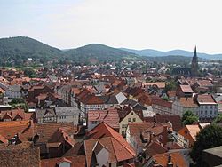
- 7 Sontra (225 m) - Die als „Berg- und Hänselstadt“ bekannte Kleinstadt im Werra-Meißner-Kreis gehört zu den ältesten Siedlungen im hessisch-thüringischen Grenzraum, wird aber erst 1232 erstmals als Suntraha erwähnt. In der als staatlich anerkannter Luftkurort ausgezeichneten Stadt leben heute etwa 7535 Einwohner, am Bahnhof halten Züge der cantus Verkehrsgesellschaft (KBS 613), sowie in der Altstadt die Buslinien 224, 250, 251, 252 and 260.
7. Etappe: Sontra - Wanfried: 30 km


Die siebte und letzte Etappe des Hessischen Radfernwegs R5 verläuft durch den Ringgau and the Werratal meist bergab auf asphaltierten Wirtschaftswegen. Die einzig nennenswerte größere Steigung findet man zwischen Wehretal-Reichensachsen und Eschwege, sie kann alternativ über die Meißner cycle tour and the Werra valley cycle path above Eschwege-Niederhone be bypassed. The latter runs between Eschwege and Wanfried-Aue identical in the routing, just like that Herkules-Wartburg cycle path-Alternative route. The Herkules-Wartburg cycle path itself runs between Sontra-Wichmannshausen and Wehretal-Hoheneiche together with the Hessian long-distance cycle route R5. For a detailed cycling map, please simply click on the POIs that will immediately direct you to the described position.
The meters in altitude are in the direction of travel Sontra-Wanfried around 180 m, in the opposite direction around 240 m.
- ~ ~> Sontra is left via Göttinger Strasse and Weißenbörner Strasse. Soon you cycle on the asphalted route of the old federal road 27 past an allotment garden and over a parking lot through the Sontra valley, before you pass the federal road 27 through an underpass, cross the Sontra and now on an asphalt farm road along the railway line Goettingen - Bebra cycles. Through the Alter Graben settlement you reach Wichmannshausen, in the village the Hessian long-distance cycle route R5 leads through two low underpasses under the federal road 27.
- 1 Wichmannshausen (200 m) - Next to the core city, the largest district of Sontra with around 1000 inhabitants was first mentioned in 1272; it is worth seeing Wichmannshausen Museum in the old Boyneburg Castle. If you want, you can make a detour from Wichmannshausen via Gut Boyneburgk up to Boyneburg. The bus routes operate in Wichmannshausen 240 and 250.
- ~ ~> Together with the Herkules-Wartburg cycle path it goes under the railway line and on an asphalt farm road through the now wider Sontratal to Hoheneiche.
- 2 High oak (190 m) - The district of the municipality with around 675 inhabitants Wehretal was first mentioned in 1233 and is the northernmost place in the Sontra valley. The "Missgeburt von Hoheneiche", a woodcut by the Renaissance artist Dietmar Merluam from the year 1577, which shows a malformed child born in Hoheneiche, is known nationwide. The bus routes run in Hoheneiche 225 and 240; the Hoheneiche station now only serves as an interlocking for dispatchers.
- ~ ~> The Hess runs between Hoheneiche and Oetmannshausen. Long-distance cycle path R5 on an asphalt path directly along the weir, which is finally crossed over a wooden bridge with a green carpet.
- 3 Oetmannshausen (185 m) - With about 380 inhabitants, Oetmannshausen is the smallest district of Wehretal and was first mentioned in a document in 1271. While the Oetmannshausen train station was closed in 1985, the bus route operates today 200/231 with bike trailers and the bus routes 200, 221, 224 and 225 without bicycle trailer.
- ~ ~> Even north of Oetmannshausen you always cycle directly along the weirs. As between Sontra and Wichmannshausen, the Hessian long-distance cycle route R5 will soon have to be between Oetmannshausen and Reichensachsen due to the new construction of the federal motorway 44 (kassel - Eisenach) (see map).
- 4 Reichensachsen (180 m) - The district of the municipality with around 4000 inhabitants Wehretal is the seat of the municipal administration and was first mentioned in 1253. Directly on the Hessian long-distance cycle route R5 is the lovely Evangelical Church of Reichensachsen, the Reichensachsen train station (KBS 613) is about 400 meters from the bike path. The bus routes continue to run 200/231 (with bicycle trailer), 200, 221, 225 and 234.
- ~ ~> From Reichensachsen the climb follows up to the Blauen Kuppe, an extinct volcano. At first, you climb slowly along the Leimbach, later you cycle on asphalt farm roads, which are steeper up a mountain ridge. After crossing the state road 3424, you finally reach the Regener Hütte, from which it goes downhill via Friedrichsruh into the Eschweger basin.
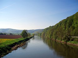
- 5 Eschwege (170 m) - The district town Eschwege lies in an extensive river valley Werra, was first mentioned in 974 as "eskinivvach" and has about 19,470 inhabitants. In addition to many well-preserved half-timbered houses, the market square with the old town hall, the Landgrafenschloss and the Nikolaiturm with a view of the entire old town are particularly worth seeing. Is known nationwide Eschwege especially due to the annual Open Flair Festival with 15,000 to 20,000 visitors. From the city station reopened in 2009 (KBS 613) With NVV mobility center and DB Agency operate the lines in addition to city buses 200/231 and 290 with bike trailers and the bus routes 170, 200, 220, 221, 222, 230, 232, 234, 235, 236 and 240 without bicycle trailer.
- ~ ~> Past the Eschwege Youth Hostel one drives together with the Werra valley cycle path on Leuchtbergstrasse Eschwege out; it is worth making a detour to the nearby Werratalsee (with Eschwege campsite). Not far from the Leuchtberge climbing forest You then cycle past on paved paths along the edge of the forest.
- 6 Niederdünzebach (165 m) - The district of Eschwege was first mentioned in 1263 as "Thuncenbach" and is located 800 meters south of the Hessian long-distance cycle route R5. The bus line operates 236.
- ~ ~> On asphalt farm roads you can quickly and straight ahead to reach Kreisstraße 12. During the Werra valley cycle path via Aue Wanfried runs, the Hessian long-distance cycle path leads to Frieda Wanfried.
- 7 Aue (165 m) - The westernmost district of Wanfried has around 575 inhabitants and is located on the northern edge of the Schlierbachswald and about 400 meters south of the Hessian long-distance cycle route R5. Sights in town are the moated castle Aue from the 12th century and the manor house Aue from 1576; the bus route runs 236.
- ~ ~> Between Aue and Frieda you follow the district road 12 over a small bridge, the traffic of which is regulated by traffic lights, over the Werra and reach Frieda under the federal road 249.
- 8 Frieda (170 m) - In the easternmost part of the municipality Meinhard about 900 inhabitants live; Frieda was first mentioned in 974 and was at times desolate. According to a well-known legend, St. Boniface is said to be missionary on the Hülfensberg north of the Werra Valley have said: "When will peace finally float over this beautiful floodplain". Folk etymologically, the names of today's places can be derived from it Wanfried, Frieda, Schwebda and Aue, which the Hessian long-distance cycle route R5 partially connects with each other. Frieda used to own a train station on the now disused railway line Schwebda - Wartha, today the bus line operates 200/231 with bike trailer and the lines 170, 230 and 232 without bicycle trailer.
- ~ ~> After crossing the Frieda brook over a narrow bridge, drive along the bypass road (Bundesstraße 249), which was completed in 2015. Shortly afterwards you cross the state road 3467 and a few meters later also the federal road 249. After another short section along the federal road 249, the Hessian long-distance cycle route R5 branches off from it and finally reaches the Wanfrieder after 234 kilometers via an asphalt farm road directly along the Werra Schlagd, the goal of the long-distance cycle route.
- 9 Wanfried (165 m) - The ancient settlement and today's country town Wanfried is the end point of the Hessian long-distance cycle route R5. Sights are the old harbor (Wanfrieder Schlagd), the Protestant and Catholic Church, the Landgrave Castle and Gut Kalkhof, where the Wanfrieder Agreement was negotiated. Also in Wanfried Since the closure of the Schwebda - Wartha railway line, there are no longer any trains, but the bus routes 200/231 with bike trailers and the bus routes 170, 230, 232 and 236 without bicycle trailer.
In Wanfried The Hessian long-distance cycle route R5 ends after 234 km. Who continues to the national border after Thuringia want, follow that Werra valley cycle path through Altenburschla and past the Großburschla train station to Heldra. The district of Wanfried was previously only accessible via a single road from the north, in all other directions the GDR border separated the population. From Hero stone high above Heldra you have a beautiful view of the again today Werra Valley into it.
literature
- WL Waldecker Land National and Nature Park Kellerwald / Edersee / Nature Park Diemelsee - topographic leisure map 1:50 000, ISBN 978-3-89446-320-5 , 9.50 €, published jointly by the Hessisch-Waldeckischer Gebirgs- und Heimatverein e.V. and the Hessian State Office for Soil Management and Geoinformation (2012).
- KB Kurhessisches Bergland Schwalm-Eder-Kreis - topographic leisure map 1:50 000, ISBN 978-3-89446-296-3 , 9.50 €, published jointly by Touristik Service Kurhessisches Bergland e.V., district committee of the Schwalm-Eder district and the Hessian State Office for Soil Management and Geoinformation (2008).
- MK Meißner-Kaufunger Forest Southern Leinetal - topographic leisure map 1:50 000, ISBN 978-3-89446-318-2 , 9.50 €, published jointly by Werratal Tourismus Marketing GmbH and the Hessian State Office for Soil Management and Geoinformation (2012).