Nine Hessian long-distance cycle routes across the country, large river routes and rail routes with a total length of approx. 3,300 km run through the diverse federal state. Many attractive regional routes have also emerged in recent years.
The most beautiful river routes can be found on the Lahn, Fulda, Werra, Eder and Main. The Rhine is only recommended in sections. The developed bike paths in the mountains on former railway lines, such as the Vulkan-Radweg in Vogelsberg and the Milseburg-Radweg in the Rhön, are popular. In both regions, buses with bicycle trailers will bring you to the highlights at the weekend.
background
Note on the "bulky" names of the Hessian long-distance cycle routes:
In the early days of cycle tourism in the early 1990s, the routes were simply numbered from 1-9 when planning (as with the streets). Since only a few users could do anything with the numbers, the geographical attachments were added. This took up the sensible trend of naming cycle routes thematically or geographically.
Notes on the nationwide "route network": As of November 2013, Hessen owns no nationwide area-wide cycle network such as North Rhine-Westphalia with the "cycle network NRW". In Thuringia there is the "Main Cycle Network" a nationwide cycling network is being set up. In Hesse so far (11-2013) there is probably not even a concept for it. Anyone who wants to ride a connection-oriented bike tour from A-City to B-City in Hesse often has to put together their own connection with regional routes or even with individual routes. These important connections are often not signposted throughout.
The routing function of the Cycle route planner Hessen already a step further. In some cases, however, even the cycle route planner does not even know important routes, as there are no signs or even closing gaps at important points (even parallel to very busy federal roads). conjure up ".
Two classic examples that some touring cyclists may be familiar with include: B. the missing gap closure on the Cornberger Höhe (in the pass crossing area of the busy B27 1 ) the direct "city connection" Fulda-Göttingen or the missing gap closure on the Gumpener Höhe (in the area of the more heavily trafficked B 38) 2 in the Odenwald between the Rhine-Neckar area and the eastern Rhine-Main area.
By the way, the state of Hesse even wanted to move the R 5 to the Cornberge Höhe around 2010 (today a very bad route in the steep forest crossing to the north). Despite 75% state funding, the project (with high-quality expansion of the pass connection via the old federal road and forest paths) failed due to the remaining portion of the financing to be raised locally.
Long-distance cycle routes

| title | length | Start point / end point | description | picture |
|---|---|---|---|---|
| Hessian long-distance cycle route R1 | 260 km | Gersfeld – Bad Karlshafen | Fulda cycle path - The Hess. Long-distance cycle route R1 follows the Fulda from its source to the Wasserkuppe above Gersfeld, Fulda, Bad Hersfeld, Bebra, Rotenburg on the Fulda, Melsungen and kassel to Hann. Münden, as well as further along the Weser until after Bad Karlshafen. The special attraction is the Beiseförth Fulda cable car Near Melsungen. |  |
| Hessian long-distance cycle route R2 | 202 km | Wallau – Jossa | Rivers tour - The Hess. Long-distance cycle route R2 first follows the Lahn of Biedenkopf to Cölbe (Marburg), to then over along smaller rivers Kirchhain, Stadtallendorf and Willingshausen to Alsfeld to run away. over Lauterbach and Grossenlüder one finally reaches Fulda and Oak cell, as well as the foothills of Rhön and Spessart. |  |
| Hessian long-distance cycle route R3 | 258 km | Rudesheim am Rhein – Tann (Rhön) | On the trail of the late harvest rider - The Hess. Long-distance cycle route R3 follows in the footsteps of the episcopal grape courier who was late in 1175, which led to the discovery of the late harvest. First you cycle through the valleys of Rhine, Main and Kinzig before it starts Schluechtern becomes more mountainous. From Fulda identical to that Milseburgradweg (-tunnel). |  |
| Hessian long-distance cycle route R4 | 415 km | Bad Karlshafen – Hirschhorn (Neckar) | From Sleeping Beauty to the Nibelungen / From the Weser to the Neckar - The Hess. Long-distance cycle route R4 crossed Hesse once completely from north to south, starting from Bad Karlshafen past Hofgeismar, Fritzlar, Alsfeld, Ulrichstein, Nidda, Offenbach am Main and Erbach to Hirschhorn (Neckar). One of the highlights is that Deiseler tunnel. |  |
| Hessian long-distance cycle route R5 | 234 km | Willingen (Upland) – Wanfried | North Hesse route Eder - Fulda - Werra - The Hess. Long-distance cycle route R5 explores the different regions and sights North Hesse. Starting from Upland you cycle through that Waldecker Land to the Edersee, through the Kellerwald in the Schwalm, through the Crunch to the Fulda and further through the Stölzinger Mountains to Werra. |  |
| Hessian long-distance cycle route R6 | 404 km | Wrexen – Lampertheim | From the Waldecker Land to the Rhine Valley - The Hess. Long-distance cycle route R6 connects typical Hessian Landscapes and regions like the Kellerwald-Edersee National Park and the Taunus together. Major cities along the route are Bad Arolsen, Frankenberg (Eder), Kirchhain, Lich, Idstein, Wiesbaden and Lampertheim. |  |
| Hessian long-distance cycle route R7 | 272 km | Limburg on the Lahn – Philippsthal (Werra) | From the Lahn to the Werra - The Hess. Long-distance cycle route R7 first follows the Lahn between Limburg and to waterto then im Vogelsberg up to Ulrichstein respectively. You finally reach it along the Fulda Bad Hersfeld in East Hessewhere the route in the land of the white mountains on the Werra ends. At slot there is an alternative route with the R7a. |  |
| Hessian long-distance cycle route R8 | 297 km | Frankenberg (Eder) – Heppenheim | Westerwald-Taunus-Bergstrasse - The Hess. Long-distance cycle route R8 shows the beauty of the Hessian West with Rothaar Mountains, Westerwald, Taunus and Mountain road. Major cities along the route are Biedenkopf, Dillenburg, Limburg on the Lahn, Bad Camberg, Idstein, Kelkheim, Frankfurt am Main, Darmstadt, Bensheim and Heppenheim. |  |
| Hessian long-distance cycle route R9 | 82 km | Bürstadt – Hainstadt | From the Rhine to the Main - The Hess. Long-distance cycle route R9 is the shortest of the nine long-distance cycle routes in Hesse and leads from the mountainous area Rhine at Worms above Bensheim, Reichelsheim, Brensbach and Maximum through the Odenwald. Of the Hessian After all, it is no longer far along the Mümling to the national border Main to Obernburg. |  |
| 3-country cycle route | 225 km | Around the Odenwald | The 3-country cycle route runs through the border triangle of Hesse, Baden-Wuerttemberg and Bavaria. Part of the cycle route leads through the Mümling valleys, Neckar and Main, partly mountainous through the Odenwald. Important cities along the bike path are Erbach, Michelstadt, Miltenberg, Walldürn, Mosbach, Eberbach, Staghorn and Beerfelden. |  |
| BahnRadweg Hessen | 245 km | Hanau – Bad Hersfeld | The BahnRadweg Hessen connects between south and East Hesse several well-known and lesser-known Railway cycle paths like that Volcano bike path, the Milseburgradweg and the Solztalradweg. The bike route impresses with its high standard of construction and the slight inclines caused by the course on the former railway lines. |  |
| Diemel cycle path | 110 km | Usseln – Bad Karlshafen | The Diemel cycle path follows the Diemel from its source in the Rothaar Mountains on the Diemelsee, Marsberg, Warburg, Trendelburg to Bad Karlshafen. Parts of the route are both in Hesse, as well as in North Rhine-Westphaliaso that the signs are not consistently consistent. Since 2014 the Deiseler tunnel. |  |
| Eder cycle path | 180 km | Lützel – Guntershausen | The Eder cycle path, also Ederauen cycle path, accompanies the Eder from its source in Rothaar Mountains through the Dodenauer tunnel past the Edersee to its confluence with the Fulda south of kassel and although it has only a few major gradients, it has a relatively large number of sections on gravel and natural paths. |  |
| GeoRadroute Ruhr-Eder | 210 km | Between Dysentery and Eder | Earth history between the Ruhr and Eder - The GeoRadroute Ruhr-Eder connects that Sauerland with the Edersee (Waldecker Land) and opened at the end of May 2015. Larger cities along the bike route are Brilon, Olsberg, Winterberg, Hallenberg, Allendorf (Eder), Frankenberg (Eder), Waldeck, Korbach, Medebach and Willingen (Upland). | ,_Viadukt,_2012-05_CN-01.jpg/150px-Willingen_(Upland),_Viadukt,_2012-05_CN-01.jpg) |
| Herkules-Wartburg cycle path | 112 km | kassel – Eisenach | The Herkules-Wartburg cycle path connects the two UNESCO World Heritage SitesBergpark Wilhelmshöhe at kassel and Wartburg at Eisenach, the birthplace of Johann Sebastian Bach. Larger cities along the cycle route are further Hessian Lichtenau, Waldkappel and Creuzburg, a 103 km alternative runs through the Werra Valley. |  |
| Lahn valley cycle path | 245 km | Lahnkopf – Lahnstein | The Lahn valley cycle path is one of the most popular German river cycle routes and follows the Lahn through a wide variety of landscapes and past many palaces, castles and churches from their source in the Rothaar Mountains above Bad Laasphe, Marburg, to water, Wetzlar, Weilburg, Limburg and Bad Ems up to its confluence with the Rhine at Lahnstein. |  |
| Limes cycle path | 818 km | Bad Hönningen – regensburg | The Limes cycle path, also German Limes Cycle Route, follow that Upper German-Raetian Limes (UNESCO World Heritage Site) between Rhine and Danube and runs through the four federal states Rhineland-Palatinate, Hesse, Baden-Wuerttemberg and Bavaria. The signposting of the mountainous cycle route is partly patchy. | 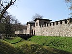 |
| Main cycle path | 600 km | Bischofsgrün/Cussen – Mainz | The Main cycle path follow that Main from its two sources to the confluence with the Rhine at Mainz. If you start on White Main (Weißmain cycle path) the route length is 538 km, you start on Red Main (Rotmain cycle path) 557 km. From the Mainz confluence at Kulmbach are along the Maines to Mainz 498 kilometers to go. |  |
| Neckar Valley way | 410 km | Villingen-Schwenningen – Mannheim | The Neckar Valley way follow that Neckar by Baden-Wuerttemberg from its source to the point where it flows into the Rhine. Larger cities are along the varied bike route Rottweil, Horb am Neckar, Tubingen, Stuttgart, Heilbronn and Heidelberg. Two short ones Hessian Sections are at Staghorn and Neckarsteinach. |  |
| Orange bike route | 243 km | Nassau (Lahn) – Bad Arolsen | The Orange bike route connects several closely with the Dutch Cities associated with royalty such as Nassau, Diez, Braunfels, Dillenburg, Wins, Freudenberg, Hilchenbach and Bad Arolsen. In some places there are only gaps in the signposting, but the cycle route often leads over other cycle paths. | .jpg/150px-Bad_Arolsen_(Germany).jpg) |
| Rhine cycle route | 1230 km | Andermatt – Rotterdam | The Rhine Cycle Route (EuroVelo 15) runs for a length of 105 kilometers from Lampertheim above Wiesbaden and Eltville on the Rhine to the ferry Mittelheim/Ingelheim right side of the Rhine by Hesse. A continuation of the Hessian section to Lorchhausen to the national border Hesse/Rhineland-Palatinate is currently under construction. |  |
| Rhön cycle path | 180 km | bad Salzungen – Hammelburg | The Rhön cycle path, also Rhönradweg, connects on its way through the Rhön the spas bad Salzungen, Bad Neustadt, Bad Bocklet and Bad Kissingen. Most of the cycle route runs along larger rivers such as the Ulster and the Franconian Saale, with a longer ascent up to the Hochrhön to the state border Hesse/Bavaria. |  |
| Schwalm cycle path | 104 km | Helpershain – Felsberg (Hesse) | The Schwalm cycle path accompanies the Schwalm from its source in Vogelsberg up to its confluence with the Eder Wobble. While the cycle route created in 2010 scores points with its good signposting, it also has a negative impact on the relatively many gravel or natural paths. Partly identical to that Hess. Long-distance cycle route R4. |  |
| Werra valley cycle path | 290 km | Thuringian Forest – Hann. Münden | The Werra valley cycle path follows the former inner-German border river Werra from its source in Thuringian Forest to the confluence with the Fulda to the Weser in Hann. Münden. Along the bike route are with Schmalkalden, Vacha, Hit time, Wanfried, Eschwege and Witzenhausen two of the most beautiful sections of the German half-timbered street. |  |
| Weser cycle path | 491 km | Hann. Münden – Cuxhaven | The Weser cycle path runs like the Weser for the most part Lower Saxonybut in its upper section between Hann. Münden and Bad Karlshafen also a smaller section through Hesse. Unfortunately, in contrast to the rest of the Weser cycle path, this one does not have any standard-compliant, but only outdated local signs. |  |
| World Heritage Cycle Route | 168 km | Lorsch – Maulbronn | The World Heritage Cycle Route connects the UNESCO World Heritage SitesLorsch Monastery, Imperial Cathedral Speyer and Maulbronn Monastery in the tri-border region Hesse, Rhineland-Palatinate and Baden-Wuerttemberg. The already incomplete signposting of the cycle route is in poor condition and is probably no longer officially maintained. |  |
Regional routes
The regional routes are arranged according to major regions from north to south:
North Hesse
See also:Hiking routes in North Hesse
District of Kassel
| title | length | Start point / end point | description | picture |
|---|---|---|---|---|
| Baunatal circular route | 30 km | All around Baunatal | The Baunatal circular route runs for a length of thirty kilometers around the city Baunatal, which supraregional by the resident there Volkswagen factory is known. However, the route also leads away from the city and industry, mostly on paved farm roads through forests and fields and also offers views Baunatal. |  |
| Discovery tour Kassel | 48 km | All around kassel | The Discovery tour Kassel was created as a project for the city's 1100 year celebration kassel and leads through the outer districts of the documenta city over a length of 48 kilometers. There are numerous sights on the edge of the route, which are explained by information boards specially set up for the route. |  |
| Fuldabrücker round | 17 km | All around Fuldabrück | The Fuldabrücker round is a small circuit of the community Fuldabrück, which connects all districts with each other. Part of the route runs together with the Fulda cycle path, partly as a supplement to local bike paths through the Söhre. You start already kassel (just six kilometers) the result is a nice, varied half-day tour. |  |
| Hessencourrierradweg | 43 km | kassel – Naumburg | The Hessencourrierradweg roughly follows the course of the museum railway Hessencourrier of kassel above Baunatal, Schauenburg and Bad Emstal to Naumburg (Hesse). The cycle route with patchy signposting has some inclines and does not always follow the best paths, but it is attractive in terms of landscape. |  |
| Kassel-Edersee cycle path | 72 km | kassel – Edersee | The Kassel-Edersee cycle path connects the documenta city with detours kassel with the Edersee. Stronger climbs exist on Hohen Dörnberg, Zierenberg-Burghasungen and at Waldeck-Frankenhagen, it is more leisurely to drive in Wolfhager Land and along the Edersee. The is not far from the bike path Selbach Viaduct. |  |
| Lossetalradweg | 28 km | kassel – Hessian Lichtenau | The Lossetalradweg today functions largely as a section of the Herkules-Wartburg cycle path and follows the Losse upstream from the Karlsaue to the old town of Hessian Lichtenau. Only in a small section between Waldau and Forstfeld does the route of the Lossetalradweg differ from that of the Herkules-Wartburg cycle path from. | .JPG/150px-Helsa_Stadtbild_(4).JPG) |
| Wonderland cycle path | 103 km | Around the Reinhardswald | The Fairyland cycle path runs along the Diemel, Esse, Fulda and Weser once around the Reinhardswald, with only the section between Hofgeismar and Fulda valley is signposted throughout as a fairyland cycle path. On the other section, the signposting has been integrated more into the existing cycle paths. |  |
| Reinhardswald cycle path | 55 km | kassel – Wülmersen | The Reinhardswald cycle path leads starting from kassel mostly on gravel roads in the Reinhardswald to Sababurg and further after Wülmersen into the Diemeltal. Unfortunately, the signposts and sections of the route are in poor condition, so maps and mountain bikes can be helpful when cycling along the route. |  |
| Söhrebahn cycle path | 10 km | kassel - Wellerode | The Söhrebahn cycle path (unofficial title) runs on large parts of the former Söhrebahn railway line, which was in operation from 1912 to 1966. The route leads from kassel, either from Leipziger Platz or the Buga (via the Herkules-Wartburg cycle path) from, over Lohfelden to Wellerode and is continuously increasing. |  |
| Warmetal cycle path | 32 km | Elmshagen – Liebenau | The Warmetal cycle path accompanied starting from Schauenburg the little river of warmth over it Zierenberg up to the confluence with the Diemel Liebenau. The route between Gut Bodenhausen and Zwergen is identical to that Hess. Long-distance cycle route R4. Longer sections of the route run on county and state roads. |  |
Werra-Meißner district
| title | length | Start point / end point | description | picture |
|---|---|---|---|---|
| Gelster cycle path | 22 km | Walburg – Witzenhausen | The Gelster cycle path connects the Herkules-Wartburg cycle path with the Werra valley cycle path and does not have its own signage. The Gelster itself is only accompanied by the cycle route, the highlight of which is a short section on the former Gelstertalbahn railway line, from Uengsterode, which is why the section to Laudenbach is a bit more mountainous. |  |
| Meißner cycle tour | 90 km | Around the Hohen Meissner | The Meißner cycle tour, also Meißner cycle path, runs through the valleys of Werra, Weirs and Gelster once around the Hohen Meissner and is often identical to other cycle routes. Starting points or larger cities are along the bike path Witzenhausen, Bad Sooden-Allendorf, Eschwege, Waldkappel and Hessian Lichtenau. |  |
Waldeck-Frankenberg district
| title | length | Start point / end point | description | picture |
|---|---|---|---|---|
| Ederseerundweg | 50 km | Around the Edersee | The Ederseerundweg ER mostly runs directly on the bank of the Edersee along once around this, only between Nieder-Werbe and Asel, up to Basdorf there is a larger ascent over gravel roads. If necessary, the cycle route can be shortened as desired using the two Ederseeferries at Scheid and Asel. |  |
| Ederseeradweg ER1 | 28 km | All around Sachsenhausen | About the Sachsenhausen hill country - The Ederseeradweg ER1 opens up the north of the Edersee located Waldecker Land. The predominantly paved bike route runs as a circular route from Nieder-Werbe through the Werbetal up to Meineringhausen and from Selbach through the Reiherbachtal back to the starting point. |  |
| Ederseeradweg ER2 | 28 km | All around Retirement home | The Frankenauer Flur experience - The Ederseeradweg ER2 connects as a circuit Herzhausen at the Edersee With Frankenau in the Kellerwald. On the way you will pass the National Park Center, the Fahrentriesch, the Quernstkapelle and the holiday village of Frankenau, where the "KellerwaldUhr" was located until November 2011. |  |
| Ederseeradweg ER3 | 37 km | All around Edertal | Along the Eder and Wesebach - The Ederseeradweg ER3 mostly circumnavigates the eastern part of the asphalt road Kellerwald-Edersee National Park and leads from Hemfurth-Edersee Via Rehbach, Bringhausen, the Sauermilchplatz, Gellershausen, Smaller ones, Spicke, Giflitz, Mehlen and Affoldern with the Affolderner See. |  |
| Ederseeradweg ER4 | 50 km | All around Smaller ones | Along the Eder and Wilde - The Ederseeradweg ER4 adds an additional loop to the ER3 Bad Wildungen. To do this, it branches off in Spicke and continues via Albertshausen and Reinhardshausen Bad Wildungen. One meets the over the former area of the state horticultural show R5, which will take you back to the Edersee leads. |  |
| Ederseebahn cycle path | 26 km | Korbach – Courtiers | The Ederseebahn cycle path runs between Korbach and Courtiers on the former railway line of the Ederseebahn (Bad Wildungen–Korbach). Structural highlights of the route are the Meineringhäuser Tunnel (75.2 m), the Sachsenhausen Tunnel (65.4 m) and that Selbach Viaduct (193 m). In Buhlen there is a connection to the R6 into the Edertal to Affoldern. |  |
| Round tour "Korbach plateau" | 21 km | All around Korbach | The Round tour "Korbach plateau" KB1 opens up the plateau located southeast of the Hanseatic city and mostly runs flat over Lelbach, Lengefeld, Nordenbeck, Ober-Ense and Nieder-Ense. On the way, a detour to the Eisenberg with visitor mine, castle ruins and observation tower, as well as for Korbach column. |  |
| Lahn-Eder cycle path | 32 km | Sarnau – Frankenberg (Eder) | The Lahn-Eder cycle path largely connects the two river valleys of Lahn and Eder and leads mostly through the scenic Wetschaftstal. If necessary, the cycle route can be shortened as required by several train stations and stops on the Burgwaldbahn, which runs parallel to the cycle path. |  |
| Lichtenfelser Rundradweg | 26 km | All around Lichtenfels | The Lichtenfelser Rundradweg LR1 connects the Lichtenfels districts of Goddelsheim, Rhadern, Fürstenberg and Immighausen. The partly very mountainous cycle route, which is designed as a circular route, leads through a varied landscape.Schaaken Monastery from the 16th century. |  |
| Lichtenfels valley tour | 32 km | Medebach – Ederbringhausen | The Lichtenfels Valley Tour LR3 connects Medebach about the Lichtenfelser Districts of Münden, Neukirchen, Sachsenberg and Oberorke with the Edertal near Ederbringhausen, as well as several small river valleys such as the Aartal, Nuhnetal and Orketal. Outside of these valleys, however, there are some vertical meters and inclines to be mastered. |  |
| Linspher bike path | 29 km | Allendorf (Eder) – Winterberg | The Linspher bike path runs between the Edertal at Allendorf and Winterberg in the Rothaar Mountains and is part of the 2015 opened GeoRadroute Ruhr-Eder. About 18.4 km of the cycle path run on the former railway line of the Nuttlar - Frankenberg railway line, the highlight is the Bromskirchen tunnel (315 m), which is closed in winter. |  |
| Ohm-Eder cycle path | 42 km | Kirchhain – Frankenberg (Eder) | The Ohm-Eder cycle path initially runs from Kirchhain to Wohra identical to that Hessian long-distance cycle route R6before continuing up the Wohratal north-east of this somewhat mountainous over Gemünden (Wohra) to Frankenberg (Eder) leads. Well-preserved historic old towns in Kirchhain, Rauschenberg, Gemünden and Frankenberg. |  |
| Twiste cycle path | 41 km | Korbach – Warburg | The Twiste cycle path is a partly planned and partly signposted bike path along the twist of Korbach to Warburg. Only from Twiste can you pass the already existing bike paths Twist lake and over Volkmarsen to Warburg cycle, partly on the former Twisting Valley Railway (signposted as R51). |  |
Schwalm-Eder district
| title | length | Start point / end point | description | picture |
|---|---|---|---|---|
| Ederauen cycle path | 39 km | Unthoughts – Guxhagen | The Ederauen Cycle Path R 10 was the predecessor of today's Eder cycle path and ran from unthoughts along the Eder Guxhagen. In the meantime, almost all signposts and signs on the local cycle route have been dismantled, only the section from Grifte to Guxhagen has not been part of the national cycle since 2012 Eder cycle path. |  |
| Schwalm-Fulda-Weg | 59 km | Wohra – Electoral houses | The Schwalm-Fulda-Weg R 11 leads from Wohratal above Gilserberg, Schwalmstadt, Willingshausen and Schrecksbach to Upper auditorium. Alternatively, between Kleinropperhausen and Wahlshausen you can also use the Rotkäppchenland railway cycle path be driven, which does not have so strong climbs, but has a little more kilometers. | 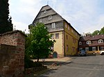 |
| Chattengau-Fulda-Weg | 55 km | Elmshagen – Schnellrode | The Chattengau-Fulda-Weg R 12 runs from Elmshagen (Warmetal cycle path) through the Chattengau to the Eder, through the Markwald to Melsungen and further through side valleys Spangenberg after Schnellrode. Due to the district boundary, there is no continuation of the cycle path Hessian Lichtenau (Herkules-Wartburg cycle path). |  |
| Schwalm-Efze-Weg | 29 km | Treysa – mountains | The Schwalm-Efze-Weg R 14 roughly follows the course of the former cannon railway from Treysa above Frielendorf (Silbersee) after Homberg (Efze), as well as further into the Efzetal to Berge, where connection to the Efzetalweg R 17 to Wobble consists. Beautiful cycle route over paved farm roads, mostly away from major roads. |  |
| Lake path | 31 km | Small glis – Hergetsfeld | The Seenweg R 15 connects several lakes in the Borken Lake District, including the Stockelache, the Borkener See, the Neuenhainer See and the Silbersee. Starting from Kleinenglis you cycle over Bark, Dillich, Frielendorf and Großopperhausen up into the Knüllgebirge to Hergetsfeld, where there is a connection to the Efzetalweg R 17. |  |
| Fulda-Efze-Weg | 16 km | Malsfeld – Homberg (Efze) | The Fulda-Efze-Weg R 16 connects in a more direct way Malsfeld (Fulda cycle path) With Homberg (Efze), whereby the route is usually led on little-traveled district and state roads. About halfway there is a detour to the Goldbergsee. As of October 2014, the signs will only be in the community Malsfeld groomed. | _(2).JPG/150px-Fulda-Efze-Weg_(R_16)_(2).JPG) |
| Efzetalweg | 50 km | Loshausen – Wobble | The Efzetalweg R 17 runs initially from Loshausen over the Rotkäppchenland railway cycle path to Neukirchen (Knull)to then after Schwarzenborn up in the Crunch to lead to Efzequelle. From there the cycle route accompanies the Efze over Wallenstein and Homberg (Efze) to its mouth at Unshausen and continues to follow Wobble. |  |
| Beisetalweg | 26 km | Remsfeld – Spangenberg | The Beisetalweg R 18 is initially between Remsfeld and Rotten identical to that Hessian long-distance cycle route R5, to then go on alone Spangenberg in the Stölzinger Mountains respectively. The cycle route only runs over a length of seven kilometers through the Beisetal and has a large number of county and state roads. |  |
| Gilsatalweg | 39 km | Winterscheid – Wobble | The Gilsatalweg R 19 runs in the upper part of Gilserberg to Bischhausen through the Gilsatal and in the lower part then continue following the course of the Main-Weser Railway to Wobble, partly together with the Schwalm cycle path and the Hess. Long-distance cycle route R4. In Trockenerfurth, a detour to Lake Borken is worthwhile. |  |
| Schwalm cycle path | 17 km | Alsfeld – Goat grove | The Schwalm cycle path R 20 was the predecessor of today's Schwalm cycle path and ran from Alsfeld along the Schwalm to Ziegenhain. In the meantime, almost all signposts and signs for the local cycle route have been dismantled and the new one has been signposted Schwalm cycle path who accompanies the Schwalm throughout. |  |
| Chattengauweg | 25 km | Fritzlar – Altenbauna | The Chattengauweg R 21 connects the half-timbered town Fritzlar with the VW city Baunatal and mostly leads away from the larger roads on farm roads through the hilly Chattengau. Between Gudensberg and Dissen, the cycle route also runs a short distance over the former railway line of the Kleinbahn Grifte - Gudensberg. |  |
| Rotkäppchenland railway cycle path | 50 km | Treysa – Niederaula | The Rotkäppchenland railway cycle path runs between Treysa and Wahlshausen on the former railway line of the Knüllwaldbahn and is part of the German Mittelland Route (D route 4). Because of this, the sections from Wahlshausen are also Niederaula and from Neustadt Signposted to Treysa as the Rotkäppchenland railway cycle path. |  |
| Beisetal-Mühlen-Radweg | 19 km | Hainrode – Beiseförth | The Beisetal-Mühlen-Radweg In contrast to the Beisetalweg R18, follows the entire course of the Beise and is signposted as "MR". The cycle route connects twelve of the original 26 mills still in existence today, some of which are still in operation. In the lower section, the mill cycle path is part of the Hess. Long-distance cycle route R5. |  |
| Kleinbahn-Radweg Grifte – Gudensberg | 8 kilometers | Handles – Gudensberg | The Kleinbahn-Radweg Grifte – Gudensberg runs on the former Grifte – Gudensberg railway line, which was in operation from 1899 to 1979, and is part of the Eder cycle path, the Tour de Chattengau and des Chattengauweges. The one continuously marked as a hiking trail Railway cycle path is paved throughout except for two kilometers. |  |
| Tour de Chattengau | 36 km | Through the Chattengau | The Tour de Chattengau is a 36 km long circuit of cities and municipalities Gudensberg, Edermünde and Niedenstein through the hilly Chattengau. Every year on the 2nd Sunday in September, a cycling day with many activities and attractions takes place on the route. However, the cycle path itself is signposted all year round. |  |
Central Hesse and Westerwald
With Lahn-Dill-Bergland and Burgwald
- Aar Cycle Path (Lahn-Dill), also as Aartal cycle path (Westerwald) known, 25 km along the Aar
- Burgwald cycle path - 39 km long round tour through the castle forest, info in Hesse cycle route planner
- Dill Valley Cycle Path - 42 km long cycle path from Haiger via Dillenburg and Herborn to Wetzlar. Identical to the Orange Bicycle Route as far as Asslar.
- Lange Hessen Cycle Route - from Fronhausen in the Lahn valley to Amöneburg at the ohm.
- Kallenbachtal cycle path from the R8 to the Lahntal in Löhnberg (without logo)
- Kerkerbachtal cycle path from the R8 to the Lahn valley in Runkel; detailed route information with photo documentation of the route can be found on Bahnrassenradwege.de and History of the Kerkerbachbahn and bike and hiking guide
- Otto Ubbelohde cycle path - 53 km in the footsteps of the artist Otto Ubbelohde between the Lahn valley and the Burgwald (mountains)
- Lake cycle path - The route runs in the Lahn-Dill-Bergland from the Perfstausee to the Aartalsee (info).
- Salt Flats Cycle Path
- Solmser Land cycle path - 39 km circuit north of Hungen
- Treisbachtal cycle path - new alternative to the Lahn valley cycle path. Of Biedenkopf From there it goes on initially very steep paths through the Sackpfeifen-Vorhöhen (?), then through the quiet Treisbachtal to Amönau and on to the Lahn-Eder cycle path. The end is at the station in Wetter. Lots of split dirt roads, but the forest section is paved. (Route in OSM)
- Wiera-Wohra cycle path - connects the valley of the Wiera and the Wohra between Neustadt (Hessen) and Gemünden (Wohra). The tour leads away from larger towns with a few inclines and descents on agricultural and forestry paths and is most suitable for e-bikes and trekking bikes
East Hesse
In the area of the Hessian Rhön in the district of East Hesse, a high-quality regional cycle route network was created with great financial outlay and commitment by local politicians. In total, almost 100 km of cycle routes have been completely rebuilt or upgraded with a fine asphalt surface in the region. The main attraction of the high-quality regional network is the well-known Milseburgradweg with its former railway tunnel, which today is Germany’s longest cycle tunnel at 1187 m.
District of Hersfeld-Rotenburg
| title | length | Start point / end point | description | picture |
|---|---|---|---|---|
| Waldhessen R10 | 28 km | Bad Hersfeld – Upper auditorium/Gersdorf | The Bike route R 10 runs from Bad Hersfeld through the Geisbach valley past Neuenstein Castle in the Neuensteiner district of Salzberg. There the bike path separates, part leads as R10.1 on the Eisenberg to Gersdorf, the other than R10.2 on the state road 3157 Upper auditorium. Possibly continuation to Ibra / Kemmerode to the R18. |  |
| Waldhessen R11 | 48 km | Alsfeld – Electoral houses | The Cycle route R 11 leads from Alsfeld about Eifa, Breitenbach am Herzberg, Niederaula and Kirchheim after Wahlshausen. An alternative route, signposted as R11.1 branches off in Eifa and runs over the Herzberg Castle to Breitenbach am Herzberg. The section of Niederaula nach Wahlshausen is part of the Rotkäppchenland railway cycle path. |  |
| Waldhessen R12 | 65 km | New hay – Hünfeld | The Cycle route R 12 connects that Knüllgebirge with the Haunetal. Starting from New hay you cycle via Ersrode, through the upper Beisetal, the Rohrbachtal, Friedlos, the Fulda valley, Bad Hersfeld, Burghaun and the Haunetal. There is an alternative route near Odensachsen, signposted as R12.1. |  |
| Waldhessen R13 | 81 km | Sontra – Breitenbach am Herzberg | The Cycle route R 13 runs from Sontra above Nentershausen, Ronshausen, Friedewald, Schenklengsfeld, Pus field and Haunetal after Wetzlos. The bike path splits in the small village, part of which leads as R13.1 into the Fulda valley to Niederjossa to the R11, the other than R13.2 über Hilperhausen ins Fuldatal nach Asbach (Fulda cycle path / R7). |  |
| Waldhessen R14 | 75 km | Sontra – Hünfeld | Die Radroute R 14 führt von Sontra above Nentershausen, Wildeck, Dankmarshausen, Heringen, Philippsthal and Unterbreizbach to Heringen. Unterwegs radelt man längere Abschnitte durch das Werratal vorbei am Monte Kali und das Ulstertal über Werratal-Radweg and Ulstertal-Radweg, sowie die Rhön. Stellenweise Alternativrouten (R14.1). |  |
| Waldhessen R15 | 65 km | Friedlos – Wenigentaft | Die Radroute R 15 folgt zunächst dem Fuldatal von Friedlos bis Bebra, bevor sie in das Ulfetal abzweigt und über Ronshausen to Wildeck verläuft. Von dort dann auf dem Werratal-Radweg durch das Werratal above Heringen nach Heimboldshausen, auf dem Solztalradweg to Hohenroda und durch die nördliche Rhön ins Ulstertal nach Wenigentaft. |  |
| Waldhessen R16 | 23 km | Sontra – Weiterode | Die Radroute R 16 verbindet Sontra above Cornberg mit Bebra und folgt grob dem Verlauf der Bahnstrecke Göttingen–Bebra ("Whisky-Wodka-Linie"). Während die Bahnstrecke die Cornberger Höhe durch einen Tunnel überwindet, müssen Radfahrer den Bergrücken auf kurvigen Wirtschaftswegen entlang der Bundesstraße 27 bezwingen. |  |
| Waldhessen R18 | 66 km | Spangenberg – Breitenbach am Herzberg | Die Radroute R 18 führt ausgehend von Spangenberg meist auf Kreis- und Landesstraßen über Alheim im Fuldatal, das Schloss Ludwigseck, Ersrode, Neuenstein, das Knüllgebirge, Kirchheim und den Ibrastausee to Breitenbach am Herzberg, ebenfalls im Fuldatal. Auf der ziemlich direkt verlaufenden Radroute sind eine Höhenmeter zu überwinden. |  |
| Kuppenrhön-Tour | 29 km | Durch die Kuppenrhön | Die Kuppenrhön-Tour wurde 2014 eröffnet und verbindet als Rundkurs Ortsteile der Gemeinden Friedewald, Hohenroda, Philippsthal and Schenklengsfeld. Die Radroute ist in Teilen identisch mit dem Hessischen Radfernweg R7, dem BahnRadweg Hessen and the Solztalradweg. In Schenklengsfeld lohnt ein Abstecher zum ältesten Baum Deutschlands. |  |
| Solztalradweg | 27 km | Bad Hersfeld – Philippsthal | The Solztalradweg verläuft zwischen Bad Hersfeld and Schenklengsfeld auf der ehemaligen Bahntrasse der Hersfelder Kreisbahn und ist Teil des BahnRadwegs Hessen und der deutschen Mittelland-Route (D-Route 4). Ab Schenklengsfeld führt die Radroute noch abseits der hier noch bestehenden Bahnstrecke weiter über Hohenroda ins Werratal. |  |
Landkreis Fulda
- Radweg Hünfeld-Schlitz − von Hünfeld zum Fulda-Radweg im Fuldatal bei Schlitz.
- Kegelspielradweg - regionales Pedant zum Milseburgradweg (allerdings ohne Tunnel). Der Bahntrassenradweg führt landschaftlich schön durch das "hessische Kegelspiel" (die Kuppenrhön).
- Milseburgradweg - bekannteste Regionalroute in Osthessen aufgrund des Radtunnels und der landschaftlich sehr schönen Mittelgebirgslandschaft an der Milseburg.
- Nüsttal-Radweg − ab 2010 im Bau, von Hünfeld-Nüst (Hauneradweg) über Hofbieber nach Mahlerts.
- Ulstertal-Radweg − Teil des Rhön-Radwegs
- VIA REGIA-Radweg - Die Strecke im Landkreis Fulda wurde als Teil der "VIA REGIA Kulturstraße des Europarates" ausgeschildert und bildet eine neue Radrelation in Südwest-Nordost-Richtung durch Osthessen. Der "VIA REGIA-Radweg 'Osthessen'" wurde am 9. Juni 2012 eröffnet. Die 55 km lange Regionalroute führt von Flieden above Fulda, Fulda-Lehnerz, Hünfeld, Großenbach, über den Hübelsberg (Teil der hessischen Kuppenrhön), Rasdorf und Grüsselsbach bis nach Wenigentaft im Ulstertal. Hier besteht Anschluss an den Ulstertalradweg Richtung Werra. Insgesamt führt die Erlebnisradweg VIA Regia von Frankfurt am Main über Mitteldeutschland bis nach Krakow in Polen (meist unter Nutzung vorhandener Radwege ohne eigene Routenwegweisung). Ob weitere Stücke der Radroute außerhalb Osthessens als neue, "eigene Radroute" konzipiert wurden, ist mit Stand 06-06-2012 nicht bekannt. radweg-viaregia.eu, bzw. allgemein zur Via Regia: www.via-regia.org
Vogelsberg und Wetterau
- Antriftsee-Tour - von Alsfeld vorbei am Antriftsee nach Homberg (Ohm). Anfangs zusammen mit dem Hess. Radfernweg R2. Später eigenständiger Verlauf. Wenn man die Tour in Homberg auf dem R6 nach Norden fortsetzt, hat man eine Alternative zum R2. Info im Radroutenplaner Hessen
- Basalt-Tour - führt rund 51 km im Vogelsberg durch eine Landschaft mit Basalten und Basalttuffen. Stationen sind Herbstein, Lauterbach and Renzendorf at Alsfeld. Die Rundtour verbindet auch das Schwalm-Gebiet mit dem Vulkanradweg, auf dem ein Abschnitt verläuft. Den Radfahrer erwarten einige Steigungen.Tourbeschreibung
- Hessische Apfelwein- und Obstwiesenroute · im Wetteraukreis - Wo das Stöffche wächst
- Hoherodskopfsteig − sportliche Anbindung des bekanntesten Berges im Vogelsberg an den R4 bei Schotten or. Ulrichstein und an den Vulkanradweg bei Hartmannshain.
- Nidda-Radweg − Die 120 km lange Route begleitet die Nidda von Ihrer Quelle im hohen Vogelsberg durch die Wetterau und den Norden Frankfurts bis zu Ihrer Mündung bei Frankfurt-Höchst in den Main. · Offizielle Seite des Zweckverband Regionalpark Niddaradweg: www.niddaradweg.de
- Keltenrouten in der Wetterau
- Die Westliche Kelten-Route (47 km Rundroute): „Die Kelten der Wetterau“ führt von Assenheim über Friedberg to Butzbach und zurück. · Strecke im Radroutenplaner Hessen
- Die Östliche Kelten-Route (30 km Rundroute mit Stichwege): „Auf den Spuren der Kelten“ führt von Büdingen über Glauburg nach Dudenrod zum archäologischen Park Glauberg.
- Ohmtal-Tour − folgt dem Verlauf der Ohm im Vogelsberg. Streckenverlauf: Hoherodskopf - Ulrichstein - Mücke - Homberg (Ohm). Hier besteht Anschluss an den Hess. Radfernweg R6. At Kirchhain trifft man auf den Hess. Radfernweg R2, der weiter entlang der Ohm bis zur Lahn führt. Radroutenplaner Hessen
- RMV-Route 6: Durch das Ronneburger Hügelland · von Gelnhausen zum Glauberg
- Rosen-Radweg − Der Rosen-Radweg verbindet Frankfurt mit Gießen auf landschaftlich schönen Wegen durch die Wetterau. Die Strecke selbst verläuft weitgehend eben entlang der Flüsse Nidda und Wetter. Nur zwischen Bad Nauheim und Gießen sind fünf steilere Anstiege (nur kürzere Strecken) zu überwinden. Bis Niddatal-Assenheim verläuft die Route auf KFZ-freien Wegen im Bereich der Nidda. Danach werden zum Teil auch ruhige Landstraßen befahren. Touristische Höhepunkte an der Strecke sind sicher Friedberg mit Burg und Altstadt, Bad Nauheim (Kurstadt und Rosenzentrum mit Rosenmuseum) sowie die Burg Münzenberg. Hinweise über Qualität und Standard der Wegweisung liegen keine vor (Stand 02/2010).

- Steigerwald-Tour − Rundtour im östlichen Vogelsberg; Radroutenplaner
- Vogelsberger Südbahnradweg − Vom Scheitelpunkt Hartmannshain des Vulkan-Radwegs im hohen Vogelsberg hinunter nach Wächtersbach im Kinzigtal (Anschluss R 3). Am Wochenende: Auffahrt mit Radlerbus bis zum Hoherodskopf.
Taunus und Rheingau
- Aartalradweg (Taunus) · von Taunusstein nach Diez am Lahn valley cycle path
- Eisenstraße · Zubringer zum Aartalradweg (Taunus) auf Höhenwegen, Radroutenplaner
- Radrundweg Ems- und Wörsbachtal (Bad Camberg) · (Alternativroute zum R8) · Radroutenplaner
- Rheingauer Riesling Route Radwanderweg · durch die Rheingauer Weinberge, meist identisch mit R3a · Radroutenplaner
- Weiltalweg · vom großen Feldberg im Taunus nach Weilburg an der Lahn, mit Fahrradbusbegleitung am Wochenende.
Rhein-Main-Gebiet
mit hessischem Spessart
- 12 Rad-Routen Rhein-Main-Vergnügen des Rhein-Main-Verkehrsverbund − Mittel- und Südhessen mit dem Rad entdecken (Tagesrundtouren).
- GrünGürtel-Radrundweg um Frankfurt · Radroutenplaner
- Hohe Straße · Von Frankfurt Bergen-Enkheim nach Hammersbach
- Nidda-Radweg · Vom Vogelsberg zum Stadtrand von Frankfurt und weiter auf dem Grüngürtelradweg zum Main · Regionalpark Niddaradweg
Südhessisches Ried und Odenwald

- Radroute Die Bergstraße - 85 km entlang der Bergstraße von Darmstadt nach Heidelberg, zwischen Odenwald und Hessischem Ried.
- Mümling-Radweg (R1) - 75 km entlang der Mümling im hinteren Odenwald von Beerfelden über Erbach/Michelstadt, Höchst und Breuberg nach Obernburg am Main.
- Gersprenztalradweg R2 - Etwa 19 km in einem Teilbereich der Gersprenz von Reichelsheim-Gumpen entlang des "Flüßlein" bis nach Groß-Bieberau. (Routenverlauf auf Openstreetmap.org).
MTB regions
| Titel | Länge | Startpunkt / Endpunkt | Beschreibung | Bild |
|---|---|---|---|---|
| Bike Arena Sauerland | 1700 km | Durch das Sauerland | Die Bike Arena Sauerland umfasst über 40 Strecken mit etwa 1.700 km Gesamtlänge. Neben speziellen Routen für Rennräder wurden auch ausgewählte Touren für Mountainbiker eingerichtet, allein von Willingen (Upland) starten zehn verschiedene Mountainbikerouten in das Rothaargebirge, das Sauerland und zum Diemelsee. |  |
| Naturpark Habichtswald | 16 km | Durch den Habichtswald | Die Mountainbike-Strecke "Um das Habichtspiel" führt sowohl über befestigte, als auch unbefestigte und naturnahe Wege durch den Hohen Habichtswald hinauf auf das Hohe Gras. Der Rundkurs startet an den beiden Ausgangspunkten Roter Stollen und Unteres Firnsbachtal und ist die erste offizielle Mountainbike-Strecke im Habichtswald. |  |
| Mountainbike-Park Werratal | 784 km | Durch das Werra-Meißner-Land | The Mountainbike-Park Werratal besteht aus 23 Mountainbiketouren mit verschiedenen Schwierigkeitsgraden, Streckenlängen von 15 bis 60 Kilometern und rund 11.500 Gesamthöhenmetern. Etwa die Hälfte der Mountainbikerouten sind nicht ausgeschildert und nur mit GPS-Geräten befahrbar, die vor Ort ausgeliehen werden können. |  |
- MTB-Netz Rhön
- Mountain Bike im hohen Vogelsberg
- Mountain Bike im Geo-Naturpark Bergstraße-Odenwald Das Streckennetz ist zur Zeit noch im Aufbau
Bicycles can be taken on trains
Innerhalb der beiden hessischen Verkehrsverbünden NVV and RMV ist die Fahrradmitnahme free, nicht jedoch für Fahrkarten der DB. Bei Bahnfahrkarten müssen Sie für jedes Fahrrad im Nahverkehr eine Fahrradkarte zu 5,- € lösen. Im Fernverkehr sind es 9,- € und das Fahrrad muss reserviert werden. Auf der Lahntalbahn (Wetzlar–Koblenz) und den beiden Westerwaldbahnen sind Fahrräder auch mit Bahnfahrkarten kostenlos.
Für ganz Hessen gibt es das Hessen-Ticket für alle Nahverkehrsmittel zu 32,- €. Es gilt für bis zu 5 Personen (Mo-Fr ab 9 Uhr, Sa, So ganztägig), es gilt auch für Mainz. Auch mit diesem Ticket ist Fahrradmitnahme kostenlos. Das Rheinland-Pfalz-Ticket zu 22,- € bis 38,- € gilt auch für das hessische Wiesbaden und der linksrheinischen Strecke Wiesbaden - Lahnstein - Koblenz. Mit diesem Ticket ist die Fahrradmitnahme Mo.−Fr. erst ab 9 Uhr frei. (Stand 2012)
Fahrgastrechte bei Verspätungen
- im Schienennetz des Verkehrsverbunds RMV · RMV: Fahrgastrechte im Eisenbahnverkehr
literature
- Die Radwanderkarte Hessen kann bei der Hessen Agentur unter der Telefonnummer 0611/95017-8191 oder durch Mail: [email protected] bezogen werden oder im online-Shop (Gebührenpflichtig): www.hessen-tourismus.de
Web links
- Radroutenplaner Hessen - offizielle Seite des Landes Hessen. Hier werden alle Radfernwege und viele lokale Routen dargestellt. Regionale, flächendeckende Radverkehrsnetze werden, sofern vorhanden ebenfalls dargestellt. (z. B. in der Rhein-Main-Region). Es können die gewählten Strecken ausgedruckt werden.
- GPS-Download: Sie können Teilbereiche der Themenroute als GPS-Track erzeugen, indem Sie auf der Karte des Routenplaners Start- und Zielfähnchen setzen und unter dem Menüpunkt ‘Kriterien Routensuche’ die Option ‘Eine bestimmte Themenroute bevorzugen’ einstellen. Dann Route berechnen und GPS-Track herunterladen. Mit dieser Methode erhalten Sie auch die Entfernungsangaben (km) und detaillierte Höhenprofile.
- Offizielle Fahrradinformationen zu Hessen auf [1]
- Bahntrassenradwege in Hessen - private Seite - Fahrradwege auf stillgelegten Bahntrassen in Osthessen und angrenzenden Regionen.
- Radfernwege beim ADFC, Informationen des Radfahrerverbandes mit Umleitungshinweisen